

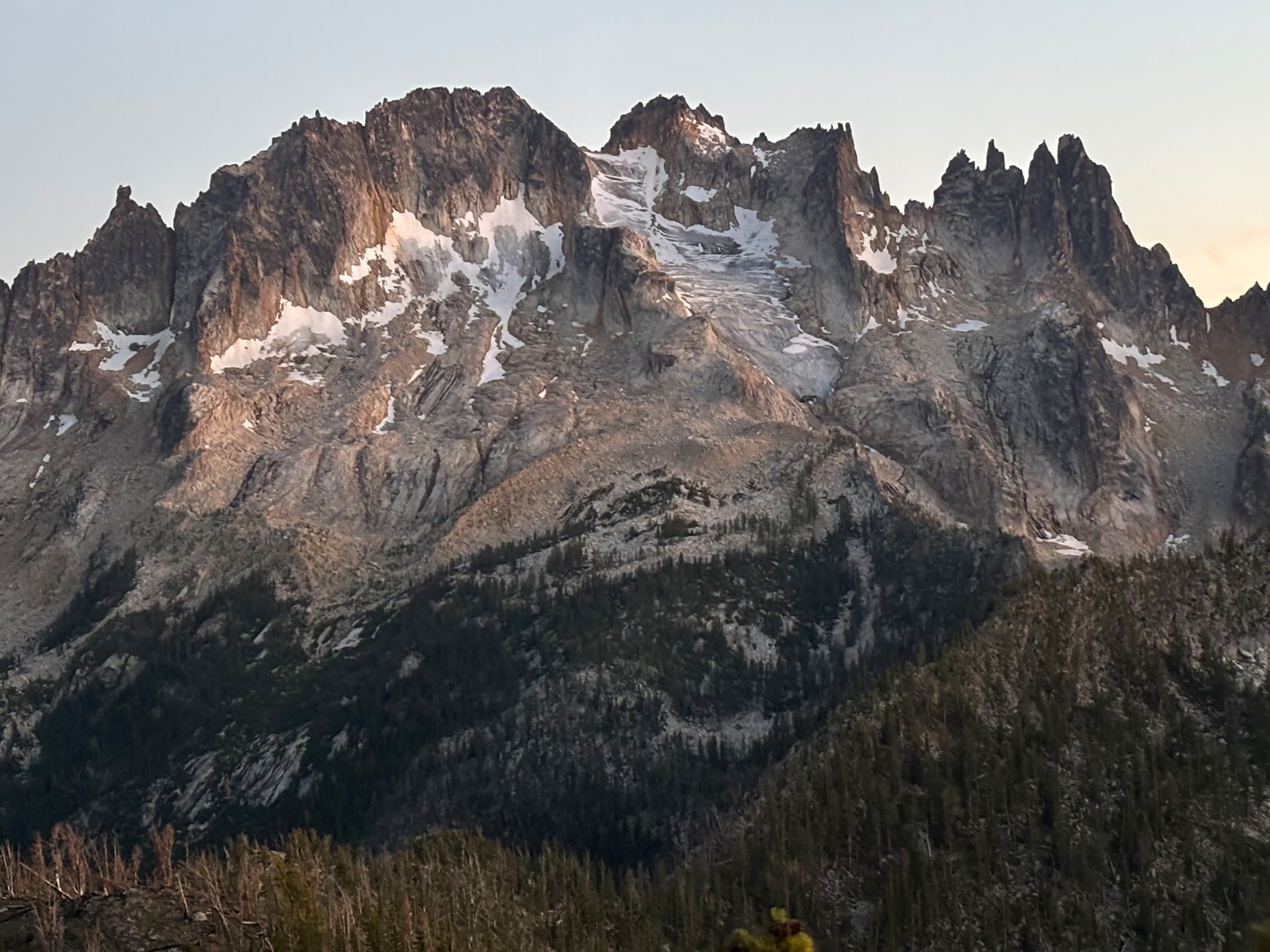
The USGS (1971) North Cascade glacier Inventory identified 15 perennial snow/glacier areas in the Methow Valley from 1958 aerial images. To qualify for the list you needed an area of 0.1 km2. There were three glaciers on Tower Mt., two on Golden Horn, two on Gardner Mt., two on Robinson Mt. and 5 on Silver Star Mt. When we began annual field monitoring of North Cascade glaciers in 1984 we explored the identified glaciers around Tower Mt. and Silver Star Mt. The northeast side of Tower Mt. still had one existing glacier and Silver Star Mt. had three.
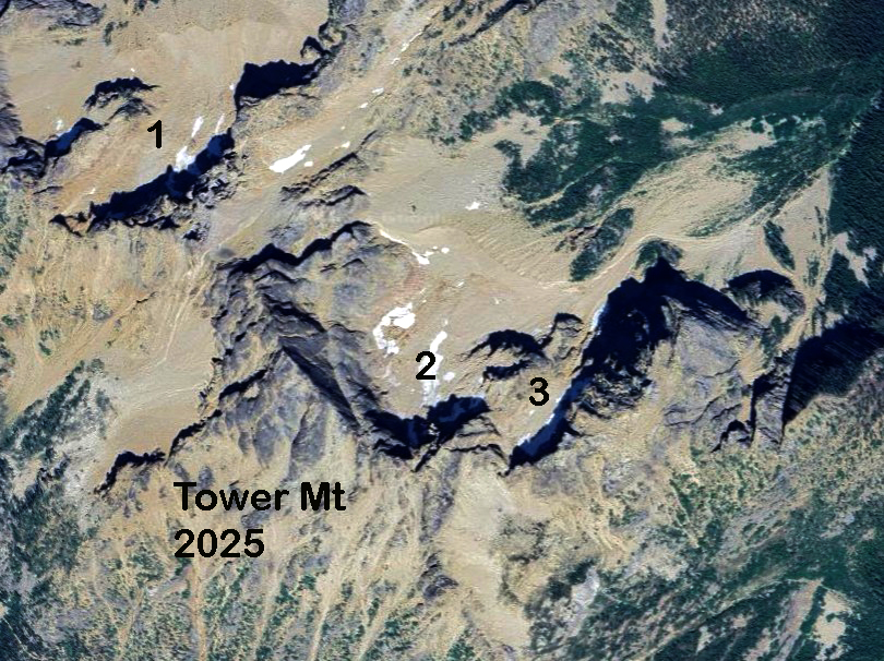
As of 2005, I could identify 9 glaciers with an area of 0.8 km2, in the Methow Valley. About 30% of this area was on Silver Star. On Silver Star there were 3 glaciers in 1958 with a combined area of 0.33 km2. Silver Star had three identified glaciers in 1958. With the western most being the most extensive. The middle and western Silver Star Glacier had crevassing. The eastern Silver Star Glacier was a perennial snow field with no crevassing and insufficient thickness and size to generate movement.

In 2006 here were two glacier left with an area of 0.19 km2 . In this area average July-Sept. ablation on the glacier is 2.6 m/a. Thus, an area of 900,000 m2 x 2.6 m =2.34 million m3 of runoff from the glaciers on average contributed to the Methow River system. This is down from 3.9 million m3 in the 1970’s. This is a significant amount of water, but based on the disappearance of Lewis Glacier, a 40% drop in runoff occurred from the glacier basin in July-Sept. after the glacier was gone. This indicates that approximately 60% of the runoff would occur from the snowpack in the former glaciated area. Thus, the loss of all glaciers will generate a loss of close to 1 million cubic meters for the basin during the July-Sept. period. This runoff would be released earlier in the melt season. Average July-Sept. flow at Winthrop was 750 cfs from 1990-2004, while the glacier runoff had declined to ~10 cfs .
In 2013 the western Silver Star Glacier still had active crevassing and does retain snow cover through the summer. The middle Silver Star Glacier was fragmented stagnant ice that indicated it may no longer have been a glacier. At that time I assessed it could not survive the next pair of warm years.

The lone remaining glacier is confined to a narrow chute is 750 m long, and no more than 200 m wide. There is a small icefall. This glacier is similar to the upper east side of Lynch Glacier, if that was the only part. The glacier is retreating slowly 75 m from 1993 to 2013.
In 2025 the western Silver Star Glacier was 670 m long, an 80 m retreat since 2013, and has an area of 0.075 km2. The crevassing is noticeably reduced. The top of the glacier has several thin areas that will lead to detachment as illustrated by the Jack McLeod image. The glacier still has crevassing and areas likely over 30 m thick. This is the only remaining glacier in the basin and can survive another decade. During late summer periods the glacier provides between 1 and 2 cubic feet per second to the stream system.
The role glaciers play for rivers is buffering low flow periods late in summer. Without glaciers the late summer water supply diminishes. The trend in the Methow has been a sharp reduction in flow for June-August from the 1990-2004 period to the 2015-2025 period. Average discharge from July-September has fallen ~40% for the 2015-2025. In the Methow River valley supporting the reintroduction of beavers is a project that can buffer late summer streamflow to an extent. The Methow Beaver Project is well on the way in this effort.

