
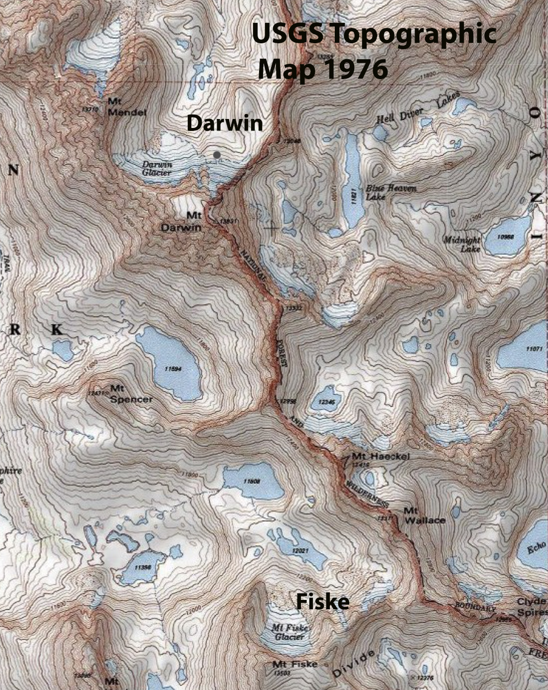
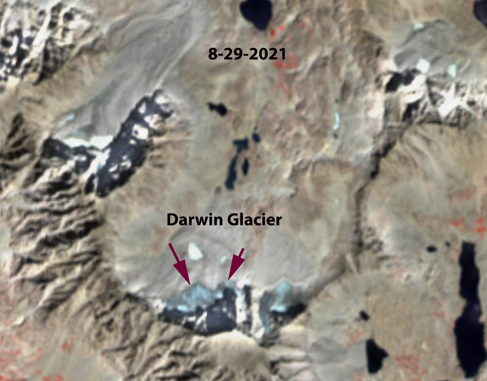
The Sierra Nevada, California has a number of small glaciers that have clung to the north facing slopes of the High Sierra. Darwin Glacier is one of those glaciers on the north side of Mount Darwin. named for Charles Darwin. The glacier is in Kings Canyon National Park and drains into the San Joaquin River.
In 1903 the glacier had an area of 0.25 km², declining 40% by 1948, 0.14 km2 Basagic and Fountain (2011). The glacier expanded beginning in the 1970s and ending in the 1990s, with an area of 0.157 km² in 1976 (GLIMS), and then had declined slightly in 2001 had an area of 0.135 km², 5-10% greater than in 1948. In 2004 area loss was increasing with the area measured in the field by Basagic and Fountain (2011), at 0.114 km2 .
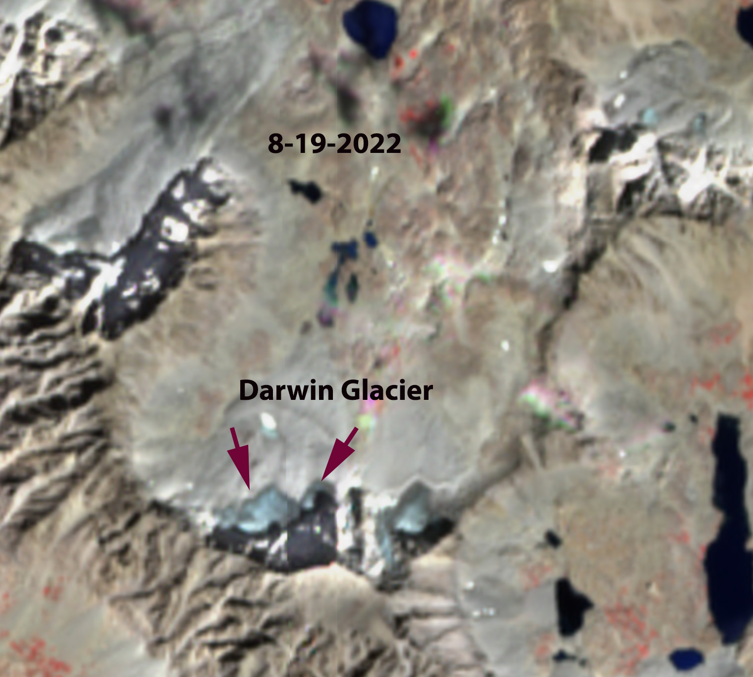
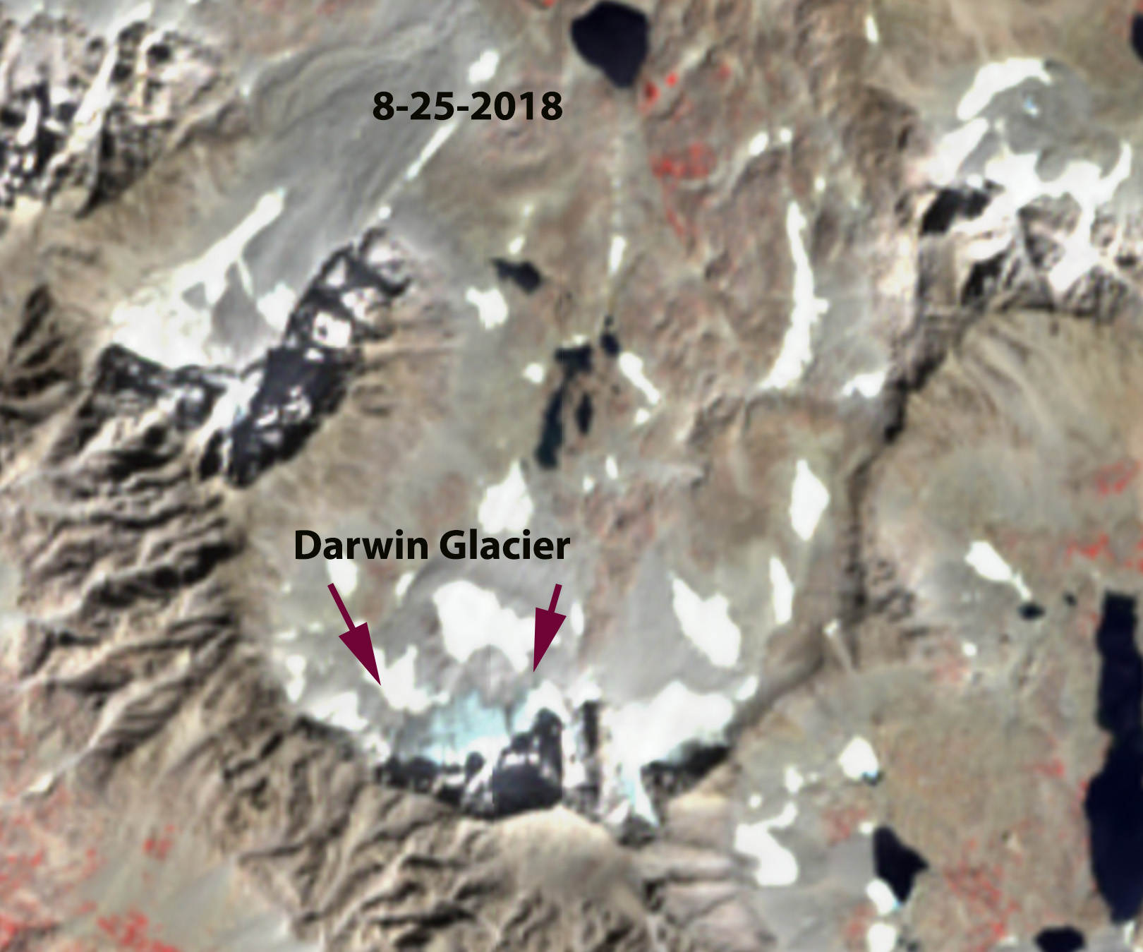
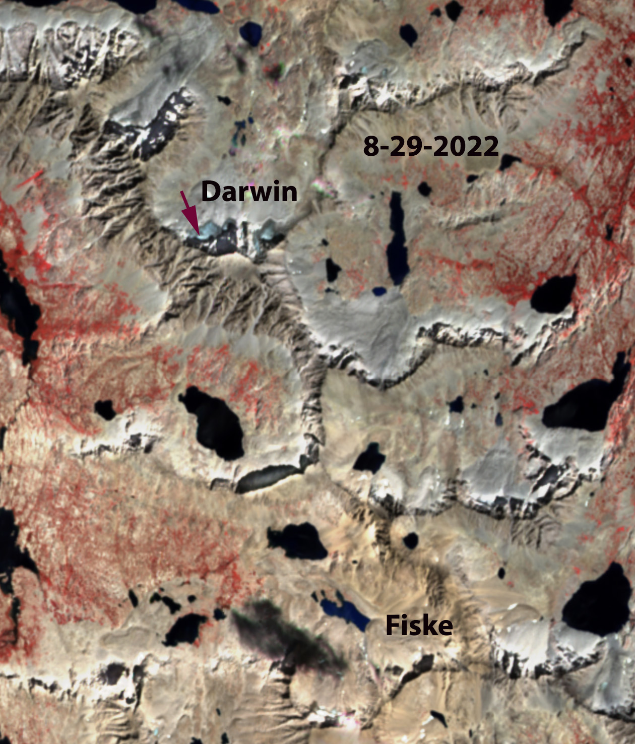
With a steep slope of ~30 degrees, the glacier depends on snow sloughing/avalanching off the north face of Mount Darwin and piling up against a moraine. Retreat from this moraine after 2004 has led to steepening of the glacier with less snowcover retained on its surface. From 2004 to 2022 the glacier rapidly lost volume and area. In 2014 the glacier area had declined 50% to 0.057 km² (GLIMS), in 2018 the glacier area was 0.048 km². The particularly warm summers of 2021 and 2022 led to further rapid decline to 0.038 km² in 2021 and 0.026 km² in 2022. At this time Darwin Glacier and was no longer a glacier with less than 20% of relict ice left from 2004, and with movement having ceased. The glacier bergshrund is also melting out. Bare rock was was also being exposed at several areas amidst the glacier area in 2022.
Just to the south Mount Fiske Glacier has disappeared as well, along with the glacier that was in the cirque on the north side of Mt. Mendel. The high snowfall winters of 2023 and 2024 have been offset by continued warm summers, preventing any significant volume increase.

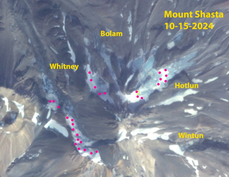
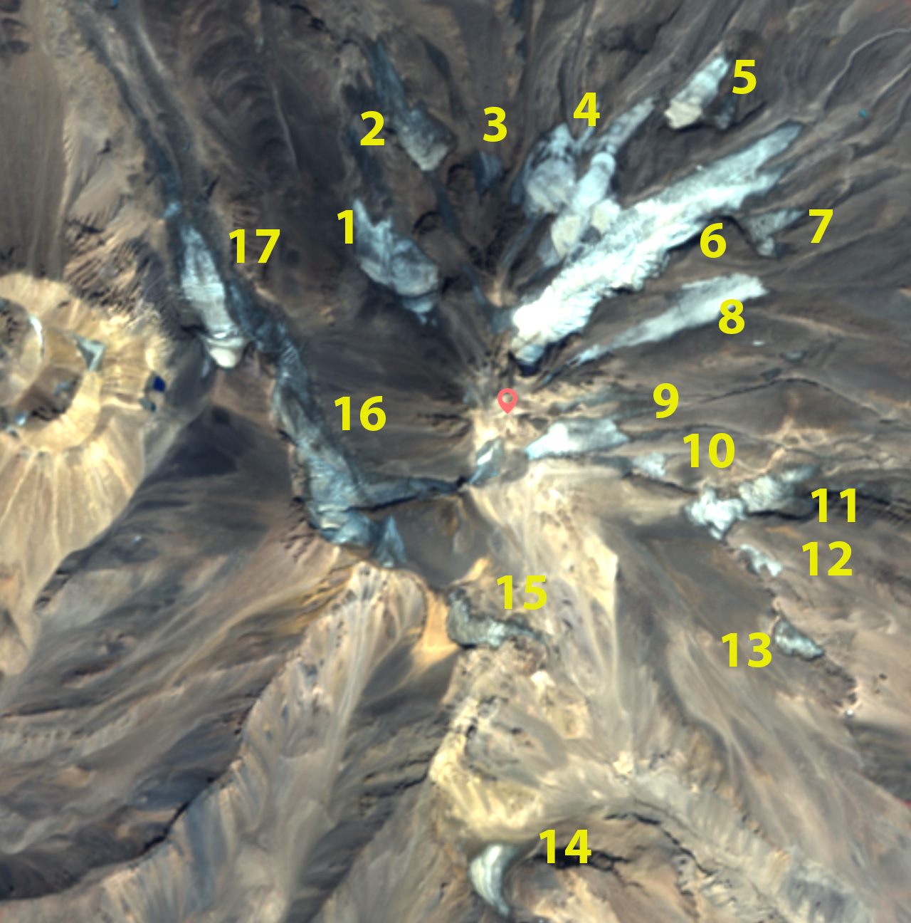
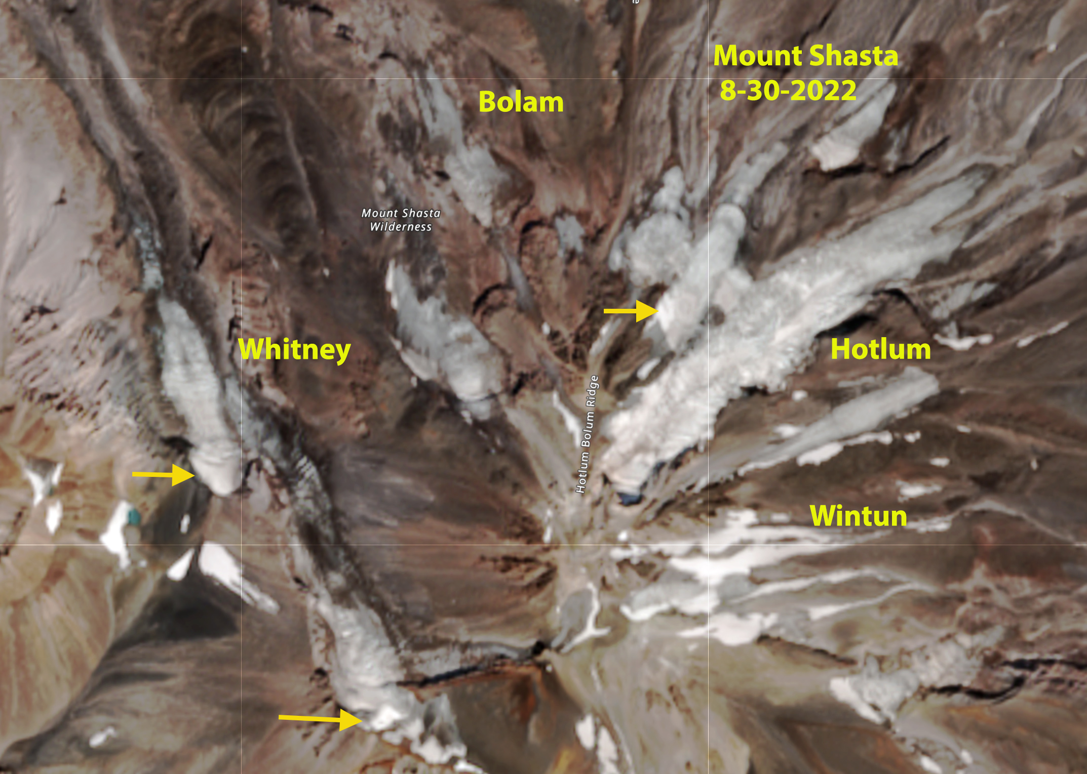
These losses are similar to those observed on Whitney Glacier, Mount Shasta. The NCEI NOAA Division 5 climate data for this area indicates that meltseason temperatures have been the primary cause of the recent decline, though declining accumulation season precipitation has been as well, see bottom.

California Division 5 Average Temperature May-September 1950-2022.