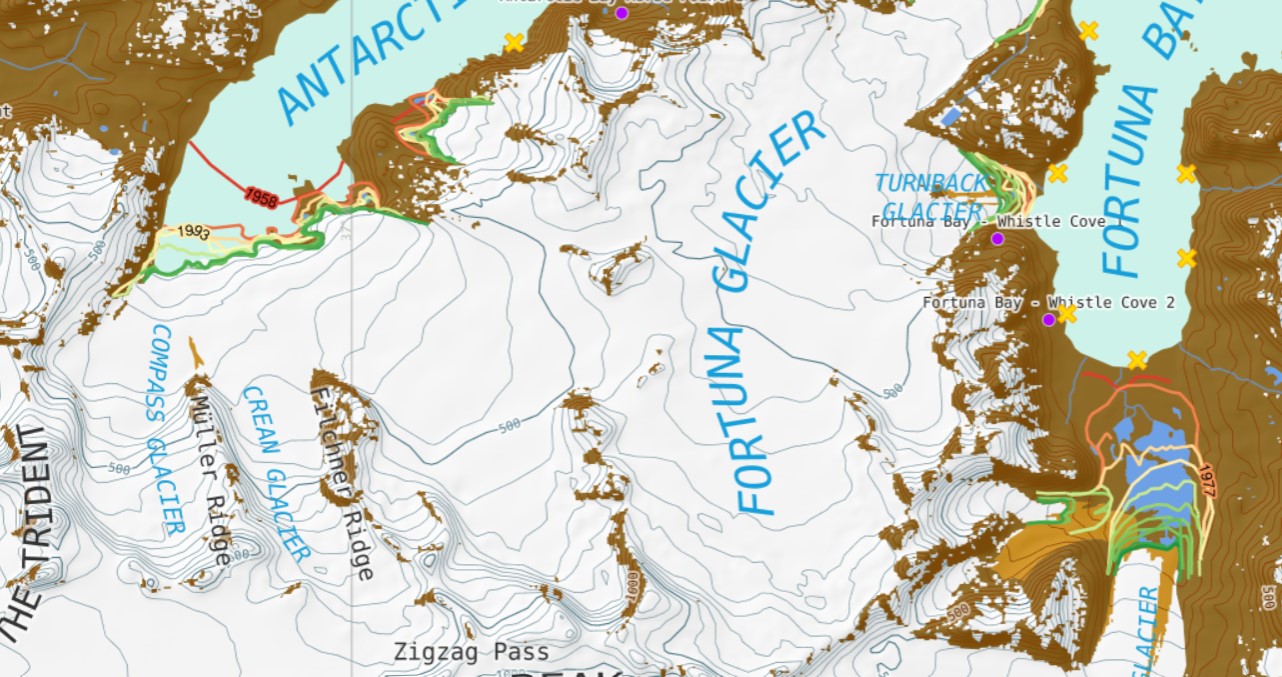
South Georgia Isalnd is a notoriously cloudy location. A remarkably clear Landsat image from Jan. 21, 2026 provides a good snapshot of glacier change since a similarly clear day on February 19, 2016. Here we examine several glacier near the southern tip of the island that have experienced retreat leading to glacier detachment. Pelto (2017) documented the retreat of 11 of these glaciers during the 1989-2015 period. I worked with NASA Earth to document the retreat of some east coast glaciers evident in Landsat images at that time. BAS map provides context on wildlife populations and glacier retreat.

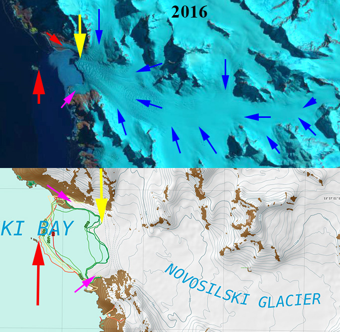
Novosilski Glacier is a large tidewater outlet glacier on the west (cloudier) coast of South Georgia terminating in Novosilski Bay It shares a divide with the rapidly retreating Ross and Hindle Glacier on the east coast. The glacier retreated 1.3 km from 2020 to 2026 leading to Tributary 1 no longer connecting to the main glacier.
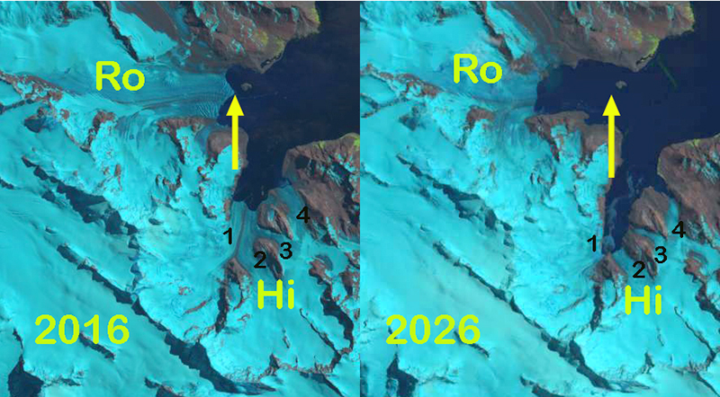
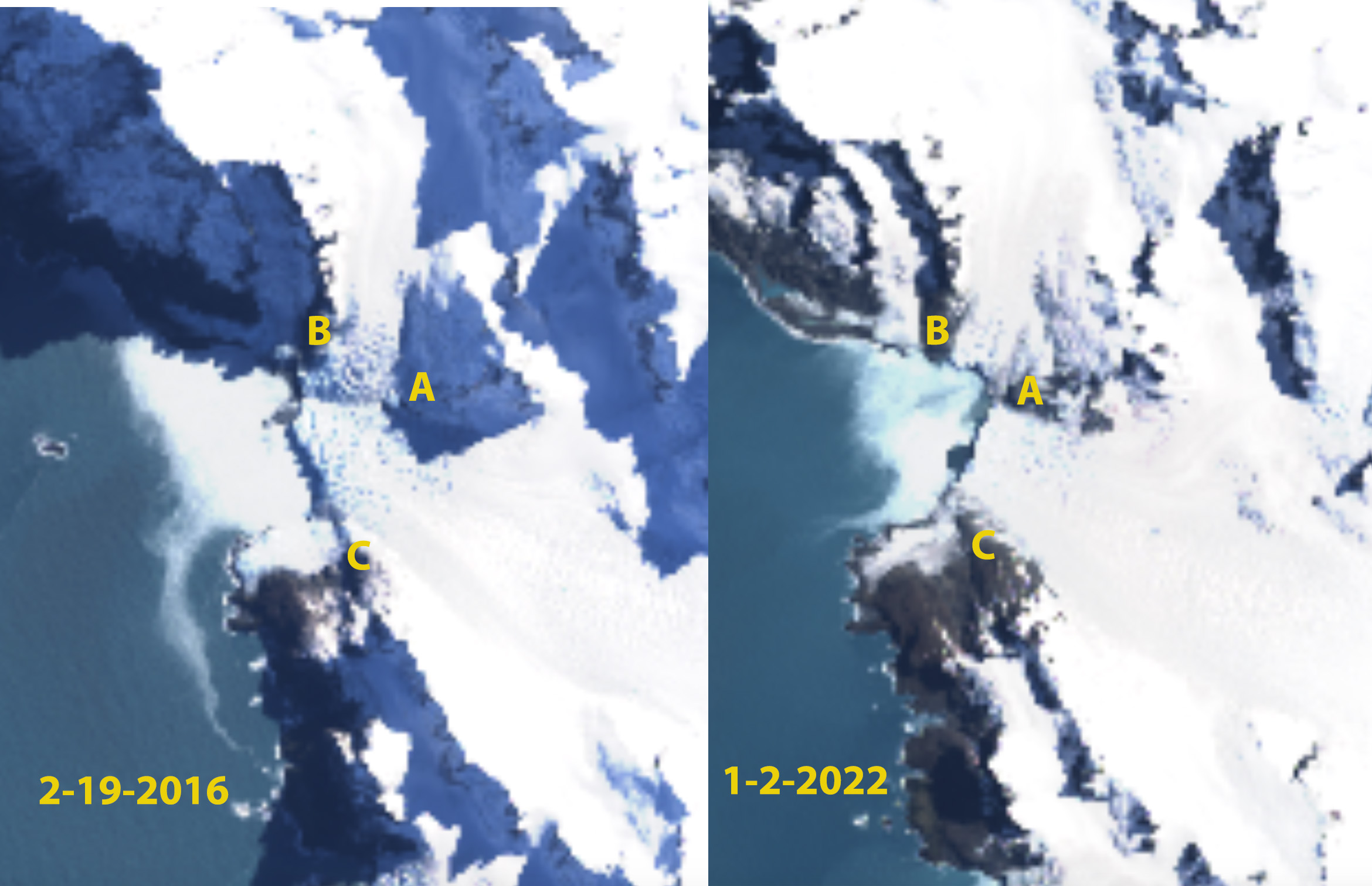
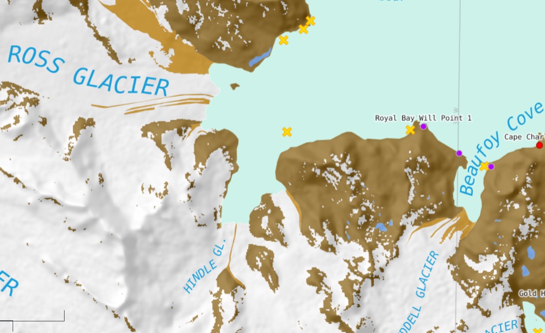
For Ross and Hindle Glacier in 1989 the glaciers joined 2.5 km from the terminus spanning Royal Bay with a 3.2 km wide calving front. By 2001 the glacier front had retreated 800 m, but was still a single joined calving front. By 2009 the glaciers had separated due to an additional retreat of 1.4 km. The Hindle Glacier front was now retreating south up opening a new separate fjord from Ross Glacier. The calving front in 2009 was 1.6 km wide. By 2015 a 1.6 km retreat led to the separation of Hindle from Tributary 4. From 2016 to 2026 a further 1.6 km retreat to the approximate head of the fjord led to separation of Tributary 1, 2 and 3. Ross Glacier retreated 2.5 km from 2016-2026 without separating from any tributary.

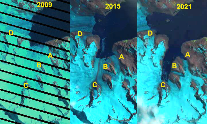
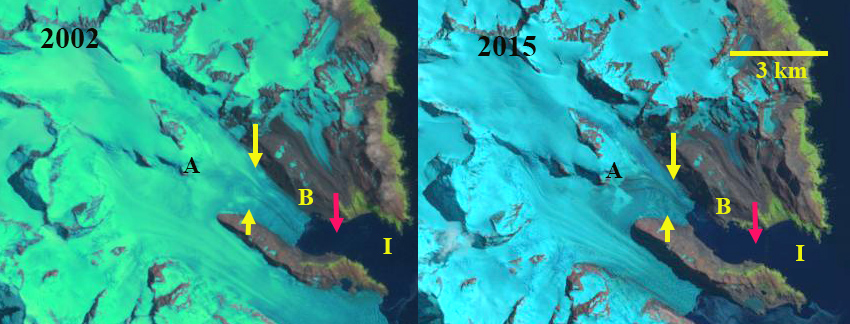
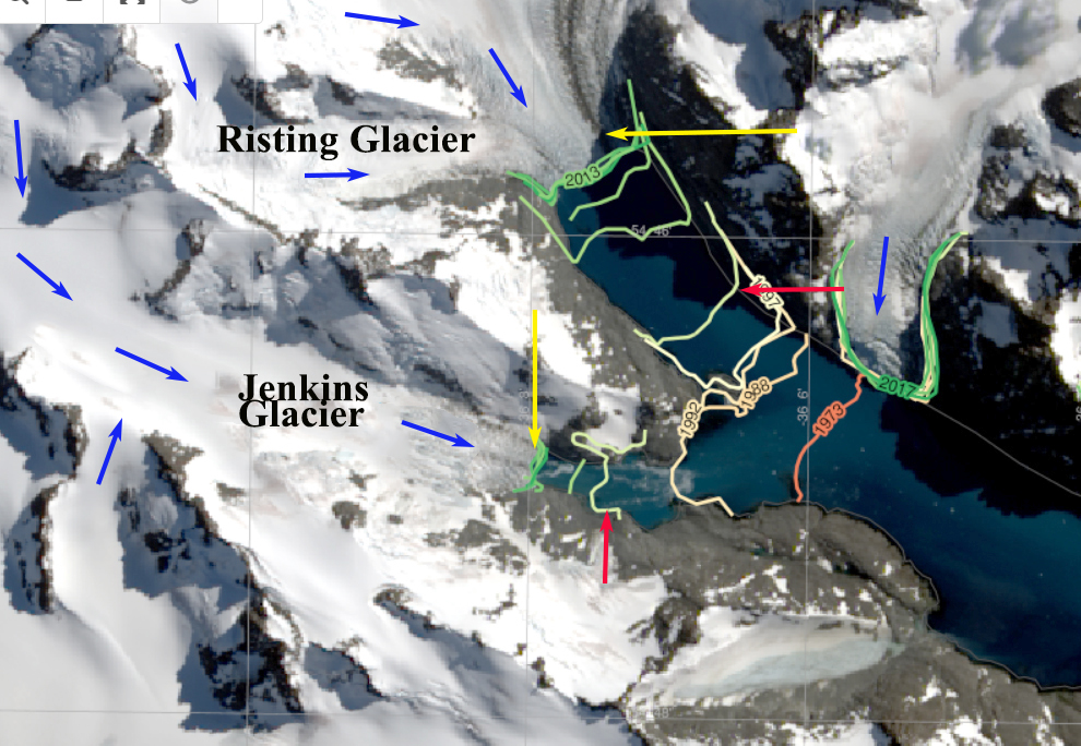
Risting Glacier terminates in Drygalski Fjord on the southeast coast of South Georgia. Risting and Jenkins Glacier were joined until the 1980’s. Cook et al (2010) note the glacier had a relatively uniform retreat rate from 1955-1999 of 40 to 50 meters/year, with retreat increasing after 2000. From 2002-2016 Risting Glacier retreated 1100 m, a rate of ~80 m/year twice the 1955-1999 rate. From2016-2026 the glacier retreated another 800 m, continuing at the same rate. This led to detachment of tributary 1 from the rest of the glacier.

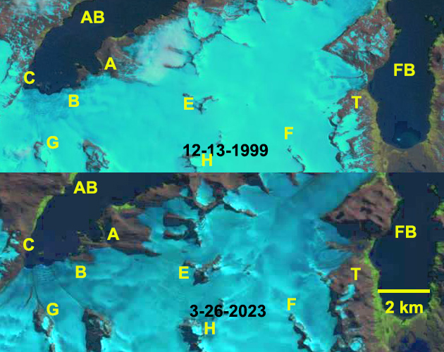
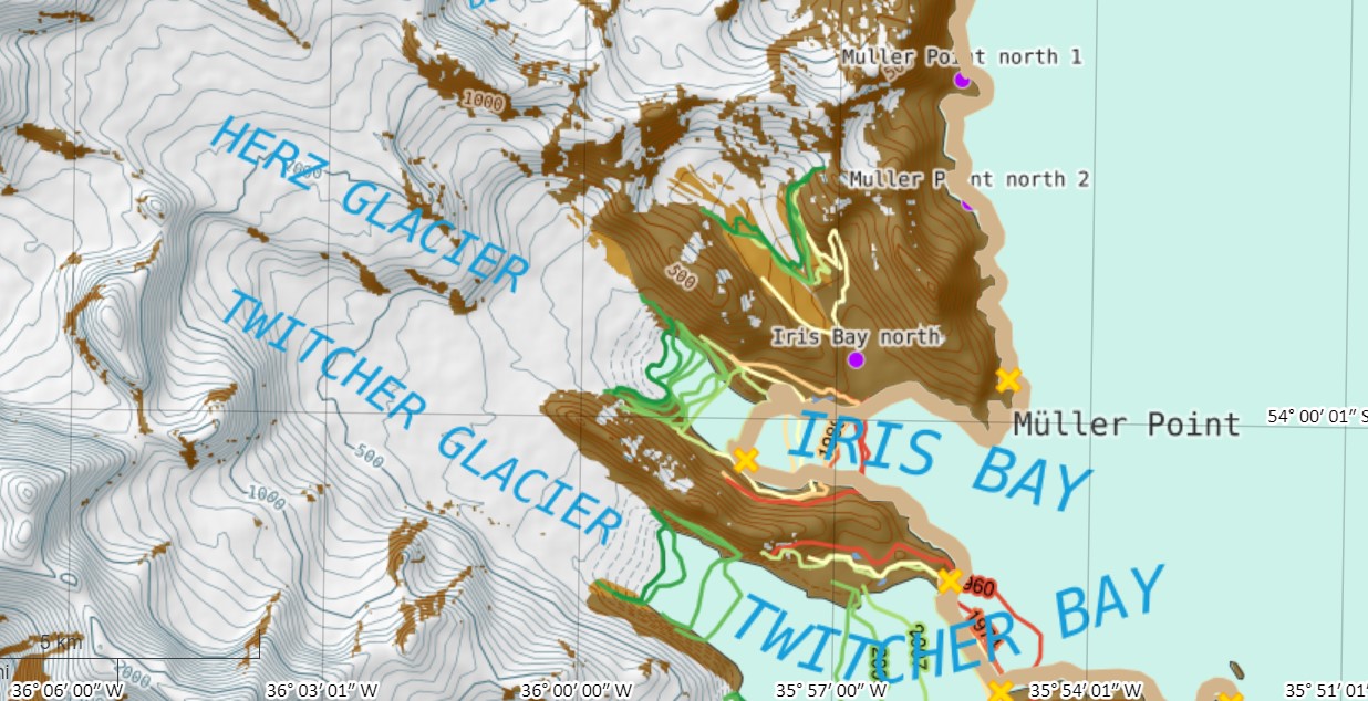
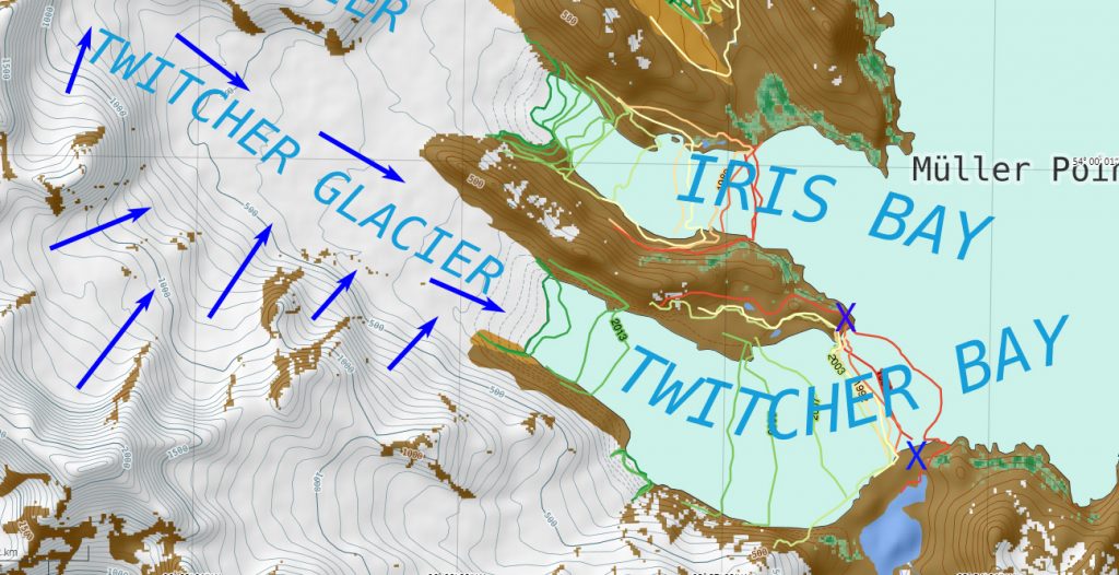
Twitcher Glacier is the next glacier south of Herz Glacier (H) on the east coast of South Georgia. Until 1989 the glacier ended at the tip of a peninsula that separates it from Herz Glacier., the ensuing retreat has led to the opening of a new fjord. By 2015 the glacier has retreated 2.2 km. An accelerated retreat from 2016-2026 of 3.7 km led to separation from Tributary 1.
The story is the same from glacier to glacier with extensive retreat leading to tributaries detaching from each other. These glaciers still maintain snow cover across a significant area of the glacier and can survive current climate.