
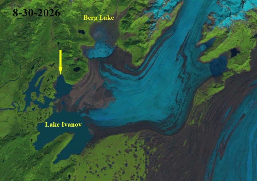
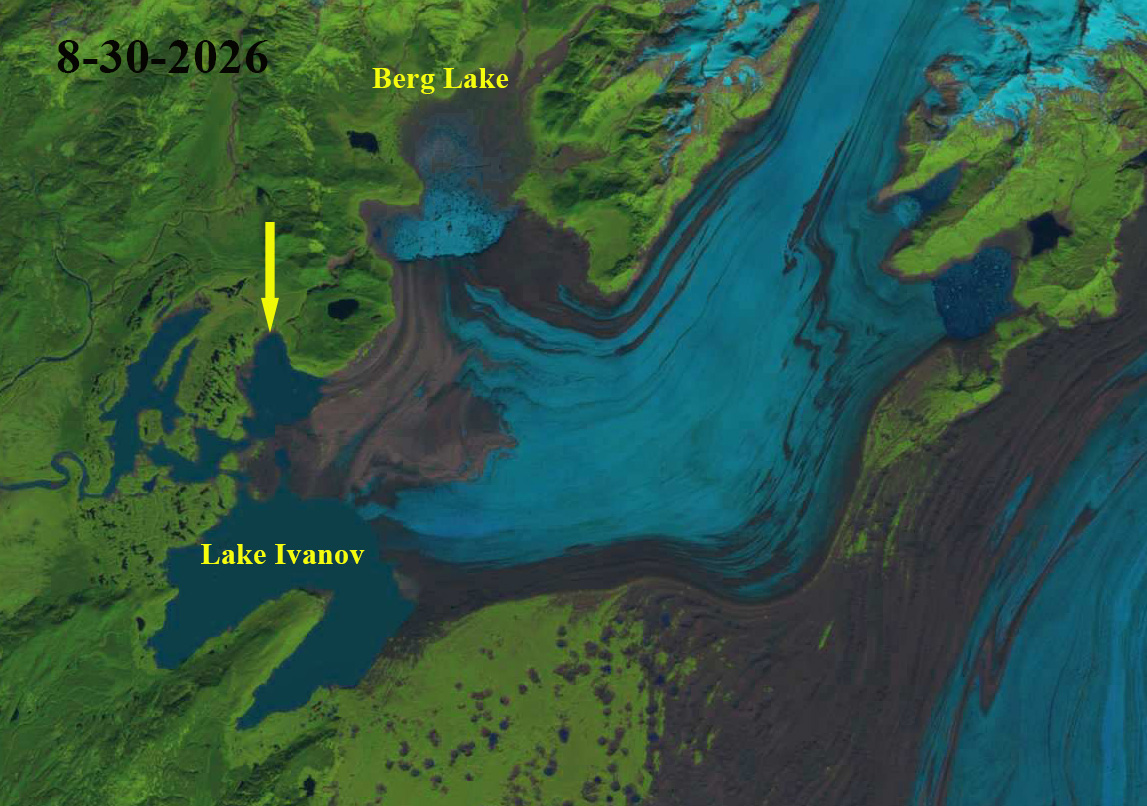
Berg Lake, Alaksa is impounded by the Steller Glacier terminus. During the latter half of the 20th century and early 21st century this lake periodically drained west through a gorge to the Bering River. The lake drainage currently goes directly from Pacman Lake into the Gandil River and then into the Bering River watershed. The lake continues to fill each summer and drain in late summer, with drainage being in August of 2021 and 2022, and late July of 2023 and 2024 and August in 2025 and 2026. The evolution was discussed in a NASA project I worked on in 2025 (NASA, 2025). Here we examine a series of Landsat images that illustrate the filled and drained lake in the summer of 2026.
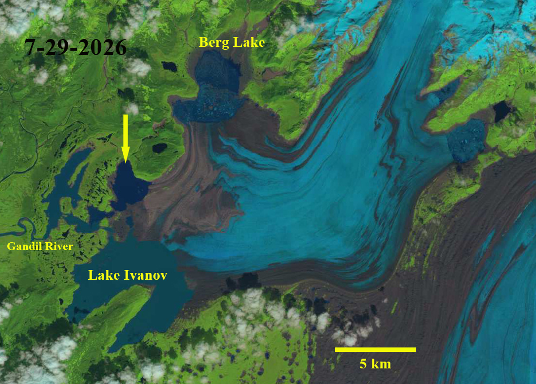
In 2026 the lake filled to an area of 13 km2 by late July and maintained that level through at least Aug. 14th. Imagery from Aug. 27th and 30th indicates the lake had drained. The lake bottom is now littered with icebergs. There are two other ice dammed lakes due east across the glacier that have not drained.
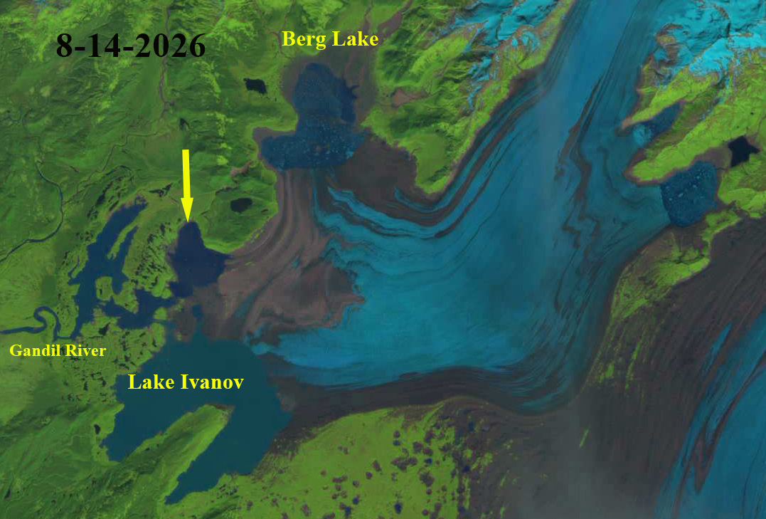
Berg Lake on Aug. 14th still full in this Landsat image. Yellow arrow indicates lake that is dark blue indicative of limited glacier input.

