Rodman Glacier, Alaska Retreat Expands Lake Ustay

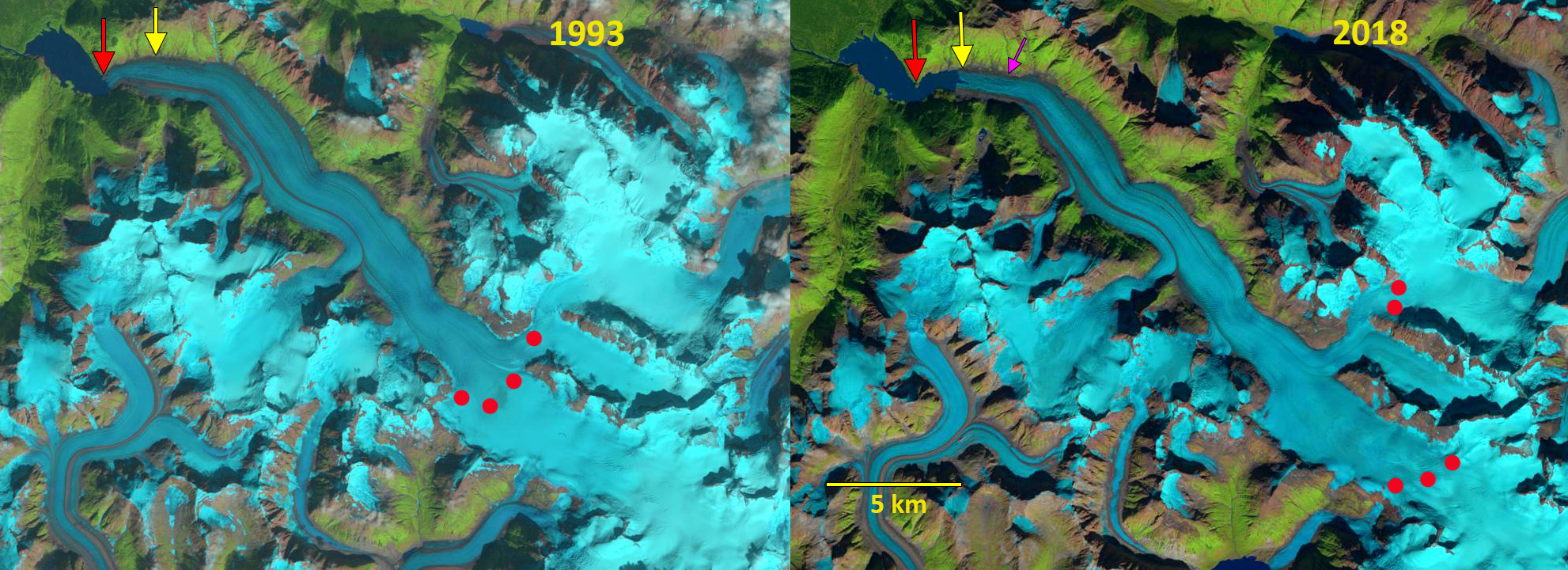
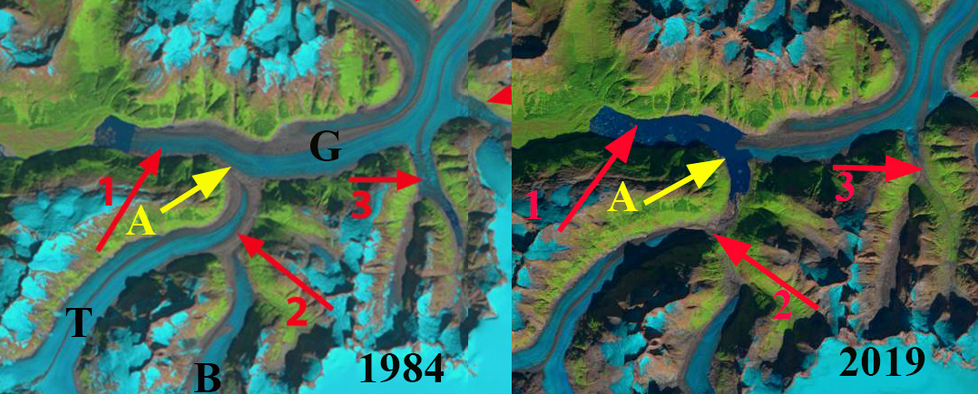
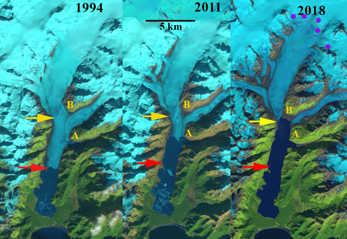
Rodman Glacier in Landsat images from 1987 to 2021 indicating 1987 terminus=red arrow, A=Akwe Lake, U=Ustay Lake, B=glacier base exposed,  C=expanding nunatak

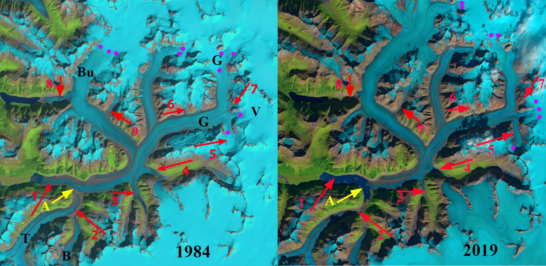
Rodman Glacier flows south from the Brabazon Range ending in Ustay Lake at the margin of the Yakutat Foreland. In the 1906 International Boundary Commission survey of the region Ustay Lake does not yet exist, Akwe Lake has just started to form with the terminus ending in it named Chamberlain Glacier. Chamberlain Glacier was a distributary terminus from Rodman Glacier and by 1948, the thinning Rodman Glacier no longer generated this second terminus. In the 1950’s the glacier terminated on an island in Ustay Lake. By 1968 Austin Post indicated that it had retreated 1400 to 2000 m from its maxiuum Little Ice Age position, but was still grounded on the island.

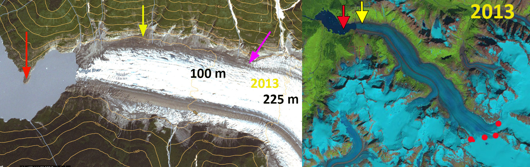
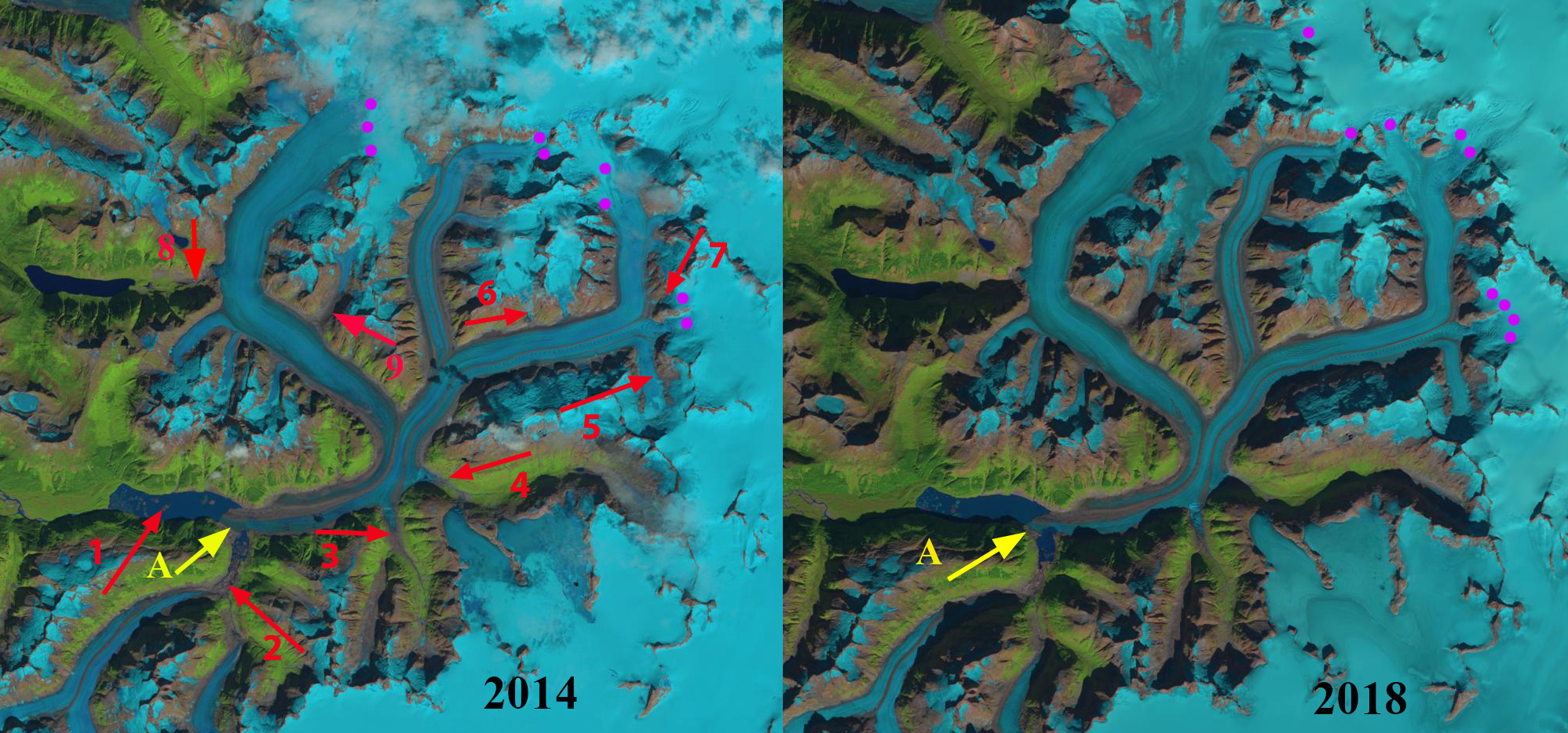
In 1987 the glacier had retreated 200 m from the island. In 2021 the glacier had retreated 800 m from the island. A slow retreat compared to nearby Yakutat Glacier, 21 km since 1906 and 10+ km since 1987) or East Novatak Glacier (2.75 km snce 1987). By Sept. 2022 the glacier had developed a 1 km long 0.4 km² terminus tongue that has significant rifts and will break up in the next year or two. This condition persists into June 2023. The glacier has also developed a significant area of 1.25 km² around Point B where bedrock is exposed in Sept. 2022 and an occasional glacial lake forms filling part of the basin such as in June 2023. At Point C an expanding nunatak indicates extensive thinning up to 800-900 m on this glacier.

.

Rodman Glacier in Sept. 2022 and June 2023 Sentinel Images indicating the terminus tongue with open water on both sides that is poised to breakup, yellow arrows. At Point B is an expanding area of bedrock in Sept. 2022 that is partially water filled in June 2023.

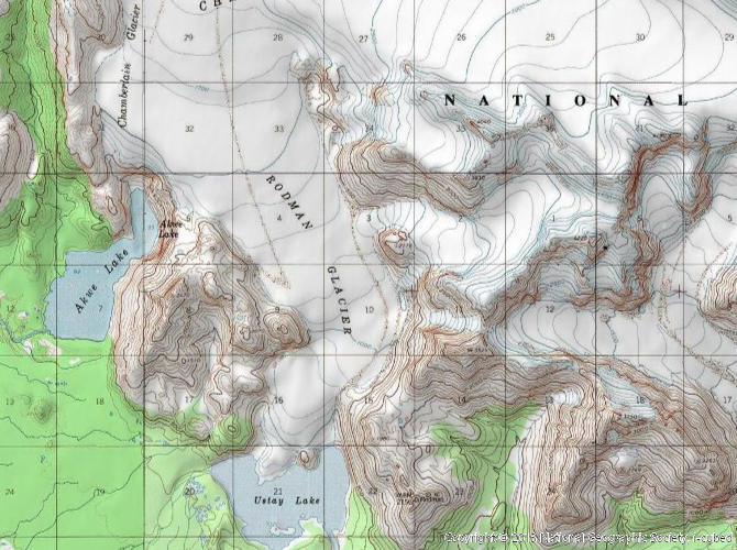
Rodman Glacier in 1950’s topographic map no Island yet in Ustay Lake.

Wright Glacier, Alaska Snowline and Terminus Retreat

Wright Glacier in 1984 and 2019 Landsat images.  The red arrow indicates 1984 terminus location, yellow arrow 2019 terminus location, pink arrow where the surface slope steepens and red dots indicate the snowline. 

Wright Glacier is the largest glacier draining an icefield just south of the Taku River and the larger Juneau Icefield. The glacier accumulation zone is mainly in British Columbia.  The glacier filled a lake basin in 1948 as illustrated by the USGS map and  NSIDC collection,  though the terminus is beginning to break up.

In 1984 the glacier ended at a peninsula in the lake where the lake turns east.  This was my view of this glacier during the summers of 1981-1984 from the Juneau Icefield with the Juneau Icefield Research Program. Our bad weather came from that direction so keeping an eye on that region during intervals between weather events was the practice. Here we examine Landsat imagery from 1984-2019 to document the retreat of Wright Glacier and the rise in elevation of the snowline.

In 1984 the lake had a length of 3.1 km extending northwest from the glacier terminus. The snowline in mid-August with a month left in the melt season was at 1150 m at a main glacier junction.  By 1993 the glacier had retreated little on the north side of the lake and 200 m on the south side. The snowline in mid-September close to the end of the melt season was at 1150 m. By 2013 the glacier had retreated 900 m and was terminating in a narrower portion of the expanding lake, 30 m/year. The snowline was again at the main junction near 1150 m. In 2018 the snowline on September 16th was at 1450 m with less than 25% of the glacier in the accumulation zone.  In 2019 on Aug. 2 the snowline was at 1500 m, likely the highest snowline in the last 70 years, as was the case at nearby Taku Glacier. The high snowlines of recent years has driven an acceleration of the retreat of 1000 m since 2013, 150+ m/year. The glacier has a steeper surface slope 2 km beyond the current terminus front indicating the lake ends either near this point, pink arrow.  This could lead to a reduction in the retreat rate, though calving has not been a major factor in retreat of this glacier.

The glacier drains the same icefield as the retreating West Speel and Speel Glacier.

Wright Glacier in 1993 and 2018 Landsat images.  The red arrow indicates 1984 terminus location, yellow arrow 2019 terminus location, pink arrow where the surface slope steepens and red dots indicate the snowline.

Wright Glacier in 2013 Landsat images and USGS Topo imagery.  The red arrow indicates 1984 terminus location, yellow arrow 2019 terminus location, pink arrow where the surface slope steepens and red dots indicate the snowline.

Gilkey Glacier Retreat Leads to Rapid Lake Expansion in 2019

Gilkey Glacier in 1984 and 2019 Landsat images indicating retreat of 4300m, tributary separation and 5 km2 lake expansion. A=Terminus tongue, B=Battle Glacier, G=Gilkey Glacier and T=Thiel Glacier.

Gilkey Glacier draining the west side of the Juneau Icefield has experienced dramatic changes since I first worked on the glacier in 1981.   The Gilkey Glacier is fed by the famous Vaughan Lewis Icefall at the top of which Juneau Icefield Research Program (JIRP) has its Camp 18 and has monitored this area for 70 years. Here we examine the changes using Landsat images from 1984, 2014, 2018 and 2019.  Landsat images are a key resource in the examination of the climate change response of these glaciers (Pelto, 2011). The August 17th 1984 image is the oldest high quality Landsat image, I was on the Llewellyn Glacier with  JIRP on the east side of the icefield the day this image was taken. JIRP was directed by Maynard Miller at that time and by Seth Campbell now.

In 1984 Gilkey Glacier terminated in a new proglacial lake that had  and area of 1.5 km2 (#1). At #2 Thiel and Battle Glacier merged and then joined Gilkey Glacier. Arrow #3 and #4 indicates valleys which tongues of the Gilkey Glacier flow into, at #3 the glacier extended 1.6 km upvalley.  At arrow #4 the glacier extended 1.5 km up Avalanche Canyon.  At #6, #7 and #9 tributaries flow into the Gilkey Glacier.  At #8 Antler Glacier is a distributary glacier terminus that spilled into a valley terminating short of Antler Lake.

By 2014 the proglacial lake had expanded to 3.65 km2 as the glacier has retreated 3200 m.  Thiel and Battle Glacier have separated from Gilkey Glacier and from each with a retreat of 2600 m for Thiel Glacier and 1400 m for Battle Glacier. The glacier no longer flows into the valley at #4. Tributaries at #6 and #9 no longer reach Gilkey Glacier.  At #7 there is not a direct flow connection, but is still an avalanche connection.  At #8 Antler Glacier has retreated 2200 m.

In 2018 and 2019 the snowline on the Juneau Icefield has been the highest of any year since observations began in 1984.  This will accelerate mass loss and lead to continued extensive retreat.  In 2018 the snowline was at 1600-1650 m on Sept. 16. In 2019 the snowline on Gilkey Glacier was 1650-1700 m on Sept. 10.  In July of 2019 the terminus tongue of the glacier reached across the junction of the Gilkey and Battle Valley, separating the two proglacial lakes.  By September 10, the glacier tongue had broken off leading to the two lakes joining expanding the size of the proglacial lake to 6.5 km2. The terminus has retreated 4300 m since 1984, while the lake has increased in size by more than 400%. The retreat will continue leading to additional lake expansion just as is occurring at Meade and Field Glacier.

The expansion of Gilkey Lake into the Battle Valley in 2019 Landsat images.

Gilkey Glacier in 1984 and 2019 Landsat images indicating retreat of 4300m, tributary separation and 5 km2 lake expansion. A=Terminus tongue, B=Battle, Bu=Bucher, G=Gilkey, T=Thiel, V=Vaughan Lewis. Snowline=purple dots.

Gilkey Glacier in 2014 and 2018 Landsat images indicating retreat, snowline elevation and lake expansion. 


Excelsior Glacier, Alaska Retreat Leads to Lake Doubling in Size

Excelsior Glacier retreat from 1994 to 2018 in Landsat images from 1994, 2011 and 2018.  The red arrow is the 1994 terminus location and the yellow arrow is the 2018 terminus location.  Point A and B are on the south and northwest side of the eastern tributary of the glacier.

Excelsior Glacier is an outlet glacier of the Sargent Icefield, on the Kenai Peninsula of Alaska, that has terminated in an expanding Big Johnstone Lake since 1941. Here we examine the retreat of Excelsior Glacier from 1994-2018 using Landsat imagery. In 1909 the glacier ended on the strip of forested land between the lake and the ocean (Molnia, 2007). By 1950 the glacier had retreated 2 km from this strip of land creating the new lake (USGS-Molnia, 2008).  This blog post is source of an article published by the Washington Post and from NASA Earth Observatory.

In 1994 the glacier was 21 km long and had retreated 5.5 km from the southern margin of Big Johnstone Lake, this is a rate of ~100 m/year since the lake began forming 1941.  There is a glacier dammed lake just south of Point A named Excelsior Lake. By 2001 the glacier had retreated 800 m from the 1994 position, a rate of ~100 meters per year, and the glacier dammed lake south Point A remains, along with a few large icebergs. By 2011, the glacier had retreated beyond the former glacier dammed lake and ended at the prominent ridge just north of this former lake, adjacent to Point A, and the new inlet that replaces it. The glacier has retreated 2200-2500 m depending where on the front the measurement is made. By 2013 the glacier has retreated back to the junction of the two main tributaries between Point A and B.  The snowline is at 900 m, with more than 80% of the glacier falling below the snowline.  A calving Alaskan glacier typically needs at least 60% of its area above the snowline consistently to be in equilibrium. In 2011 and 2013 images there are large icebergs in Big Johnstone Lake indicating active calving. In 2018 the snowline is at 925 m again leaving an insufficient accumulation zone to support the glacier. Big Johnstone Lake has expanded to a length of 10.2 km, with an area of 18 km2.  The glacier has retreated 4.7 km from 1994-2018, a rate of ~200 m/year, twice the previous rate.  The eastern and western tributaries have now fully separated.  Johnstone Adventure Lodge visited the eastern tributary, they call it Roan Glacier, glacier in May of 2019, the photograph they provided below indicates the glacier has receded from the lake.  The glacier in 2018 is 15 km long having lost ~30% of its length in 24 years. Big Johnstone Lake is nearing its maximum size as the glacier surface slope steepens within 1 km of the current terminus, indicating a substantial increase in elevation of the base of the glacier. The lake width has changed little and is 1.4-1.8 km wide in the region the terminus has been retreating through during the last 25 years are has doubled from 9 to 18 km2.  There will be a reduction in calving and retreat rate as the lake development nears completion, in 2018 for the first time there are no visible icebergs. Johnstone Adventure Lodge observed 15-20 harbor seals during their first visit to the glacier front in 2019, 10 of them had pulled out on icebergs.  A reduction in icebergs will make the lake less attractive to harbor seals.

Excelsior Glacier follows the pattern of retreat of the neighboring Ellsworth Glacier and  Pedersen Glacier of the Harding Icefield. This glacier is seen as a model for the impending retreat of Brady Glacier (Pelto et al, 2013).

Excelsior Glacier retreat from 1994 to 2018 in 1984 USGS map and Landsat images from 2001 and 2013.  The red arrow is the 1994 terminus location and the yellow arrow is the 2018 terminus location.  Point A and B are on the south and northwest side of the eastern tributary of the glacier.

“Roan Glacier”  the eastern tributary of Excelsior Glacier in May 2019 now terminating on an outwash plain.  Image from Johnstone Adventure Lodge.