Davidson Glacier is a large glacier that flows east from the Chilkat Range to the foreland along Chilkat Inlet and Lynn Canal in southeast Alaska. As a result it has a long history of observation of change. Molnia (2008) noted that from 1889 to 1946 the glacier retreated 400 m and a lake had developed at the terminus. By 1978 the glacier had retreated another 700 m with the proglacial lake at the terminus further expanding. Molnia (2008) futher observed a 700 m retreat by 2004. Here we examine Landsat imagery from 1993 to 2014 to identify recent changes of the glacier.
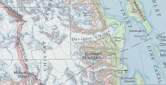
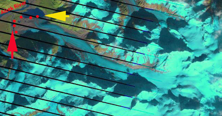
USGS map

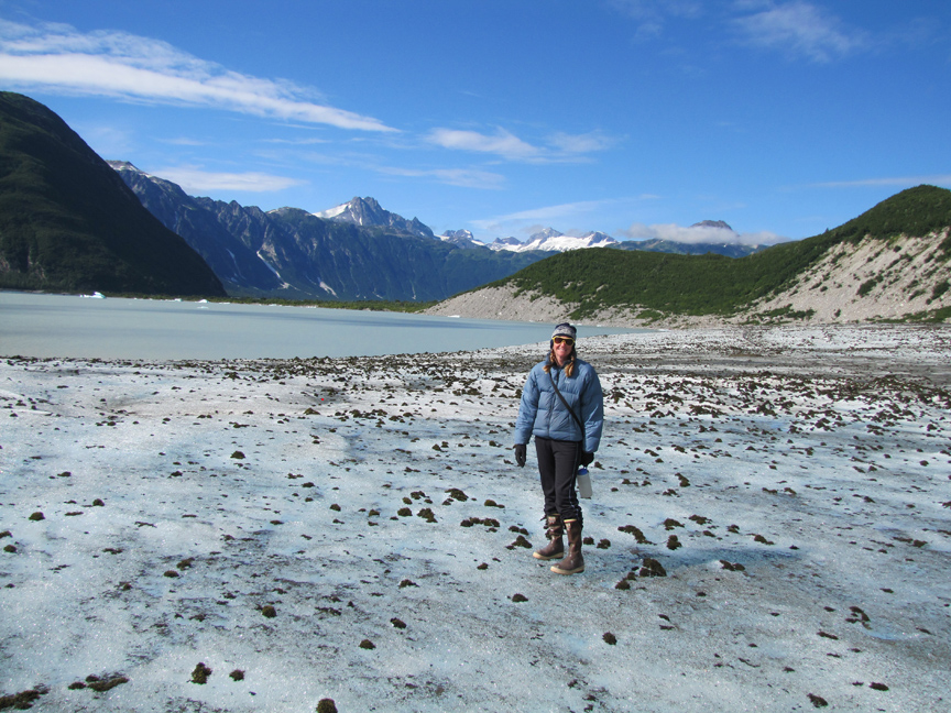
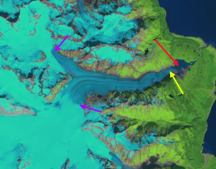
Google Earth Image
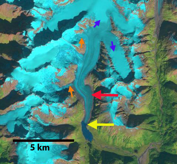
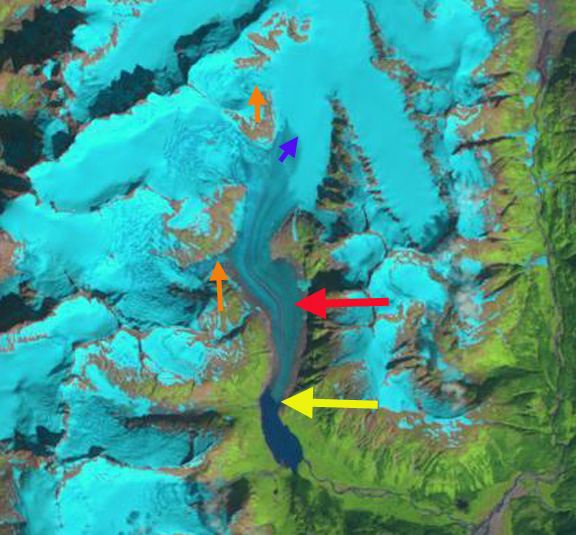
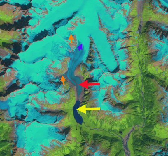
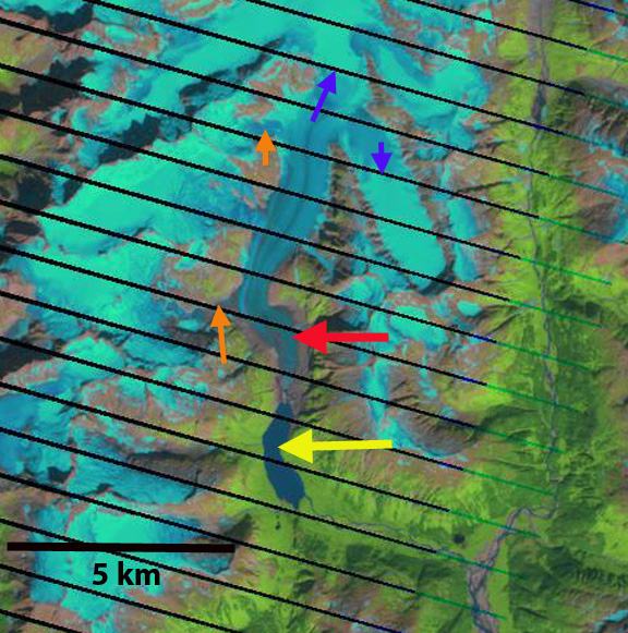
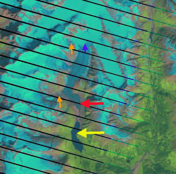
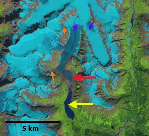
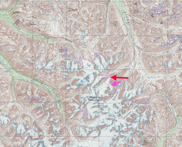
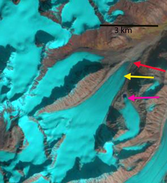
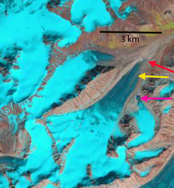
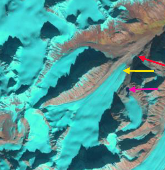
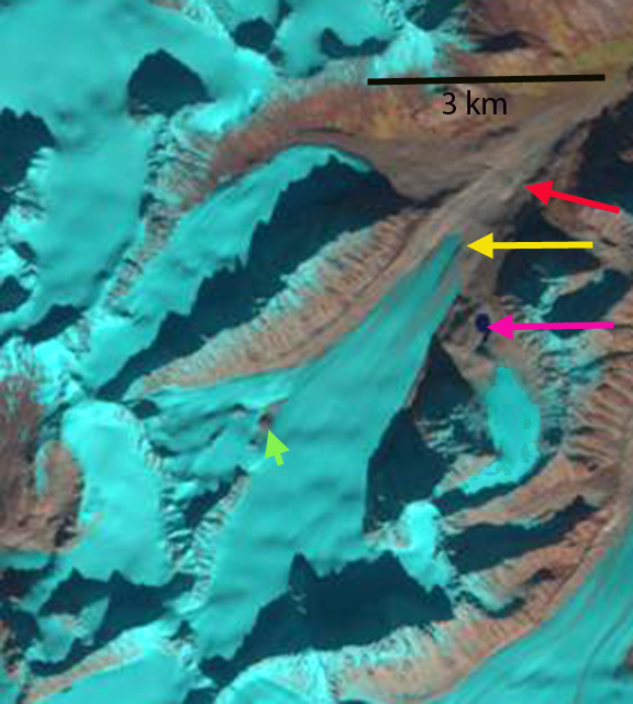
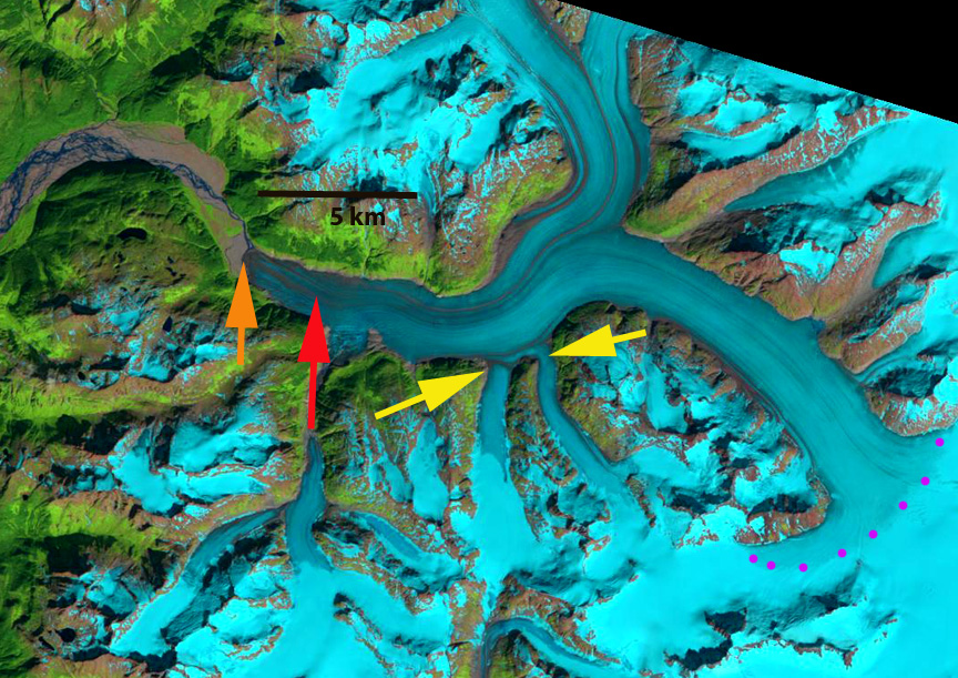
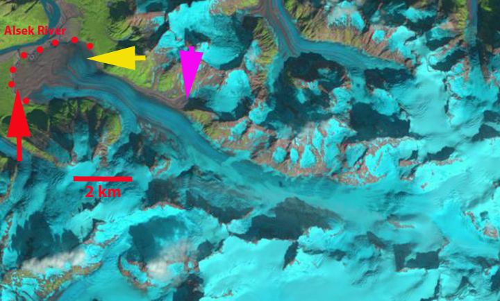
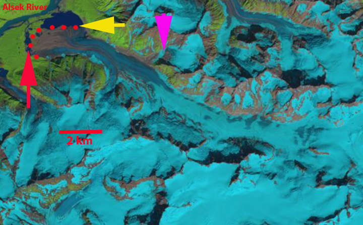
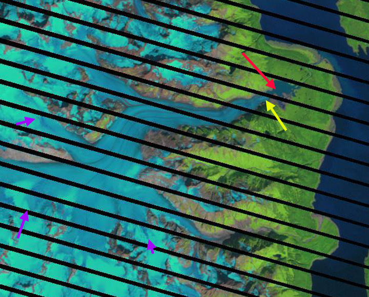
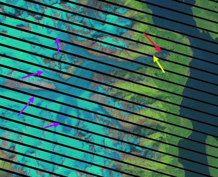
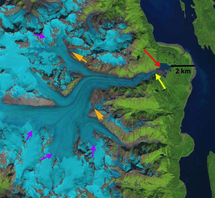
In 1984 the glacier terminated at the end of a peninsula extending from the south side of the proglacial lake, red arrow. The purple arrow is the snowline at 1100 m. The orange arrows indicate two tributaries feeding the main glacier. By 2001 the terminus has retreated 500 m into a narrower western section of the lake. In 2004 the snowline is at 1250 m, leaving little accumulation area. In 2009 the snowline is at 1200 m. The terminus has retreated from the proglacial lake. In 2013 the snowline is at 1100 m, there is a river connecting the terminus at the yellow arrow to the proglacial lake. The glacier no longer reaches the foreland having retreated into a mountain valley. In 2014 the snowline was at 1300 m at the start of August with a month left in the melt season. The two tributaries at the orange arrows only have a thin connection to the main glacier. The terminus has retreated 800 meters from 1984 to 2014. The retreat will continue due to the high snowlines in recent years and tributary separation. The retreat is less than most nearby glaciers such as Sinclair Glacier or Ferebee Glacier, just east across Lynn Canal.
Johnson et al (2013) compare changes in Davidson and Casement Glaciers that share a flow divide at 1200 m, Casement Glacier flows west and Davidson Glacier flows east. Both glaciers thinned at a rate of 1 m per year at the flow divide from 1995-2011. This is an indication of the high snowlines and negative glacier mass balance. Casement Glacier had a much greater thinning below 600m than Davidson Glacier, which leads to greater retreat. The difference is that Davidson Glacier has a steeper gradient from the terminus than most glaciers. 
1984 Landsat image
2001 Landsat image
2004 Landsat image
2009 Landsat image

2013 Landsat image
2014 Landsat image