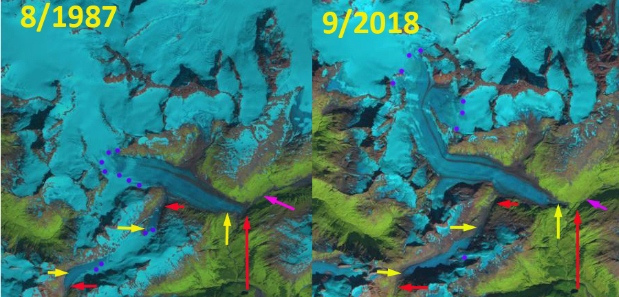
Cordova Glacier retreat and glacier separation revealed by Landsat images from 1987 and 2018, red arrow is the 1987 terminus position of main glacier and tributaries, yellow arrow is the 2018 terminus location. Purple dots indicate the snowline and the pink arrow the former location of Rude Lake.
Cordova Glacier is located at the head of the western fork of the Rude River in the Chugach Mountains, Alaska. In USGS maps the glacier dams Rude Lake which is ~1.5 km long and 0.5 wide (see below). Molnia (2008) noted the lake was gone in 2008 and the former bed was covered by vegetation indicating the lake had not recently drained for the last time. Here we examine changes in the glacier from 1987-2018 using Landsat imagery.
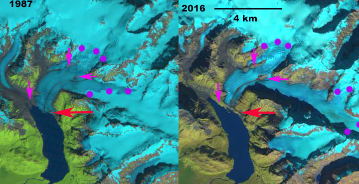
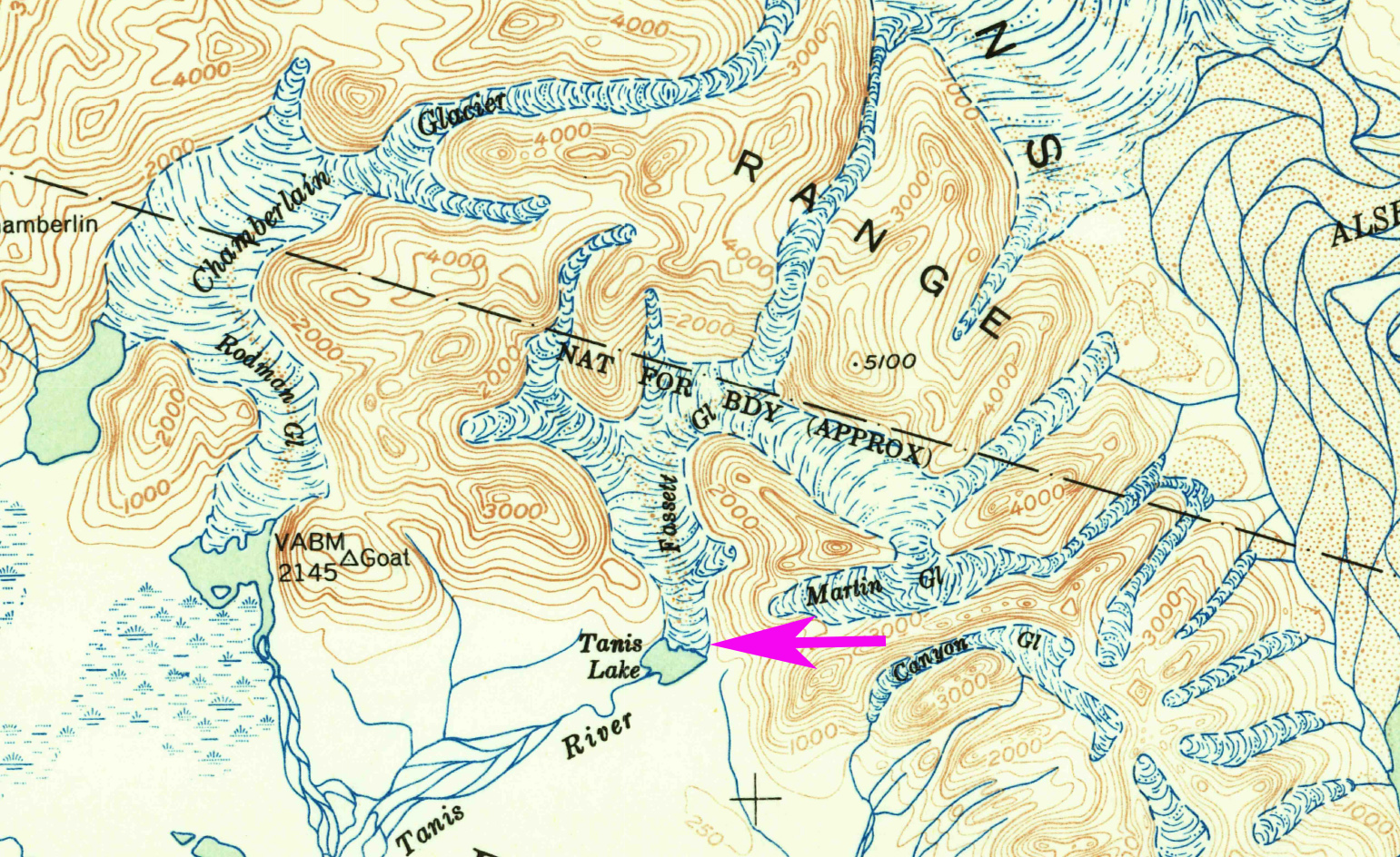
In the USGS map of the region from the 1950’s, Rude Lake is dammed by the terminus of Cordova Glacier, pink arrow. There is a significant tributary entering from the southwest a short distance above the terminus. By 1987 Rude Lake has drained and much of the lake bottom has been occupied by vegetation. The terminus does still extend to the bottom of the West Branch Rude River Valley. The tributary entering from the southwest has detached from Cordova Glacier. The snowline is at 950 m in August 1987. In 9/2016 and 8/2017 the transient snowline is at 1400 m and 1350 m respectively. The former southwest tributary like the main glacier has limited retained snowcover that cannot maintain the glacier at it current size. In early September 2018 the snowline on Cordova Glacier is again at 1400 m. The main terminus has retreated 800 m since 1987. The southwest tributary has both a western and eastern terminus that have retreated 1100 m and 500 m respectively. The total length of the southwest tributary declined from 6.1 km to 4.1 km in length the entire valley reach of the glacier has lost snowpack in 2016-2018. That heralds that this section of the glacier will melt away.
The retreat of this glacier is less significant than many glaciers in the region including Alsek Glacier and Shoup Glacier. The high snowline in 2018 indicative of high ablation, which was also noted on Lowell Glacier.
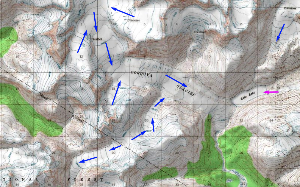
Alaska Topographic Map of Cordova Glacier indicating Rude Lake, pink arrow.
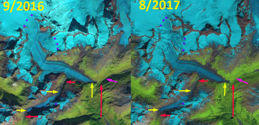
Cordova Glacier terminus position and snowline revealed by Landsat images from 2016 and 2017, red arrow is the 1987 terminus position of main glacier and tributaries, yellow arrow is the 2018 terminus location. Purple dots indicate the snowline and the pink arrow the former location of Rude Lake.