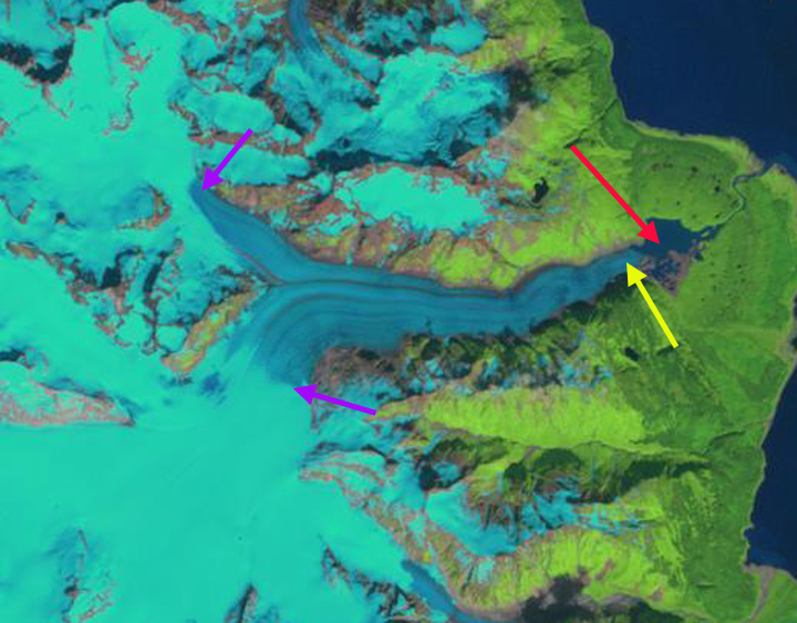
Oscar Lake growth on the east margin of Brady Glacier in Landsat images from 2000-2020. Point A indicates glacier tongue that becomes iceberg. Blue arrows indicate flow direction.
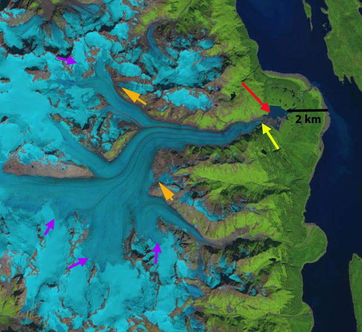
Brady Glacier, is a large Alaskan tidewater glacier, in the Glacier Bay region that is beginning a period of substantial retreat Pelto et al (2013). The glacier has a number of expanding lakes that are expanding as the secondary termini feeding them retreat. The lakes Trick, North Deception, Dixon, Bearhole, Spur, Oscar, and Abyss continue to evolve. Pelto et al (2013) noted that the end of season observed transient snowline averaged 725 m from 2003-2011, well above the 600 m that represents the equilibrium snowline elevation.In 2018 and 2019 the melt season has been intense for the Brady Glacier in Alaska reaching 1100-1200 m both years. Here we examine the expansion of Oscar Lake from 2000-2020.
In 2000 the lake was just developing and had an area of ~0.5 km2. In 2004 the lake had expanded to ~0.8 km2. In 2006 the glacier was 1.0 km2 in area, Capps et al (2010) reported the maximum lake depth measured with a remote control boat at 140 m near the ice front. The glacier still reaches the east margin of the basin separating the lake into a northern and southern section. They further noted that nearby Abyss Lake had begun to drain subglacially into Oscar Lake. In 2010 Oscar Lake had doubled since 2006 to an area of 2 km2. In 2004 the glacier tongue that extends to the east margin of the lake is still in place, but is too narrow to be stable. In 2016, 2018 and 2019 very high snowlines led to extensive melt and glacier thinning, reported in 2016 (Pelto, 2016), and on nearby Taku Glacier setting a record (Pelto, 2019). In 2018 and 2019 a debris covered tongue, Point A, remained attached to the main glacier. In July 2020 this tongue has broken free. The lake now has an area of 4 km2. The high snowline in 2019 exposed many firn layers from previous years. These layers were the retained snowcovered from previous winters, that had survived summer and been buried by the next years snowfall. The collective melt of the recent years is exposing the layers.
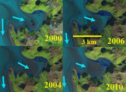
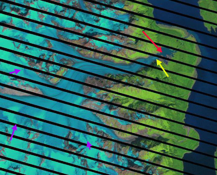
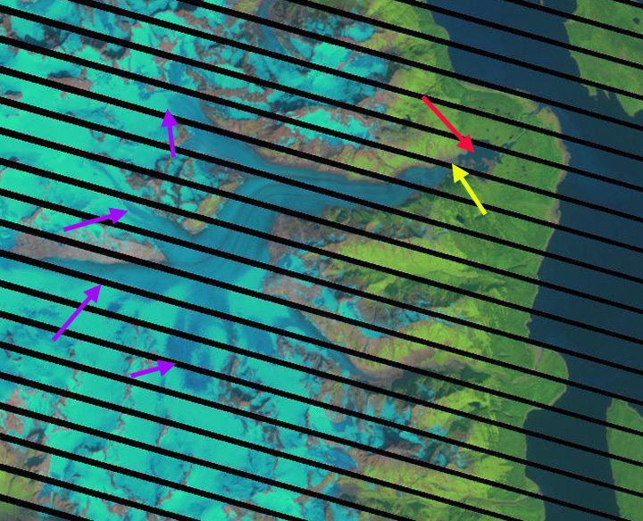
Oscar Lake growth on the east margin of Brady Glacier in Landsat images from 2000-2010 Blue arrows indicate flow direction. There is a southern and northern part of the lake separated by the glacier tongue during this period.

Oscar Lake in 2014 in a Digital Globe image. Note unstable tongue exteding to east end of basin.

Brady Glacier in 98/2019 Landsat image indicating snowline at 1100-1200 m with purple dots. S=Spur Lake, O=Oscar Lake, A=Abyss Lake, F=Firn lines, D=Dixon Lake, B=Bearhole Lake, N=North Deception Lake, T=Trick Lake

Firn layers on upper Brady Glacier in 9/8/2019 Landsat image.