Sheridan Glacier, Alaska Retreat Causes Rapid Lake Expansion

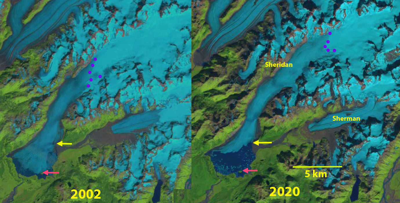
Sheridan Glacier in 2002 and 2020 Landsat images illustrating retreat of the margin and expansion of the lake. Red arrow is 2002 margin on small island, yellow arrow is 2020 terminus location just north of Sherman Glacier stream and purple dots are the snowline.

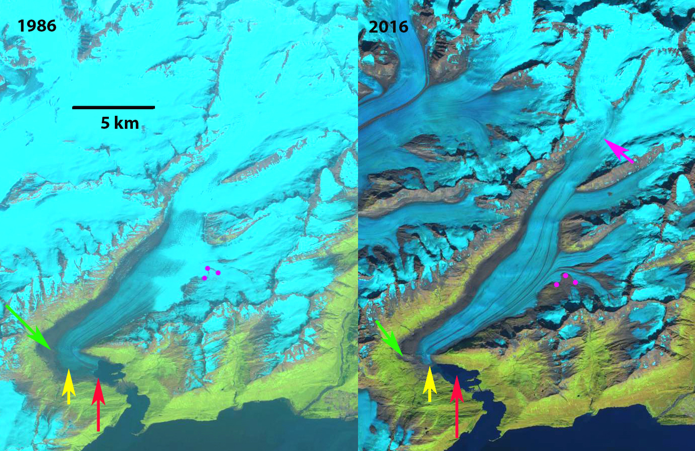
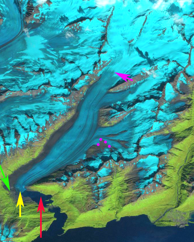
Sheridan Glacier in the Chugach Mountains of Alaska begins at 1500 m and flow southwest out of the mountains with the terminus spreading out in a  lake basin on the low slope coastal plain.  Sheridan Lake is a proglacial lake at the terminus that drains into the Sheridan River which 12 km later reaches tidewater. From 1950 to 2000 Sheridan Glacier experienced modest retreat, with the terminus, with a fringing proglacial Sheridan Lake persisting, followed by a terminus disintegration from2000-2016. (Shugar et al 2018). Here we examine Landsat imagery from 2002-2020 to identify the retreat and resultant lake expansion.

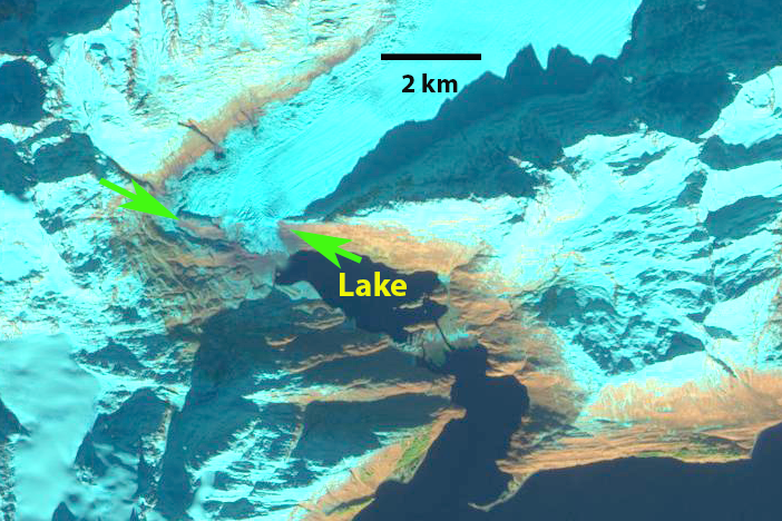
In 2002 the proglacial lake has an area of 3.8 km2, with the terminus crossing one small island in the lake.  The snowline is at 750 m. In 2013 there is a 4 km2 terminus area that has disintegrated, the terminus has retreated off of the island.  The snowline is at 850 m. By 2016 the terminus has retreated north of the glacier stream from Sherman Glacier entering from the east, though much of the lake is still filled with an iceberg melange.  The snowline is at 925 m.  In 2020 the Sheridan Lake area has expanded to 11.2 km2, representing a retreat of 7.4 km2 since 2002.  The snowline in 202o is at 970 m.  In June 2021 there are a significant number of new icebergs indicating ongoing lake expansion during 2021.  Sheridan Lake is not a large glacial lake by Alaskan standards, but is bigger than any glacial lake in most alpine regions such as the Himalaya.  The ability to be so large is in large part due to the ability to develop larger basin on low sloped terrain near the coastline.

The amount of terminus retreat here is less than that at Excelsior Glacier or Yakutat Glacier, but the lake expansion rate is comparable to Excelsior Glacier.

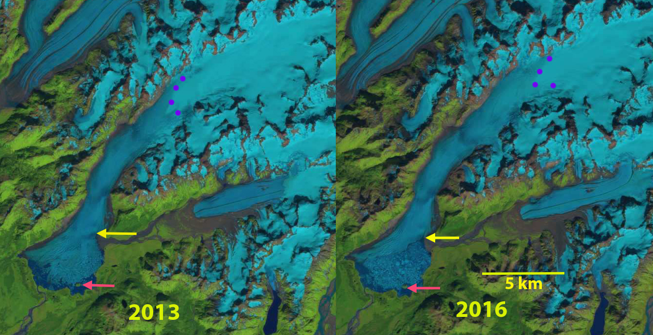
Sheridan Glacier in 2013 and 2016 Landsat images illustrating the breakup of a large terminus region generating a melange of icebergs. Red arrow is 2002 margin on small island, yellow arrow is 2020 terminus location just north of Sherman Glacier stream and purple dots are the snowline.

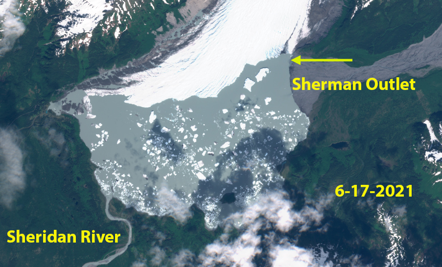
June 2021 Sentinel Image indicating considerable new iceberg activity leading to ongoing lake expansion in 2021.


Shoup Glacier, Alaska Retreat, Thinning, Velocity Decline

Shoup Glacier comparison in 1986 and 2016 Landsat images.  The glacier retreated 1900 m in this interval.  Red arrow is 1986 terminus, yellow arrow the 2016 terminus, green arrow rock rib emerging from beneath glacier, purple dots a landslide deposit, and purple arrow the snowline.

Shoup Glacier is between the Columbia Glacier and Valdez draining from the Chugach Mountains in southern Alaska.  The glacier was a tidewater terminating glacier until 1953 (McNabb et al, 2014).  From 1985 to 2011 McNabb et al (2014) noted a 1.7 km retreat.  The retreat was enhanced by significant lacustrine calving in an expanding tidal lagoon.  Here we examine Landsat and Sentinel images from 1986-2016 to identify recent and potential future changes.

In 1986 the glacier extends to the red arrow in the midst of a tidal lagoo. The glacier is 2.5 km wide at the sharp bend in the glacier 2.5 to 3 km from the terminus, green arrow.  There is significant crevassing at this bend indicating an increase in slope.  There is an landslide/avalanche deposit near the junction with a tributary, purple dots.  By 2002 the glacier has retreated 1.5 km since 1986, the minor ice cliff at the terminus indicates the glacier ends in shallow water near the end of the tidal lagoon.  The glacier is now 2 km wide at the sharp bend.  The landslide deposit, purple dots,  has shifted little since 1986. The snowline is at 1200 m in 2002.  By 2016 the glacier has retreated an additional 400 m since 2002, 1900 m since 1986.  The glacier no longer terminates in the lagoon.  A bedrock rib at the sharp bend has been exposed and the glacier is only 500 m wide now and this bend is just 500 m from the terminus, green arrow.  A closeup of this rib in a 2016 Sentinel image indicates why the crevassing had occurred, it is also clear this is an extension of the ridge that runs east from the glacier.  This is a band of erosion resistant rock.  This suggests that a basin exists above the this bedrock rib/ridge and a new lake will form.  The glacier slope from the green arrow for the next 2 km upglacier is quite low 1/40, again indicative of a basin beneath the lower glacier.  There is an increase in crevassing 2 km above the current terminus,  suggesting another increase in surface slope and the probable limit of the basin.  In 2016 the snowline is at 1250 m.  The landslide deposit remains little changed since 2002, indicating a low velocity in this region.  Burgess et al (2013) indicates the velocity of the Shoup Glacier near the terminus is in the range of 100 m annually.  The tributary is clearly significantly less. The low velocity, thinning and retreat indicates the glacier is continuing to lose volume via surface melting, despite no longer calving as Larsen et al (2015) have indicated is the prime mechanism for ice loss.  The retreat of this glacier is similar to that of nearby Valdez Glacier.

Shoup Glacier comparison in 2002 Landsat image.  Red arrow is 1986 terminus, yellow arrow the 2016 terminus, green arrow rock rib emerging from beneath glacier, purple dots a landslide deposit, and purple arrow the snowline.

Shoup Glacier terminus in 2016 Sentinel 2 image.  Green arrows indicate rock rib.