Burphu Glacier Retreat, Uttar Pradesh, India

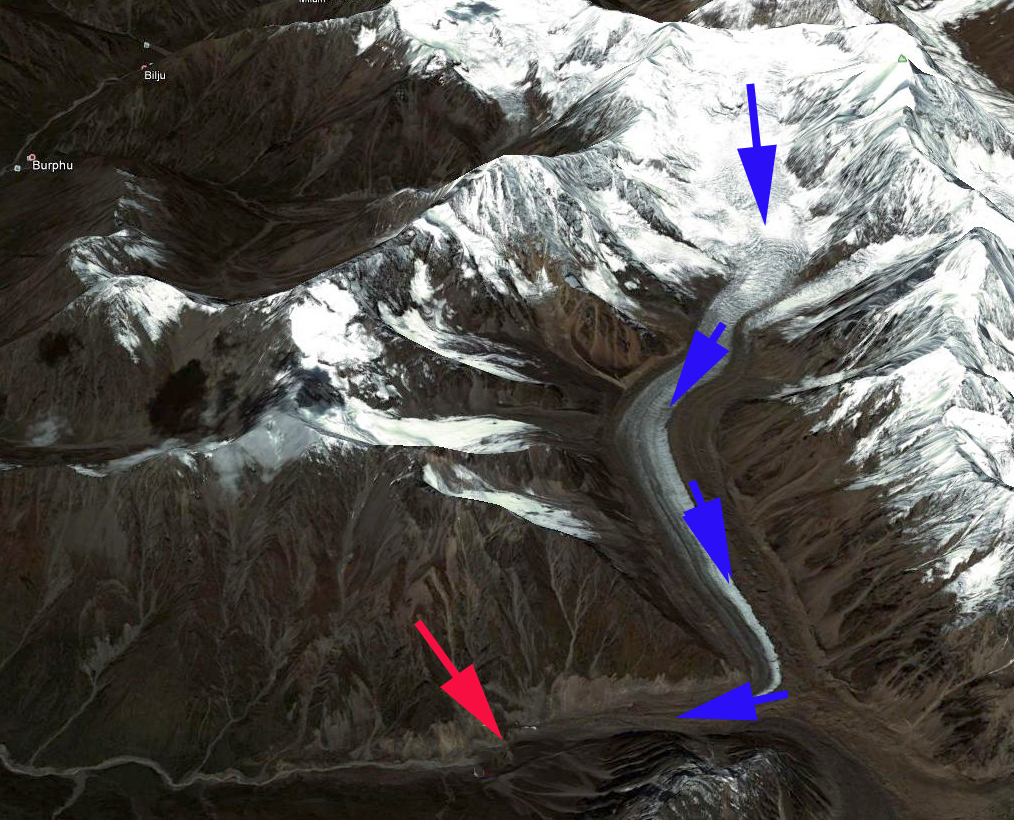
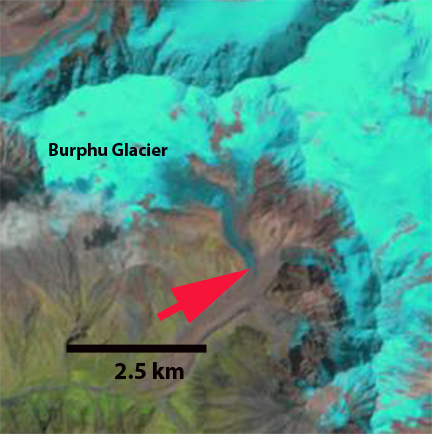
Burphu Glacier is in Uttar Pradesh, India draining into the Goriganga River. The Burphu Gad stream enters the Goriganga a short distance upstream of the proposed hydropower project at Bogudiyar. This project is slated at 370 MW, and will have only a minor dam to divert the water from the river for a short distance before running through turbines and returning to the river. The map of the area is a 1940’s era map with the terminus of the Burphu Glacier indicated by the yellow arrow.burphu map

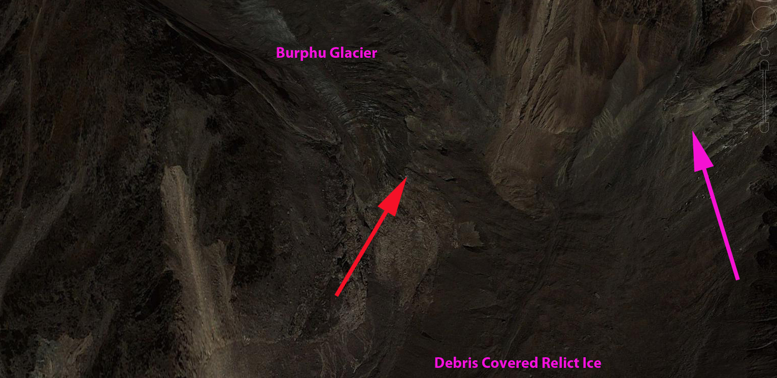
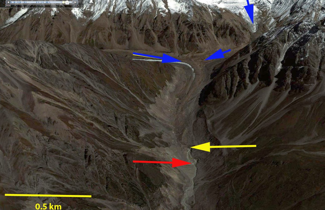
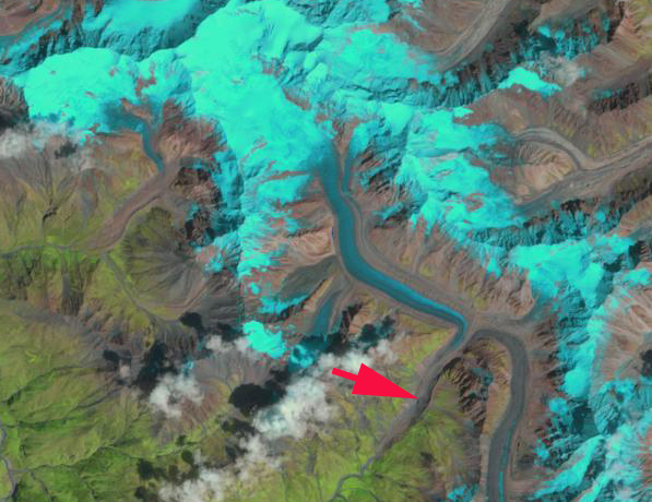
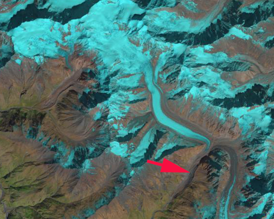
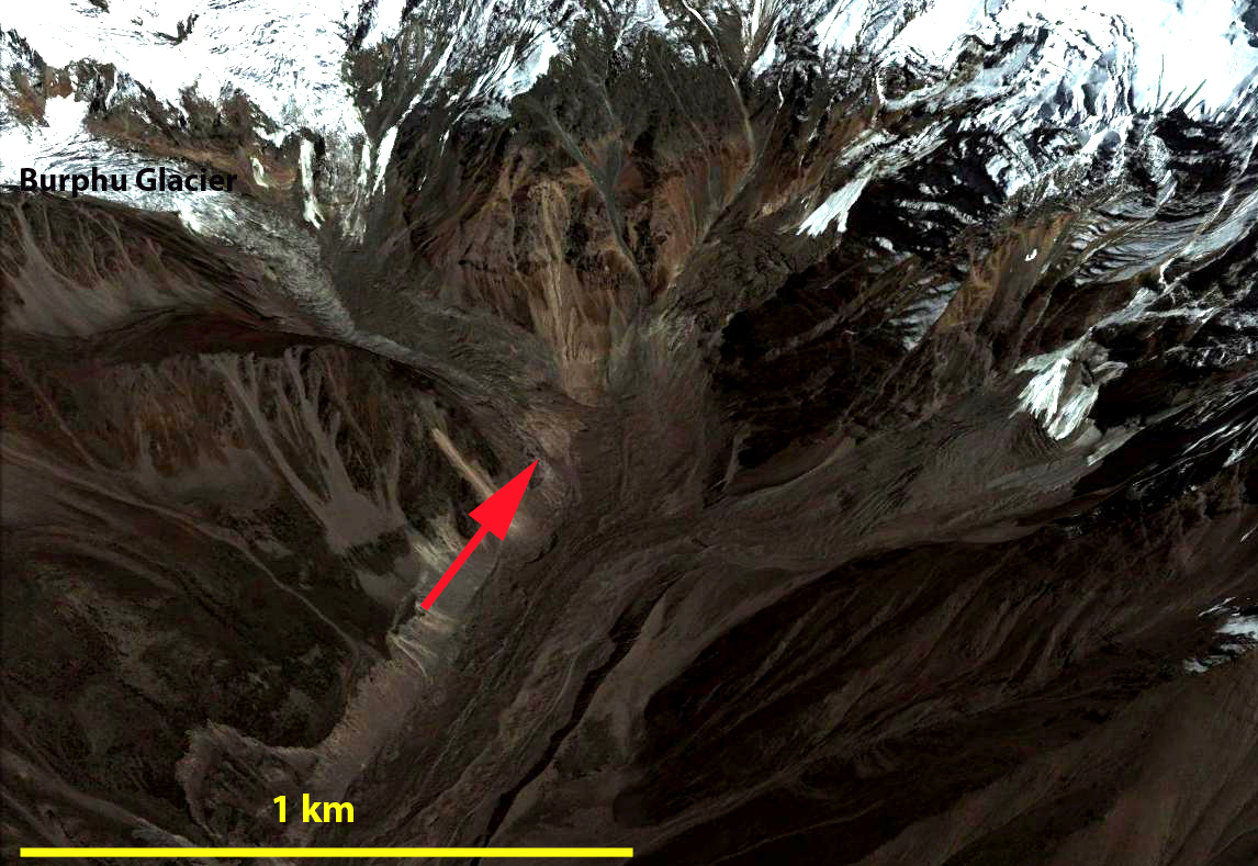
Here we examine Google Earth imagery and Landsat imagery from 2000-2013 to identify more recent changes. The Burphu Glacier has a substantial accumulation zone above 5000 m, before the glacier narrows and flows through an icefall descending to 4300 m where the glacier reaches the main valley and turns southwest, yellow arrow indicates map terminus, red arrow 2012 terminus. In the 2000 Landsat image the blue ice tongue of the Burphu Glacier reaches the main valley at the westward turn where debris cover than dominates, red arrow. By 2013 the Landsat image indicates the blue ice tongue no longer reaches the main valley, red arrow. In 2012 the Google Earth image illustrates an area of bare rock at 4400 m at the red arrow indicating that the Burphu Glacier terminates above the main valley as suggested by the Landsat 2013 image, though some relict ice remains in the main valley below. An even closer view indicates that the other tributary to the main valley tongue of the Burphu Glacier no longer reaches it either, pink arrow. Thus, this area with some pockets of relict glacier ice buried under debris cover is now fully detached. The total glacier retreat from the 1940’s mapped terminus to 2012 is 2800 meters. The retreat from 2000-2012 is at least meters 250 m as this the distance from the relict main valley ice to the current terminus. The retreat of this glacier is very similar to that of the nearby Kalabaland Glacier and is following the pattern of Malana Glacier, Milam Glacier and Satopanth Glacier in this region. burphu overview
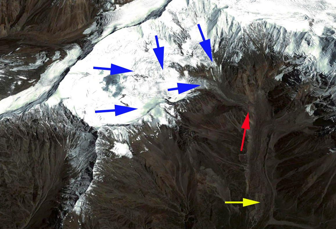
Google Earth overview 2012

burphu 2000
2000 Landsat Image

burphu 2013
2013 Landsat Image

burphu 2012
2012 Google Earth view

burphu closeup

Kalabaland Glacier, Retreat, Uttar Pradesh, India

Kalabland Gal (Glacier) in Uttar Pradesh, India drains into the Goriganga River, via Ralam Gad. The glaciers flows southeast from the Peak of Chhiring We, joins the Yankchar Glacier and turns sharply southwest. The combined terminus is referred to as Shunkalpa Gal, but here since Kalabaland is the largest contributing glacier, that name is applied to the terminus as well. Here we examine changes in the glacier from 2000 to 2013 using Google Earth and Landsat imagery. purphu map
Map of Region

ralma ge
Google Earth Image, blue arrows glacier flow, red arrow terminus.

The Goriganga River is fed by many glaciers and is a target for a number of run of river hydropower projects, some existing such as at Talla Dummar and others projected, such as at Bogudiyar. These projects have only minor dams to divert the water from the river for a short distance before running through turbines and returning to the river. In 2000 both Landsat and Google Earth imagery indicate the terminus location, red arrow. The terminus is heavily debris covered and is evident because of the glacial stream that emerges from beneath the debris covered ice. By 2012 the glacier had retreated 250 m to the yellow arrow. The lowest one kilometer of the glacier has thinned both in width and thickness, is stagnant and will melt away soon. The side by side view from 2000 and 2012 better indicates the change and the thinning of the terminus tongue. The two pink markers are at the 2000 and 2012 terminus respectively, dark pink 2000 and light pink 2012.

ralma 2004
2000 Google Earth

Ralma 2012
2012 Google Earth

ralman terminus change
Terminus closeup in Google Earth

Landsat images from 2000 to 2013 indicate that the terminus retreat is small compared to the full length of the glacier, red arrows. The width and length of blue ice extending southwest at the bend has been reduced from 2000 to 2013 indicating a continued reduction in net flow of ice to the terminus. This glaciers retreat is following the pattern of Malana Glacier, Milam Glacier and Satopanth Glacier in this region.

ralman ls 2000
2000 Landsat image

ralman 2013
2013 Landsat image