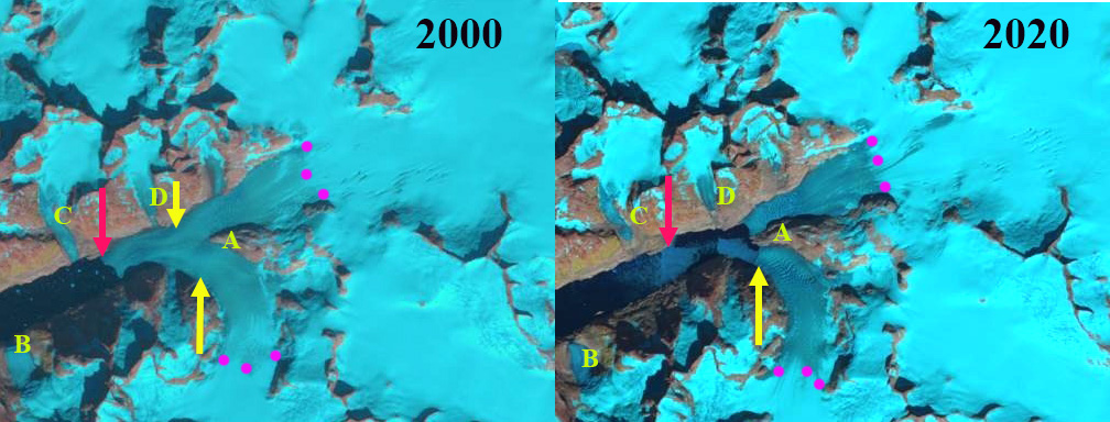
Paarliit Sermia in 2000 and 2020 Landsat images. The red arrow indicates the 2000 terminus location and the yellow arrow the 2020/21 terminus location. A denotes the junction of two main glacier branches, while B,C and D indicate tributaries
Paarliit Sermia is one of the most southerly tidewater glaciers in Greenland. It is an outlet glacier of a mountain icefield and not part of the main ice sheet. Similar to other icefield outlet glaciers whether in Alaska (Dawes Glacier) or Patagonia (Upsala) retreat is leading to glacier separation. Greenland tidewater outlet glaciers in this region have experienced substantial retreat since 1990, Weidick et al (2012) and Howat and Eddy (2011). There was also an increase in sea surface temperature (Straneo et al, 2013). Moon et al (2020) noted a there is a rapid reconfiguration of the Greenland Ice Sheet Coastal margin due to retreat. The retreat of glaciers in southern Greenland is changing the physical geography and hence the physical oceanography of the fjords. Here we examine Landsat imagery from 2000-2021 to identify the changes of Paarliit Sermia.
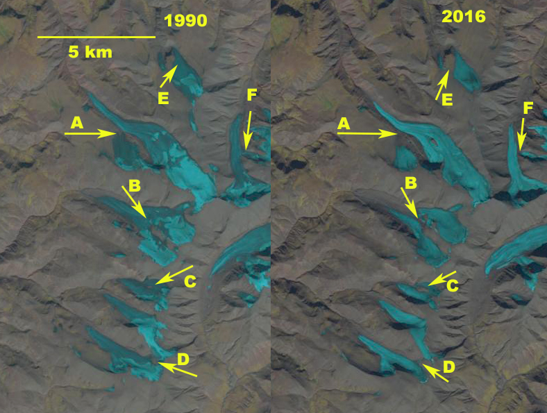
The Greenland Topographic map indicates the terminus down fjord from tributary B, 6.5 km from the main junction of two glacier branches at Junction A. Tributary B, C and D all feed the main glacier. By 2000 the glacier has retreated beyond tributary B and C. The snowline is between 550 m and 600 m in 2000 and 2002. In 2017 the glacier has retreated beyond Tributary D, and the snowline is slightly above 600 m. The two main branches are still joined, with the terminus now just 1 km from Junction A. Former Tributary C and D no longer reach tidewater. In 2020 the two main branches have separated and Point A is no longer a junction glacier has separated into two branches, the snowline is at ~600 m. In mid-June of 2021, the snowline is already at 500 m, despite being early in summer. Paarliit Sermia has retreated 2.4 km from 2000-2021, a rate of ~200 m/year.
Nearby Kangersuneq Quingordleq Glacier retreated 2.8 km from 1999-2016. To the northeast Qaleraliq has experienced a 3.2 km retreat of its west arm and 1.2 km of its east arm from 1992 to 2012. To the northeast Tingmiarmiit Glacier’s retreat from 1999-2015 has led to complete separation of the western and northern tributary. The western tributary is the main glacier and has retreated 2.4 km and the northern tributary has retreated 2.2 km in the 16 year period. In the case of nearby Tasermiut Fjord retreat has led to the fjord losing its tidewater connection.
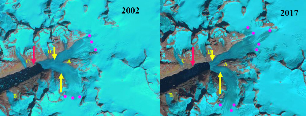
Paarliit Sermia in 2002 and 2017 Landsat images. The red arrow indicates the 2000 terminus location and the yellow arrow the 2020/21 terminus location. A denotes the junction of two main glacier branches, while B,C and D indicate tributaries 
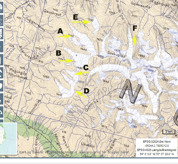
Paarliit Sermia in 1980’s Greenland Topographic map (from Nuna GIS) and 2021 Landsat images. In the Landsat image the red arrow indicates the 2000 terminus location and the yellow arrow the 2020/21 terminus location. On both map and image A denotes the junction of two main glacier branches, while B,C and D indicate tributaries