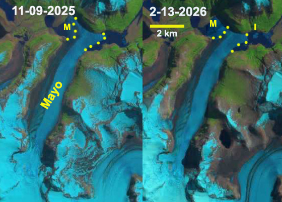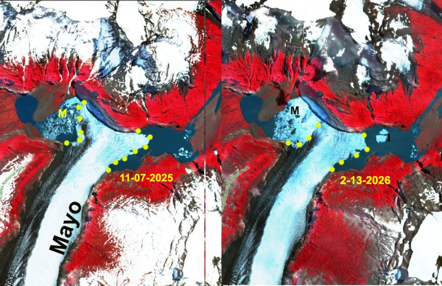

Glaciar Mayo, Argentna in Los Glaciares National Park is an eastern outlet of the Southern Patagonia Ice Cap. The glacier has terminated on the northern shore of a glacial lake for the last ss years. The mass balance from 1975-2011 was identified as slightly positive by Schaefer et al (2015). This enabled the glacier to terminate on the northern shore of a glacial lake, an arm of Lago Argentino from 1984-2020. From 2000-2019 Minowa et al (2021) noted that Glaciar Mayo had transitioned to a negative balance and overall thinning. This thinning is what has led to the terminus beginning to collapse into the lake.
The terminus tongue projecting into the lake had been 2.5 km2, had now declined to 1.4 km2. The terminus along the northern shore had been 2000 m wide and is now 1150 m wide. There is further crevassing/rifting that suggests the glacier tongue is not done thinning in 2026. This continues to be an active year for calving retreat in Patagonia as seen at Upsala and Jorge Montt Glacier, see below.