Nizkiy Glacier, Novaya Zemlya Embayment Drains via Terminus Breach

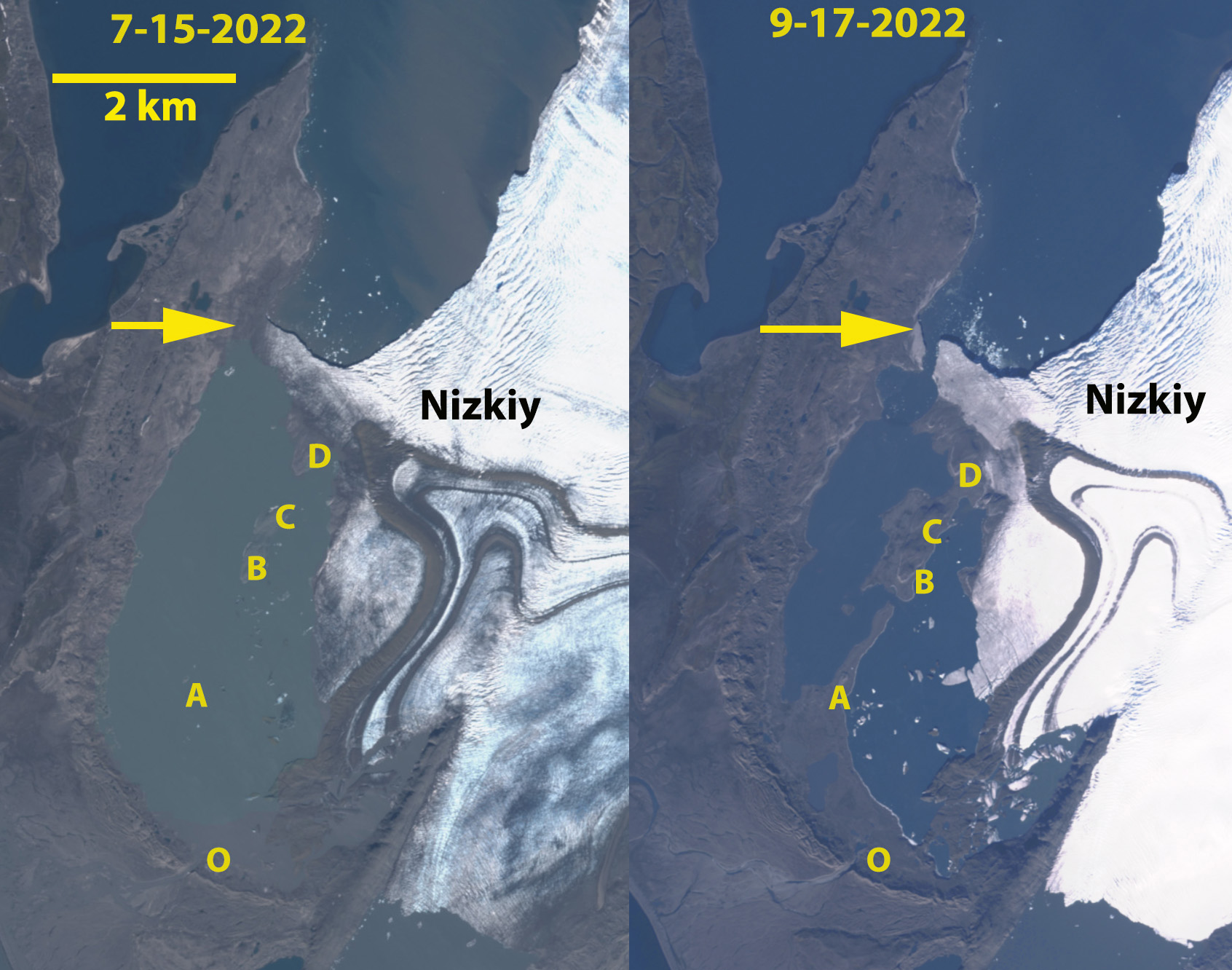
Nizkiy Glacier in Sentinel images from July 15 and Sept. 17 2022, before and after the breach of the terminus. Point A-D indicate emerging land due to falling water level as the embayment drains. The former outlet (O) is also noted.

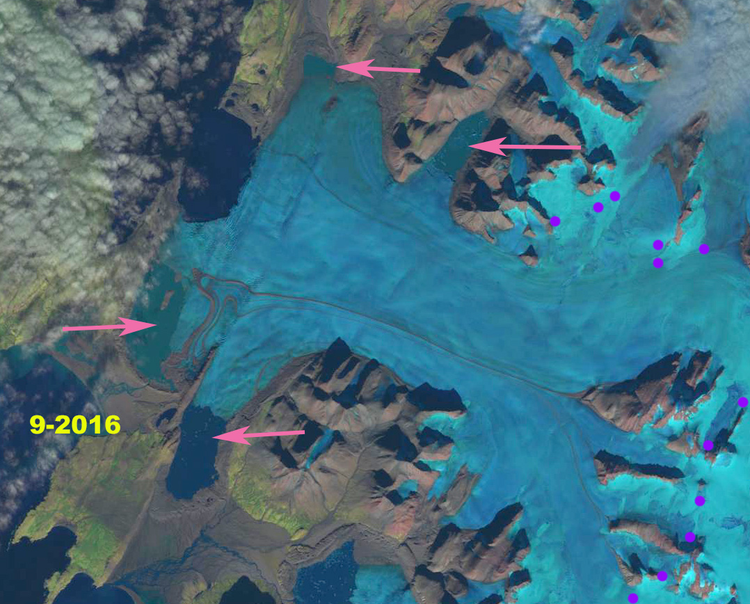
Nizkiy  Glacier is on the west coast of the island reaching the Barents Sea Coast.  Carr et al (2014) identified an average retreat rate of 52 meters/year for tidewater glaciers on Novaya Zemlya from 1992 to 2010 and 5 meters/year for land terminating glaciers. Pelto, (2016) noted the contined expansion of an empbayment between the central teminus and a peninsula.


Nizkiy Glacier in Landsat images from 1990, 2015 and 2022 indicating the reduction in width of the terminus ice dam for the embayment. Red arrows=1990 terminus, yellow arrow the 2015 terminus.

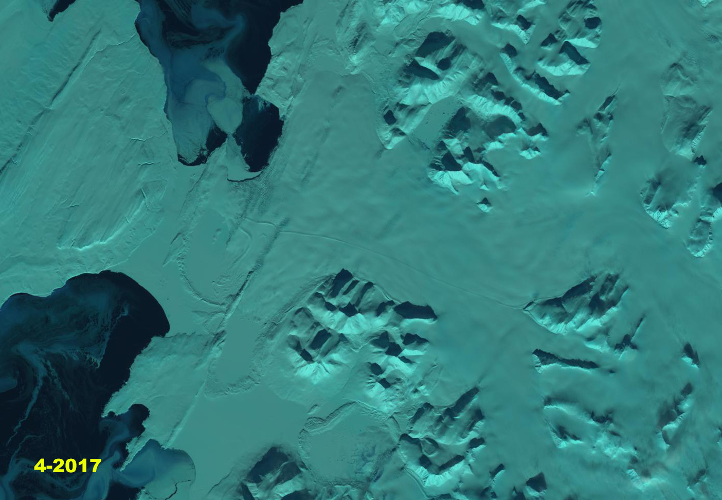
In 1990 the Nizkiy Glacier has several termini in lakes and one in the Barents Sea. The main terminus extends north beyond the end of a peninsula in 1990, with an embayment developing from the peninsula across to the northern edge of the terminus. The middle terminus ends in a proglacial lake and in 1990 the terminus largely envelops an island in the lake. The southernmost terminus is in a proglacial lake shown is indicated by a red arrow as well. The 2015 Landsat image indicates the continued reduction in Nizkiy Glacier width reaching the peninsula at the yellow arrow, from 4 km in 1990 to 1.5 km in 2015, having retreated 1200 m from the 1990 position on the northern edge. Hence, it will likely be quite soon when the proglacial lake with the island joins with the Barents Sea. In early July 2022 the terminus tongue width impounding the lake had been reduced to 600 m, the embayment water level was higher than sea level indicating limited drainage under the glacier tongue with the main outlet still being at the southern end of the embayment, Point O. By early September the glacier tongue had been breached and the embayment had drained lowering water level. The drainage channgel is 200 m wide. This has exposed ~2 km2 of new land after embayment drainage. The glacier has lost 15 km2 of area from 1990-2022. The retreat of this glacier has been less than at Vilkitskogo Glacier, will the loss of this pinning point accelerate retreat now?

Closeup view in Sentinel 2 image from 2022. The breach is 200 m wide and has lowered water level in the embayment exposing 2 km2 of new land. 

Nizkiy Glacier Embayment Expands Island Forms, Novaya Zemlya

Nizkiy Glacier in 1990 and 2016 Landsat images.  red arrows indicate locations of the 1990 terminus and yellow arrows the 2016 terminus.  Purple arrow indicates an expanding bedrock rib amidst the glacier and purple dots indicate the snowline.

Nizkiy  Glacier is on the west coast of the island reaching the Barents Sea Coast. The glaciers of northern Novaya Zemlya, Russia are truly generally out of sight out of mind. There remoteness and lack of importance as a water resource being the key reasons. It is particularly important to pay attention to these glaciers due to the recent changes in sea ice cover that have left a much longer duration of open water around the island particularly to the west in the Barents Sea.  Nizkiy lost 1.2  km2 in area  from 1990-2000  (LEGOS, 2006).  Carr et al (2014) identified an average retreat rate of 52 meters/year for tidewater glaciers on Novaya Zemlya from 1992 to 2010 and 5 meters/year for land terminating glaciers. Here we compare a Landsat image from 1990 and 2016.

The Nizkiy Glacier has several termini in lakes and one in the Barents Sea. The main terminus juts north out to the end of a peninsula in 1990, with an embayment developing from the peninsula across to the northern edge of the terminus. The middle terminus ends in a proglacial lake and in 1990 the terminus largely envelops an island in the lake. The southernmost terminus is in a proglacial lake shown is indicated by a red arrow as well. The 2016 Landsat image indicates the continued reduction in Nizkiy Glacier width reaching the peninsula at the yellow arrow, having retreated 1200 m from the 1990 position.  Hence, It will likely be quite soon when the proglacial lake with the island joins with the Barents Sea. The northern edge of the terminus has retreated little, but the size of the embayment between the northern edge and the peninsula has doubled since 1990.   A new island has been exposed in the proglacial lake between the main terminus and the peninsula.  The expansion of the proglacial lake on the north side of the glacier just inland of the main terminus has retreated 600 m.  The southernmost terminus has retreated 1100 m in an expanding proglacial lake. The purple arrow in the comparison image indicates an expanding rib of bedrock amidst the glacier. In 1990 the snowline is at  550 m.  In 2015 the snowline is at 450 m.  In July of 2016 the snowline is at  525 and in September is at 600 m. This glacier fits the pattern of other Novaya Zemlya glaciers (Pelto, 2016), such as Krayniy and Tasija.  The lack of sea ice off the west coast of Novaya Zemlya in April of 2017, seen below, is a continuation of the pattern of open water early in the melt season, enhancing frontal melt. Note the pattern of sea ice in mid-April of 2004-2012 below

2015 Landsat Image, pink arrows indicate a bedrock rib that thinning ice is making evident. Purple dots indicate the snowline.

September 2016 Landsat image indicating the snowline is at a high elevation late in the summer.  Pink arrows are proglacial lakes. 

April 2017 Landsat image, note the lack of sea ice in front of the glacier. 

April Sea ice around Novaya Zemlya 2004-2012.