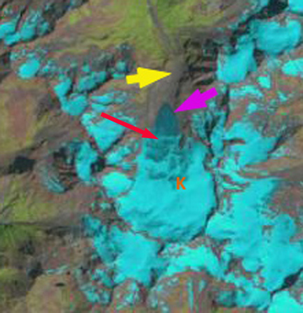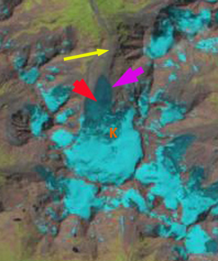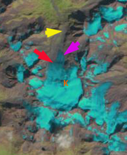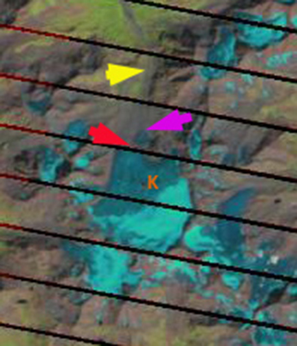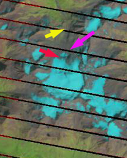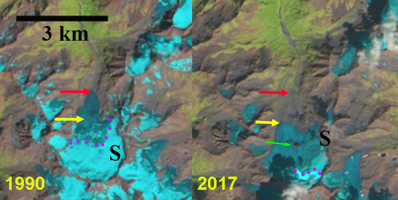
Sulztalferner in Landsat images from 1990 and 2017. Red arrow is the 1990 terminus, yellow arrow the 2017 terminus, purple dots the snowline and the green arrow an area of emergent bedrock amidst the glacier.
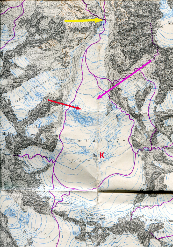
Sulztalferner is a glacier in the Subaier Alps of Austria. The glacier begins at 3200 m below Daunkogel Peak and descends north from the peak. Schlicker (2006) identified that between 1969 and 2003, 14 of the 88 glaciers in this range disappeared. The area of the glaciers was to 54.1 km2 in 1969, increased slightly to 54.4 km2 in 1985, decreased to 47.2 km2 in 1997 and the a rpaid decline to 36.9 km2 in 2003. Schlicker (2006) observed that the area of Sulztalferner, one of the largest glaciers in the region, decreased from 4.16 km2 in 1969 to 3.51 km2 in 2003. This fits the pattern of all Austrian glaciers Fischer et al (2015). Fischer and Kuhn (2012) measured the thickness of the glacier finding the average was 42 m and the maximum was 131 m. The glacier terminus fluctuations are examined annually and reported by the Austrian Alpine Club Fischer (2016) and Fischer (2017), with all 11 glacier in the Stubaier area retreating in 2015 and 2016 and Sulztalferner retreating 14 m each year.
In 1990 the glacier descended a steep icefall at the yellow arrow and terminated at 2430 m at the red arrow, the glacier was 3050 m long. By 1999 the glacier retreat and thinning made the icefall more pronounced. By 2015 the glacier terminated near the top of the a steep bedrock step that had caused the icefall to exist. An area of bedrock had also emerged just below the snowline. In 2017 the glacier is 2100 m long extending from an elevation of 3200 m to 2730 m. Retreat from 1990-2017 has been 950 m, a mean of 35 m/a. That is more than 1% of the glacier length lost per year. In 2017 in late August only 10% of the glacier has retained any snowcover indicating substantial volume losses will occur in 2017, which will drive further retreat. This glacier is following the pattern of Bachenfallenferner just to the north. This glacier is just to the west of the Stubai Glacier and the Stubai ski area that has utilized a protective by blanket on the glacier The Stubai Glacier Ski Area opens for the 2017/18 season this Saturday 9/16 after a couple of snowstorms that have blanketed Sulztalferner and Stubai Glacier with some fresh snow.

Sulztalferner in Landsat images from 1990 and 2017. Red arrow is the 1990 terminus, yellow arrow the 2017 terminus, and purple dots the snowline.

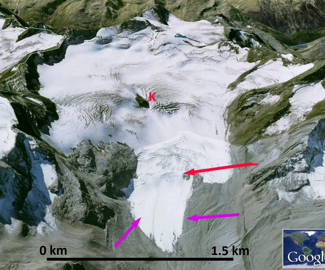
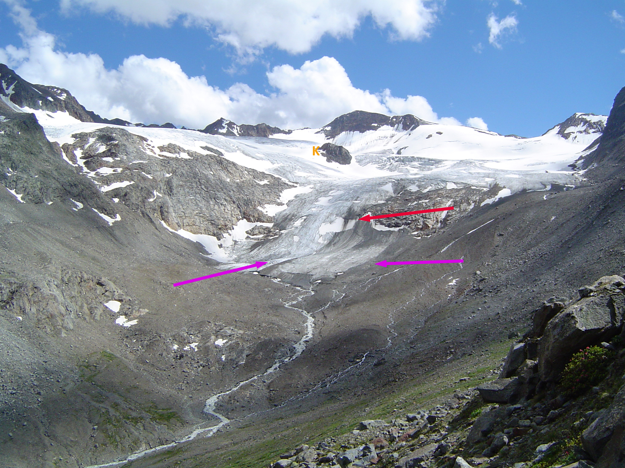
Digital Globe image from 2015 indicating the bedrock exposed in the midst of Sulztalferner. It measures 250 m long and 150 m wide. Note the thin nature of the retreating terminus.
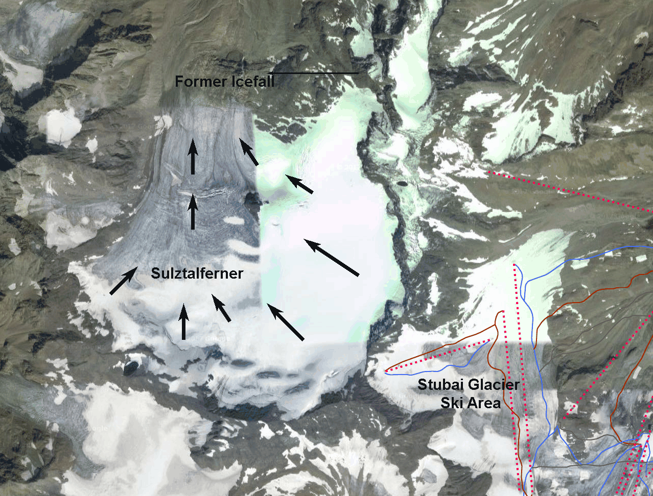
Sulztalferner Digital Globe image from 2015. Note adjacent ski area and deglaciated icefall reach.