
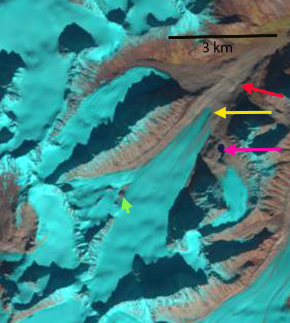
Sovereign Glacier is on the northeast side of the Talkeetna Mountains, Alaska and drains into the Talkeetna River. The Sovereign Glacier, red arrow, was joined by a tributary from the south in the map image, pink arrow. Molnia (2007) noted that all glaciers in the region have retreated since the early 1950’s when the area was mapped and that all the major termini were retreating and thinning in 2000. Here we examine Landsat imagery from 1986 to 2014.
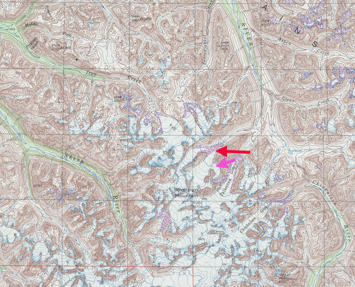
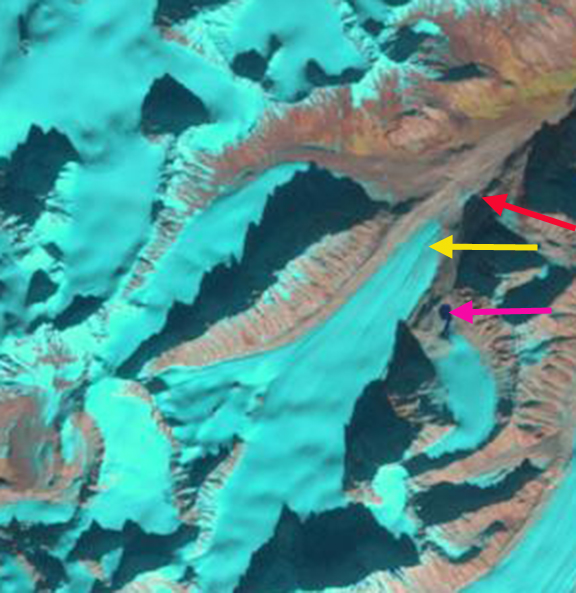
In 1986 the glacier terminates at the red arrow at the valley junction. The tributary to the south, pink arrow has separated from the main glacier and ends in a proglacial lake. In 1989 retreat is evident during the last three years with an expanding proglacial lake at the pink arrow, and the glacier terminus no longer reaching the valley junction, red arrow. By 2001 the glacier has retreated most of the distance from the red arrow at the 1986 terminus location to the yellow arrow, the 2014 terminus location. The former tributary glacier has receded from the proglacial lake. In 2009 there are two new outcrops of bedrock in the upper portion of the glacier indicating glacier thinning near the equilibrium line at 2000 m, at green arrow. By 2014 the main glacier has retreated 1100 m from the 1986 position, red arrow, to the yellow arrow. The tributary glacier at the pink arrow has retreated 400 m since 1986. The green arrow indicates further thinning of the upper glacier since 2009. The thinning upglacier indicates that retreat will continue. The retreat parallels that of nearby South Sheep River Glacier. This thinning in the upper glacier is similar to that of Lemon Creek Glacier as well (Pelto et al, 2013).
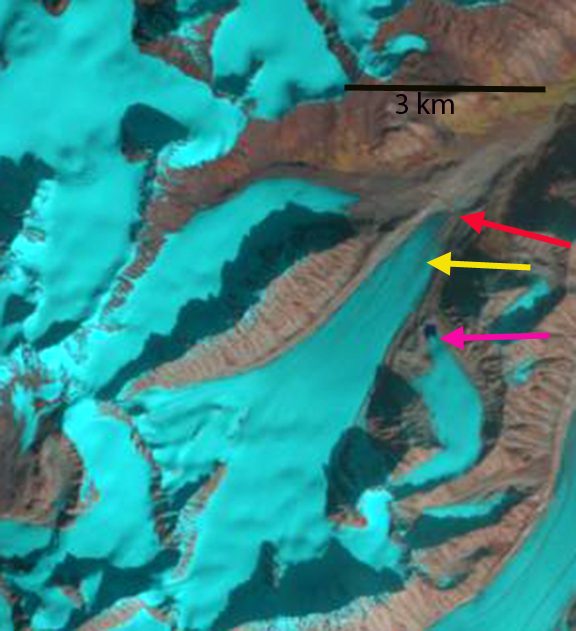
1986 Landsat image
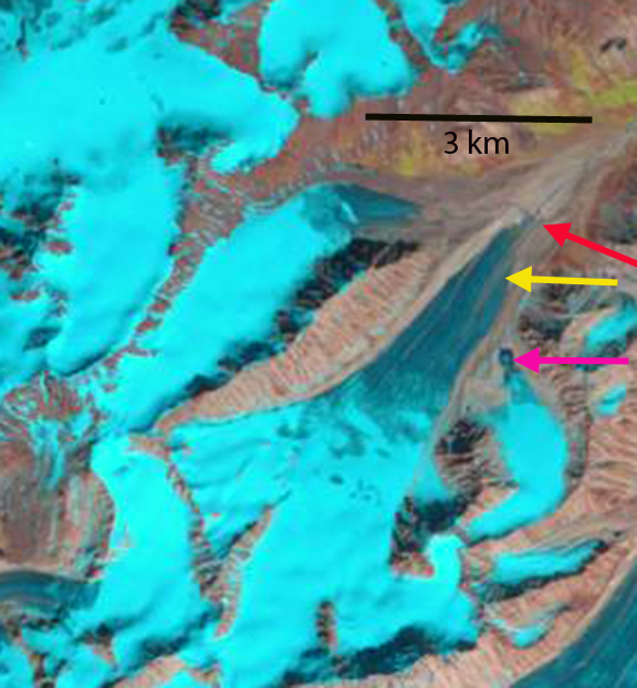
1989 Landsat image
2001 Landsat image

2009 Landsat image
2014 Landsat image


