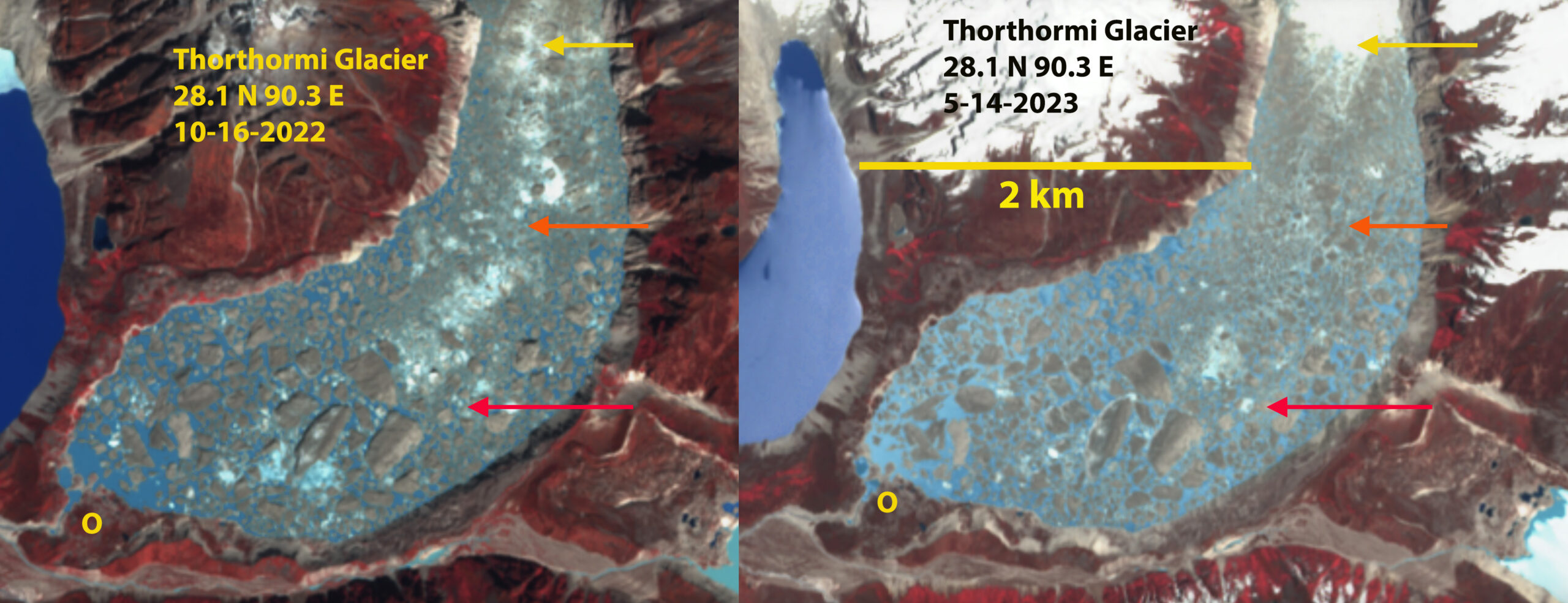
Thorthormi Glacier terminus lake in false color Sentinel images from October 2022 and May 2023. Red arrow=terminus locaiton in August, 2019, Orange arrow=terminus location October 2021, Yellow arrow terminus location in October 2022. Lake area in October 2022 is 4.3 km².
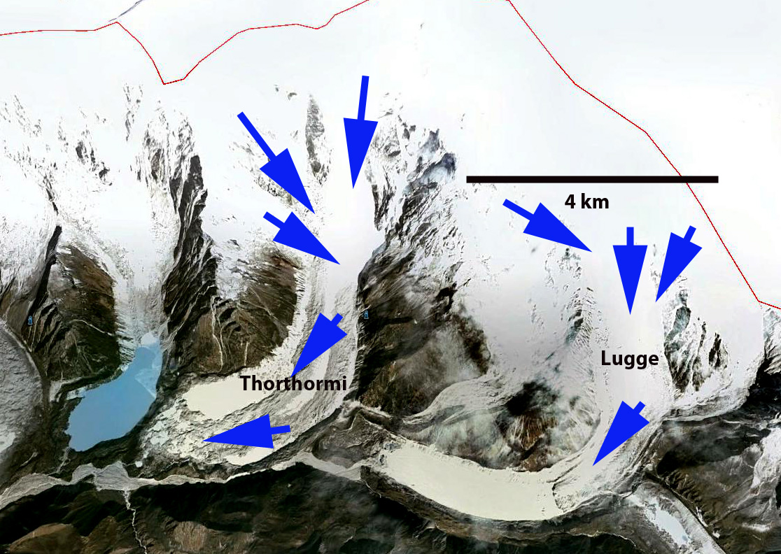
Thorthormi Glacier drains south from the border with China into the Pho Chu River, Bhutan. Osti et al (2012) reported in detail on the nature of potential Glacier lake outburst floods (GLOF) in the Pho Chu, noting there are eight dangerous lakes including Thorthormi Cho at the terminus of the Thorthormi Glacier. In 1994 Lugge Cho experienced a glacier lake outburst flood GLOF which incurred substantial damage in the Pho Chu basin. The 1994 GLOF event had a peak discharge of about 2539 cubic meters/second and extended 200 km downstream as a flood wave Osti et al (2012).The National Center for Hydrology and Meteorology has added Thorthormi Cho has one of 17 potentially hazardous lakes in Bhutan and installed a water level sensor as part of a flood warning system. On June 20, 2019 Thorthormi Glacier lake experienced a smaller GLOF that was indicated by the water level sensor. A detailed report of this event was completed identifying that the outlet channel had changed position, which meant the water level sensor had to be relocated NCHM. Water released from Thorthormi Glacier lake does not flow into the Raphstreng Lake directly to the west as it is separated by a 300-500 m wide moraine that rises 50 m above Thorthormi glacial lake.
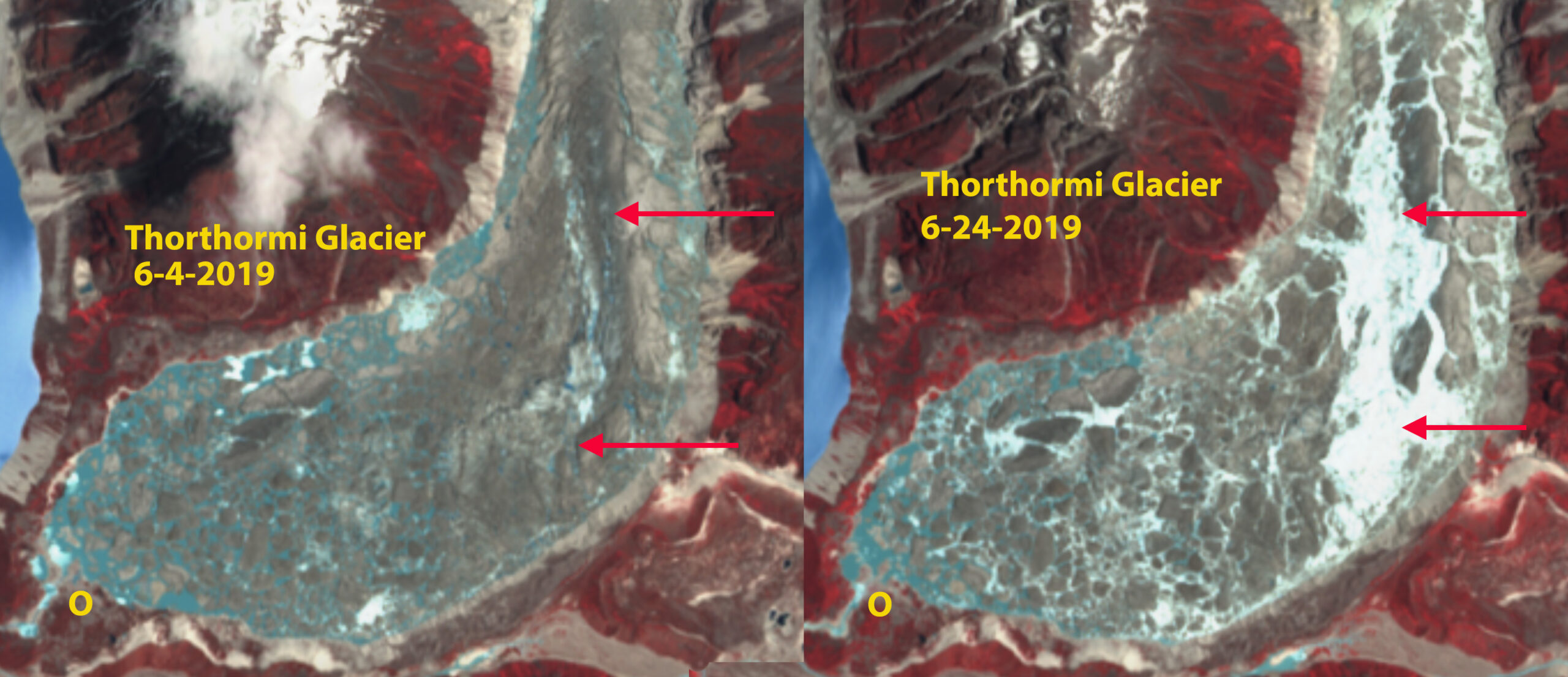
Thorthormi Glacier before and after June 2019 outburst flood. Note channel development at red arrows. NCHM. noted a 0.8 m water level drop and 2.7 million m³ of water loss.
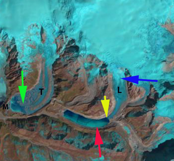
The Thorthormi Glacier had marginal pockets of proglacial lake in 2000 with the debris covered terminus extending across the lake basin to the Little Ice Age moraine (M). By 2013 Thorthormi Glacier’s debris covered terminus connection to the moraine (M) had melted away and the lake had an area of ~1.5 km². The retreat of Thorthormi was 700 m from 2000-2013. In 2013 it was evident tht the lowest 1 km of the glacier is stagnant and melt should be enhanced by calving into the lake, and that retreat would remain quick in the next decade (Pelto, 2014). From 2013 to 2019 an additional 1100 m retreat occurred and the lake expanded to 2.2 km². From 2019-2022 the narrow terminus tongue disintegrated leading to a further 2250 m retreat. The lake has doubled in size from 2019-2023 4.3 km². The lake is still largely filled with icebergs. Rinzin et al (2023) observe that Lugge and Thorthormi glacial lakes are most prone to GLOF in te Pho Chu valley, and can potentially impact over 16,000 people, two hydropower projects, and agricultural land. The run-of -river 1,020 MW Punatsangchhu-II and run of river 1,200 MW Punatsangchhu-I Hydroelectric Project are the two hydropower projects. A further detailed assessment in the Fall of 2019 by NCHM indicated that the moraine between Raphstreng and Thorthormi glacial lakes remains unstable, but showed no signs of recent landslide activity after the June event. The moranie at its narrowest is 300 m wide and has a crest that is 33.5 m wide.
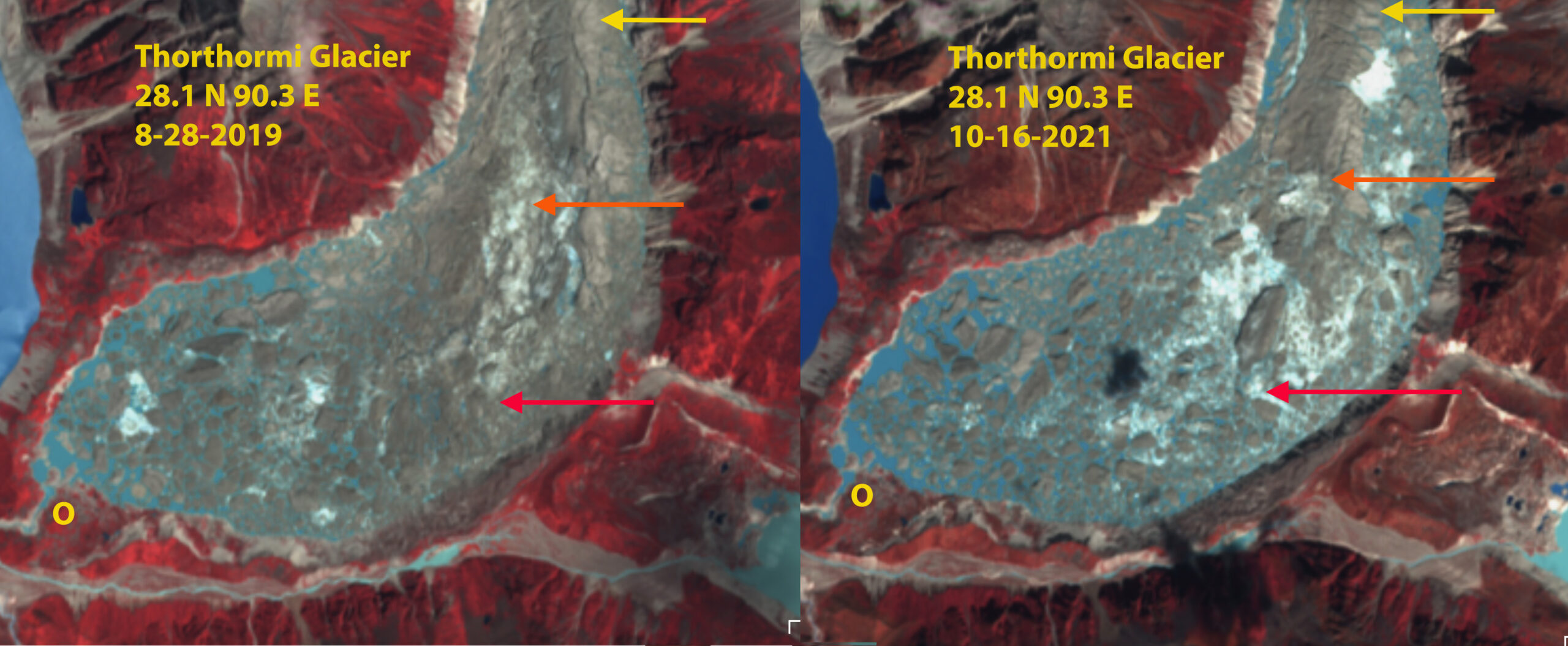
Thorthormi Glacier terminus lake in August 2019 and October 2021. Red arrow=terminus locaiton in October, 2019, Orange arrow=terminus location August 2021, Yellow arrow terminus location in October 2022.
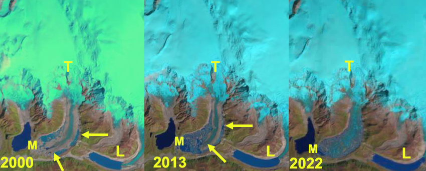
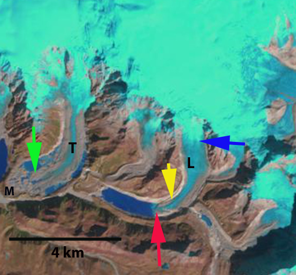
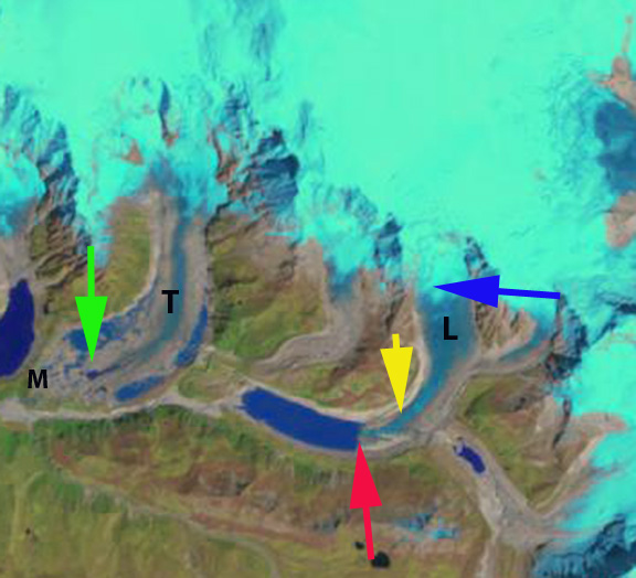
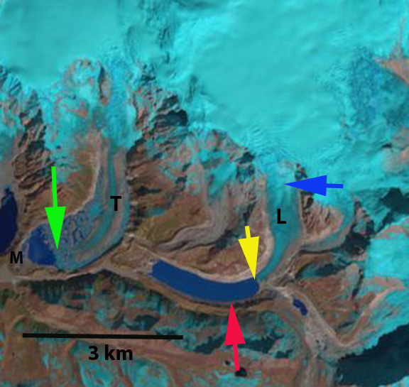
Thorthormi Glacier (T) retreat from 2000-2022 from the Little Ice Age moraine (M). Lugge Glacier and lake (L) is just to the east. Yellow arrows point out the tongue of debris covered ice representing the terminus that has disintegrated after 2019.