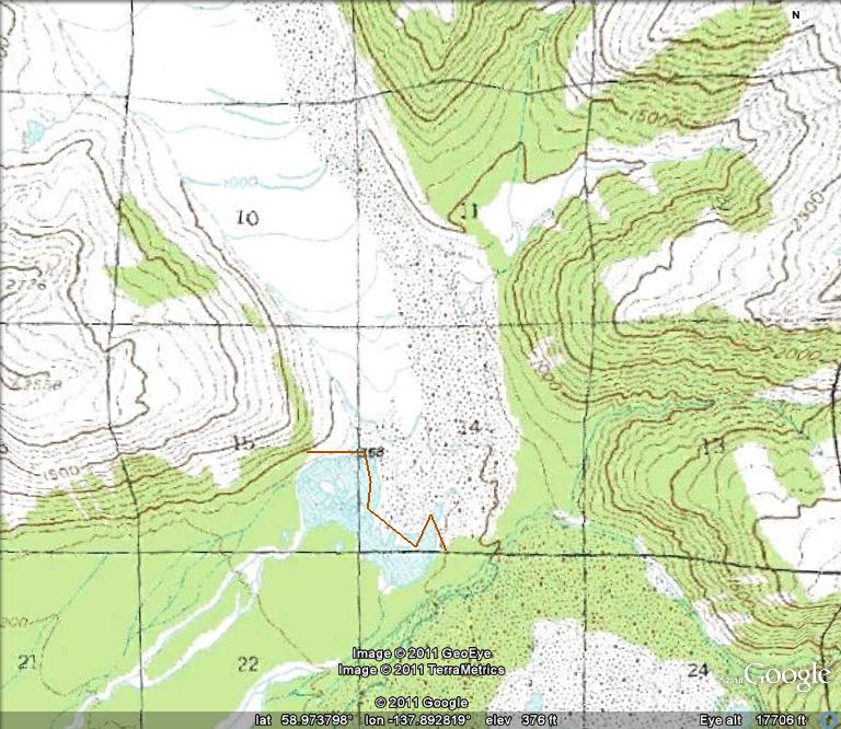
Grand Plateau Glacier drains southwest from Mount Fairweather in southeast Alaska. The glacier advanced during the Little Ice age to the Alaskan coastline. Early maps from 1908 show no lake at the terminus of the glacier. The 1948 map (below) shows three small distinct lakes at the terminus of the main glacier and a just developing lake at the terminus of the southern distributary terminus (D). The distance from the Nunatak N to the terminus was 11 km in 1948. The lake at D is 400 m wide.


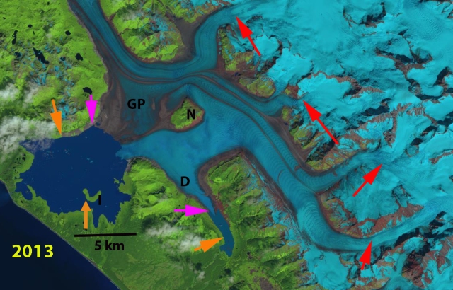
Landsat images from 1984 indicates the fromation of a single connected proglacial lake with an area of 24 km2. Key reference points in each image are the Nunatak, N, and and Island, I. The retreat from 1984-2013 is evident with the orange arrows indicating the 1984 terminus and pink arrows showing the 2013 terminus location. The distance from the Nunatak to the terminus is 8.5 km in 1984 and 4 km in 2013. On the north shore of the lake the retreat between arrows is 2.7 km from 1984-2013. From the island the glacier retreated 3.3 km from 1984-2013, with the lake expanding to 43 km2. The distributary tongue (D) retreated 2.2 km from 1984-2013. The retreat was driven by higher snowlines in recent years, the snowline had been reported at 1000 m in the 1950’s. Satellite imagery of the last decade indicates snowlines averaging 1500 m, red arrows. The glacier snowline is evident in Landsat imagery in 1984 and 2013 red arrows.

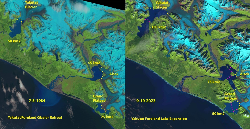
In 2024 the lake area has grown further to 49 km2, as a result of a retreat of 8 km since 1948 and 5.5 km since 1984. Today a second island is emerging at the terminus, Point A. The distributary tongue to the southeast now terminates in a lake that is now 5.2 km long, a 4.8 km retreat since 1948 and 2.6 km since 1984. The combination of higher snowlines and increased calving into the terminus lake will continue to lead to retreat of this still mighty river of ice. This retreat parallels that of nearby Alsek Glacier and Yakutat Glacier. The rapid growth of the three lakes since 1984 when I visited them is amazing.


