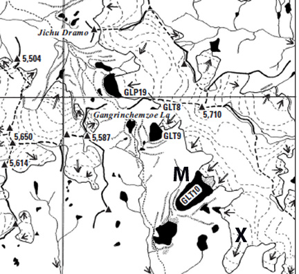
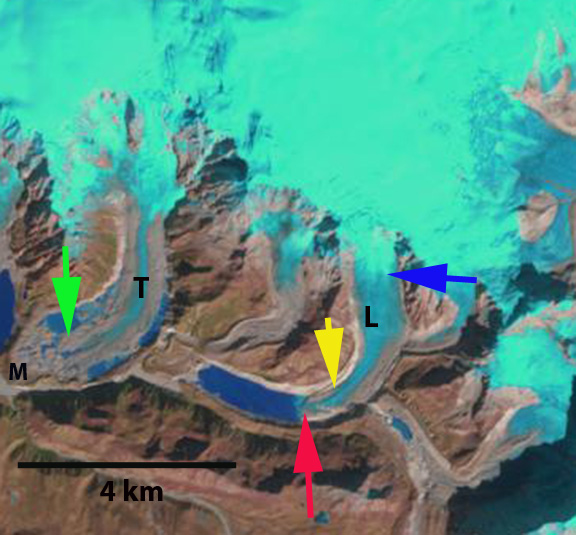
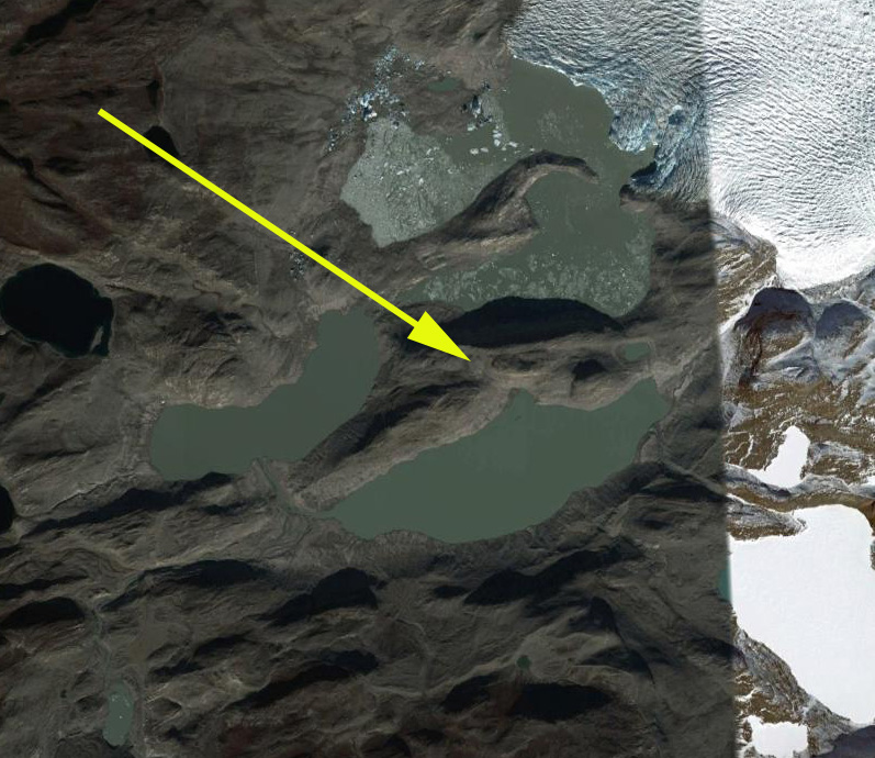
Kerguelen Island sits alone isolated at the edge of the furious fifties in the southern Indian Ocean. The island features numerous glaciers, the largest being the Cook Ice Cap at 400 square kilometers. Here we focus on the Arago Glacier and an adjacent glacier to the south on an icecap on the Raillier du Bay Peninsula Ice Cap using satellite imagery from 2001-2011. Arago Glacier descends east from the ice cap currently ending in a proglacial lake.

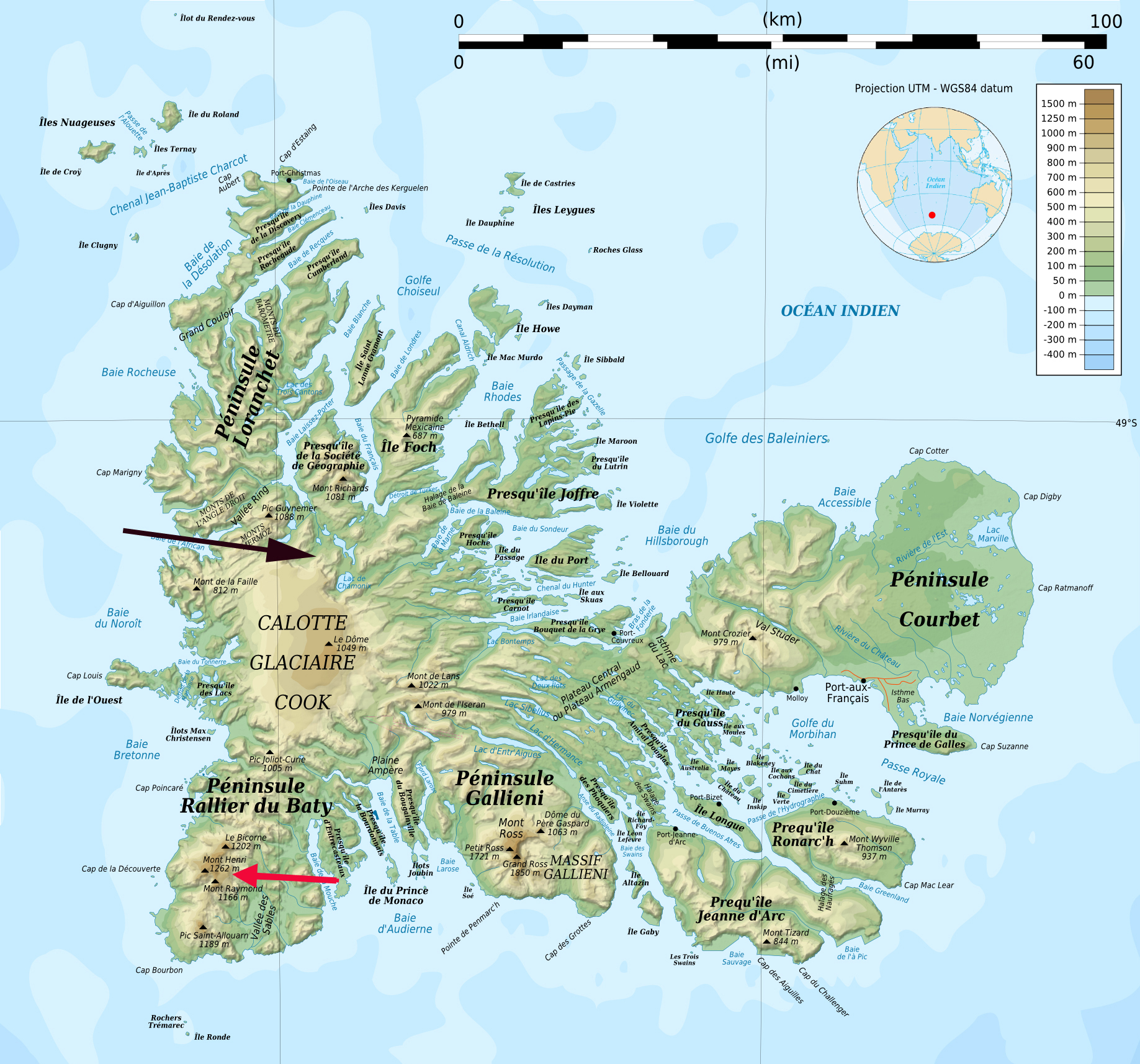
Kerguelen Island Map

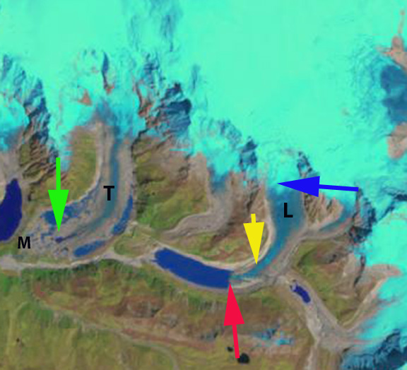
Rallier du Baty Peninsula Google Earth image
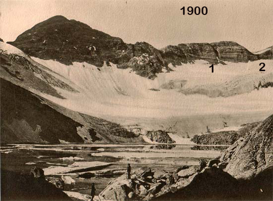
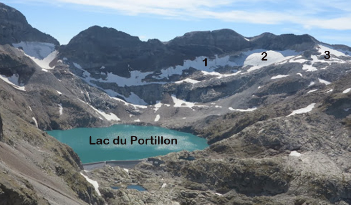
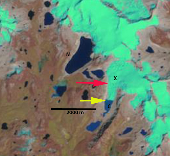
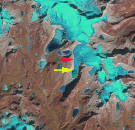
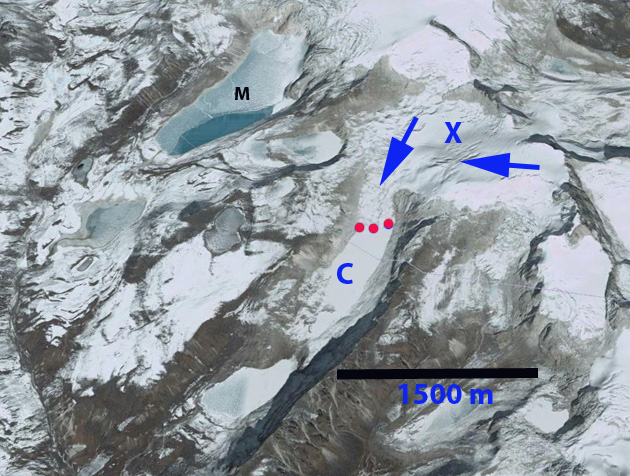
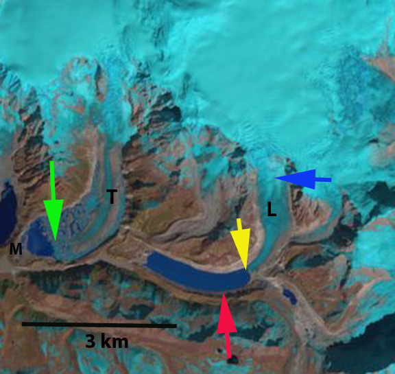
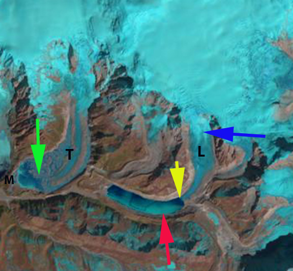
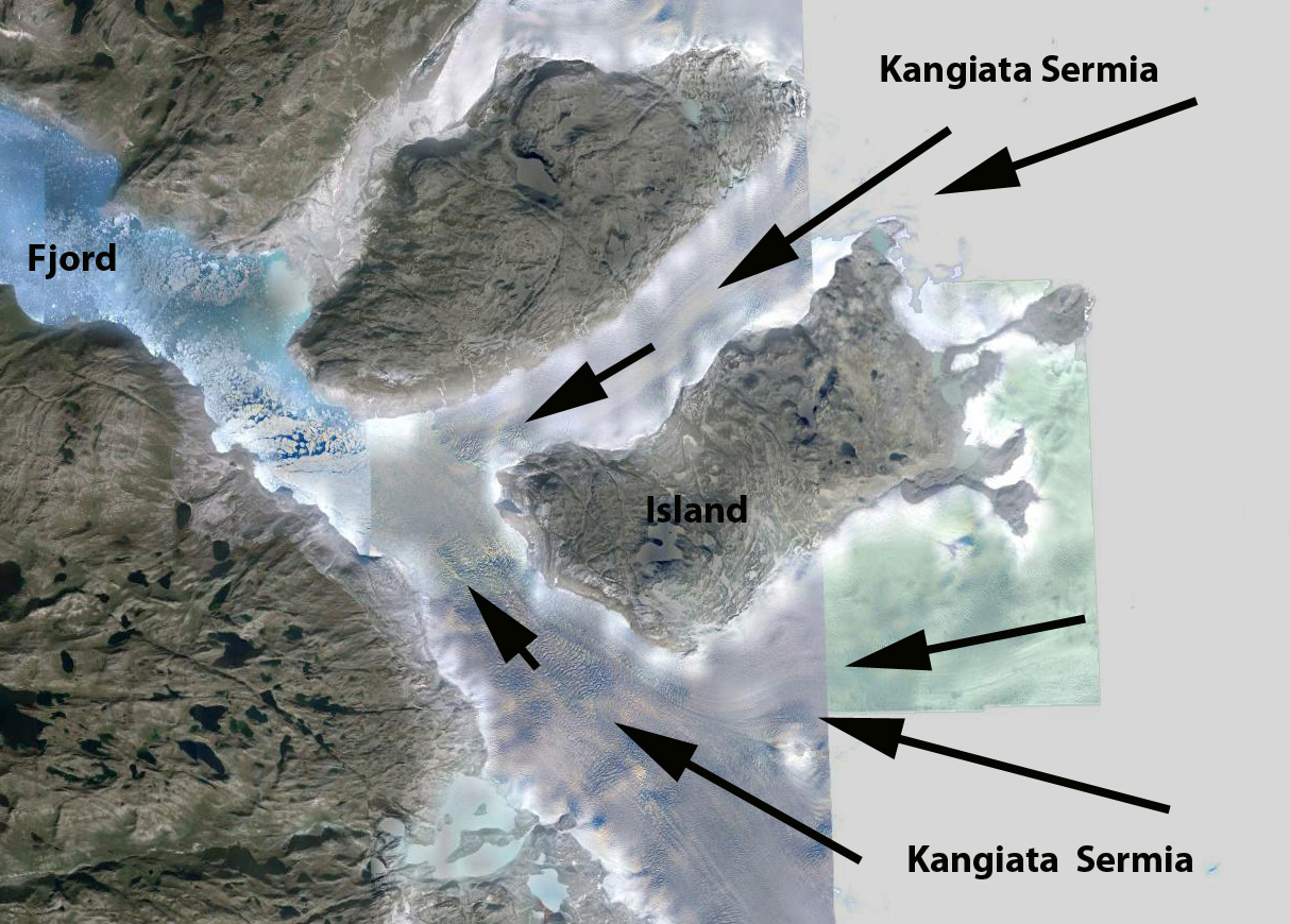
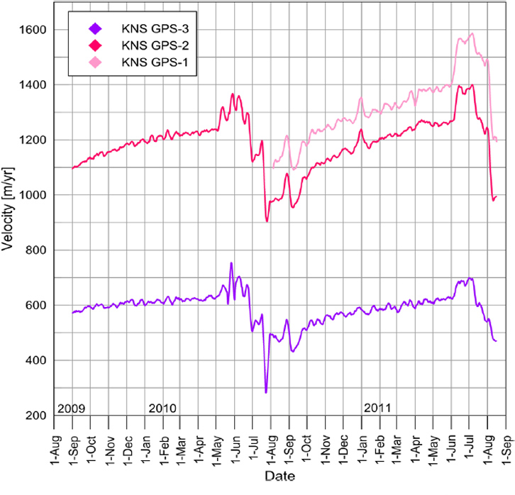
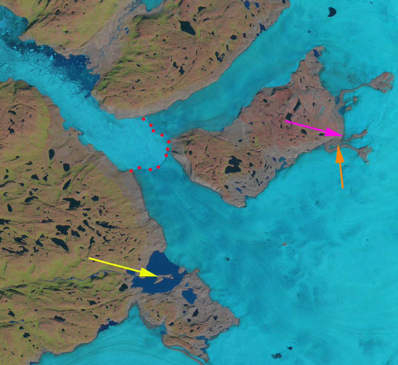
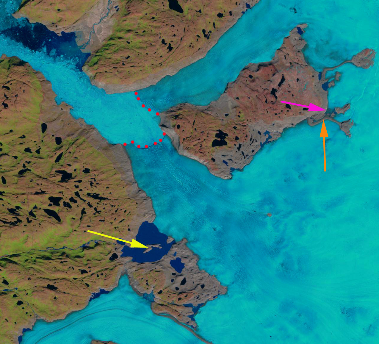
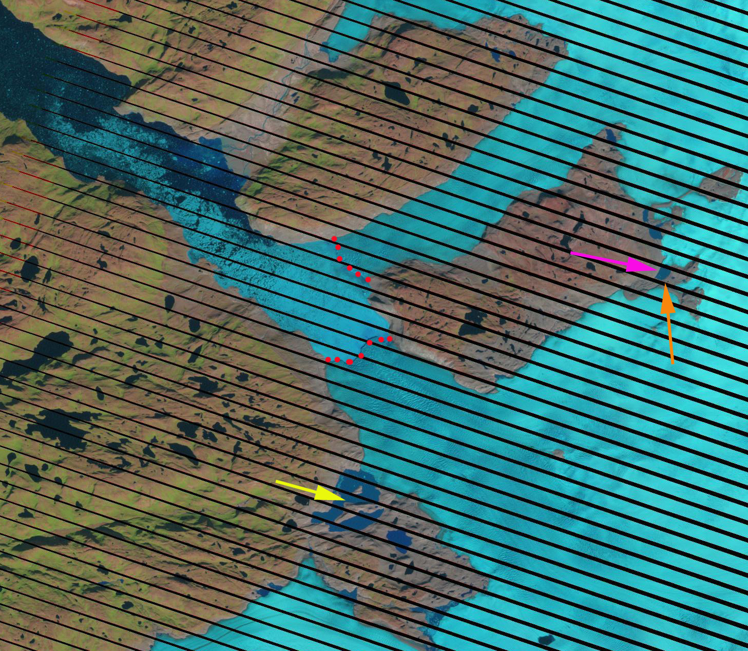
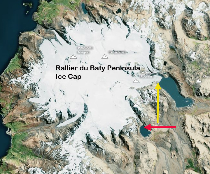
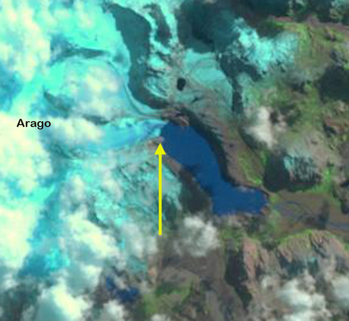
Berthier et al (2009)note that this glacier had retreated 3 km from 1964-2001. In 1964 the glacier filled the lake basin, yellow line in first figure below. They had a single profile across the glacier shortly above the terminus that indicated 80 km of thinning from 1964-2000 and 30 m from 2000-2005. The profile is the blue dotted line from their paper in the first figure below. In 2001 Arago Glacier terminated at the tip of a peninsula, yellow arrow. The Arago Glacier is joined just above the terminus by a tributary from the north, which has a substantial width in 2001 at the pink arrow. The glacier to its south ended at the northern end of a lake, red arrow. By 2006 Arago Glacier has retreated from the peninsula. Cloud cover obscures the glacier to the south. By 2011 Arago Glacier has retreated from the peninsula, 300-400 m since 2001, expanding the proglacial lake. The glacier tributary at the pink arrow width has declined substantially. This is indicative of a thinning glacier as well. The contribution of this tributary to the main terminus is quite limited by 2011. The glacier to the south at the red arrow has also retreated 300-400 m, leading to lake expansion there. This island is notoriously cloud covered, and I have not located an image with a clear view of the region since 2011, when I do the post will be updated. The retreat of Arago Glacier follows the pattern of retreat of the glaciers of other glaciers on the island including Ampere Glacier and the northern outlet of the Cook Island Ice Cap

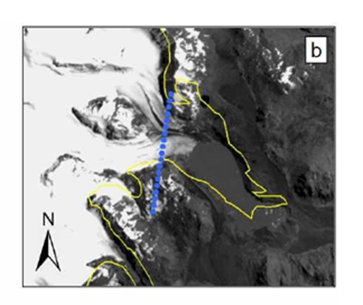
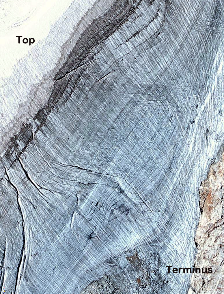
Figure 8 from Berthier et al (2009)

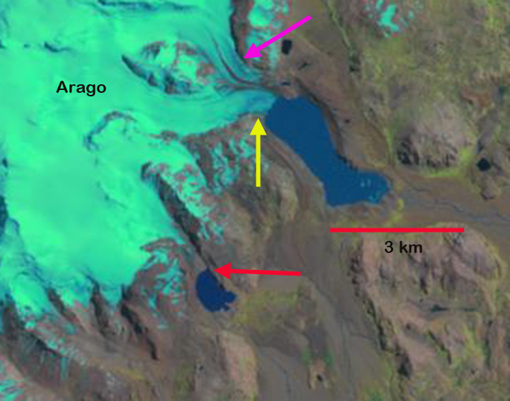
Landsat image in 2001
Month: April 2014
Portillon Glacier, French Pyrenees- Retreating and Disappearing
Portillon Glacier is in the Luchon-Bagneres region of the French Pyrenees, just north of the border with Spain. This currently small, and becoming smaller glacier drains into Lac du Portillon, which has a dam impounding it for hydroelectric generation. Like the nearby Aneto Glacier, Portillon Glacier has been thinning, retreating and separating. First a comparison of photographs from 1900 and 2013. In 1900 the glacier fills most of the cirque and nearly reaches the shore of the lake. The lake level is lower at this time also. By 2013 the glacier occupies a few small niches near the head of the cirque.

1900 image from the Lakes of the Pyrenees web forum

2013 image from Julien Lacrampe
By 2006 Google Earth imagery indicates a glacier with an area of 0.12 square kilometers, red dots indicate the terminus of the glacier. Section 3 of the glacier has separated from the main section, 2. Section 1 is a narrow avalanche fed fringe beneath the cliffs. This section is too steep to retain good snow. In the 2008 image The glacier also is notably thin with few crevasses, and several bedrock outcrops amidst the thinning ice. Both the 2006 and 2008 image indicate the lack of snowcover on the glacier. This has exposed up to 75 annual layers in a closeup transect from head to terminus of the glacier. There are only a few crevasses on this relatively steep glacier, indicating the lack of movement, which can only come from thin ice on a steep slope.
The lack of persistent snowcover at the end of the melt season indicates a glacier,, like the Aneto and Maladeta Glacier, that will not survive current climate (Pelto, 2010). Its area is much less than Aneto Glacier, and it will disappear sooner. As SOER (2010) indicates more than 80% of the area of glaciers in the Pyrenees has been lost since the start of the 20th century. The color of Lac du Portillon and the loss of glacier in the basin reminds me of the Milk Lake Glacier, Washington that I watched disappear recently.

Google Earth image
Aneto Glacier, Spain-Retreating and Disappearing
Aneto Glacier in the Pyrenees of Spain is listed as its largest glacier in a 1984 inventory. In 1984 the glacier had an area of 1.32 square kilometers and a length of 1.6 km (Serrat and Ventura, 2005). The glacier is located on the northeast side of Aneto Peak. The glacier is just a few kilometers from the rapidly retreating Maladeta Glacier. SOER (2010) indicate that more than 80% of the glacier area on the Maladeta-Aneto Massif was lost between 1984 and 2007.

The glacier is too small to rely on our usual Landsat imagery. Here we focus on images from Google Earth and the Digital Globe. The glacier’s maximum top to bottom length by 2005 is no more than 600 meters, black dots indicate glaciers lower margin. The area in 2007 is 0.4 square kilometers by which time the glacier has developed a number of rock outcrops protruding through the thin ice. Snowcover in most images by late summer is minimal. This indicates the lack of a consistent accumulation zone, which a glacier cannot survive without (Pelto, 2010). The glacier has many exposed annual layers extending well upglacier, this is a further indication of the poor preservation of even old glacier ice. In 2005 and 2007 less than 10% of the glacier is snowcovered in the images which are not even at the end of the summer. This glacier is disappearing and like the Careser Glacier, Italy will break into several parts. The thin nature of the glacier is evident by looking up glacier from the terminus, last image from Gus Llobet (llobetgus-on Panaramio)

2005 Google Earth image, limited snowcover evident

Arrows indicate rock outcrops amidst the glacier.

2007 Digital Globe image
Annual layers of main glacier trunk in 2007
Images from Panaramio user-llobetgus
Mangde Chu Glacier Retreat, Bhutan
The Mangde Chu Basin in Bhutan is home to many alpine lakes, and the number is increasing as glacier retreat leads to both new lakes and expanding lakes. Many of these alpine lakes are impounding by glacial moraines of varying stability. Some of the glacial lakes are capable of outburst floods (GLOF), the resulting hazard has led to an inventory of these lakes in Bhutan and this watershed in a joint effort between Bhutan and EROC in Japan. Here we examine the development of a new lake not shown in the USGS map of the region from a 1993 SPOT image. This glacier is marked by an X and is just south of the Methatshota Tsho (M).

USGS Map
In a pair of Landsat images from October and December of 2000 the lake (C) has formed and the glacier terminates at the yellow arrow, red arrow is 2013 terminus. The lake is 550 m long. By 2006 in the Google Earth image the lake is 850 m long, terminus red dots. In 2013 Landsat images from October and December indicate the lake has expanded to a length of 1400 m. The glacier has retreated 1400-1500 m since 1993 and 850 m since 2000. Just above the red arrow the lake to the west of the glacier is not as close to the glacier, this indicates thinning of the upper sections of this glacier and marginal retreat in the accumulation zone. This is typically a sign that a glacier cannot survive current climate (Pelto, 2010). The lake is not impounded by a substantial terminal moraine, and does not appear to be prone to a substantial GLOF. This is what the joint Bhutan-Japan study indicates as not requiring urgent counter measures as the moraine dam is thick and the slope is not too high either of the moraine or the glacier leading into the lake, note last figure. The channel leading out of the lake is immature and will likely downcut through the glacial sediments, reducing the lake area somewhat. The glacier surface rises quickly just above the current terminus, indicating that the lake will not grow much longer, and glacier retreat will then slow as the terminus pulls out of the lake. This glacier is retreating as are the nearly all glaciers in the region such as Lugge Glacier, Thorhormi Glacier and Theri Kang Glacier all a short distance north. 
2000 Landsat image

2000 Landsat image

2006 Google Earth Image

2013 Landsat image

2013 Landsat image

2006 Google Earth Image

Image from Kumori
Lugge and Thorthormi Glacier Retreat, Bhutan
Luge and Thorthormi Glacier drain south from the border with China into the Pho Chu River in Bhutan. Both glaciers end in expanding glacier lakes that are prone to outburst floods, which sweep down the Pho Chu. Osti et al (2012) reported in detail on the nature of these floods, noting there are eight dangerous lakes including the two at the terminus of Lugge and Thorthormi Glacier, Thorthormi Cho and Lugge Cho. In 1994 Lugge Cho experienced a glacier lake outburst flood GLOF which incurred huge damage in the Pho Chu basin. The 1994 GLOF event had a peak discharge of about 2539 cubic meters/s and extended 200 km downstream as a flood wave Osti et al (2012) . The GLOF occurred after rapid retreat of Lugge Glacier from 1988-1993 of 160 m/year. 
Google Earth Image
Here we examine the retreat of both glaciers in Landsat imagery from 2000-2014. In each image the red arrow indicates the 2000 terminus, the yellow arrow the 2014 terminus, the blue arrow the snowline on Lugge Glacier and the green arrow the center of the Thorthormi Glacier terminus in 2013. In 2000 the Lugge Glacier ends in a 2 km long Lugge Cho. The Thorthormi Glacier has pockets of proglacial lake in 2000, but also a debris covered terminus that extends across the lake basin to the Little Ice Age moraine (M). The two images from 2000 are from the start of October and late December. Note the snowline remains near 5100-5200 m in both images. The glaciers of Bhutan are summer accumulation type glaciers, in which the main accumulation season is during the summer monsoon. The snowline tends to rise from October into December with limited snowfall. By 2013 Lugge Glacier has retreated 1 km from the 2000 position, and Lugge Cho is now 3 km long. The terminus of Lugge Cho is not stagnant and it is not clear how much longer the deep basin extends under the glacier. If the basin does not extend much further retreat will soon be reduced. Thorthormi Glacier debris covered terminus connection to the moraine (M) has melted away and a lake extends across the full width of the glacier basin. The contiguous lake now has an area of over 1 square kilometer. The retreat of Thorthormi has been 700 m since 2000. The lowest 1 km of the glacier is stagnant and melt should be enhanced by calving into the lake, hence the retreat should remain quick in the next decade. The snowline in the Late November 2013 and early February 2014 image indicate the snowline at close to 5300 m in both. The retreat of these glaciers is leading to expansion of proglacial lakes much like the nearby Theri Kang and many other across the region Changsang Glacier, Sikkim, Lumding Glacier, Nepal Matsang Tsanpo, Tibet .

2000 Landsat image

2000 Landsat image
Kangiata Sermia, Retreat Southwest Greenland
Kangiata Sermia is an outlet glacier in Southwest Greenland that empties into the Kangersunaq fjord east of Nuuk. Thomas et al (2009) noted that Kangiata Glacier thinned most notably near its terminus decrasing up glacier to negligible thinning 30 km inland. They further found that the glacier bed was above sea level 40 km inland. Sole et al (2010) observed variations in the velocity of this glacier and found that there was a substantial spring speedup as the melt season began and then an even more significant slowdown for most of the summer. They noted that the net effect of the summer speed variations on annual motion is small (∼1%), indicating the lack of a meltwater induced overall acceleration. The velocity figure below is from Figure 4 of Ahlstrom et al (2013), indicating the annual velocity minimum is in late summer. Box and Decker (2011) noted that glacier retreated 100 meters/year from 2000 to 2010.

Google Earth image

Thomas et al (2009) Figure showing the bedrock and surface profile of Kangiata Sermia

Ahlstrom et al (2013) Figure showing seasonal velocity change of Kangiata Sermia
Here we examine Landsat imagery of the glacier from 1987 to 2013 to identify changes. In 1987 the two main termini of the glacier were joined, down fjord of an island that separates the two branches. The terminus in each image is indicated by red dots, the yellow arrow note an island in the middle of a peripheral ice dammed proglacial lake, the pink arrow a minor terminus on the north side of the island and the orange arrow a medial-lateral moraine comples extending into the glacier. By 2001 the glacier terminus has separated into two parts, with a retreat of jsut over 1 km in the 14 years. The proglacial lake is still full, yellow arrow. The upglacier minor terminus is developing a lake at its terminus as it retreats. The orange arrow indicates the expansion of the moraine complex as the glacier thins. By 2006 the main terminus has continued to retreat up the south side of the island 1.5 to 2 km since 2001. The proglacial lake level has declined and the island has become a peninisula. The thinning ice is simply not able to impound as deep or large a lake. The minor terminus at the pink arrow has developed a lake that is over 1 km long. In 2013 the changes from 2006 are limited, the moraine complex has continued to expand. The overall retreat from 1987 to 2013 is 3 km. The retreat is similar to that of Narssap Sermia , Kuussuup Sermia, and Qaleraliq as each responds to the climate warming. The lake is a bit larger, though the lake does fluctuate through an annual cycle filling and draining. Google Earth imagery indicates the lake at an even lower level, it no longer fills to nearly the level of 2001. This lake is similar to Tiningnilik in its size and location, but has lost more of its volume. The lake at the pink arrow is 1.2 km long. Each winter the fjord in front of the glacier freezes and the terminus protected from calving can advance. The Google Earth closeup image indicates the heavily crevassed nature of both termini indicative of rapid flow. On April 2, 2014 the fjord is quite filled with sea ice to the southeast bend 50 km from the terminus. The terminus is not distinct in this particular image. 
1987 Landsat image

2001 Landsat image

2006 Landsat image


