
Macbeth Icefield is the Purcell Mountains of southwestern British Columbia. The several icefield outlet glaciers drain into Duncan Lake the Duncan River and then Kootenay Lake. From 2011-2020 glacier loss accelerated by more tha 250% from the 1984-2010 period in this region (Bevington and Menounos, 2022). The 2021-2024 period was noted as a period of unprecedented ice loss in Western Canada (Menounos et al 2025). The summer of 2025 was even worse. Access to the Macbeth Icefield Recreation Area is currently closed due to extensive forest fire impact to the long hiking trail that accesses the icefield (images below illustrate the burn scars).
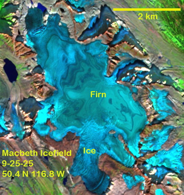
I have had the opportunity to review satellite images of this area from 1984-2025. In 2025, for the first time the icefield lost all snow cover exposing many annual layers of firn. The firn is snow that endured at least one summer, and is not yet converted to glacier ice. This firn is signficantly darkened by particles of dust and forest fire derived material. This further enhances melt once exposed.
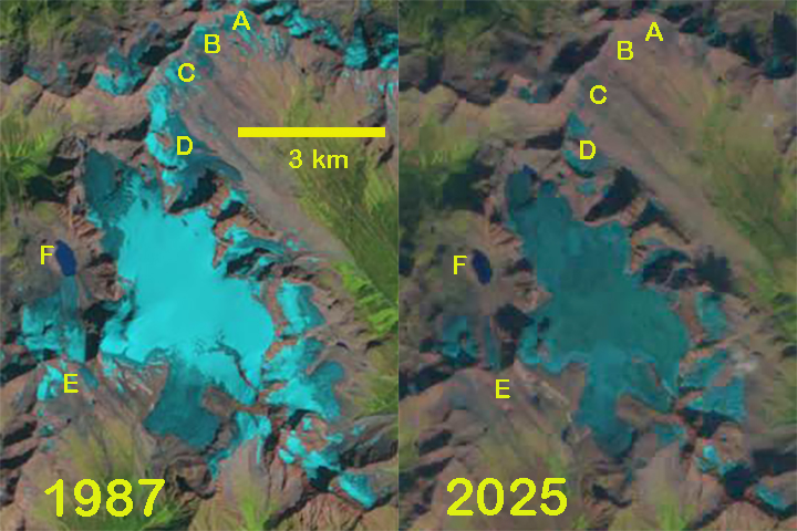
In 2023 and 2024 significant firn areas were exposed as well, in the sequence of images below. . The repeated years of limited snow cover has led to mass balance loss and a 25-30% reduction in icefield area since 1987. From 1987-2025 several small adjacent glaciers have been lost A,B, C and E. t Point D the glacier has fragmented. At Point F the glacier ended in the lake in 1987 and now the glacier has retreated 700 m from the lake.