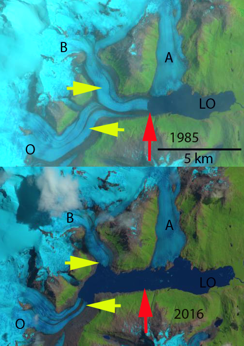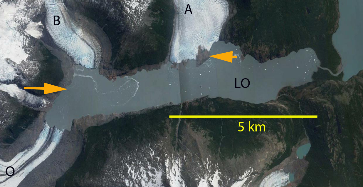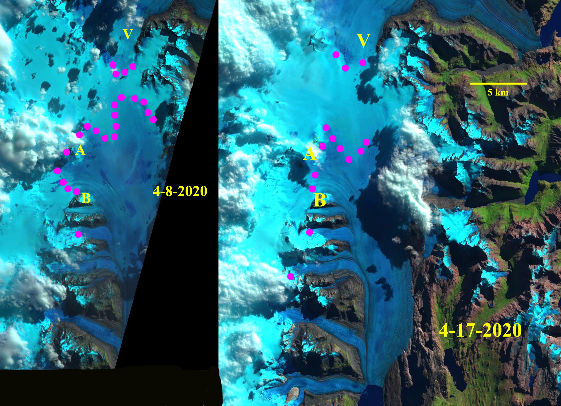
Upsala Glacier transient snowline (TSL) in Landsat images from April 8 and April 17, 2020. TSL is indicated by purple dots, Point A and B are the same nunataks in each image. On April 8 the TSL almost reaches the divide with Viedma Glacier (V).
Glaciers exist and survive when the majority of the glacier is always snow covered even at the end of the summer melt season. For a calving glacier the percentage of the glacier in the accumulation zone (accumulation area ratio: AAR) required to be in equilibrium is at least 65%, depending on calving rate. At the end of the melt season the transient snow line (TSL) is the equilibrium line where melting equals accumulation, above this point accumulation is retained. In the last year we have observed a number of glaciers with exceptionally limited retained snow cover at then end of summer in 2019. The limited AAR is a driver of mass balance loss and future terminus retreat. Here we report on the TSL on Upsala Glacier, Argentina in April 2020. This glacier flows south from a divide with Viedma Glacier and is fed from the crest of the Southern Patagonia Icefield. The glacier terminates in Lago Argentina and has retreated substantially, 7.2 km from 1986-2014 (NASA, 2014).
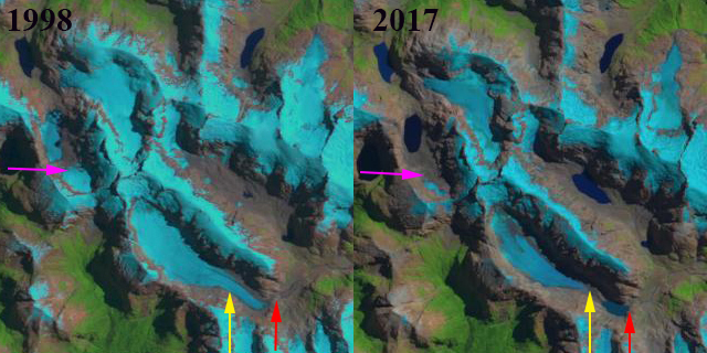
De Angelis (2017) noted the equilibrium line for Upsala Glacier was 1170 m based on 2002 and 2004 observations, which equates to an AAR of 65%. Landsat images from 2001 and 2014 both from March indicate a TSL at 1075 m in 2001 and 950 m in 2014. With the snowline downglacier of Point B. On Feb 14, 2018 the TSL reached its highest observable elevation at 1275-1300 m. On March 14, 2019 the TSL reached 1300 m. On April 8, 2020 the TSL is between 1325 and 1350 m upglacier of Point A and nearly to the Viedma Glacier divide. On April 17, 2020 the TSL has descended slightly to 1300 to 1325 m. The ELA of ~1350 m is the highest annual observation for Upsala Glacier and equates to an AAR of ~48%. Malz et al (2018) indicated a 3.3 m thinning of Upsala glacier with significant thinning extending to the Viedma Glacier divide. Since 2014 retreat has largely paused, but given mass losses upglacier and consistent high snowlines ~1300 m in 2018-2020, not for long.
The unusually high snowlines in 2019 were observed at the Northern Patagonia Icefield, Taku Glaicer, Alaska and on Penny Ice Cap, Baffin Island.
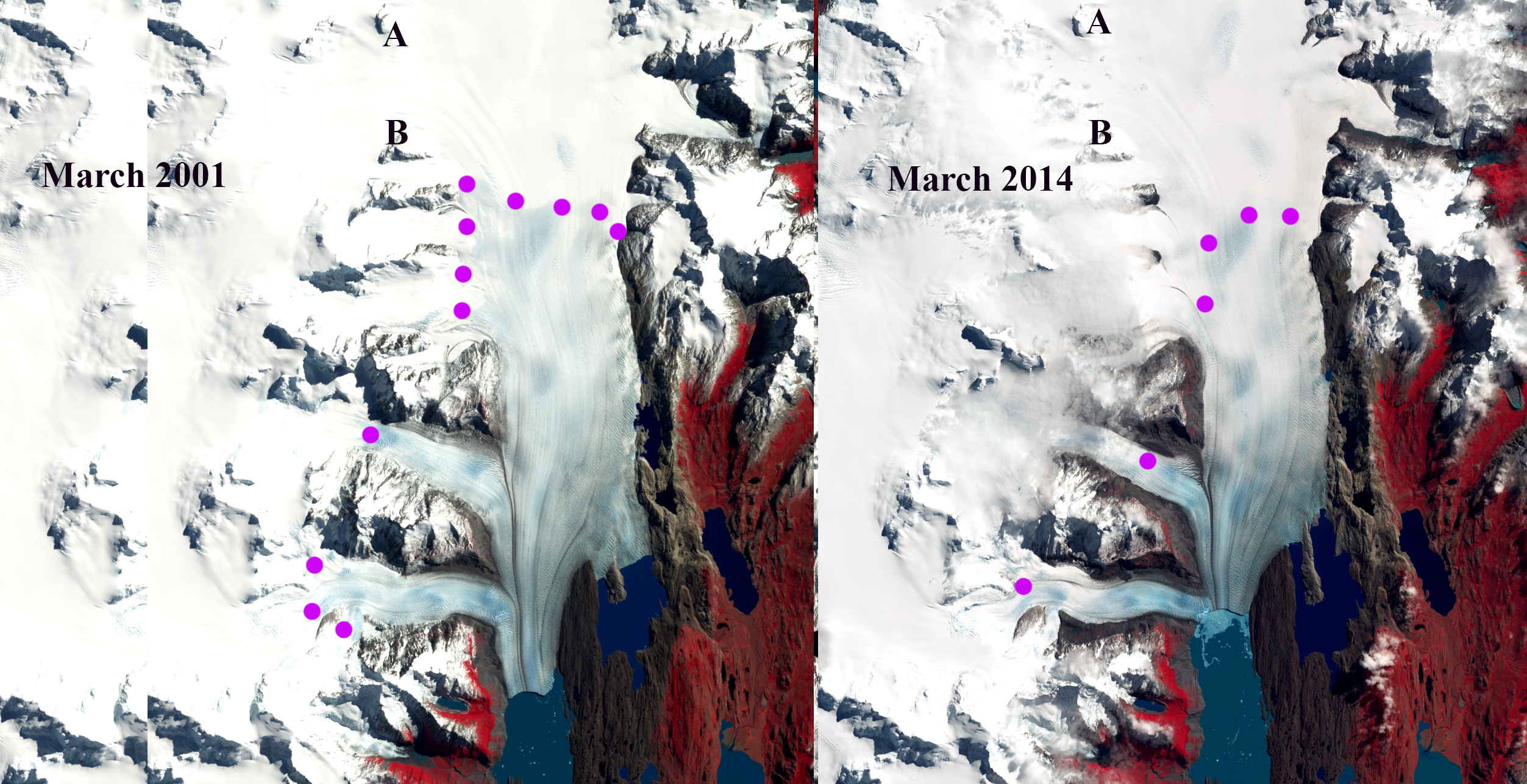
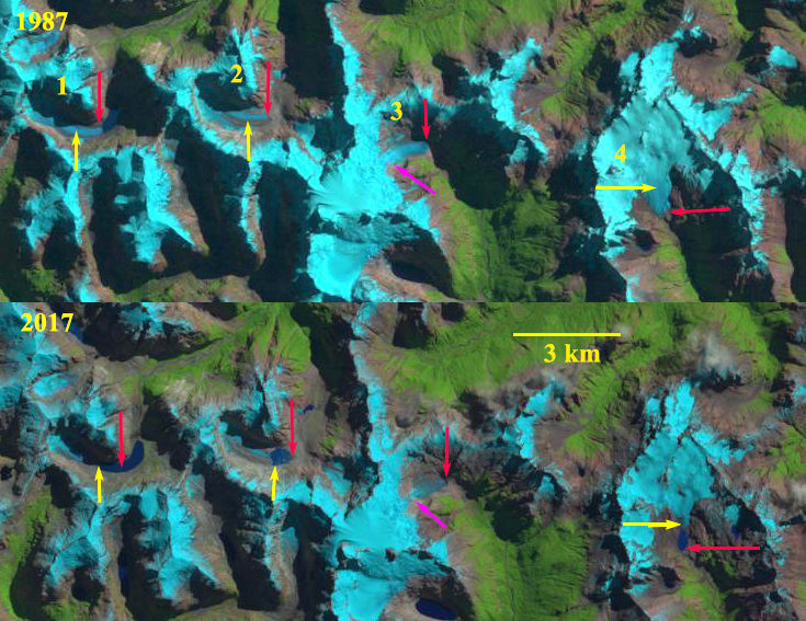
Upsala Glacier transient snowline (TSL) in Landsat images from March 2001 and March 2014. TSL is indicated by purple dots, Point A and B are same location on each map.

Upsala Glacier transient snowline (TSL) in Landsat images from February 14, 2018 and March 14, 2019. TSL is indicated by purple dots, Point A and B are same location on each map.

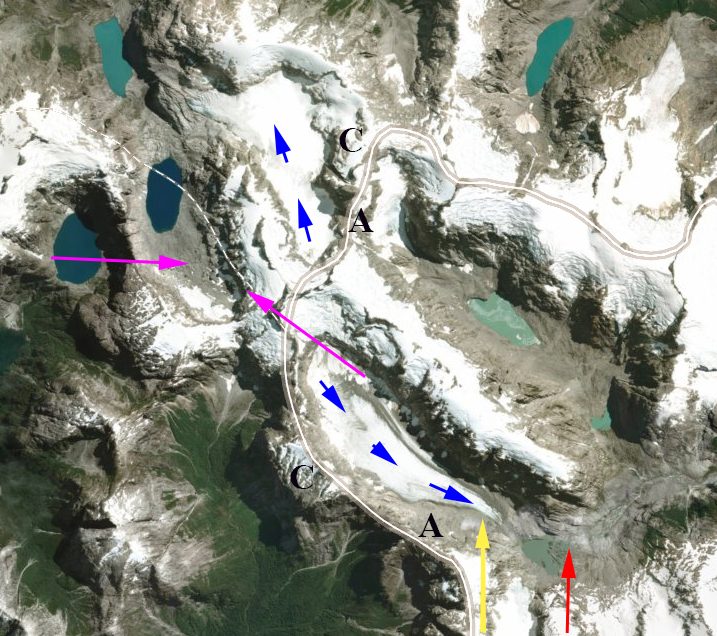
Map from GLIMS of the glacier divide of Upsala and Viedma Glacier with contours in meters noted.