
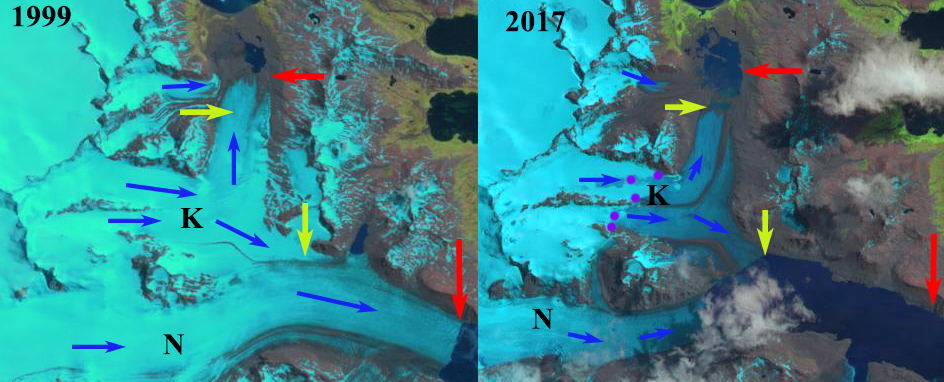
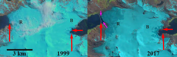
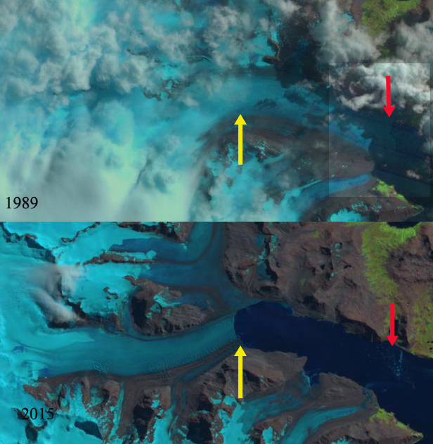
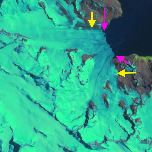
Konig Glacier (K) terminus retreat compared in 1999 and 2017 Landsat images. The red arrow indicate the 1999 terminus location, yellow arrows 2017 terminus location and blue arrows the surface movement. The southern terminus formerly connected with Neumayer Glacier (N) is now separate.
Konig Glacier is a land terminating glacier just north of the Neumayer Glacier, on the northwest coast of South Georgia. The glacier has a split terminus, a northern terminus ending on an outwash plain near Fortuna Bay and a southern terminus that has merged with Neumayer Glacier. In 1977 the glacier extended to within 300 m of Fortuna Bay and no proglacial lake existed (BAS map). Neumayer Glacier is a calving glacier that has retreated 5600 m from 1999 to 2016 and is dynamically connected to the Konig Glacier along its southern margin just where the glacier turns northeast. Gordon et al., (2008) observed that larger tidewater and sea-calving valley and outlet glaciers generally remained in relatively advanced positions until the 1980’s. After 1980 most glaciers receded; some of these retreats have been dramatic and a number of small mountain glaciers will soon disappear. Here we examine 1999-2017 Landsat imagery to identify glacier change.
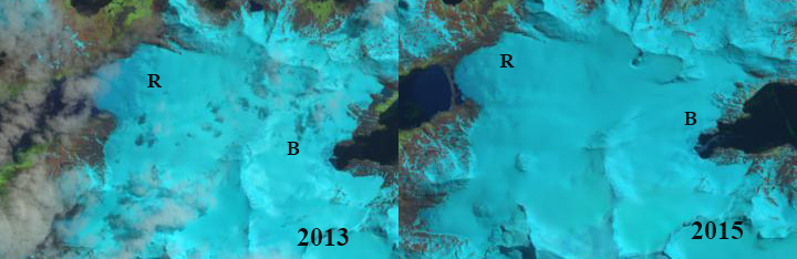
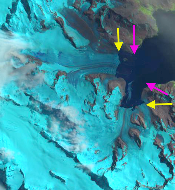
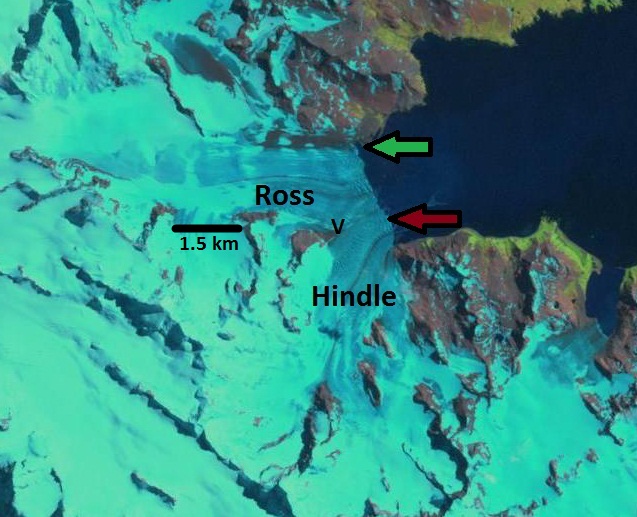
In 1999 the southern terminus merged with Neumayer Glacier and extended several kilometers down the fjord. The northern terminus ended in a proglacial lake adjacent to a tributary joining from the west. By 2002 glacier retreat had expanded the lake at the northern terminus while limited retreat had changed little at the southern terminus. In 2006 the northern terminus is at the southern margin of the proglacial lake. By 2015 the northern terminus had separated from the western tributary and the terminus had retreated from the proglacial lake. The proglacial lake had expanded in width possibly due to ice cored moraine metling. The snowline, purple dots, in 2015 is at 550 m. By 2017 the southern terminus of Konig Glacier has separated from the rapidly retreating main trunk of Neumayer Glacier. The northern terminus has retreated 1100 m since 1999 and a new upper proglacial lake is forming at the terminus. The western tributary no longer approaches Konig Glacier. The medial moraine running down both the southern and northern arm have expanded in prominence suggesting enhanced ablation. The snowline in December 2017 is at 450 m with several months of the melt season to go. The retreat of Konig Glacier is like that of land terminating Purvis Glacier. While glacier separation has also been since at Ross and Hindle Glacier.
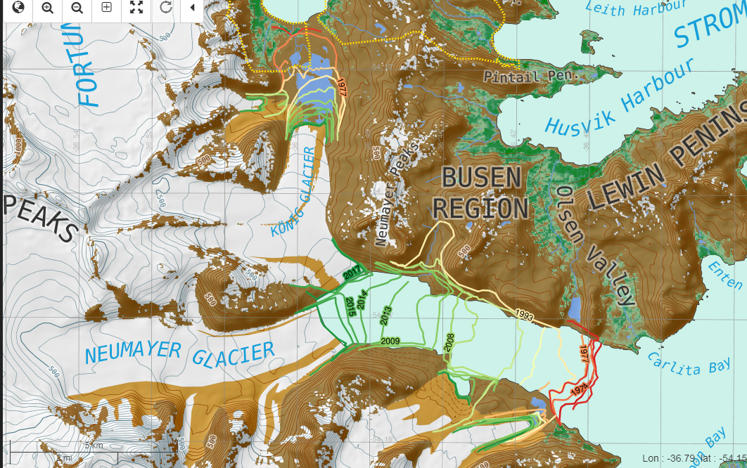
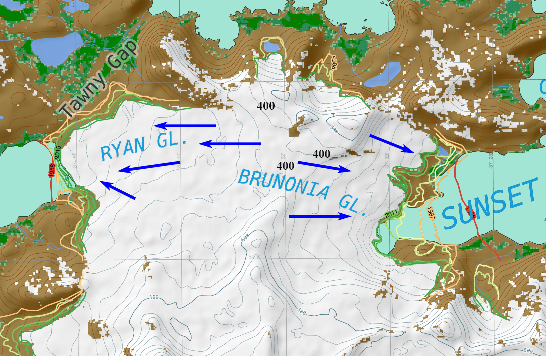
Map of terminus positions of Konig and Neumayer Glacier, South Georgia from the British Antarctic Survey online map site.
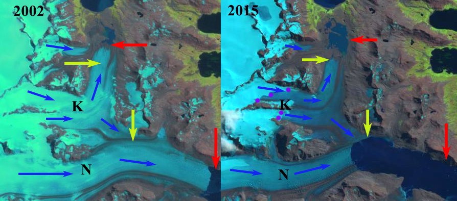
Konig Glacier (K) terminus retreat compared in 2002 and 2015 Landsat images. The red arrow indicate the 1999 terminus location, yellow arrows 2017 terminus location and blue arrows the surface movement. The southern terminus is still connected with Neumayer Glacier (N).
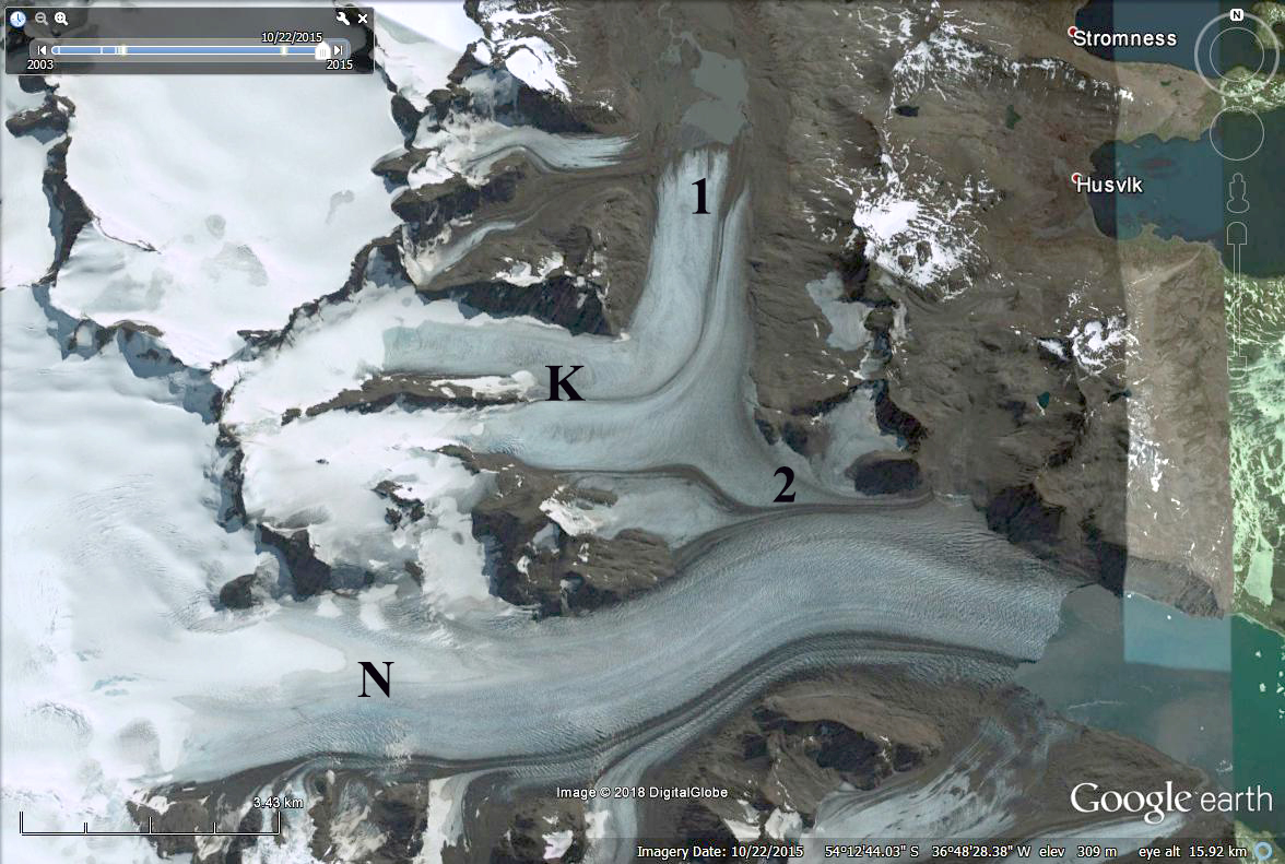
Konig Glacier in 2006 Google Earth image indicating northern terminus (2) and southern terminus (1).


