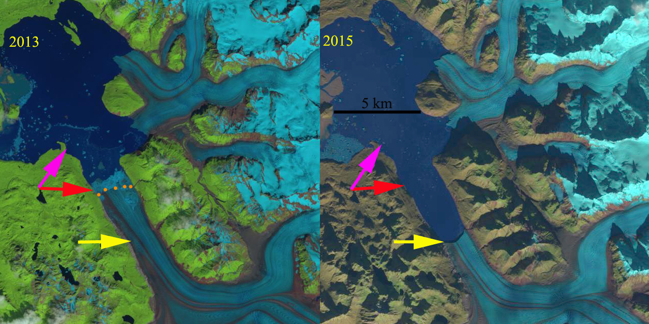
Alsek Glacier in a 1984 Landsat image and 2017 Sentinel image. Red arrows indicate 1984 terminus, yellow arrows 2017 terminus location, pink arrows tributaries that joined the glacier in 1984 and purple dots the snowline. AR=Alsek River, G=Gateway Knob and P=Prow Knob.
Alsek Glacier descends from the Fairweather Range terminating in Alsek Lake on the coastal plain. The glacier terminated at Gateway Knob (G) near the outlet of Alsek River from Alsek Lake in the early part of the 20th century (Molnia, 2005). At that time it had a joint terminus with Grand Plateau Glacier. The glacier retreated 5-6 km by 1984 along the central margin from Gateway Knob. The glacier remained connected with the Grand Plateau Glacier in 1984. In 1960 the glacier had a single terminus joining downstream of an unnamed island in Alsek Lake, that Austin Post told me reminded him of a boats prow. This “Prow Knob” (P) much like Gateway Knob a century ago stabilizes the terminus. Retreat from this knob will lead to an increase in retreat of Alsek Glacier. Here we examine the change from 1984-2017 with Landsat and Sentinel imagery.
In 1984 the terminus location is denoted with red arrows it has separated into two termini on either side of “Prow Knob”. The northern terminus tongue is located on a narrow island on the north side of Alsek Lake. The southern tongue merges with the northern arm of Grand Plateau Glacier. Two tributaries at the pink arrows merge with the main glacier. In 1984 the snowline is at 900 m. By 1999 the northern tongue has retreated from the narrow island, which exposes the terminus to enhanced calving. The southern terminus has separated from the Grand Plateau Glacier. In 1999 the snowline is at 900 m. By 2013 the northern terminus has retreated almost to the northern end of “Prow Knob” and the southern terminus is directly south of “Prow Knob” in a 1.8 km wide channel. By 2016 two tributaries of Alsek Glacier are fully detached from the glacier, pink arrows. In 2017 the northern terminus tongue has retreated 3.7 km since 1984 into the 2.0 km wide channel on the northeast side of “Prow Knob”. The center of the southern terminus has retreated 3.0 km since 1984 and remains in the channel on the south side of “Prow Knob”. The length of the calving front has declined from an 8 km long calving front in 1984 to a 4 km calving front in 2017. In both 2016 and 2017 the snowline is at 1200 m, at this elevation the mass balance of the glacier will be significantly negative driving further retreat. Larsen et al (2007) indicate thinning in the lower Alsek Glacier of 3+m/year in the last half of the 20th century, indicating the glacier is a in a long term adjustment to climate change. The retreat of this glacier is similar to that of Walker Glacier and North Alsek Glacier, and less than that of the northern arm Grand Plateau Glacier to which it was connected in 1984 or Yakutat Glacier a short distance north.

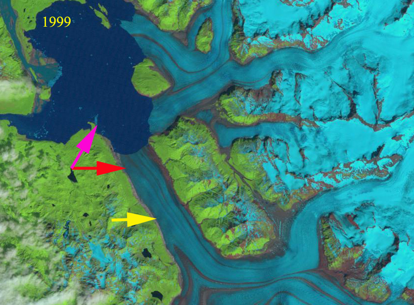
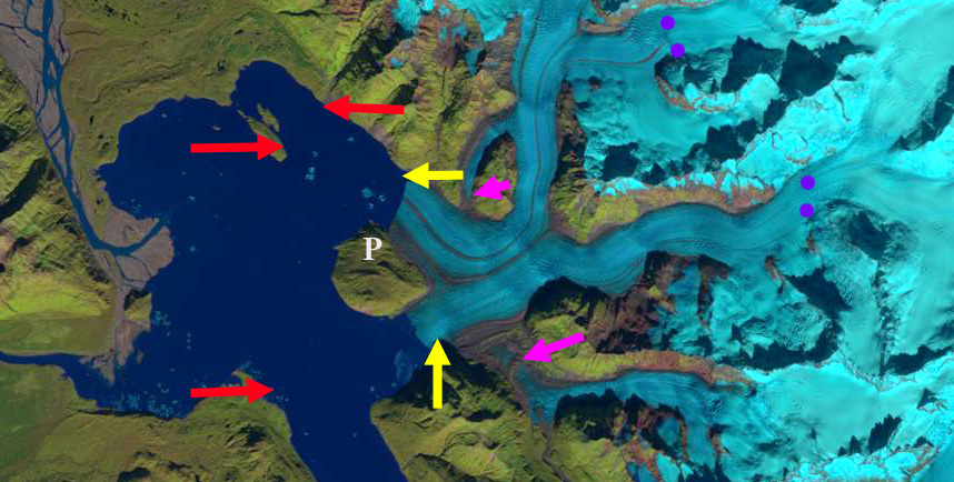
Alsek Glacier in a 1999 Landsat image . Red arrows indicate 1984 terminus, yellow arrows 2017 terminus location, pink arrows tributaries that joined the glacier in 1984 and purple dots the snowline. P=Prow Knob.
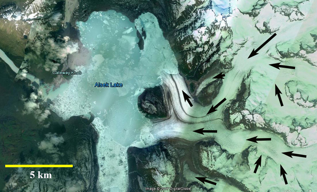
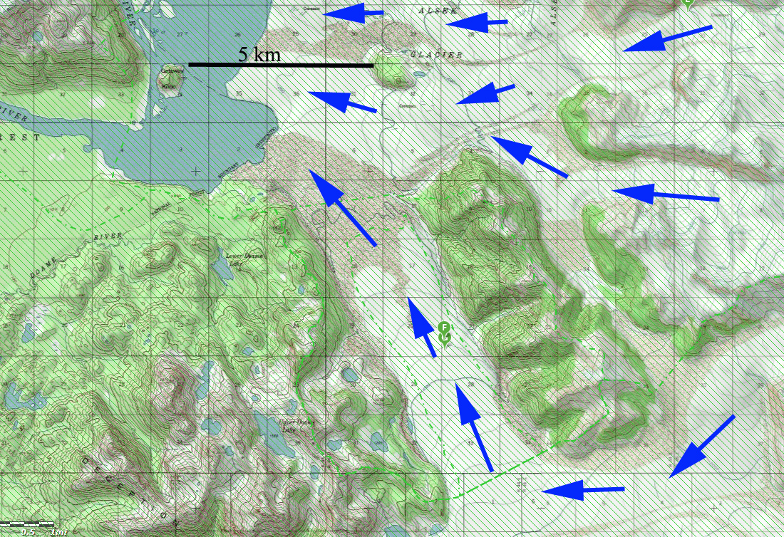
Alsek Glacier in 2014 Google Earth Image,indicating flow directions.
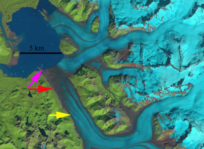
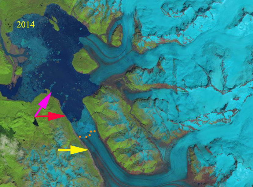
Alsek Glacier in a 2016 Landsat image . Red arrows indicate 1984 terminus, yellow arrows 2017 terminus location, pink arrows tributaries that joined the glacier in 1984 and purple dots the snowline. P=Prow Knob.