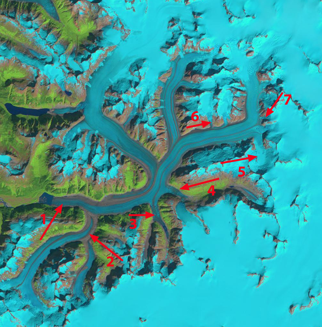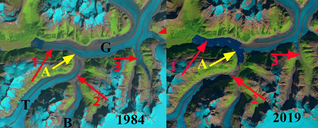
Gilkey Glacier in 1984 and 2019 Landsat images indicating retreat of 4300m, tributary separation and 5 km2 lake expansion. A=Terminus tongue, B=Battle Glacier, G=Gilkey Glacier and T=Thiel Glacier.
Gilkey Glacier draining the west side of the Juneau Icefield has experienced dramatic changes since I first worked on the glacier in 1981. The Gilkey Glacier is fed by the famous Vaughan Lewis Icefall at the top of which Juneau Icefield Research Program (JIRP) has its Camp 18 and has monitored this area for 70 years. Here we examine the changes using Landsat images from 1984, 2014, 2018 and 2019. Landsat images are a key resource in the examination of the climate change response of these glaciers (Pelto, 2011). The August 17th 1984 image is the oldest high quality Landsat image, I was on the Llewellyn Glacier with JIRP on the east side of the icefield the day this image was taken. JIRP was directed by Maynard Miller at that time and by Seth Campbell now.
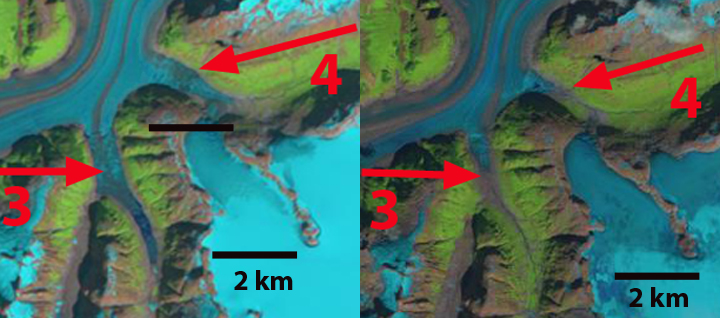
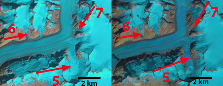
In 1984 Gilkey Glacier terminated in a new proglacial lake that had and area of 1.5 km2 (#1). At #2 Thiel and Battle Glacier merged and then joined Gilkey Glacier. Arrow #3 and #4 indicates valleys which tongues of the Gilkey Glacier flow into, at #3 the glacier extended 1.6 km upvalley. At arrow #4 the glacier extended 1.5 km up Avalanche Canyon. At #6, #7 and #9 tributaries flow into the Gilkey Glacier. At #8 Antler Glacier is a distributary glacier terminus that spilled into a valley terminating short of Antler Lake.
By 2014 the proglacial lake had expanded to 3.65 km2 as the glacier has retreated 3200 m. Thiel and Battle Glacier have separated from Gilkey Glacier and from each with a retreat of 2600 m for Thiel Glacier and 1400 m for Battle Glacier. The glacier no longer flows into the valley at #4. Tributaries at #6 and #9 no longer reach Gilkey Glacier. At #7 there is not a direct flow connection, but is still an avalanche connection. At #8 Antler Glacier has retreated 2200 m.
In 2018 and 2019 the snowline on the Juneau Icefield has been the highest of any year since observations began in 1984. This will accelerate mass loss and lead to continued extensive retreat. In 2018 the snowline was at 1600-1650 m on Sept. 16. In 2019 the snowline on Gilkey Glacier was 1650-1700 m on Sept. 10. In July of 2019 the terminus tongue of the glacier reached across the junction of the Gilkey and Battle Valley, separating the two proglacial lakes. By September 10, the glacier tongue had broken off leading to the two lakes joining expanding the size of the proglacial lake to 6.5 km2. The terminus has retreated 4300 m since 1984, while the lake has increased in size by more than 400%. The retreat will continue leading to additional lake expansion just as is occurring at Meade and Field Glacier.
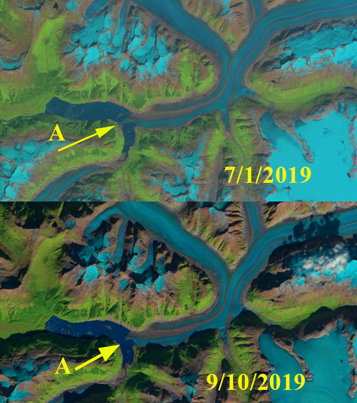
The expansion of Gilkey Lake into the Battle Valley in 2019 Landsat images.
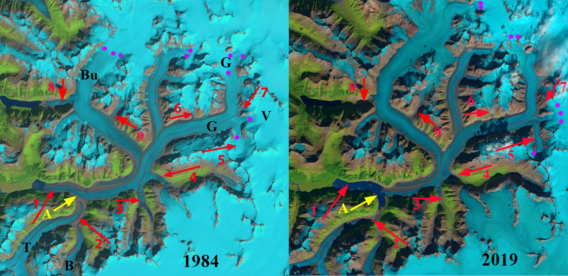
Gilkey Glacier in 1984 and 2019 Landsat images indicating retreat of 4300m, tributary separation and 5 km2 lake expansion. A=Terminus tongue, B=Battle, Bu=Bucher, G=Gilkey, T=Thiel, V=Vaughan Lewis. Snowline=purple dots.
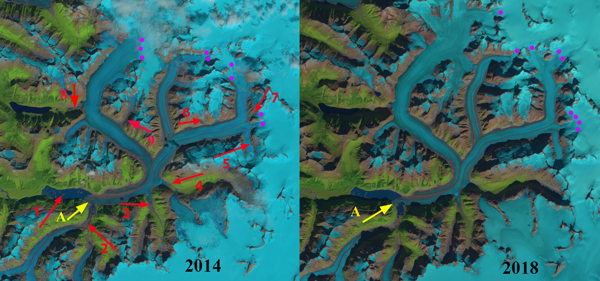
Gilkey Glacier in 2014 and 2018 Landsat images indicating retreat, snowline elevation and lake expansion.