Evighedsfjord (E) with glaciers terminating in the fjord in 2000 and 2018 Landsat images. Q=Qingua Kujatdleq is at the head of Evighedsfjord (Q), Tapa Glacier (1), Unnamed glaciers (2 and 3), and developing nunatak area (4) . The red arrow is the 2000 terminus and the yellow arrow is the 2018 terminus.
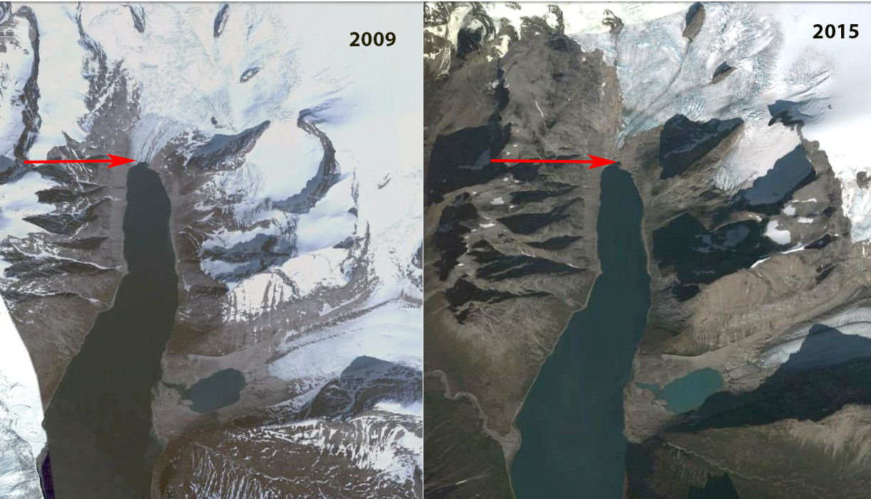
Evighedsfjord (Kangerlussuatsiaq Fjord) in southwest Greenland has numerous glaciers that reach or did reach this 75 km long fjord. Here we examine the termination of the fjord at Qingua Kujatdleq. Here we examine Landsat imagery from 2000, 2002, 2014 and 2018 to identify changes in four glaciers that in 2000 terminated in the fjord. Leclercq et al (2012) note that the glacier retreated 1.5 km from 1850-2009.
In 2000 Tapa Glacier (1) terminated in the fjord. Glacier #2 and #3 also terminated in the fjord in 2000. Quingua Kujatdleq Glaicer terminated at the red arrow, and #4 represents small nunataks within the ice. The snowline is at ~1000 m. In 2002 all four glaciers reach Evighedsfjord still and the snowline is at ~1000 m. There are no evident sediment plumes where the glaciers reach the fjord. By 2014 only Qingua Kujatdleq still reaches the fjord, the snowline is at ~1100 m. There is a sediment plume emanating from Tapa Glacier. In 2018 Qingua Kujatdleq has retreated 2200 m since 2000. This is a greater retreat than Leclercq et al (2012) show for the entire 1850-2009 period. Tapa Glacier has retreated ~500 m and no longer reaches the ocean and has a persistent summer sediment plume. Glacier #2 no longer reaches the ocean having retreated 500 m. Glacier #3 no longer reaches the ocean having retreated 300 m. The two small bedrock outcrops at #4 in 2000 have merged into one large nunatak by 2018. The loss of glacier ice reaching fjords has also been documented at Alangordlia Fjord and Tasermiut Fjord.
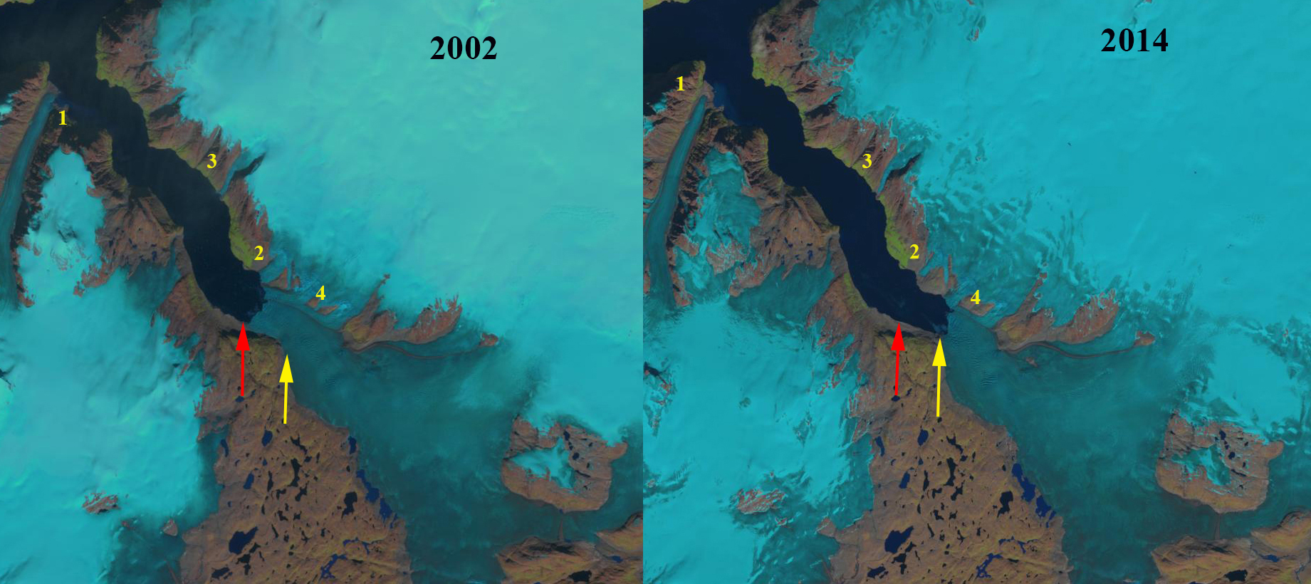
Evighedsfjord (E) with glaciers terminating in the fjord in 2002 and 2014 Landsat images. Q=Qingua Kujatdleq is at the head of Evighedsfjord (Q), Tapa Glacier (1), Unnamed glaciers (2 and 3), and developing nunatak area (4) . The red arrow is the 2000 terminus and the yellow arrow is the 2018 terminus.

Greenland topographic map of the region right and 2018 Landsat image of with Qingua Kujatdleq (Q), Tapa Glacier (Point 1). Unnamed glaciers #2 and #3 also noted.