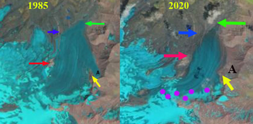
Dzhikiugankez Glacier in 1985 and 2020 Landsat images with the snowline shown by purple dots. A tributary at Point A has disappeared and tributary at the red arrow has separated. Thinning and marginal retreat is emphasized by blue and green arrows.
Dzhikiugankez Glacier (Frozen Lake) is a large glacier on the northeast side of Mount Elbrus, Caucasus Range. The primary portion of the glacier indicated in the map of the region does not extend to the upper mountain, the adjoining glacier extending to the submit is the Kynchyr Syrt Glacier. The glacier is 5 km long extending from ~4000 m to 3200 m. Shahgedanova et al (2014) examined changes of Elbrus glaciers from 1999-2012 and found a 5% area loss in this short period, with accelerattion retreat from the 1987-2000 period. Of the glaciers on Elbrus over 10 km2 in area Dzhikiugankez Glacier experienced a high rate of reduction, the relative loss was 27% between 1960 and 2014 (Tielidze and Wheate, 2018). This is driven by a persistent lack of retained snowcover, here we examine Landsat imagery to illustrate that. This post is inspired by the frequent imagery of Caucasus glacier change posted on Twitter by @LevanTielidze.
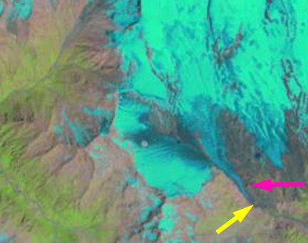
In 1985 the glacier connects beneath the subsidiary rock peak at the red arrow, a tongue of ice extends on the east side of the rock rib at the yellow arrow, Point A. The transient snow line is at 3550 m and less than 30% of the glacier is snowcovered. The medial moraine at the blue arrow is just beyond the glacier terminus, green arrow. In 2013 a wide zone of bare rock extends up to the subsidiary peak at the red arrow and the glacier has separated from the western tributary. The medial moraine, blue arrow is exposed all the way to its origin near the red arrow. In 2013 the tongue of ice at Point A, is gone. This glacier is retreating faster on its lateral margins than at the terminus, a 20% reduction between red and yellow arrows from 1985 to 2013. In 2013 the snowline is at 3600 m, with several weeks of the melt season left.
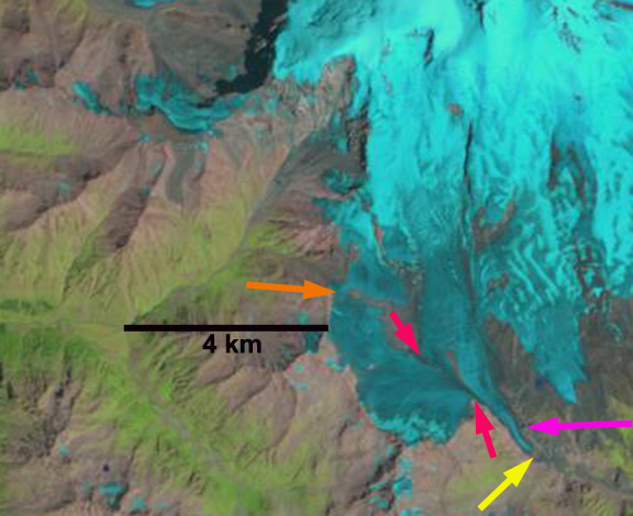
In 2018 the transient snowline near the end of the melt season is at 3900 m, leaving less than 10% of the glacier snowcovered. In 2019 the transient snowline is at 3800 m near the end of the melt season leaving 10-15% of the glacier snowcovered. In mid-July 2020 the transient snowline is already at 3600 m with at least 6 weeks left in the melt season. It is evident from the Landsat images from the 2013 to 2020 period that Dzhikiugankez Glacier consistently has the lowest percent of overall snowcover on Elbrus and too small of an accumulation zone to persist. The limited snowcover and glacier separation in also seen at Azaubashi Glacier on Mount Elbrus

Dzhikiugankez Glacier in 2013, 2018 and 2019 Landsat images with the snowline shown by purple dots.
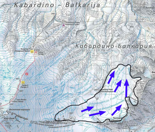
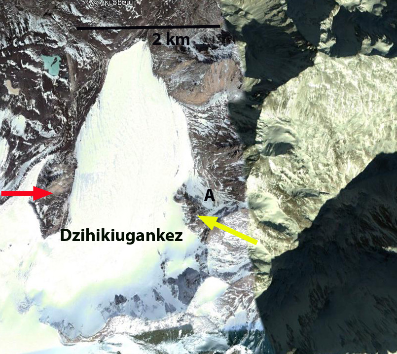
Map of northeastern side of Mount Elbrus, summit on left. Dzhikiugankez Glacier (Dzhikaugenkjoz) is outlined in black.