Engabreen is an outlet glacier of the Svartisen ice cap in northern Norway. It has an area of 40 km2. Most of the area lies between 1200 and 1450 m the high plateau of the ice cap. This glacier has been the focus of attention from the Norwegian Water Resources and Energy Directorate (NVE) for over 50 years.
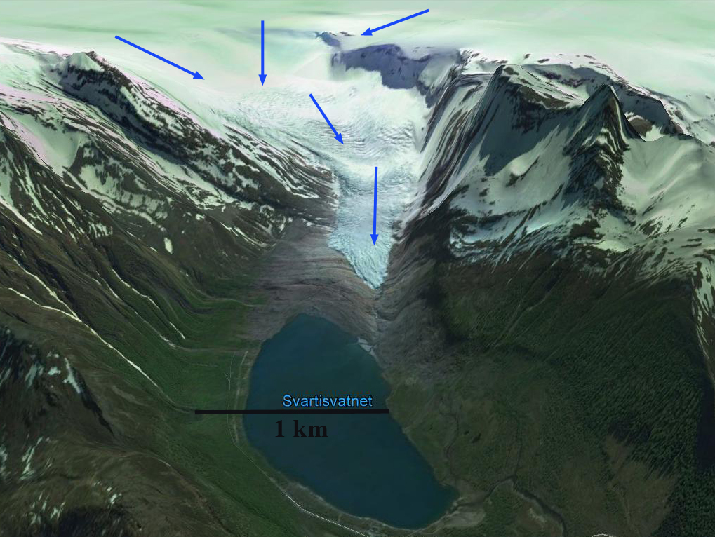
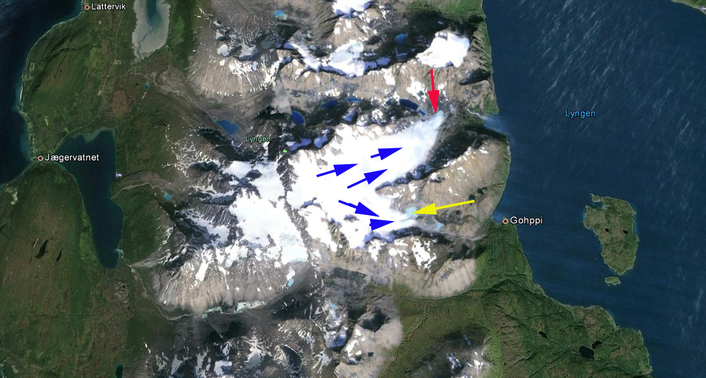
Google Earth image of Engabreen Glacier, 2014.
NVE maintains the most extensive and detailed glacier monitoring network in The NVE annual mass balance measurements on Engabreen indicate that winter snow typically accumulate 3 m of water equivalent on the ice cap. This amounts to 5-7 m of snowpack as the melt season begins in May. The glacier terminus descends from the ice cap down nearly to Svartisvatnet, a lake at 7 m. At the terminus annual melting is 12 m. The rivers from the northern and eastern side of Svartisen were regulated in the 1990’s for hydro power production by construction of a tunnel system partly underneath the glacier. Today about 60% of the potential runoff of the Engabreen is captured and sent through a bedrock tunnel to the hydropower facility. During completion of this tunnel access to the glacier base was opened. Today there is the world’s only ongoing subglacial laboratory here The melt water from Engabreen is collected into this tunnel system at 620 m a.s.l. underneath 200 m of glacier ice in the ice fall. The sub-glacial blog has further details of this mainly winter research location
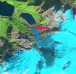
Late in the 18th century Svartisvatnet,the lake below the terminus, started to appear as the glacier retreated upvalley. In 1903 regular length change observations were initiated, a small advance ensued until 1910. By 1931 the glacier retreated 100 meters, and the glacier tongue was thinning. During the next decade calving led to rapid retreat revealing the rest of Engabrevatnet. This period of retreat ended in 1965, Engabreen advanced with three different pulses ending in 1971, 1984 and 1999, the last pulse reaching to within a few meters of the lake shore.Below are pictures from the NVE taken in 2000 and 2008 of Engabreen, note the large contraction of the terminus area. This is further illustrated in Landsat images below. 
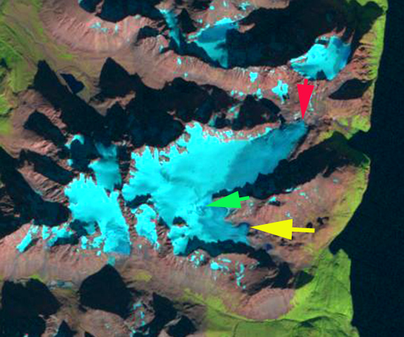
NVE images of Engabreen Glacier
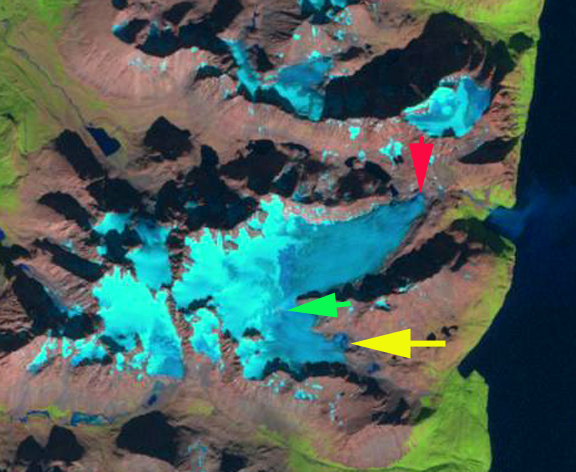
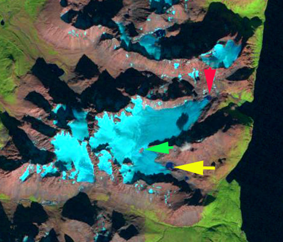
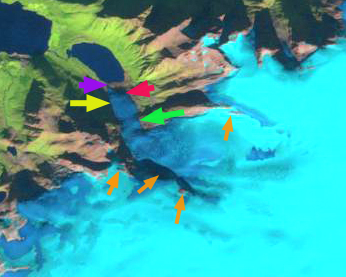
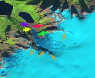
From 1990 the glacier ended at the red arrow before advancing by 1999 to the purple arrow. Retreat followed to the yellow arrow in 2015, this is a 350 m retreat. From 1999-2013 NVE amual terminus assessment indicates a retreat of 317 m.. At the green arrow the width of the glacier declined from 475 m in 1999 to 325 m in 2015. At the orange arrows thinning is evident higher on the glacier as bedrock areas have expanded. The snowline in 2014 is above these areas and is at all but one in 2015. This thinning suggest retreat will continue. The 2015 position is its point of furthest retreat since the Little Ice Age. The recent retreat indicates a recent trend of negative mass balance on the glacier. There is excellent flow off the ice cap that has persistent and consistent snowcover indicating this glacier will survive current climate. This is also leading to the retreat of Storglombreen and Flatisen from the same ice cap
1990 Landsat image
1999 Landsat image

2014 Landsat Image
2015 Landsat image