Austre Torellbreen, Svalbard Retreat and Nunatak Expansion

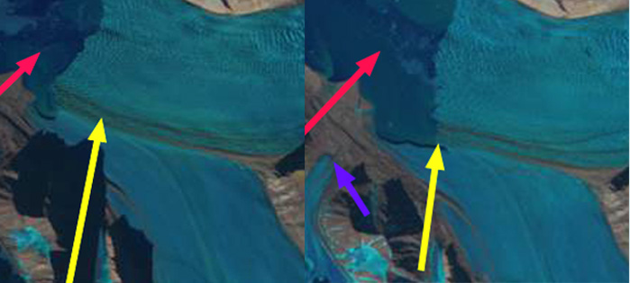
Austre Torellbreen in 2000 and 2019 Landsat images.  Red arrow is the 2000 terminus location, yellow arrow the 2019 terminus location. Point 1,2 and 3 are nunatak areas that are expanding.

Austre Torellbreen is an outlet glacier on the southwest coast of Svalbard.  It is just west of calving glacier that are retreating such as Paierbreen and Samarinbreen and adjacent to the land terminating Nannbreen. Blaszczyk et al (2008) report the velocity of Austre Torellbreen near the calving front of 220-265 m/year. Nuth et al (2013) determined that the glacier area over the entire archipelago has decreased by an average of 80 km per year over the past 30 years, a 7% reduction.

In 2000 the calving front is 4.7 km wide and has a low slope at the terminus with the surface reaching 150 m 2.5 km from the calving front.  The calving front is at a point where the embayment widens upglacier and has outwash plains on either side of the margin. The snowline is at 300 m in 2000.  At Point 1 is an isolated nunatak and at Point 2 and 3 are limited ridges extending from nunataks. By 2014 the glaciers western margin has retreated into the widening embayment, with more limited retreat in the center and eastern margin of the glacier.  By 2019 the Austre Torellbreen western margin has retreated 2400 m, while the eastern margin has retreated 800 m. The terminus has narrowed to 4.2 km and is retreated from an area of low slope margins to a location between two peak Brattho and Raudfjellet. There is an area of extensive crevassing at the current calving front, suggesting that further calving retreat will occur. At Point 1 the nunatak has expanded in area and vertical relief. At Point 2 the ridge that was separated in two segments has joined into a single ridge.  At Point 3 the ridge has extended by 500 m and has a greater relief in 2019.  The nunataks and mountain ridges that are amidst and adjacent to Austre Torellbreen can be seen to emerge and expand from 2000 to 2019 as the glacier thins.  This thinning leads to the retreat that is enhanced by calving.


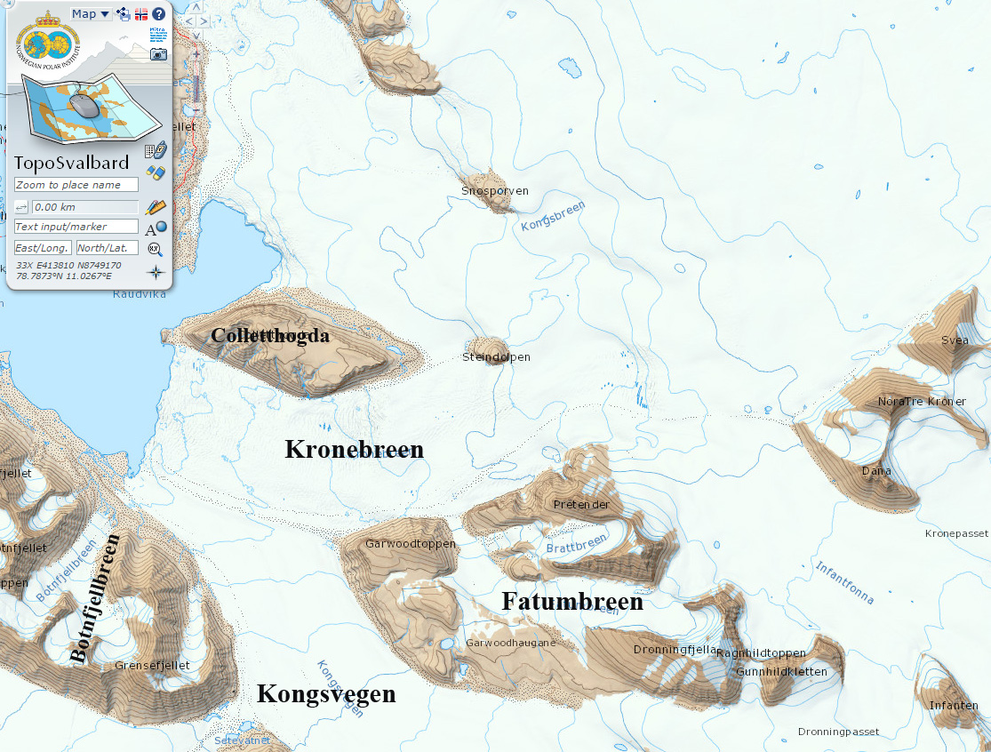
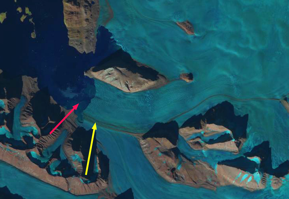
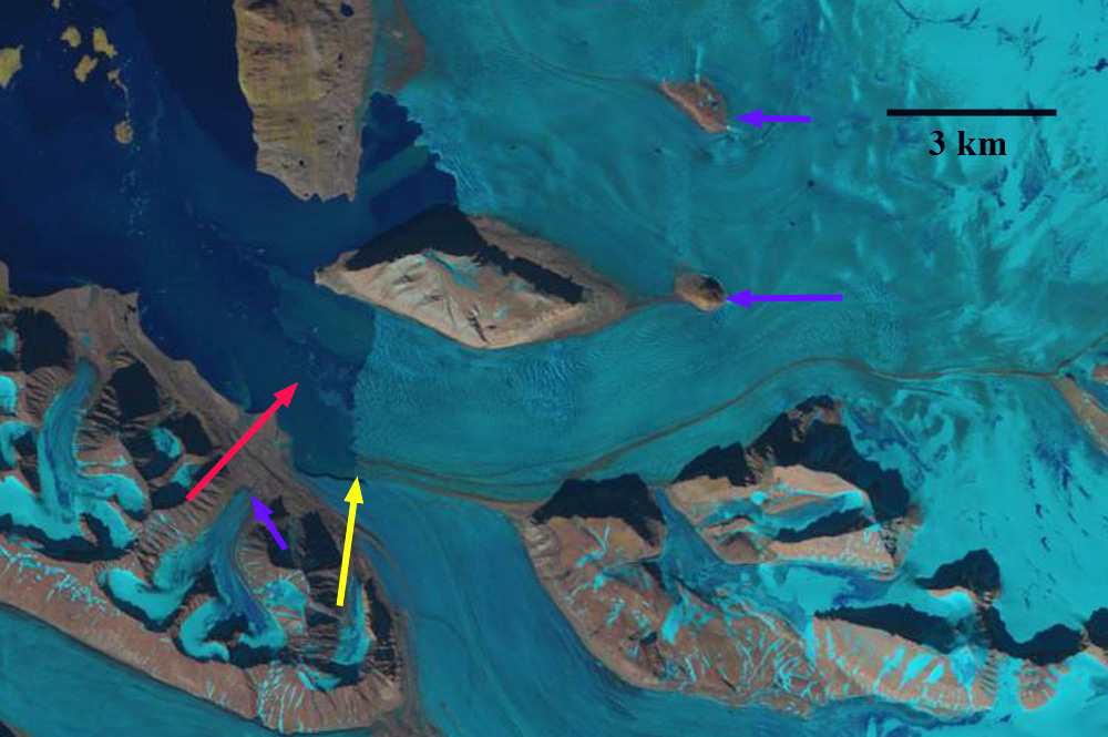
Austre Torellbreen in TopoSvalbard map from circa 2000 and in a visual image from 2014.

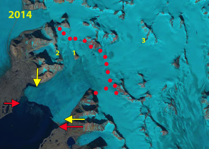
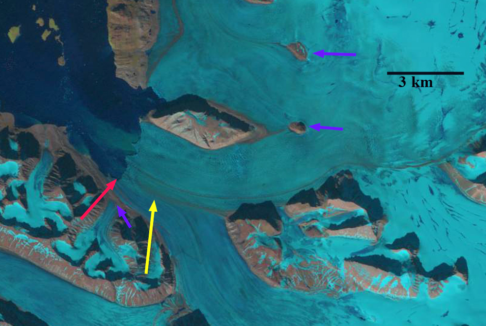
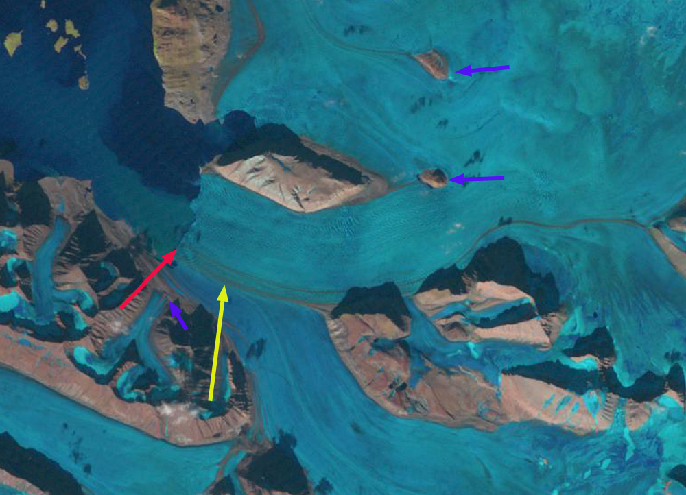
Austre Torllbreen in 2014 Landsat image. Red dots indicate the snowline at 350 m.

Kronebreen and Kongsvegen, Svalbard Initiation of Glacier Separation 2015

kronebreen terminus2
Kronebreen terminus in 2013 (left) and 2015 (right), note the configuration change and separation initiation of Kronebreen and Kongsvegen at yellow arrow.
Kronebreen is a large, (450 km2) tidewater glacier on the northwest coast of Svalbard terminating in a shared terminus with Kongsvegen at the head of Kongsfjorden.  Changes in 2015 indicate the shared terminus will not continue.  Luckman et al (2015) observed Kronebreen has a winter speed of 1.5–2 m/day, with summer peaks of 3–4 m/day associated with positive air temperatures and periods of high rainfall.  The terminus of the glacier was relatively stable from 1990 to 2001 with even a slight advance at the end of that period (Trusel et al, 2010).  The fjord lacks a significant sill at its mouth resulting in significant connectivity with water masses of the West Spitsbergen Shelf, including Atlantic Water  Trusel et al, 2010). This aspect during summer can aid in frontal ablation and terminus retreat as noted in Figure 2a from Luckman et al (2015). Shellenberger et al (2014) observed that the period of Kronebreen stability ended in 2007 and that the glacier retreated 850 m and lost 2.1 square kilometers from 2007-2013. Long term they observed that the ablation loss of the terminus reach increased from 0.14 Gt per year from 1960-1990, to 0.20 Gt per year from 1990-2007 and was 0.21 Gt per year in 2013. The University Centre in Svalbard has established a set of cameras for time lapse work at the terminus, which is fortuitous given the changes that have occurred recently. In 2015 returning in the spring University Centre in Svalbard researchers noted the thinning and stretching of the terminus reach: Doug Benn, Penelope How, Heidi Sevestre and Nick Hulton. Penelope How examines the deployment of the cameras in 2015. Here we examine Landsat images to provide a snapshot of the changes that the above researchers have examined in detail.konebreen map
Map of Glacier front from TopoSvalbard.
In 1987 the joined front terminated near the western tip of Colletthogda, red arrow. The purple arrows indicate locations for comparison to 2015 of glacier thinning. By 1998 there has been a small retreat, that will be erased by a small advance the following years. I 2011 the front remains a single linear front, the greater level of crevassing of Kronebreen is evident as well as the shallower water on the southern margin of the fjord the Kongsvegen terminus. In 2013 a larger retreat has begun, the calving front is concave with more retreat on the southern, Kongsvegen side of the terminus. In 2015 substantial changes have occurred. The front of Kronebreen has retreated 1200 m on the northern margin since 1998 and 1500 m on the southern lateral moraine, this is 300-500 m since 2013. The most striking element is the right angle turn in the calving front at the lateral moraine with Kongsvegen. This is not a stable configuration. This represents the initiation of the separation of Kronebreen and Kongsvegen. The weakness along which the process is taking place is the lateral moraine. Kronebreen terminates in deeper water and can retreat more rapidly via calving. This retreat has been driven by enhanced ablation both at the surface and by the ocean. The higher velocity of Kronebreen is clear in the video of the glacier from the University Center of Svalbard. The process of separatiion is a trend in Svalbard note Samarinbreen.and Vasilievbreen.kronebreen 1987
1987 Landsat image

kronbreen 1998
1998 Landsat image
kronebreen terminus ge 2014
2011 Image from TopoSvalbard, note the differenence in level of calving between Kronebreen and Kongsvegen.

kronebreen 2013
2013 Landsat image

kronebreen 2015
2015 Landsat image