Jiemayangzong Glacier in 1991 and 2020 Landsat images. The red arrow is the 1991 terminus location, yellow arrow is the 2020 terminus location and purple dots mark the snowline. Point A indicates a tributary that has disconnected, while bedrock expanded at Point B.
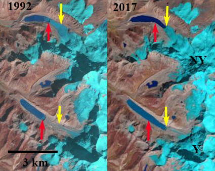
Jiemayangzong Glacier drains east from 6200 m peaks along the Nepal-China border. The glacier ends in a lake- Jiemayangzong Tso. Ren et al (2016) identify this as the headwaters of the Yarlung Tsangpo (Zangbo), which becomes the Brahmaputra River. The Zangmu hydropower project was completed on the river in 2015, it is a 510 MW project. Here we examine Landsat and Google Earth imagery from the 1991-2014 period. This is a region where Li et al (2011) noted that increasing temperature during the 1961-2008 period, especially at altitude, led to the retreat of glaciers and expansion of glacial lakes in this region. Liu et al (2011) noted that this glacier’s area has decreased 5%, retreating 768m ( 21 m/year), leading to lake expansion of ~64% during the 1974-2010 period.
In 1991 the lake was 1.1 km long, the snowline was at 5500 m near the elevation where the northern tributary joined at Point A. In 1998 the snowline was at 5600 m, the glacier had not retreated appreciably. In 2017 tributary A no longer is connected to the main glacier, the snowline is at 5600 m and the lake has expanded to a length of 1.9 km. In 2020 the snowline in mid-September, with the melt season still going, is at 5700 m. The glacier has retreated 1000 m from 1991-202o a rate of ~33 m/year. The lake is now 2.1 km long and has an area of 1.3 km2. The glacier has a wide stable moraine belt (M) and does not pose a GLOF threat. Immediately downstream of the lake is a 10 km2 braided valley/wetland area ![]() as well that would mitigate any potential flood hazard. This glaciers retreat is similar to many others draining north into Tibet from the Himalayan crest, Chako Glacier, West Ganglung Glacierand Asejiaguo Glacier
as well that would mitigate any potential flood hazard. This glaciers retreat is similar to many others draining north into Tibet from the Himalayan crest, Chako Glacier, West Ganglung Glacierand Asejiaguo Glacier

Jiemayangzong Glacier in 1998 and 2017 Landsat images. The red arrow is the 1991 terminus location, yellow arrow is the 2020 terminus location and purple dots mark the snowline. Point A indicates a tributary that has disconnected, while bedrock expanded at Point B.

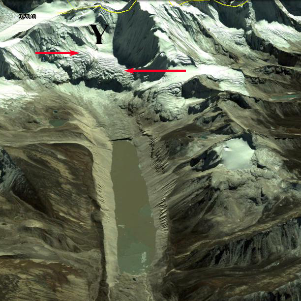
Jieayangzong Glacier (JG) in 2015 Digital Globe image indicating the expanding proglacial lake (JL), moraine belt (M) and large wetland ![]()