Continental Glacier, Wyoming Fragmentation Accelerates

Continental glacier 1994-2023

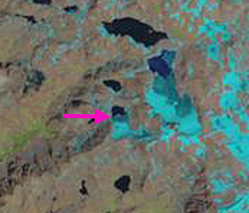
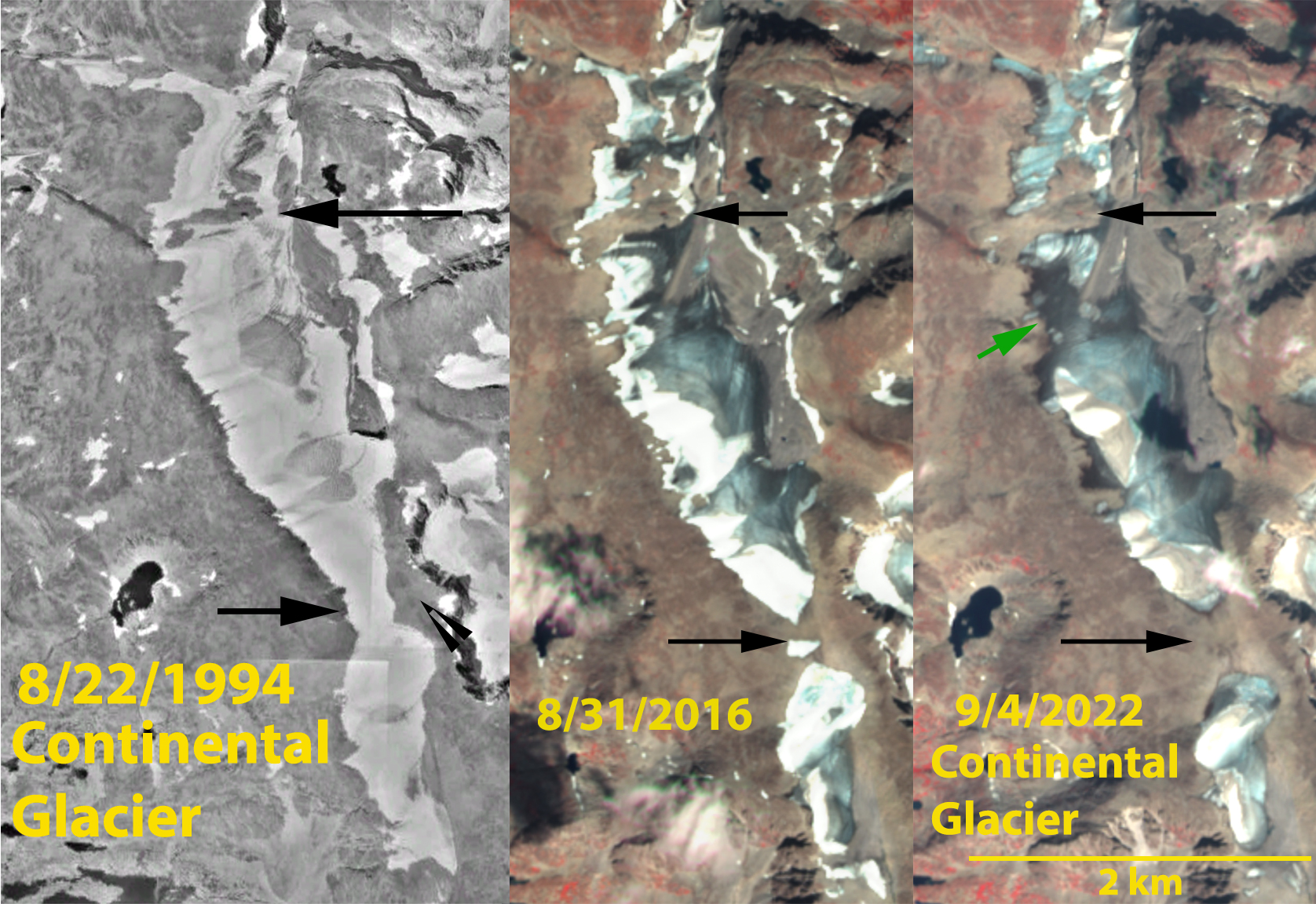
Continental Glacier in 1994 Google Earth and 2016 and 2022 Sentinel images, illustrating the separation at the black arrows, into the northern middle and southern parts, with an impending separation at green arrow.

Continental Glacier is a long plateau glacier draped along the continental divide in the Wind River Range, Wyoming. It drains into Torrey Creek and then the Wind River. In 1994 this glacier extended 5 km from south to north with an area of 2.4 km². In 2012 Van Looy et al (2013) used GPR to determine ice thickness and project how long the glacier could last.  They found 59% of the glacier was less than 40 m thick, with two cirque depressions filled with deeper ice exceeding 150 m. They found a thinning rate of 0.3 m/year for the 1966-2012 period. They did not include the southern part of the glacier in their study.

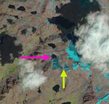
In 2016 the glacier is in three parts and glacier area has been reduced to 1.9 km². By 2022 additional fragmentation at the green arrow in the middle segment is imminent. The northern and southern parts are wasting away rapidly. A closeup of the northern section of the glacier in 2022 illustrates how thin, fragmented, and stagnant the ice has become. Point A-E indicate bedrock areas emerging amidst northern part. Point F-I indicate very thin, old, dark ice in the middle part. This glacier is following a similar path to the Grasshopper Glacier just to the south.  Van Looy et al (2013) noted that in the next century the volume would be reduced by 43% and the glacier would be lost in 300-400 years. The pace of loss has increased significantly with volume loss of ~2% per year since 2013, which will lead to loss of all areas with less than 40 m of ice in 2012 being lost by 2040. The two areas of deep ice will persist much longer. This same trend has led to the loss of Heap Steep Glacier, Harrower Glacier and Twins Glacier in the Wind River Range since 2015.

Screenshot
Screenshot

Continental Glacier in 9-4-2022 false colar Sentinel image. Point A-E are bare rock areas amidst northern part of glacier. Point F-I dark, old thin ice in the middle part.

J Glacier Retreat-Impending Loss, Wyoming

J Glacier is a small Glacier on the northwest side of Klondike Peak in the Wind River Range of Wyoming. In this post we examine changes in this glacier from 1994-2013 using Landsat Imagery and from 2013 and Google Earth imagery from 1994, 2006 and 2009. In 1966 the glacier ended on the far side of the lake basin and no lake was present. The retreat from 1966-1995 was 60 m a rate of 2 m per year. By 1994 a lake had formed at the terminus, the 1994 margin of the glacier is indicated with a burgundy line on each Google Earth image. The main terminus of the glacier retreated 100 m from 1994 to 2009, a rate of 6.6 m/year. More importantly the image from 2006 indicates a significant retreat and rock exposure on the upper portion of the glacier on the west side, pink arrow. In 2009 the glacier terminus is beginning to recede out of the lake as seen by emerging shoreline rock near the glacier center. In 2013 a July and August Landsat images indicate the extent of snowpack loss that occurred in just one month, leaving the glacier without any snowcover by late August. The terminus is indicated with a pink arrow, any change since 2009 cannot be discerned on this image. The complete snowpack loss has led to glacier ice melt and separation of the upper eastern corner of the glacier from the rest of the glacier, yellow arrow. The loss of area and exposure of rock on both the upper west and upper east side of the glacier indicate the lack of an accumulation zone. This indicates a glacier that cannot survive as noted by Pelto (2010). This is the same forecast as for nearby Minor Glacier and Grasshopper Glacier, whereas the neighboring Sourdough Glacier has fared a bit better. j glacier map
USGS Map of J glacier and Sourdough Glacier, from 1966 aerial photography.

J glacier 1994
1994 Google Earth image

j glacier 2006
2006 Google Earth Image

J glacier 2009
2009 Google Earth image

j glacier 7-2013
July 2013 Landsat Image

j glacier 8-2013
August 2013 Landsat image