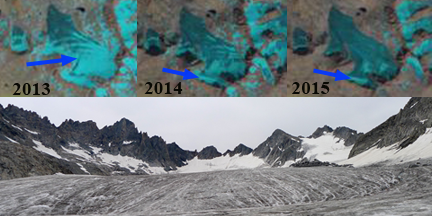
At top Landsat images from September 2013, 2014 and 2015 of Mammoth Glacier. The blue arrow indicates retained snowcover. A 2013 images of Mammoth Glacier from Sarah Meiser, note low slope and lack of crevassing above
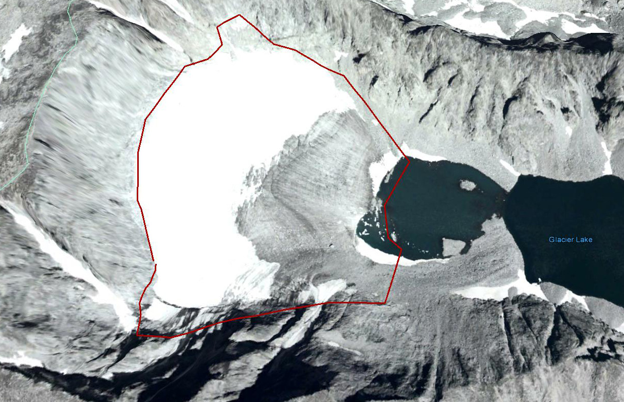
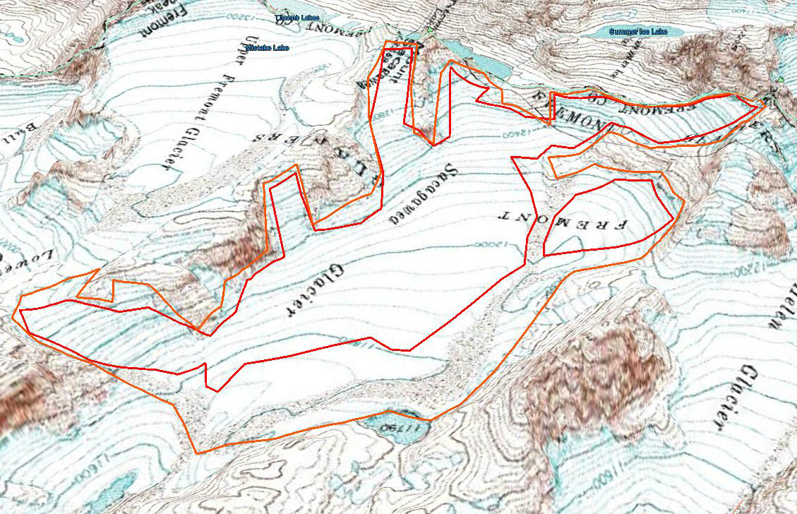
Mammoth Glacier is in the Wind River Range of Wyoming. The ongoing retreat is leading to a glacier that does not warrant the name mammoth for size, but soon it will for obsolescence.The long and low sloped glacier is the largest west of the Continental Divide in the range. The glacier is at the headwaters of the Green River and Green River Lakes. The glacier had an area of 4 square kilometers in 1952, 2.1 square kilometers in 2007 and 1.8 square kilometers in 2015. The Landsat sequence above from 2013, 2014 and 2015 illustrates the problem, insufficient retained snowcover to approach equilibrium, that is also evident in 2006 shown below. The setting is better illustrated with images from Sarah Meiser who I think has the best collection of recent images of Wind River Glaciers. A glacier like Mammoth with limited avalanching needs more than 50% retained snowcover at the end of the summer (accumulation area ratio) to be in equilibrium. In 2013 with three weeks left in the melt season, the accumulation area ratio (AAR) is slightly below 50%, note Sarah Meisel image below. In 2014 the AAR is 25 % and in 2015 the AAR is 5-8%. These periods of sustained bare ice exposure lead to area loss and thinning. A comparison of Google Earth images illustrate the area loss. In each image the orange line is the 1966 map position, green line 1994 margin, blue line 2006 margin and purple line 2014 margin. The loss in area at the margin is evident as is the loss on the western side between 2006 and 2014. Retreat has been 200 m from 1966 to 1994, 95 m from 1994-2006 and 95 m from 2006 to 2014. Area loss after the poor snowcover in 2015 will continue and the glacier will not long be considered mammoth in size. Pelto (2010) examined glaciers in the Wind River Range and found two-thirds could not survive current climate as they did not have a persistent accumulation zone, including Mammoth Glacier and Sacagawea Glacier. Thompson et al (2011) noted a 38% loss in area of the 44 Wind River Range glaciers from 1966-2006. Maloof et al (2014) noted an even larger drop in volume of 63% of the same glaciers from 1966-2012.
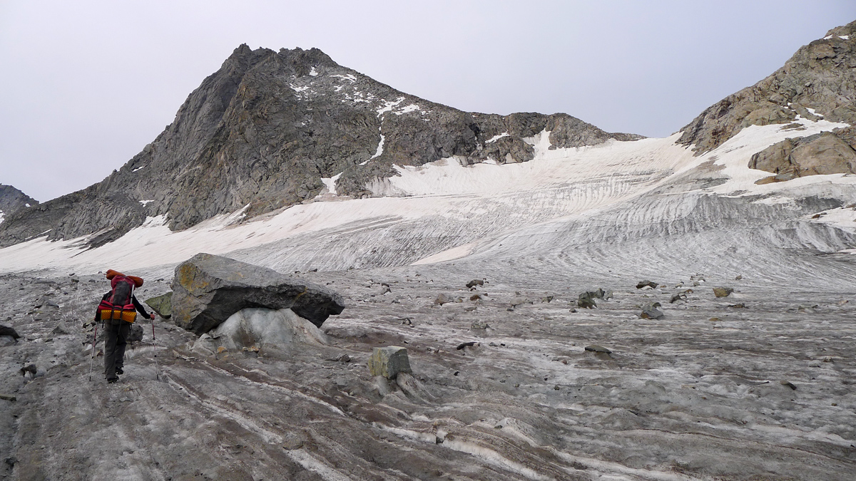
Sarah Meiser image illustrating how close to the top of the glacier the bare ice extends. This fact indicates that all of the firn had been lost, thus the area shown has not been a recent accumulation area.
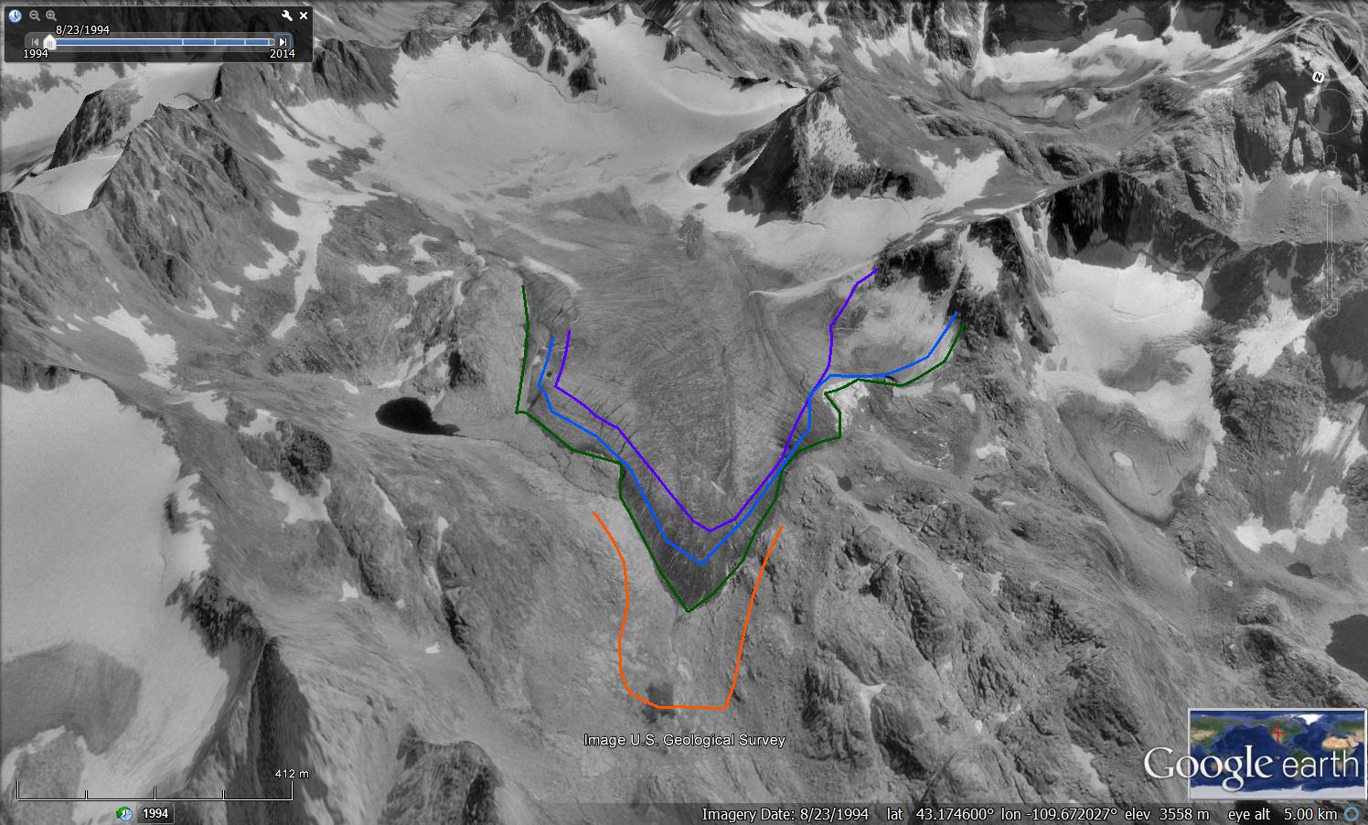
1994 Google Earth Image
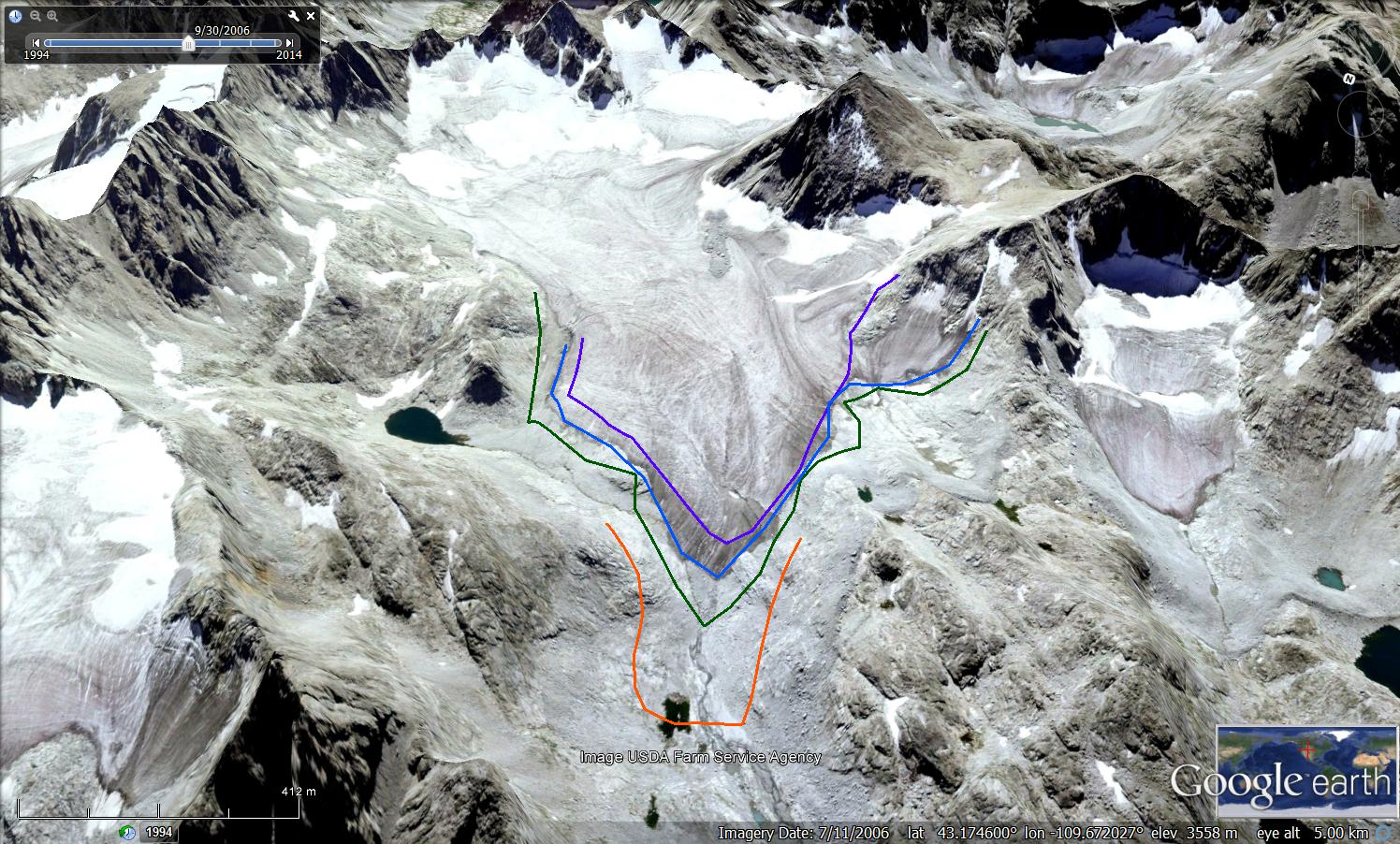
2006 Google Earth Image
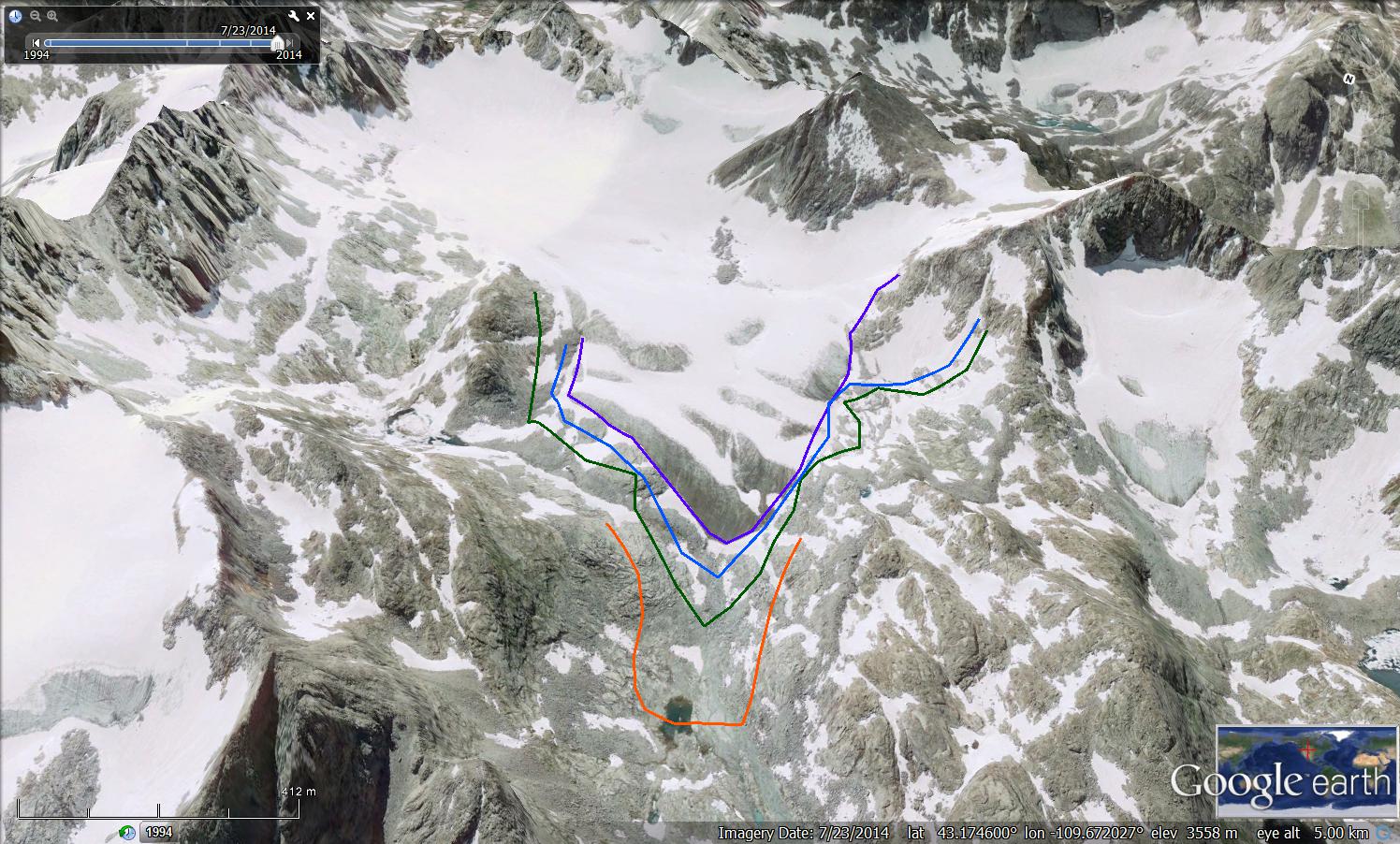
2014 Google Earth image