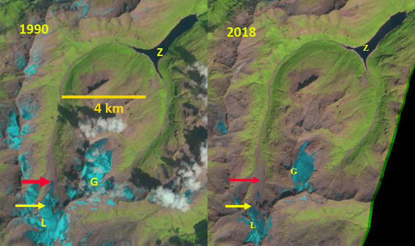
Läntagletscher (L) in 1990 Landsat image and 2018 Sentinel image. Red arrow is the 1990 terminus location, yellow arrow 2018 terminus location, Zervreilasee (Z) and Gufergletscher (G)
Läntagletscher is in the Alps draining into the Zervreilasee and then the Rhone River. Zervreila is a 22 MW hydropower facility, with a 150 m high arch dam . From 1990-2014 the glacier retreated at a steady rate of ~24 m/year. The upper portion of the glacier then separated from the lower terminus resulting in an 800 m retreat from 2014-2017 Swiss Glacier Monitoring (GLAMOS). GLAMOS has a new website design with good visualizations of glacier change in Switzerland. Here we examine the changes in this glacier from 1990-2018 with Landsat and Sentinel images.
In 1990 the glacier’s upper basin from 3300 m-2700 m feeds a narrow tongue that descends an icefall to the terminus section that extends from 2600 m to 2350 m, and was 1 km long. In 2006 the glacier has retreated ~400 m, but still remains connected to the upper glacier. In 2013 Google Earth image below the terminus lobe is still connected to the upper glacier. By 2016 the connection has been lost. The snowline in 2016 also illustrates limited retained snowcover. In 2018 there is limited snowcover remaining on Läntagletscher and Gufergletscher. Läntagletscher has retreated 1400 m since 1990 and is now confined to upper glacier region terminating at 2700 m. In the near future retreat will be slower. The loss of connection to a valley tongue has also been seen at Bas d”Arolla and Sulztalferner.
The continued loss of glacier area will reduce summer glacier runoff into the Zervreila Hydropower project as is the case across Switzerland (Schaefli et al, 2018).

Läntagletscher (L) in 2006 Landsat image and 2016 Sentinel image. Red arrow is the 1990 terminus location, yellow arrow 2018 terminus location, pink arrow is a location where disconnection may occur on Gufergletscher (G).

Google Earth image of Läntagletscher, yellow arrow is the terminus lobe, green arrow the icefall connection and blue arrow the upper glacier.
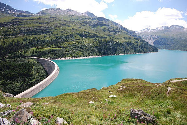
Zervrielersee and dam, color due to glacially eroded sediments (glacial flour). Image from Micha L. Rieser in 2009.
