For the 42nd consecutive year we were in the field observing North Cascade glaciers. Our expedition of scientists and artists observes the response of the glaciers to climate change. In the last five years the glacier system in this mountain range is showing signs of collapse. The signs range from vanished glaciers, dwindling summer runoff, increased rockfall and serac instability.
Our first field area was Columbia Glacier, which feeds the North Fork Skykomish River. This is the largest glacier in the Skykomish River Basin and a World Reference glacier. We have observed ongoing retreat and accelerated volume loss, 50% of its volume lost in 42 years. The primary field team consiste of Emmett Elsom (field scientist), Caitlin Quirk (field scientist), Jill Pelto (art director) and Mauri Pelto (science director). In 2025 the new glacier lake that developd in 2010 continue to expand, a warmer Blanca Lake supported more algae, and the reduced glacier area provided notably less streamflow dring this the late July-August period.
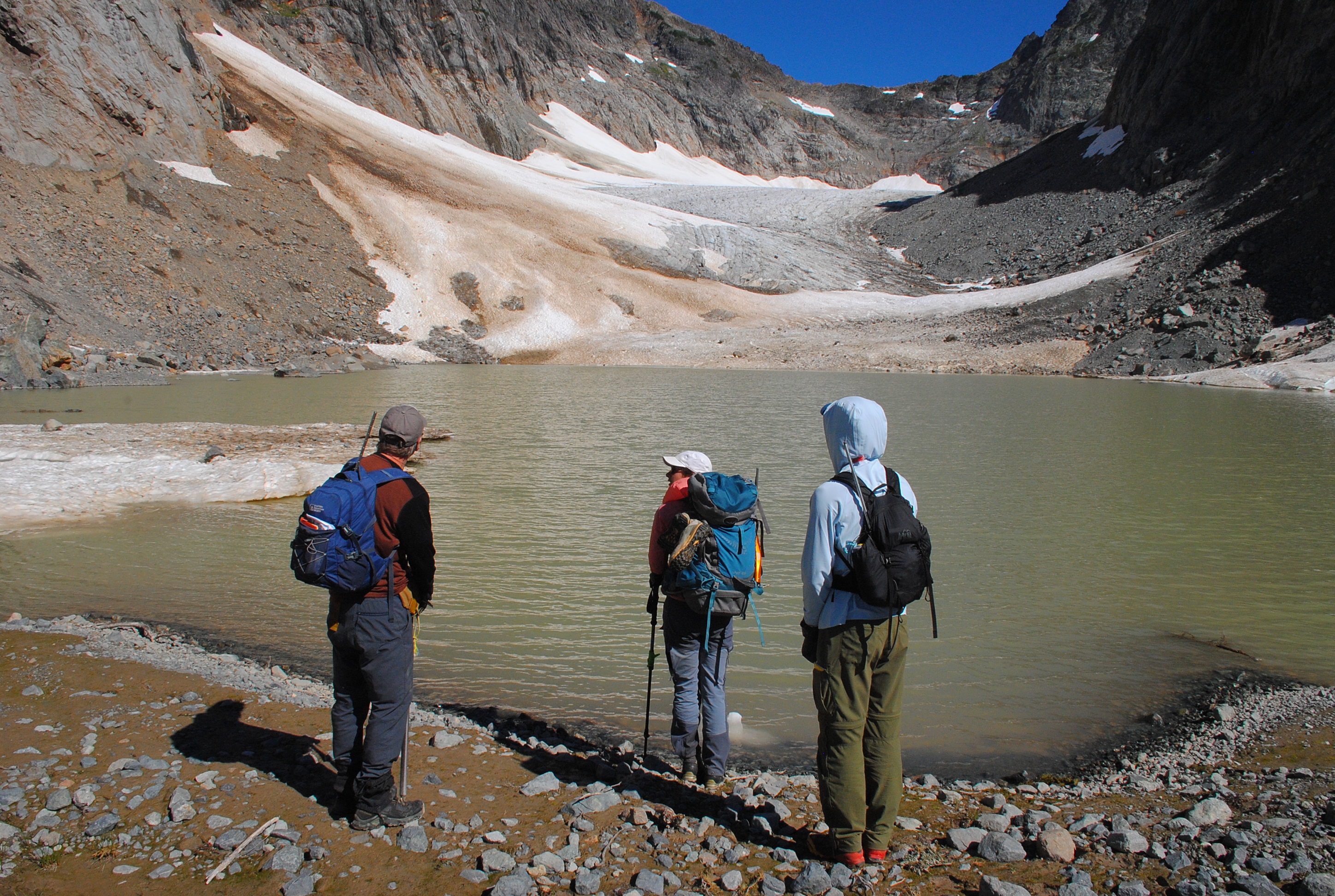
We next headed north to Lower Curtis Glacier on Mount Shuksan, which feeds into Baker Lake. We were joined by Katie Hovind (field scientist) and Margaret Kingston (oil painter). Leah Pezzetti, meteorologist and Nick Goldring videographer from KING5 in Seattle joined us.
The terminus of this glacier continues to thin, with the seracs becoming less imposing. The terminus front has diminished from over 45 m high, to 25 m. The glacier is thinning almost 1 m per year even in the accumulation area of the cirque basin. Glacier retreat has been 225 m since retreat began in 1986 across the wide terminus front.
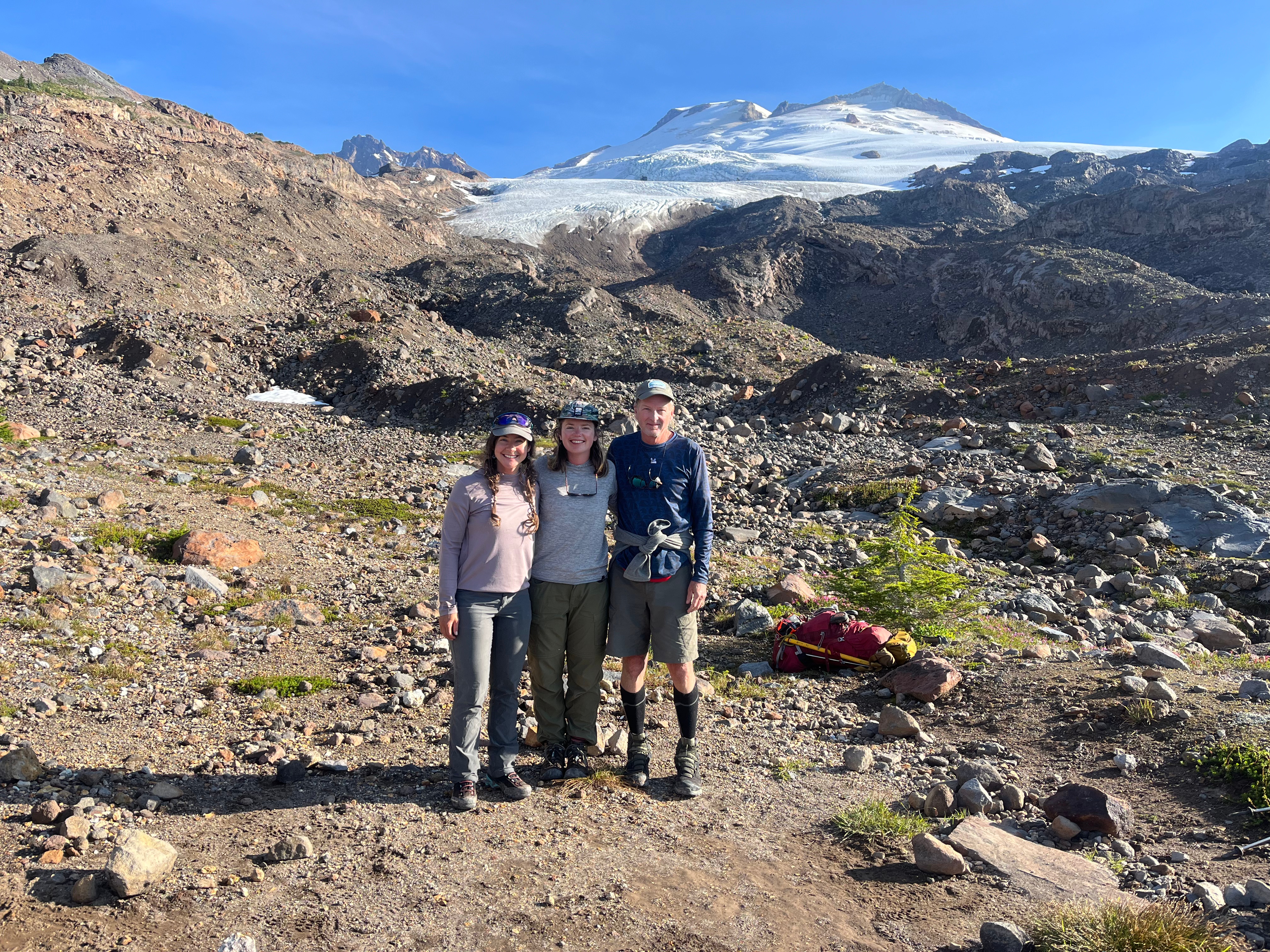
Next up was Sholes and Rainbow Glacier, both accessed from our camp on Ptarmigan Ridge. Claire Seaman (oil painter) joined our crew for both. Ben Pelto and Margot Pelto joined us for Sholes Glacier, along with their nine-month old daughter Wren, (my granddaughter). The Sholes Glacier has been rapidly thinning and losing area along its broad lower margin particularly in the last 5 years. The glacier has lost 0.25 km2 in this century along this margin, or 30% of the total glacier area. In 2023 we explored an ice cave that was over 100 m long. In 2025 this entire slope is devoid of ice. CBS Sunday News joined us on Sholes Glacier and captured well, what we do and how we combine art and science.
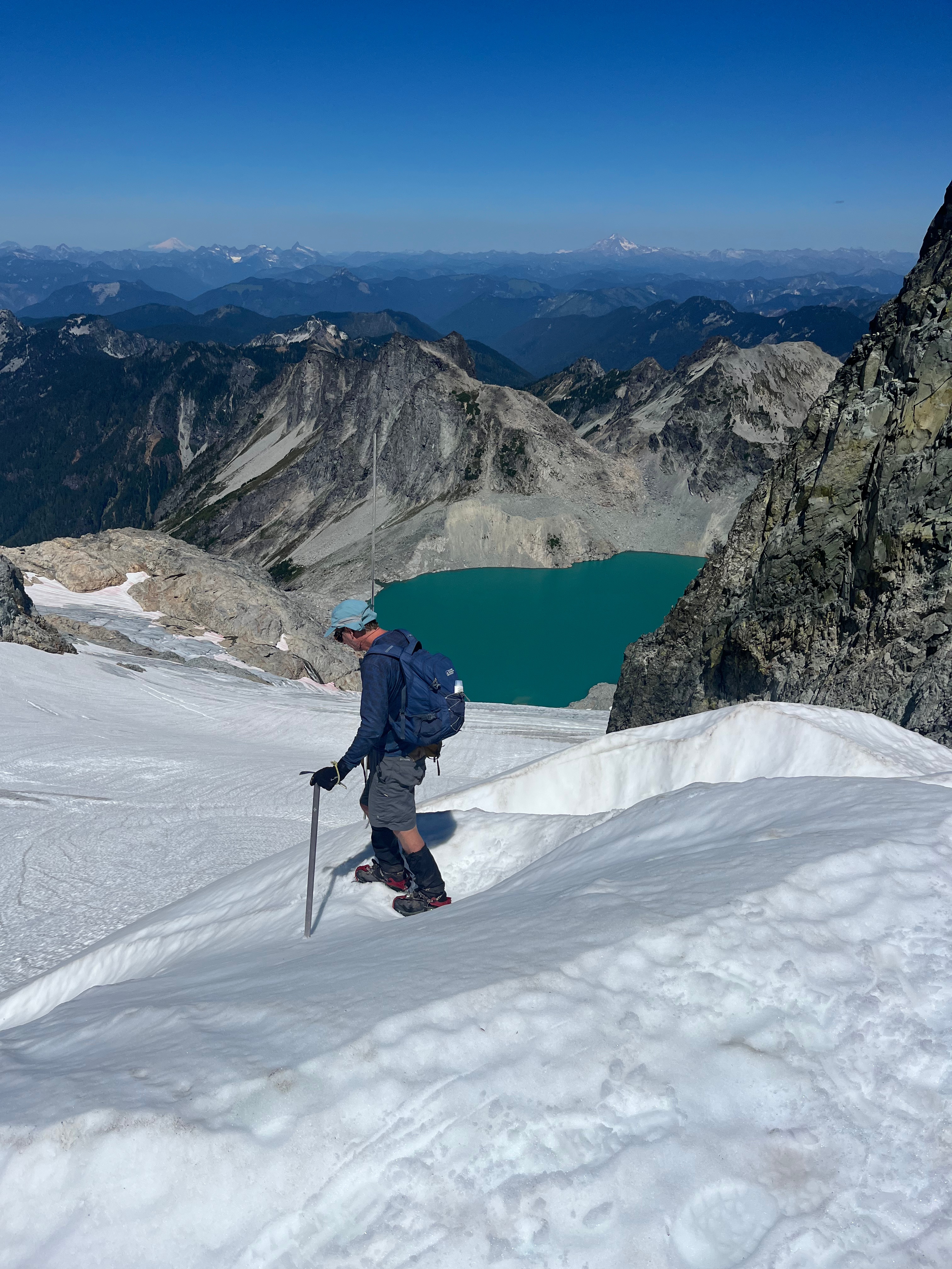
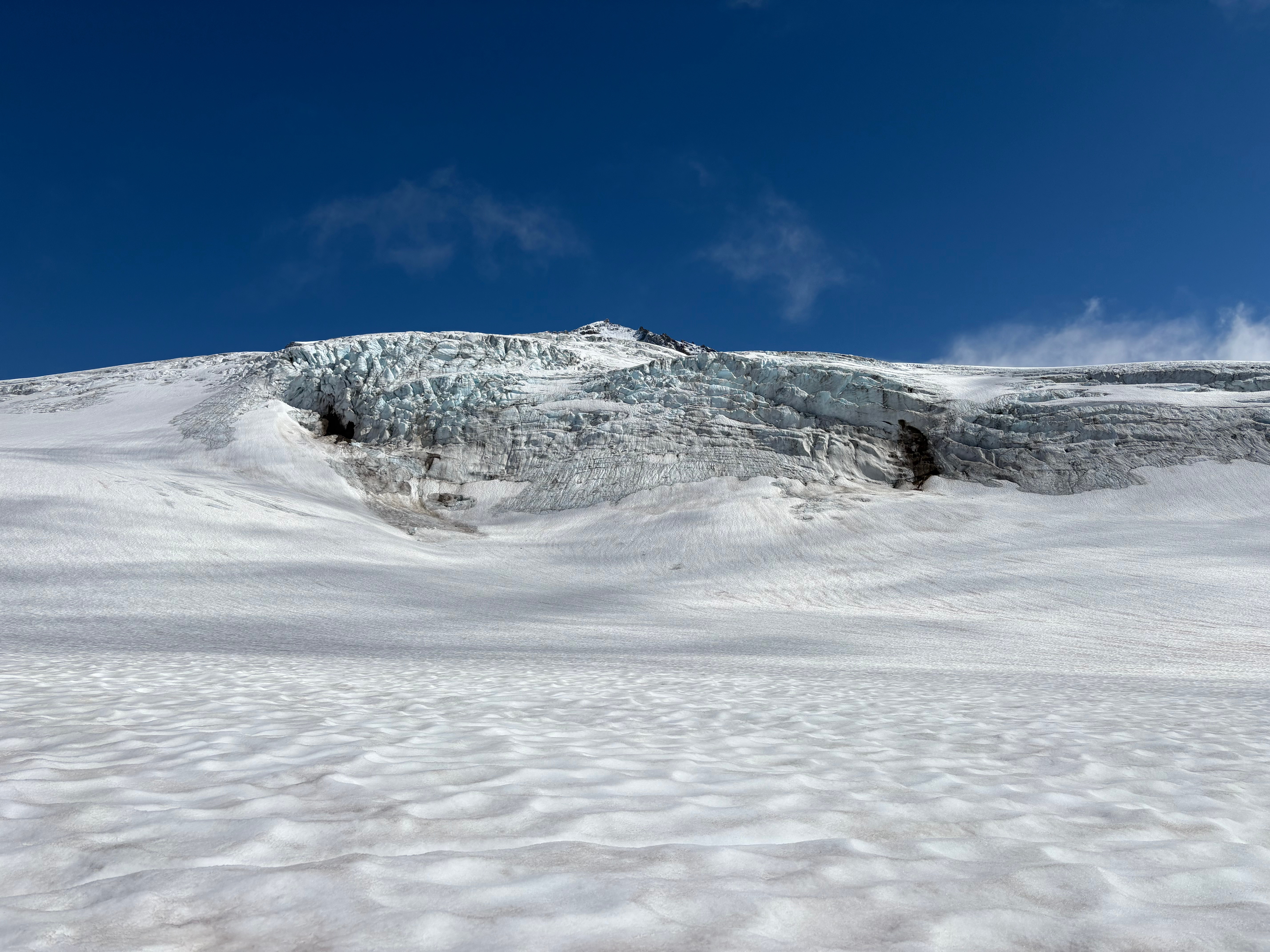
Rainbow Glacier descends from a saddle with the Mazama Glacier. This area consistently retains deep snow. This year the snowpack was 3.5-4.75 m deep in early August. Further down glacier, a series of bedrock knobs continue to emerge from beneath the ice, leading to steeper, thinner icefalls that leads to unstable serac conditions. The collapse of these seracs is predictable in terms of where. We did observe a large one. We descended to the terminus of the glacier. The glacier continues to retreat, with a retreat of 890 m since 1986. The glacier had been advancing prior to 1986.
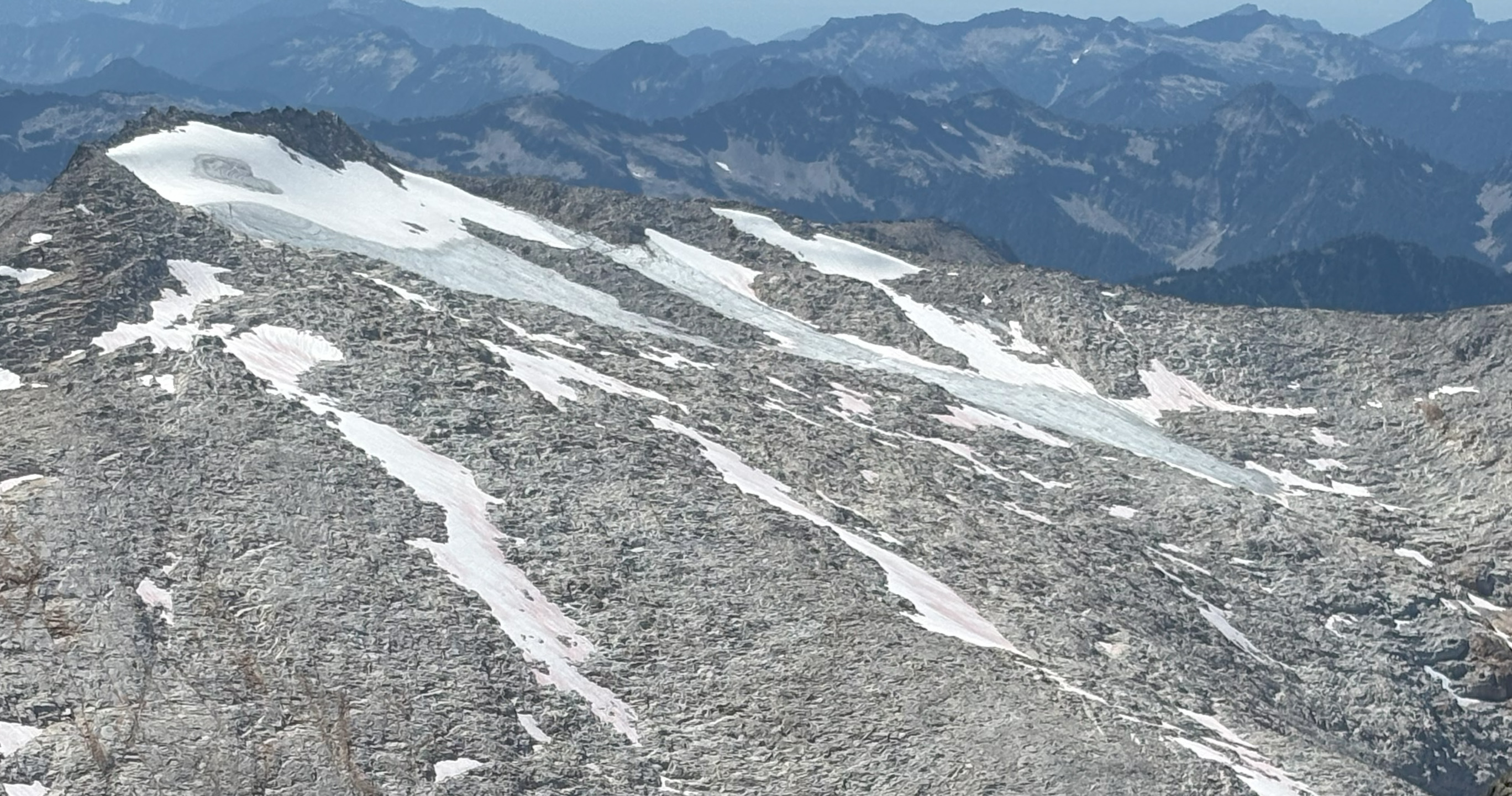
We circled to the south side of Mount Baker to examine Deming, Easton and Squak Glacier. Easton Glacier has retreated 705 m since retreat began in 1990. This year we continued to observe new bedrock emerging from beneath the glacier, including in the main icefall at 2000 m and as high as 2800 m on the glacier. This is also occurring on Deming Glacier. In both cases there is oversteepening in icefall areas leading to unstable seracs. On Squak Glacier we descended, what had been a crevassed icefall, that now is a steep ice ramp, to the terminus. This indicates limited velocity feeding the now nearly stagnant glacier tongue.
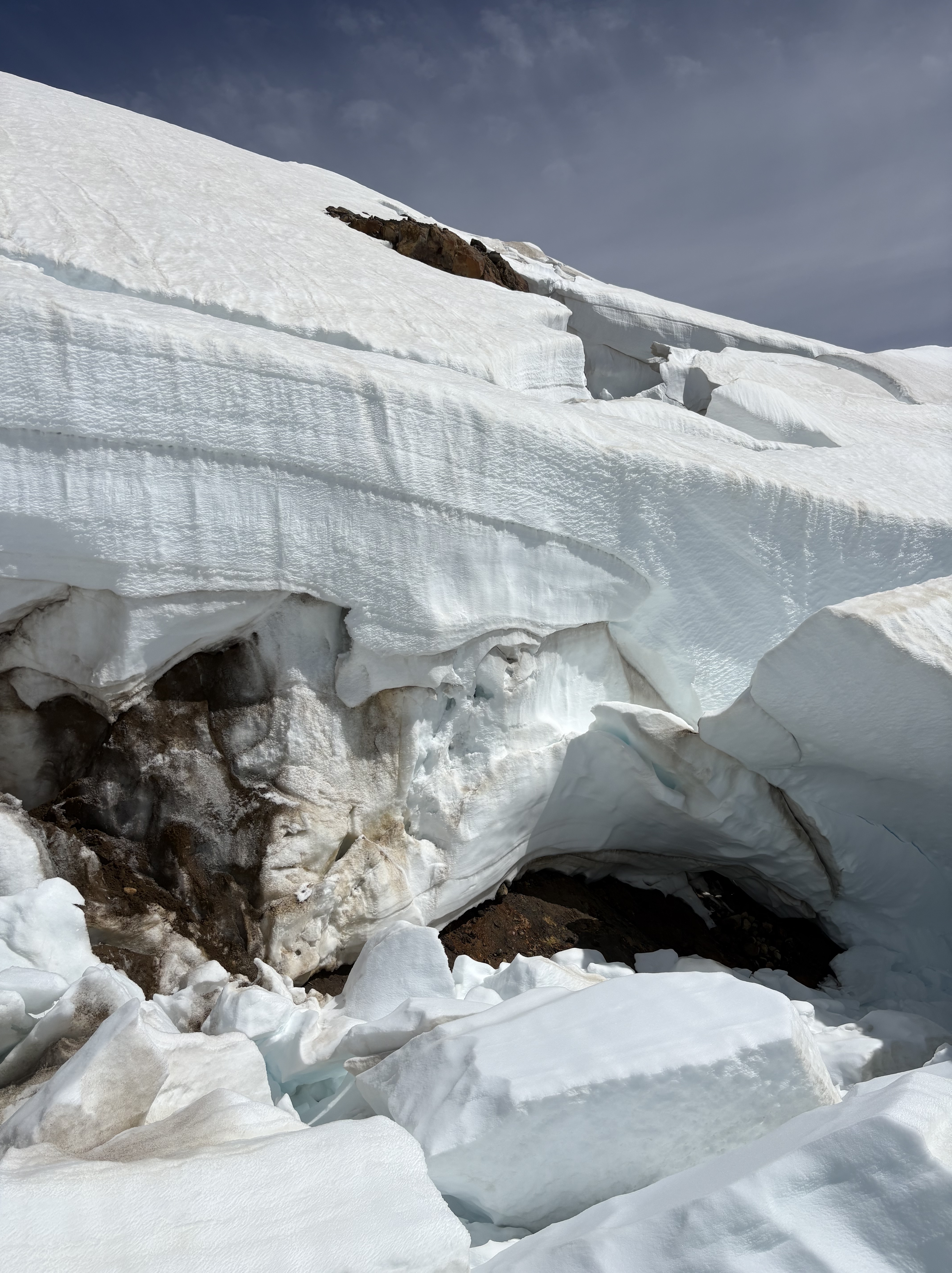
Bedrock emerging at 2800 m on Easton/Deming Glacier. These features illustrate thinning is extensive even near the top of Mount Baker glaciers.
Our last stop was in the Alpine Lake Wilderness, and we were joined by Cal Waichler (wood cut printing) and Margaret Kingston. The glaciers of Mount Daniel and Mount Hinman have been in rapid decline this century. With six of the nine ceasing to exist by 2024. We continue to monitor Lynch and Daniels Glacier each year. Lynch Glacier continues to retain snowpack on the upper portion of the glacier, while losing 50% of its area since 1984. Daniels Glacier has lost 60% of its area since 1984 and is no longer retaining significant snow pack by the end of the summer. The retreat of area loss on Daniels Glacier has been 5% per year in the last five years. The runoff from glaciers into the Cle Elum Reservoir has diminished markedly in late summer reducing both runoff and increasing water temperatures. By late August Cle Elum Reservoir had dropped to 7% full, which will curtail water allocation to downstream Yakima Basin agriculture.