Southwest Brazeau Icefield Retreat, Alberta

The Brazeau Icefield straddles high peaks southeast of Jasper, Alberta.  The northern outlet glaciers drain into Maligne Lake and the southern outlet glaciers drain in to Brazeau Lake and the Brazeau River.  The Brazeau River flows into Brazeau Reservoir a 355 MW hydropower facility, before joining the Saskatchewan River. An inventory of glaciers in the Canadian Rockies indicate area loss of 15% from 1985 to 2005 (Bolch et al, 2010).  The more famous Columbia Icefield to the west has lost 23 % of its area from 1919-2009 with ice loss at a minimum during the 1970’s (Tennant and Menounos, 2013). Here we examine an unnamed outlet glacier at the southwest corner of the Brazeau Icefield from 1995 to 2014 using Landsat imagery.

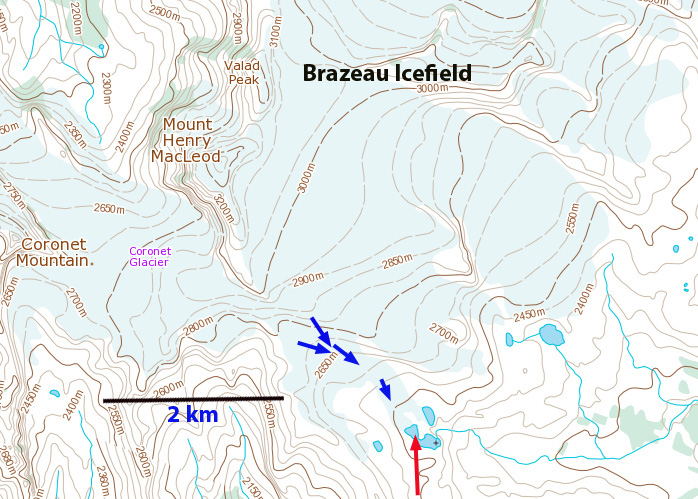
brazeau Icefield map

In 1995 the glacier terminated at the red arrow and was 1900 m long, orange dots mark the upper boundary.  The glacier had limited retained snowpack in 1995.  The poor clarity is do to forest fire smoke in the region.  In 1998 the proglacial lake where the glacier terminates is much clearer, snowpack is again limited, but more extensive than in 1995.  In 2002 retreat is evident as the lake is expanding as the glacier retreats.  The glacier still ends in the lake and still has limited snowcover.  In 2013 the glacier has retreated completely from the lake and snowcover is again limited.  The lack of snowcover is persistent in the satellite images which are typically not from the end of the melt season, hence even more snowcover will be lost.  Lack of a significant persistent snowcover area indicates a glacier that will not survive (Pelto, 2010). In 2014 the area experienced considerable forest fires, which leads to poor image clarity.  The glacier terminus is now significantly separated from the lake and terminates at the yellow arrow.  The distance from the yellow to the red arrow represents a 350-400 m retreat in 20 years.  The glacier has lost 20% of its length in this period.  This retreat is similar to that of Fraser Glacier and more significant given the small size of the glacier than for Saskcatchewan Glacier

brazeau icefield 1995

1995 Landsat image

brazeau icefield 1998

1998 Landsat image

brazeau sw 2002

2002 Landsat image

braeau sw 2013

2013 Landsat image

brazeau sw 2014

2014 Landsat image

Anderson Glacier, Olympic Mountains, Washington Disappears

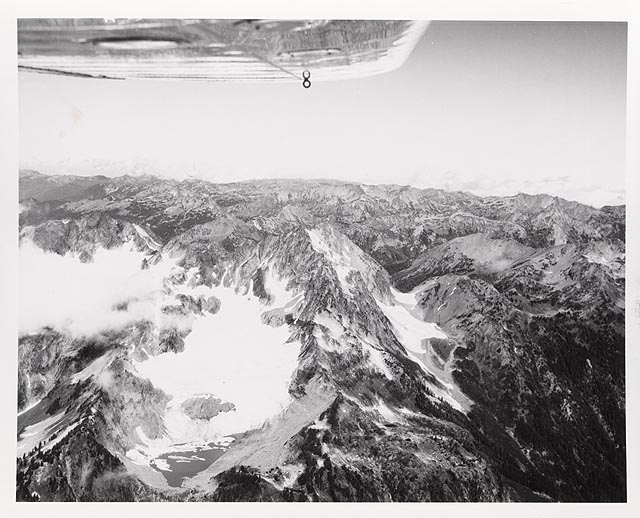
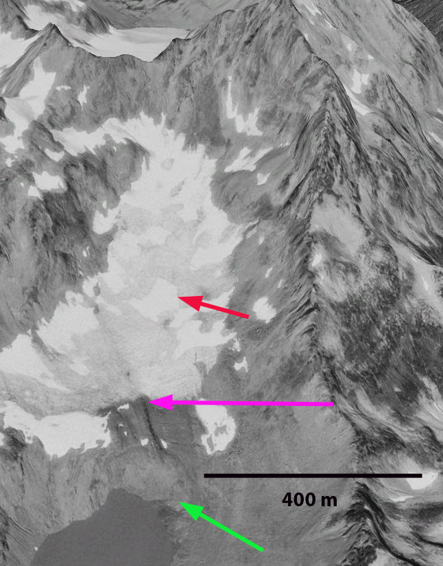
Anderson Glacier was the headwaters of the Quinault River in the Olympic Mountains of Washington. A century ago the glacier was 2 km long, and a half kilometer wide. Retreat of this glacier in the first half of the 20th century exposed a new alpine lake as the glacier retreated 1 kilometer. From 1950-1980 the glacier diminished slowly. From 1959 to 1990 the glacier thinned and retreated from the shore of the lake trapped behind the Little Ice Age moraine. The 1959 picture below was donated to me by Austin Post. Since 1990 the glacier has begun to shrink rapidly. The Google Earth image from 1990, indicates Anderson Glacier has retreated 200 m from the 1959 terminus position near the lake shore, green arrow to the 1990 position, pink arrow. The red arrow indicates a future location of a bedrock outcrop.
1959 Austin Post image
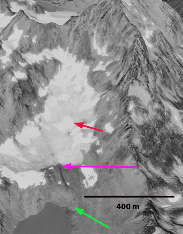
anderson Glacier 1990
1990 Google Earth image

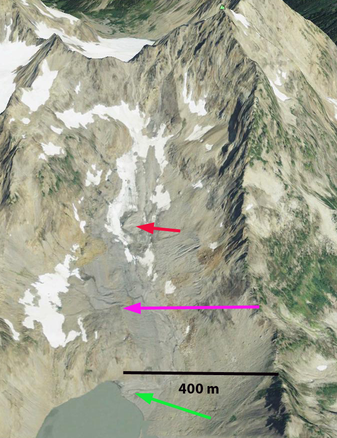
Investigating this glacier in 1992 we measured its area at 0.38 square kilometers, down from 1.15 square kilometers a century before. Ten years later the glacier had diminished to 0.28 square kilometers, but had thinned even more, leaving it poised for a spectacular change, over the next five years. Large outcrops of rock appeared beginning in 2003 and further exposed in 2005 and 2007 in the middle of the glacier. Note the outcrops in the 2007 image from Kathy Chrestensen. The 2009 Google Earth image indicates the 1990 terminus position, pink arrow, and the fact that there is no longer a ribbon of snow that is even 50 m wide. The snow patches have insufficient size or thickness to be classified as a glacier.  The largest outcrop at the red arrow had been beneath the ice in 1990, giving a scale to the thinning.  The glacier at this point no longer exists. In 2014 an Eric Hovden image indicates some seasonal snow in the basin, but the thin ribbon of snow has numerous holes in it as well, indicating the thin nature of the remaining snow patches, with a month left in the 2014 melt season.

Kathy Chrestensen Image
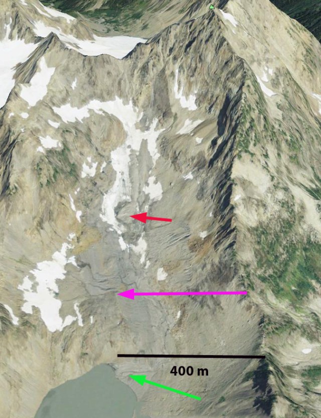
anderson glacier 2009
2009 Google Earth Image

anderson glacier 2014
2014 Eric Hovden image.

This glacier had become a series of small disconnected relict glacier ice patches in 2005 and by 2009 had disappeared. It is not the only glacier that is disappearing, which has led to a visual model for forecasting glacier survival (Pelto, 2010). The key is observed retreat of the margin of the upper portion of the glacier and emerging rock outcrops in the upper part of the glacier where snow should accumulate and be retained through the melt season. If a glacier does not have a significant persistent accumulation zone it cannot survive. Anderson Glacier was not the only glacier feeding the Quinault River, all the others are retreating as well. The result of this glacier retreat is reduced late summer and early fall streamflow, impacting salmon runs at that time of the year. This is primarily the fall Coho, Chum and Chinook salmon and Steelhead summer run. During the spring and early summer runoff increases as snowmelt still occurs, but is not retained in the glacier system.To get a sense of the special nature of this area Out of the Mist is an excellent start

Nizina Glacier Retreat, Lake Formation, Alaska

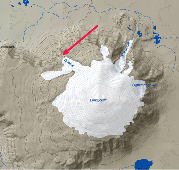
If you have heard of Nizina Glacier in the Wrangell Mountains of Alaska it is probably because you have contemplated a float trip down the Nizina River from Nizina Lake.  In 1990 there was no lake, since 2000 the lake has provided a good location for float planes to land.  In 2014 the lake has reached a new maximum in size and minimum in icebergs on its surface.  Here we examine Landsat imagery form 1990-2014 to identify changes in the Nizina Glacier.  The main tributary of the Nizina Glacier is Regal Glacier indicated by the dark blue flow arrows.  The light blue flow arrows are from the Rohn Glacier tributary that no longer reaches the terminus area.

nizina ge

Google Earth image

In each image the yellow arrow marks the 1990 terminus, red arrow the 2014 terminus location and pink arrows the summer snowline.  In 1990 the glacier had narrow sections of fringing lake evident, though the glacier reached the southern shore of the developing lake at yellow arrow.  By 1995 the lake had developed to a width of 100-300 m fringing the shoreline around the terminus of Nizina Glacier.  In 1999 the main lake has developed and is 1.6 km long and 1.3 km wide though it is still largely filled with icebergs.  In 2013 there are a few icebergs left in the lake.  In August, 2014 the lake is free of icebergs for the first time, which does mean more will not form. The lake is 1.4 km wide and 2.3 km long.  The glacier has retreated 2.1 km from 1990 to 2014, a rate of 150 m per year, red arrow marks 2014 terminus. A close up view of the terminus in Google Earth from 2012 indicates numerous icebergs but also substantial rifts, green arrows, that will lead to further iceberg production and retreat.  The snowline in this late July or early August images is typically at 1800-1900 m, pink arrow, with a month still left in the melt season. The retreat of this glacier is similar to that of glaciers in the Talkeetna Range to the west South Sheep Glacier and Sovereign Glacier and Valdez Glacier to the south.

nizina glacier 1990

1990 Landsat image


nizina glacier 1995

nizina glacier 19991995 Landsat image

nizina glacier 1999

1999 Landsat image

nizina glacier 2013

2013 Landsat image

nizina glacier 2014

2014 Landsat image

nizina lake 2012

Google Earth image 2012


Kuh-E Myana Glacier Retreat, Afghanistan

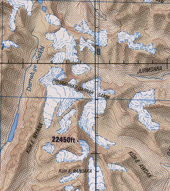
Kuh-E Myana Glacier is in Hindu Kush Range in Badakhshan Province of northeast Afghanistan.  This region of the Hindu Kush has not been the focus of detailed glacier study. Northeast of Takhar Province in the Wakhan Corridor a group of glaciers was examined by Umesh Haritashya and others (2009) and found 28 of thirty had retreated. Examples are Zemestan Glacier and Tchap Dara Valley. The Hindu Kush follows the pattern of the high mountains of central Asia including the Himalaya
Kuh E Myana map
kuhemyana ge
2004 Google Earth image
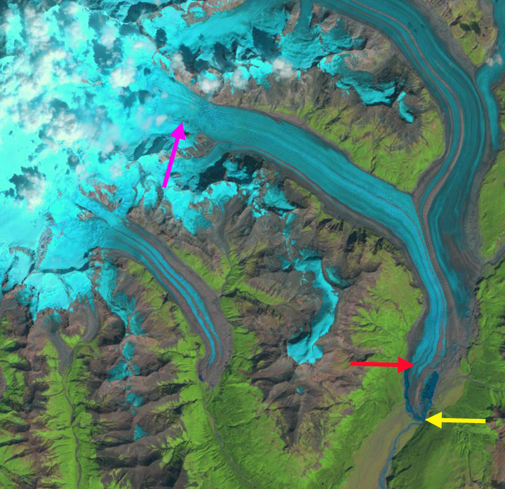
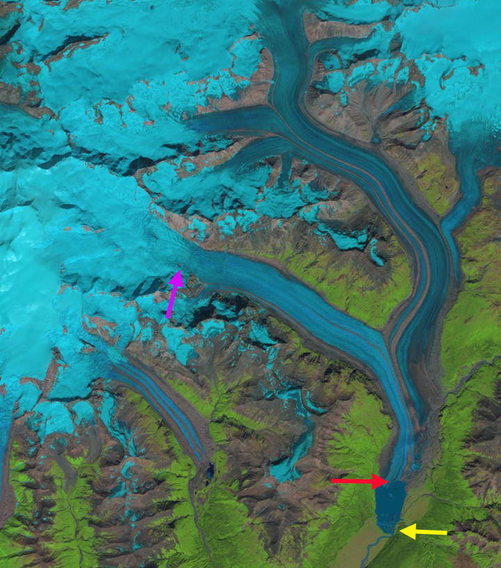
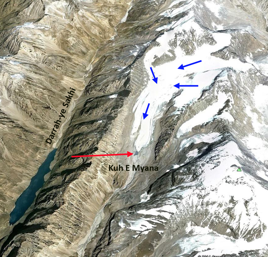
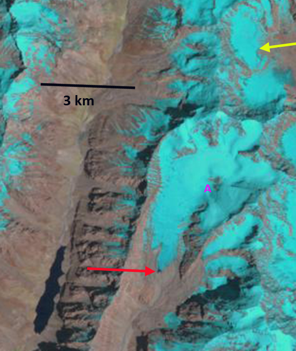
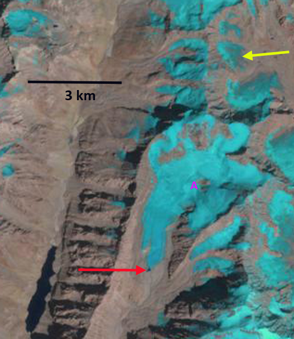
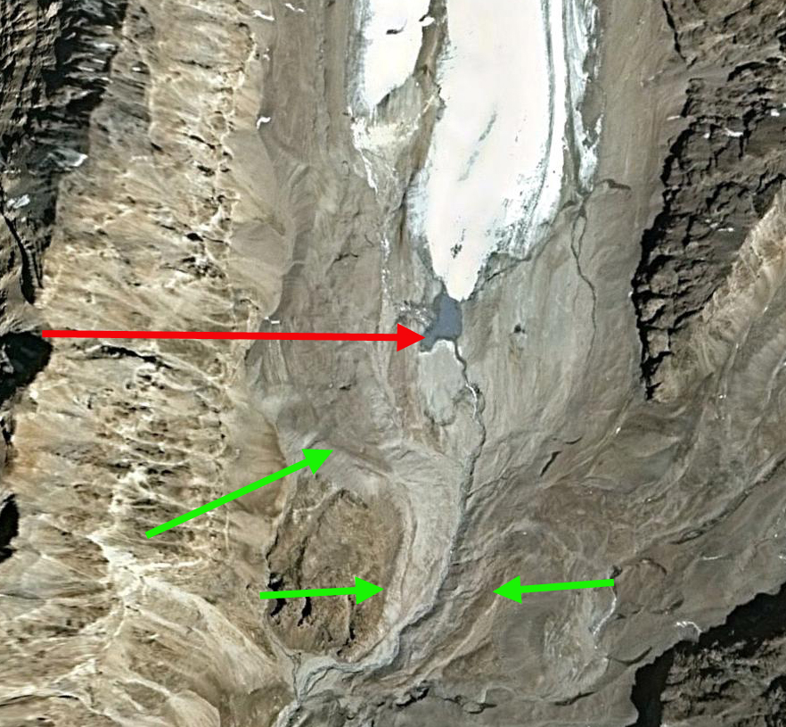
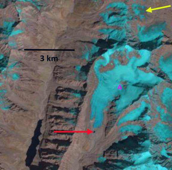
Here we examine the changes of the glacier from 1998-2014 using Landsat imagery.  In 1998 the glacier ended in a small proglacial lake, red arrow.  A nunatak is at Point A. In 2002 the glacier still reaches the edge of the proglacial lake.  A small niche glacier is indicated by the yellow arrow.  The 2004 Google Earth image indicates an expansion of the proglacial lake, and that the glacier terminus is quite thin.  By 2014 the glacier has retreated 250 from the proglacial lake, red arrow. The majority of this retreat has occurred in the last decade. The glacier has retreated 1200 m from the Little Ice Age moraines to the 2004 terminus, green arrows on 2004 terminus image.  The retreat since 2004 is much faster than the overall retreat. The nunatak at Point A has expanded.  The niche glacier at the yellow arrow has developed a pair of substantial bedrock gaps as the thinning glacier disappears. kuhemyana 1998
1998 Landsat image
kuhemyana 2002
2002 Landsat image
kuhemyana terminus
2004 Google Earth Image
kuhemyana 2014
2014 Landsat image

Gietro Glacier Retreat and Hydropower, Switzerland

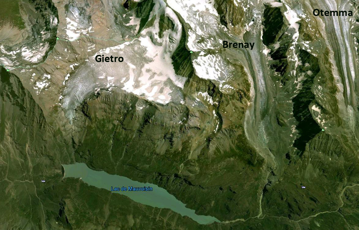
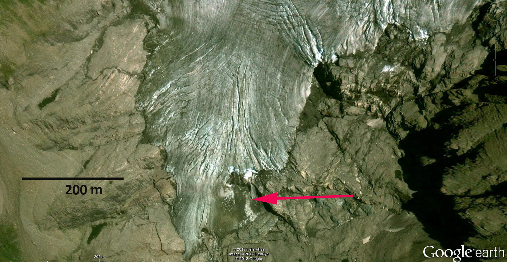
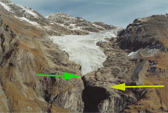
Gietro Glacier may sound like a type of italian dessert, but this glacier has a deadly history. During periods of advance the glacier blocked off the valley of Mauvoisin. Failure of the glacier ice dam led to large flood events in 1595 and 1818 that lead to the loss of many lives in the valley below. Today the Mauvoisin Dam one of the 10 largest concrete arch dams in the world not only provides hydropower but also protection against this hazard. In 1818, an advance of the Gietro glacier, now retreated high above the reservoir, generated ice avalanches which blocked the flow of the river. When the ice barrier was breached, 20 million cubic meters of flood water was released devastating the valley (Collins, 1991).There are several other large glaciers in the basin Otemma, Mont Durand and Brenay that provide runoff to power what is today a large hydropower project. The Mauvoisin Dam can produce 363 MW of power, and typically provides 1030 millionKWh of power each year. The reservoir can store 200 million cubic meters of water. Erosion largely from the glaciers in the watershed produce enough sediment to cover the lake bottom with 60 cm of sediment per year (Loizeau, et al. 2010). Gietro Glacier is one of the glaciers where the terminus is monitored annually by the Swiss Glacier Monitoring Network (SCNAT). The glacier advanced 150 m from 1962-1985. Retreat from 1985 to 2000 was 110 m or 7.5 m/year, accelerating to 275 m from 2000-2010, 27.5 m/year. This post focuses on comparison of a 1988 Landsat image, 2001 terminus photograph from the SCNAT and 2009 Google Earth imagery. In 1988 the glacier terminates at the top of a steep cliff that is evident in the 1988 image, yellow arrow, dam is burgundy arrow. By 2001 the glacier has retreated to the first prominent joint feature, green arrow, on the north side of the glacier above the cliff, still yellow arrow. In 2009 the terminus is indicated by a blue arrow. A limited area above the terminus is stagnant an area that is 200 m by 150 m, red arrow. Above this point the glacier has been thinning, but still remains active as indicated by the crevassing. . The glacier in 2009 has very limited snowcover by the end of the summer. A glacier to thrive should be 60% snowcovered at the end of the melt season, in this case it is less than 20%, green dots mark the main snowline below. The lack of snowcover indicates a negative mass balance that is driving the retreat. If the glacier consistently loses most of the accumulation zone snowcover it cannot survive (Pelto, 2010). In the Swiss Glacier Inventory(Kääb et al, 2002), noted a 21% loss in glacier area from 1973-1998, with almost all the change occurring after 1985. The retreat if this glacier is similar to that of other Swiss glaciers, Ried Glacier and Triftgletscher

Petrov Glacier Retreat, Kyrgyzstan

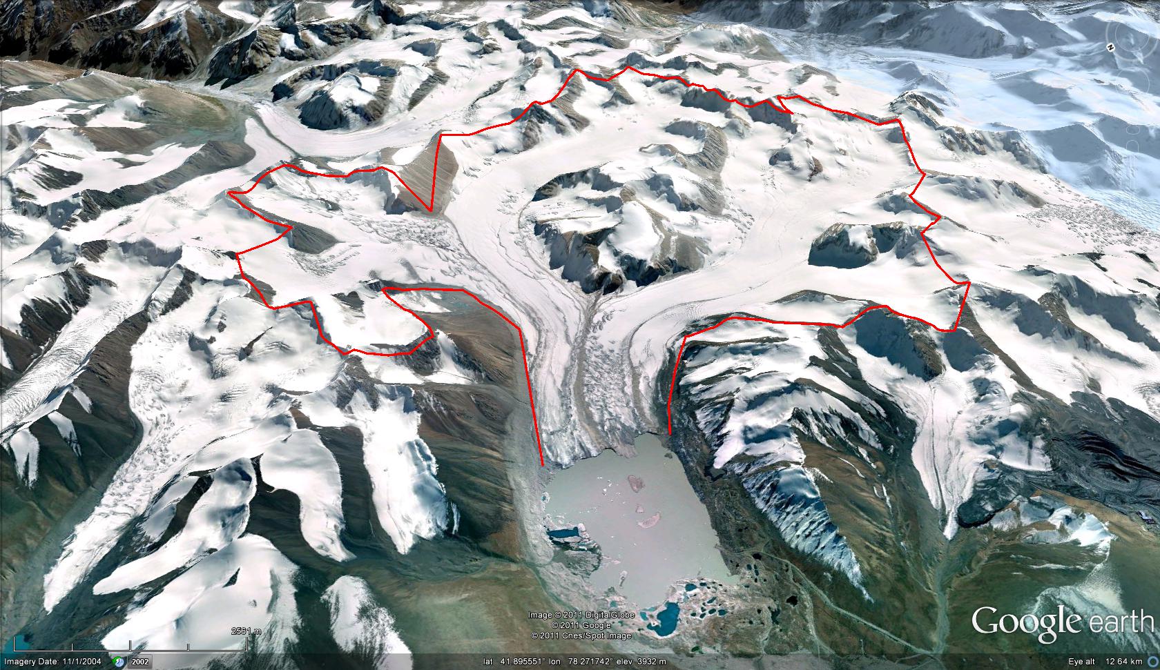
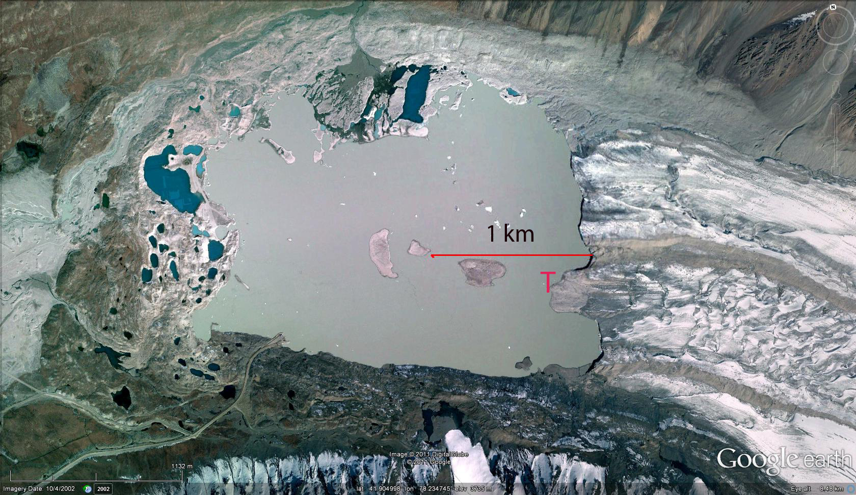
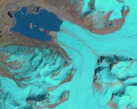
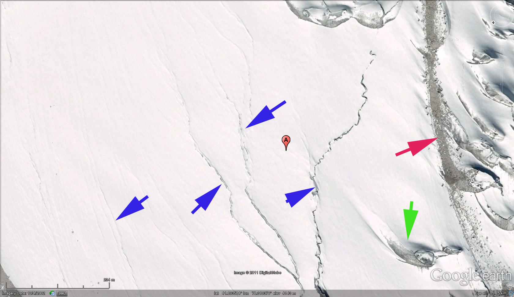
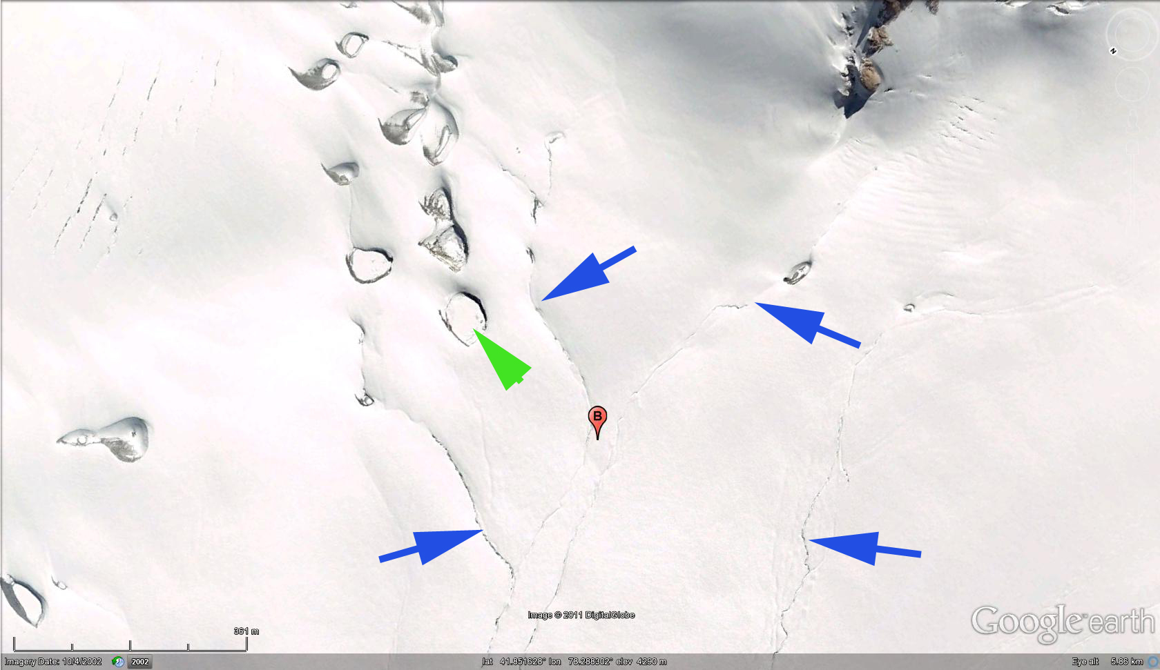
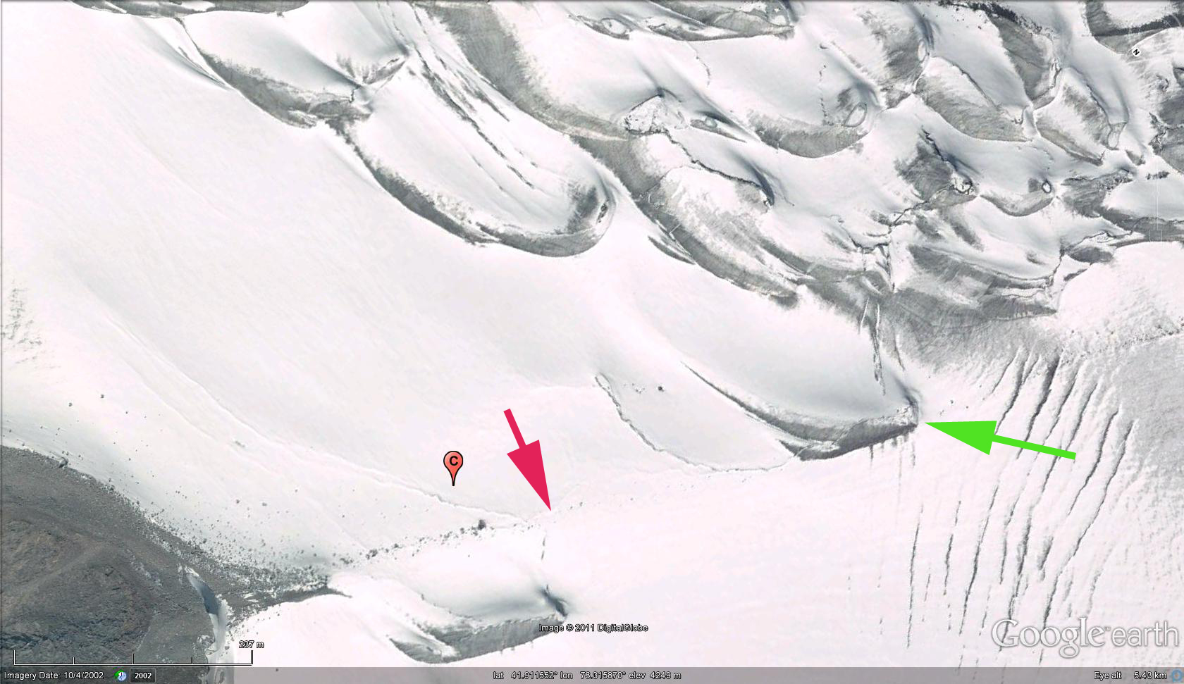
Petrov Glacier flows north down the slopes of Ak-Shiyrak in the Tien Shan Mountains of Kyrgyzstan. The glacier ends in Petrov Lake which continues to expand as the glacier retreats. The glacier is 12 km long has three main tributaries each beginning at 4600-4700 meters and descending to the lake at 3700 meters. The lake in particular has been the focus of an extensive research project by a group Czech scientists, Cerny et al (2009)and Jansky et al (2009). This research for Geomin is driven by interest in a potential outburst flood event, the water level in the Petrov Lake and the moraine-ice dam are monitored and proposals on how to decrease the water level are being developed. Petrov Glacier is the largest glacier in the Naryn River watershed, Jansky et al (2009) report that the glacier retreated at a rate of 24 meters/year from 1957-1960, 40 meters/year from 1980-1999 and 61 m year from 1999-2006. Using two satellite images from 2001 (top) and 2011 (bottom) and Google Earth imagery from 2005 (middle) here we look in detail at the current condition of the glacier. The glacier has retreated 300 meters during the 2001-2011 period. Notice the Peninsula extending from the glacier into Petrov Lake (T). . A snapshot of the glacier at three different locations indicate the extent of the ablation zone. For points A,B and C the red arrow indicates lateral moraines, green arrows surface wind scour features that have trapped dust, and the blue arrows surface streams. Lateral moraines and surface streams cannot exist in the accumulation zone, and the wind scour features indicate locations where accumulation is not retained. Each of these feature types at A,B and C extend to 4300 meters. A glacier such as Petrov that lacks substantial avalanching and is in a region of low annual precipitation generally needs 60% of its area in the accumulation zone to be in equilibrium. The glacier has insufficient accumulation zone size recently and will have to continue to retreat. Petrov Glacier reflects the trends of the region where glaciers have lost 2 cubic kilometers per year of volume from 1955-2000, as documented by Harrison and others, University of Newcastle
h