Glacier Blanc is on the east side of Barre Des Ecrins the southernmost of the 4000 m peaks in the Alps. It is the largest glacier on the peak. The glacier began a sustained retreat after 1870, that ceased in 1895-1900 , 1915-1920, 1935-1940 and 1980-1990 (Cossart et al, 2006). The glacier had a mass loss of 11 m from 1981-2005 (Rabatel et al, 2008), which is 5-10% of the total glacier volume.  John Hessler, a physical geographer has an excellent series of images from Glacier Blanc, including the image above of terminus change from the Cossart et al (2006) paper. Glacier Blanc was joined with Glacier Noir in 1900, today Glacier Blanc has retreated 1.5 km from the former connection in the St. Pierre River valley, as seen in the image below from Cossart et al (2006).
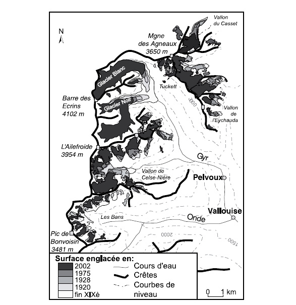
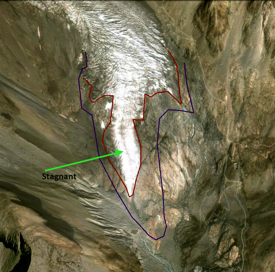
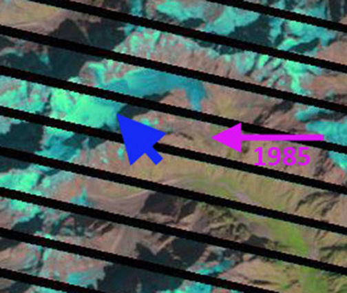
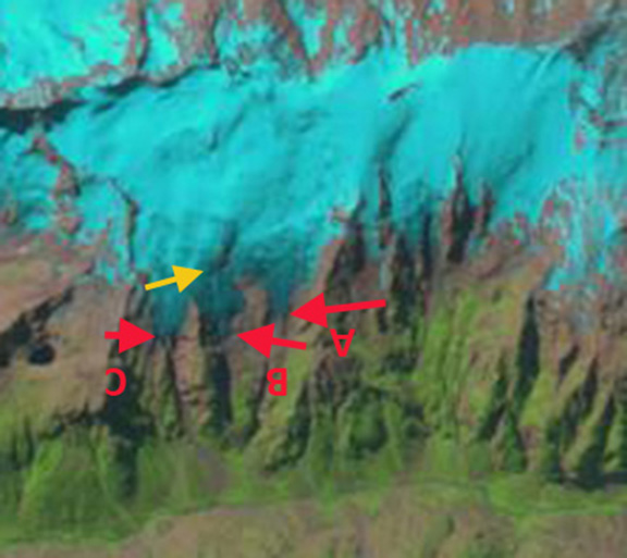
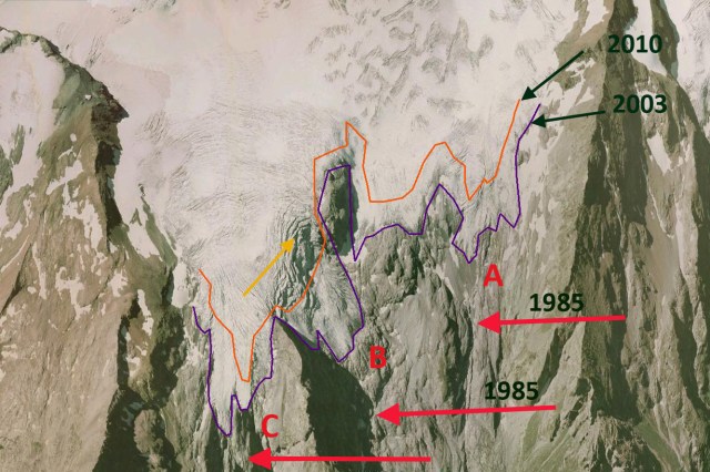
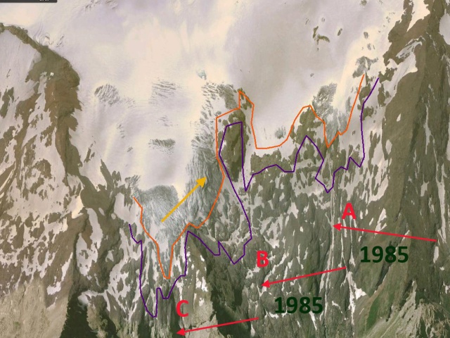
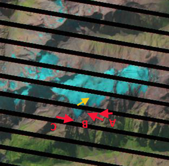
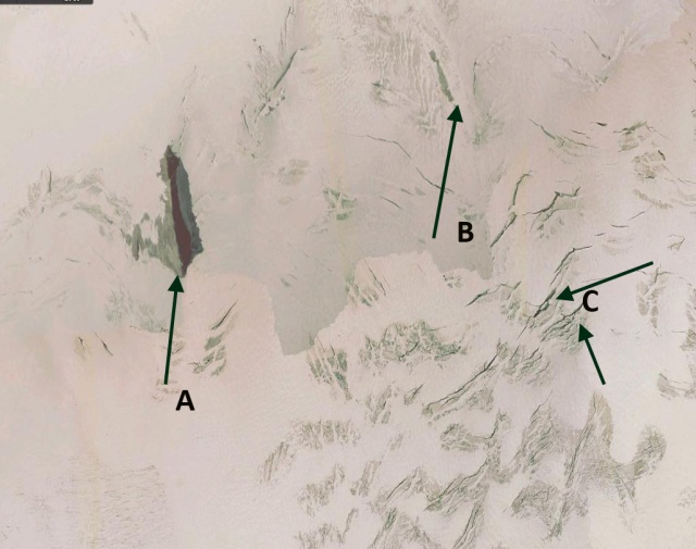
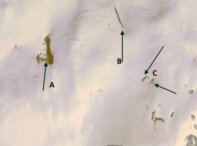
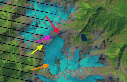
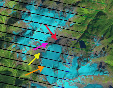
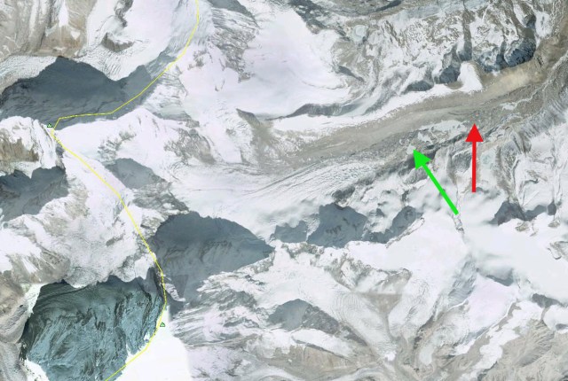
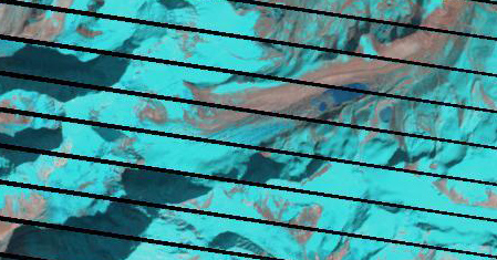
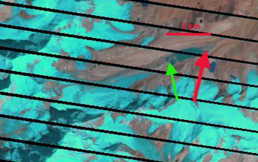
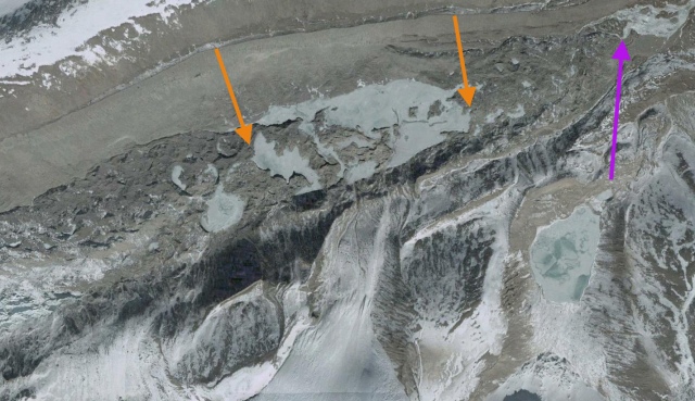
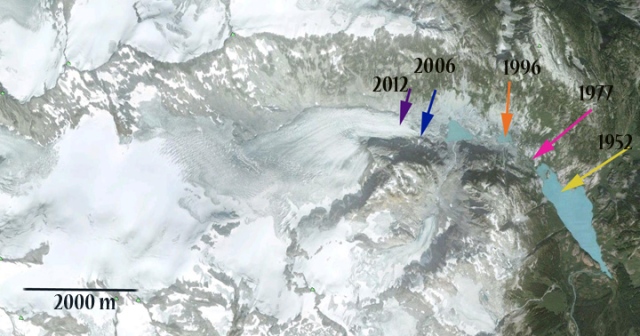
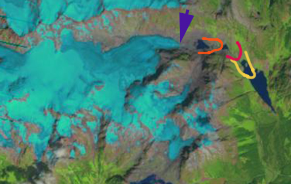
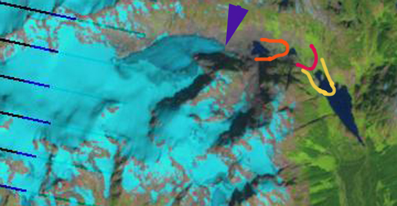
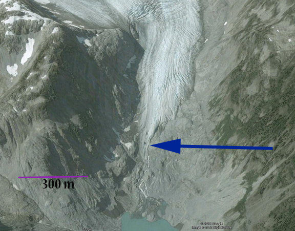
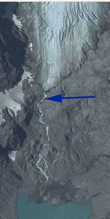
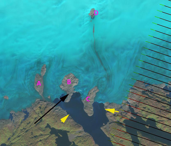
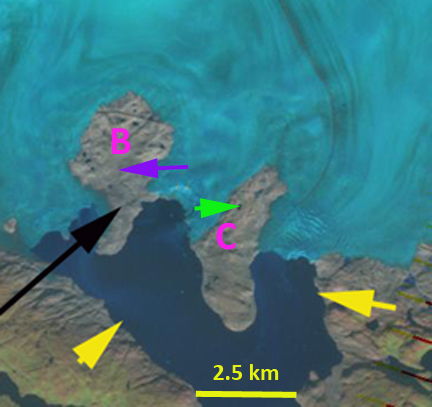
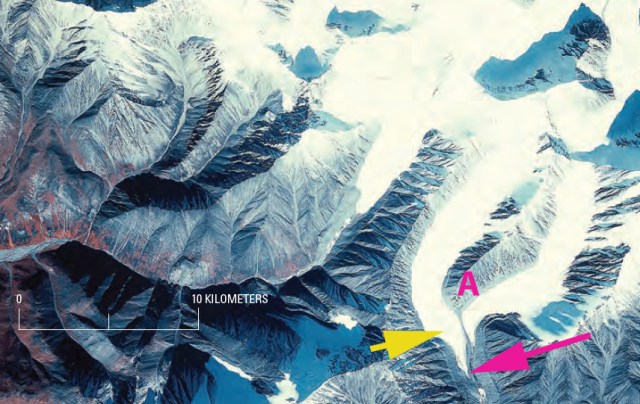
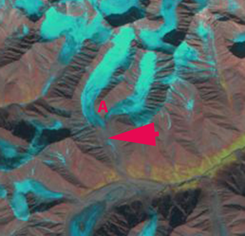
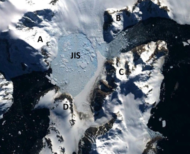
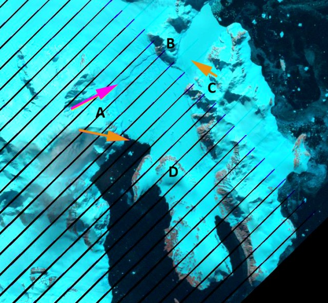
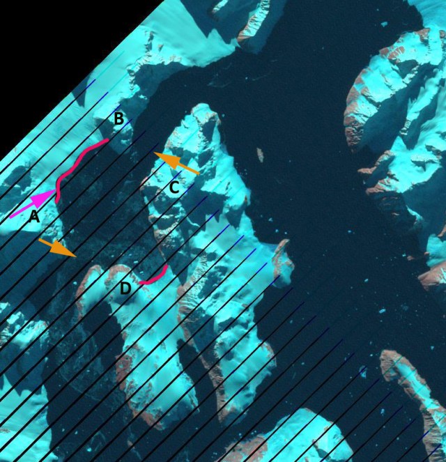
The series of images below are used to examine the retreat over the last 27 of Glacier Blanc. The first image is a 2003 Google Earth image illustrating the 1985 terminus a pink line, 2003 a purple line and 2010 a red line. The images following are a 1985 Landsat image, pink arrow terminus and blue arrow snowline. The closeup of the terminus in 2003 and 2010 indicates the change in terminus position and stagnant ice. The last image from 2012 notes the 1985 terminus position with pink arrow and the snowline blue arrow. Retreat from 1985 to 2003 was 320 meters, 18 meters/year. From 2003 to 2010 retreat is 250 meters, 36 meters/year. The rate of retreat is increasing. This glacier largest area is the valley basin from 3000 to 3300 meters which is 2.7 km long and 0.9 km long. For the glacier to babove 3200 meters from 2002-2005 (Rabatel et al, 2008). This basin certainly is over deepened and would have a lake if the terminus retreats into it significantly. The glaciers retreat has been similar to that of Glacier de la Girose just 15 km north.