Hallo Glacier Retreat, Katmai Alaska

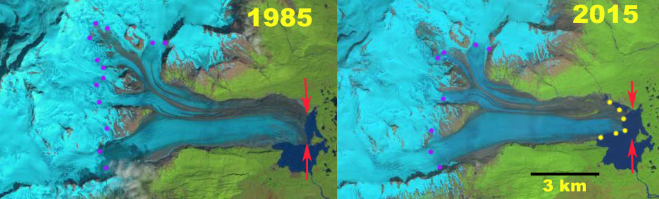
Landsat images of Hallo Glacier in 1985 and 2015 indicating the 1985 terminus position red arrows and yellow dots indicate 2015/2016 terminus location.  Purple dots show the snowline

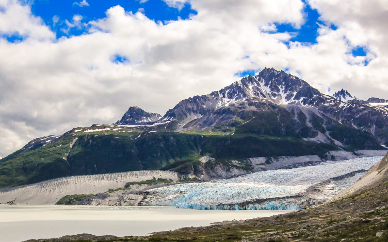
Hallo Glacier is one of the larger glaciers in Katmai National Park draining east from Mount Steller and ending in an expanding proglacial lake east of Hallo Bay.  Hallo Bay is well known as a good location for brown bear watching (NPS).  Arendt and Larsen (2012) assess the glacier changes in Alaska National Parks they provide a map of the change in glacier extent from 1956-2009, Figure 7.  This indicates a significant retreat but it is not quantified. They further note a 15% decrease in areal extent of Katmai Region glaciers from 1956-2009.  Giffen et al (2015) indicate the glacier retreated 900 m from 1951-1987 and then advanced 150 by 2000. Here we utilize Landsat imagery to examine retreat from 1985 to July 2016 to examine the glaciers response.

In 1985 the glacier terminated just off the western shore of a small island in the lake.  The terminus front in the lake measured 3000 m in length.  The snowline averaged 1050 m across the glacier. By 1995 little retreat had occurred, the snowline was averaged 1050 m. In 2000 the glacier terminus had changed little from 1985.  The average snowline was at 1100 m. In 2015 the terminus had retreated 600 m from the island and 800 m along the northern shore of the lake.  The snowline is at 2000 m.  In 2016 the snowline is averages 1150 m , the highest observed. The terminus front in the lake remains 3000 m long.  The rate of retreat increased after 2000, and the glacier is poised for additional retreat. A 2013 Google Earth image illustrates that the lower 3.5 km of the glacier has a low slope and limited crevassing, except for minor crevassing along southern calving front.  This indicates the lake is likely to expand at least to this point.  Further that the glacier is poised for continued significant retreat and lake expansion.  The retreat is less than, but similar to that of nearby  FourPeaked  and  Spotted Glacier.


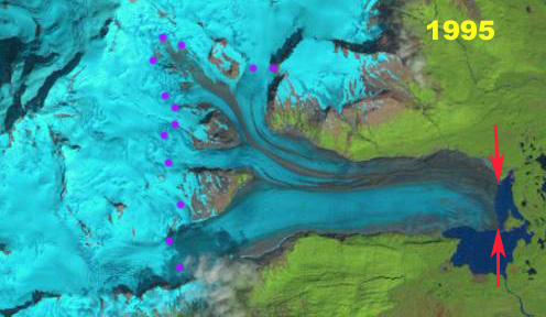
1995 Landsat image of Hallo Glacier indicating the 1985 terminus position red arrows.  Purple dots show the snowline

2000 Landsat image of Hallo Glacier indicating the 1985 terminus position red arrows and yellow dots indicate 2015/2016 terminus location.  Purple dots show the snowline

2016 Landsat image of Hallo Glacier indicating the 1985 terminus position red arrows.  Purple dots show the snowline.

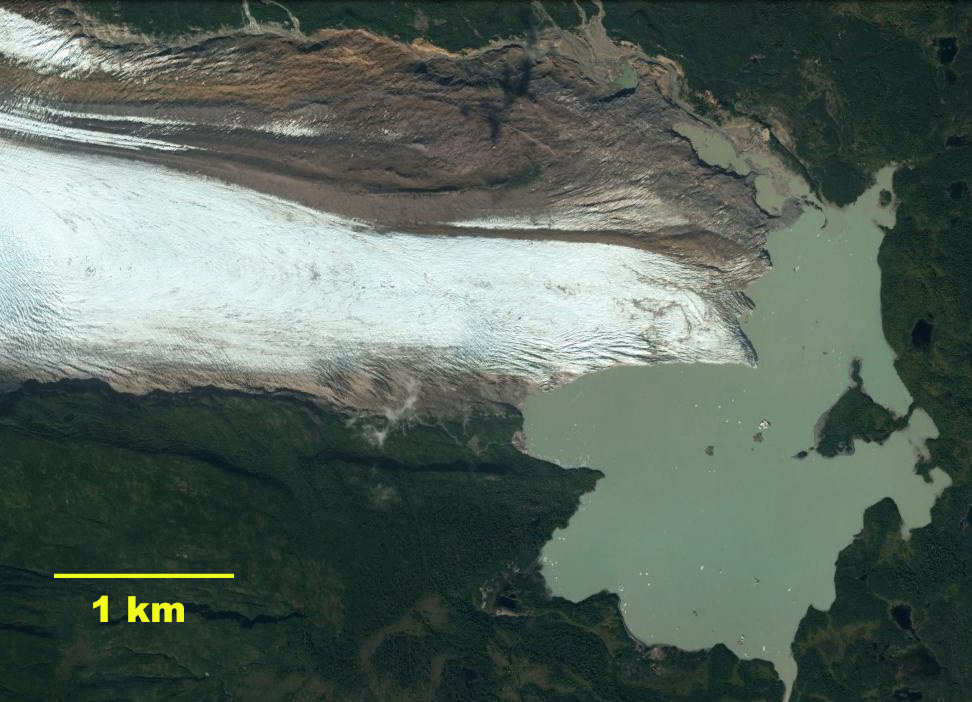
2013 Google Earth image of Hallo Glacier, note low uncrevassed terminus tongue in lower 3.5 km.


Shamrock Glacier, Alaska Loses Terminus Tongue

shamrock glacier compare
Shamrock Glacier comparison in 1987 and 2014 Landsat images. Red arrow 1987 terminus, yellow arrow 2014 terminus, purple arrows upglacier thinning and purple dots the snowline. The terminus tongues extending into the lake has been lost.

Shamrock Glacier flows north from the Neacola Mountains into Chakachamna Lake in the Lake Clark National Park of Alaska. This lake is transited by several species of salmon, mainly sockeye, heading into spawning  areas upriver. The lake had been the site of a proposed hydropower plant, that would not have required building of a dam, but this project is currently not being developed. The National Park Service completed a Southwest Alaska Network mapping project that identified the changes of glaciers in the region. Lake Clark NP has 1740 glaciers which have lost 12% of their total area from 1950 to 2009 (Loso et al, 2014). Here we examine Landsat imagery from 1987 to 2014 to identify recent change of Shamrock Glacier.

shamrock glacier profile
July 2015 image looking across Shamrock Lake to Shamrock Glacier, taken by Jerry Pillarelli, note he has many more gorgeous images of area. The trimline on the far side of the glacier between sediment and vegetation indicates the 1950 margin. There is an elevation step several hundred meters inland of the terminus indicating Shamrock Lake will expand little.

In 1987 Shamrock Glacier had receded from a terminal moraine in Chakachamna Lake that it had terminated on in the 1950’s map. The new proglacial lake was less than 500 m across. The snowline was at 1200 m. In 2000 seen below the snowline was at 1350 m, and the terminus had narrowed more than it had retreated. By 2014 the terminus had retreated 900 m leaving the new Shamrock Lake within Chackachamna Lake. The new Shamrock Lake has an area of 4 square kilometers. This is the majority of the loss in glacier area since 1950 as well. In 2014 the snowline is quite high at 1450 m. A snowline that is consistently above 1300 m will drive continued retreat. Thinning upglacier is evident with expanded bedrock areas adjacent to the glacier margin above 1200 m at the purple arrows, indicating the snowline has been consistently higher than this. The retreat is similar to other glaciers in the region South Sheep Glacier, Sovereign Glacier and Fourpeaked Glacier.  With the glacier retreating out of the lake basin soon, the rate of retreat should decline.

shamrock glacier 2000
2000 Landsat image

shamrock glacier ge 2013
2013 Image of Shamrock Glacier, Shamrock Lake and Chakachamna Glacier.