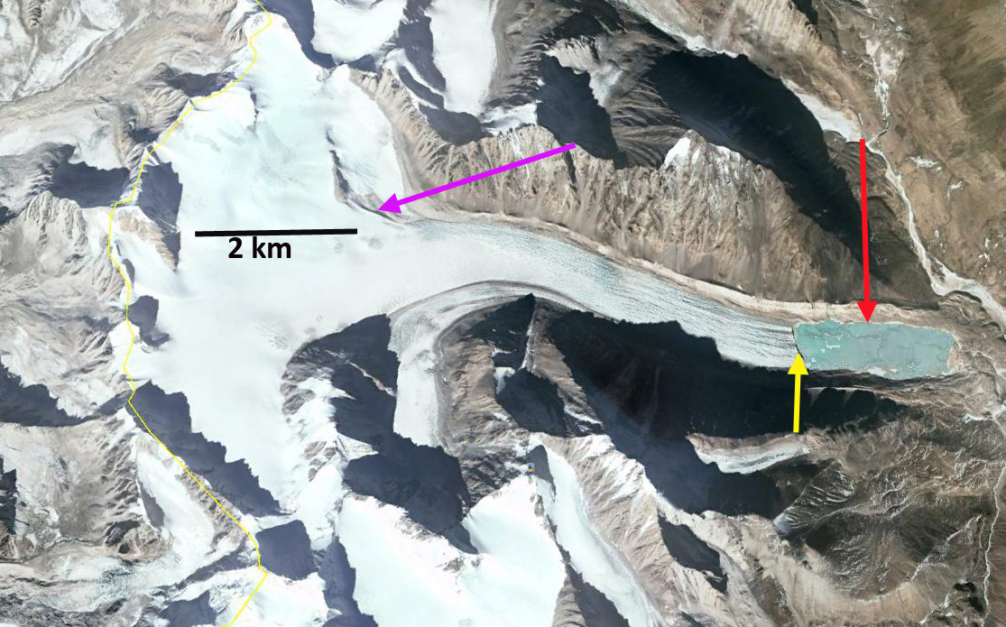
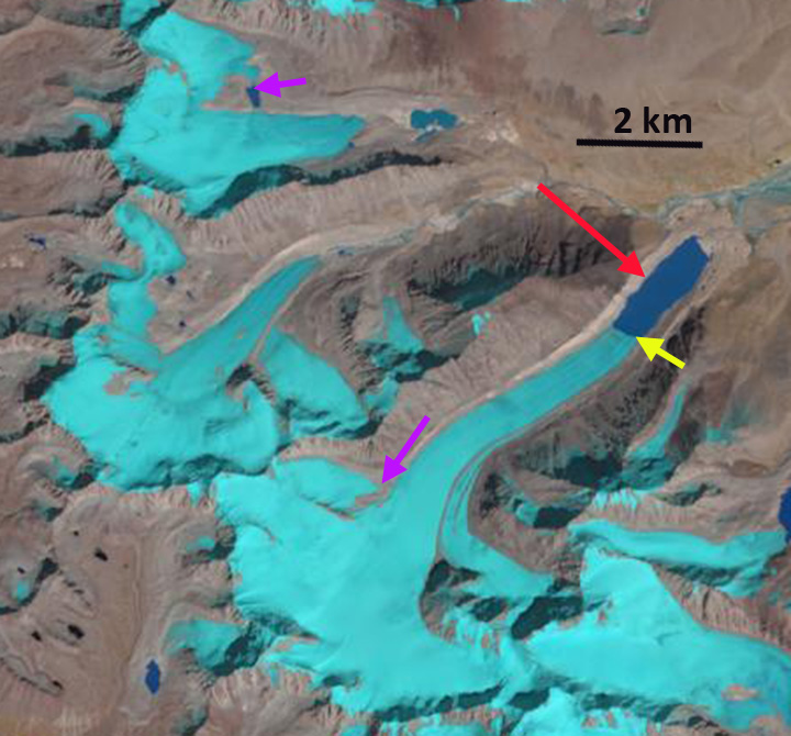
Jiongla Glacier retreat right and Jiangyegong Glacier left retreat from 1988 to 2015 in Landsat images. The red arrow is the 1988 terminus and the yellow arrow the 2015 terminus. Jiongla Glacier retreated 3200 m and Jiangyegong Glacier 800 m.
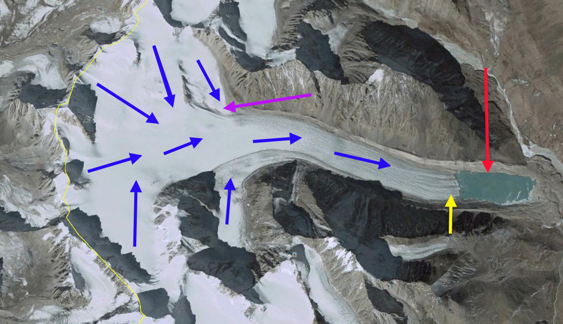
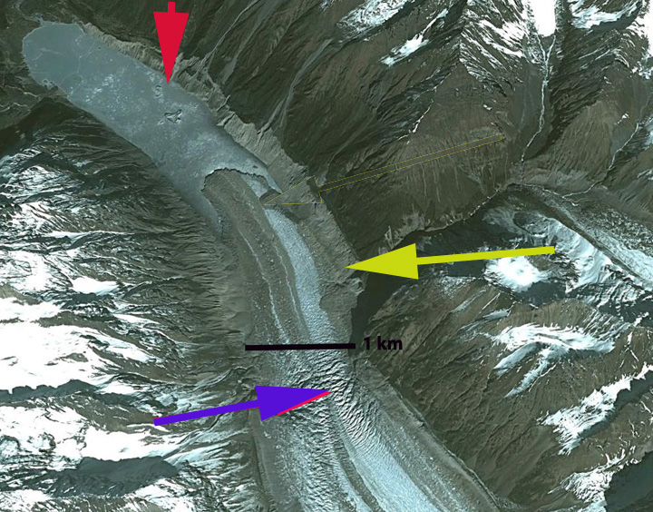
Jiongla Glacier is at the northern boundary of the Brahmaputra River Basin at the east end of the Nyainqentanglha Shan. The glacier drains the western slopes of Koma Kangri Peak and ends in a lake before feeding into the Parlung Zangbo and then Yarlung Tsanpo. his glacier feeds the Parlung Zangbo which is the site of numerous planned hydropower projects, last image, before joining the Yarlung Tsanpo which becomes the Brahmaputra River. The Zangmu Dam went online in 2015, this hydropower facility will produce 2.5 billion kilowatt-hours of electricity a year. In a study by Tobias Bolch et al (2010) in the western Nyainqêntanglha Mountains glacier area decreased by 6% between 1976 and 2001 and continued to shrink from 2001–2009. Li et al (2010) examined glacier change over the last several decades in China and found ubiquitous glacier retreat and commonly lake formation as glaciers retreated. Ninglian and Shichang (2014) in the China National Report on Cryospheric Sciences noted a loss in glacier area of 15 to 17 % in the region. Here we examine satellite imagery from 1988, 2000, 2009, 2010, 2011 and 2015. The red arrow denotes the 1988 terminus and the yellow arrow the 2011 terminus.
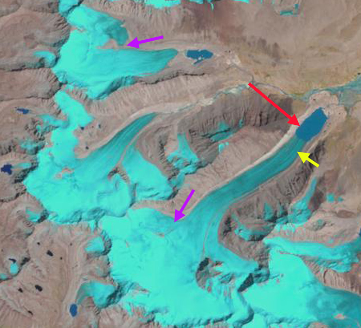
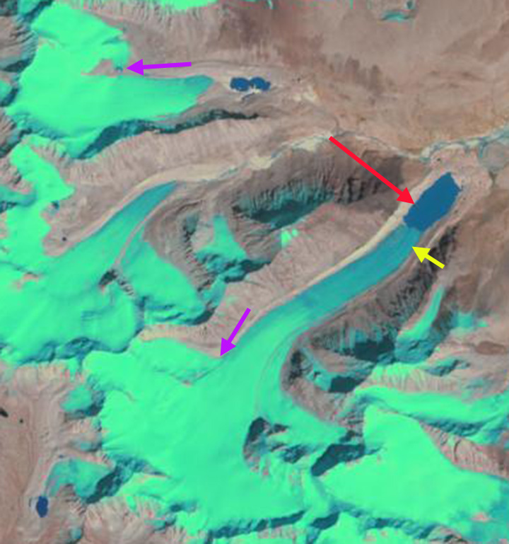
In 1988 the lake where Jiongla Glacier ends is at 2 km long. By 2000 the glacier has retreated 1300 meters. In the 2003 terminus closeup that indicates vigorous flow through an icefall, purple arrow, 2 km behind the terminus. This indicates the lake will end before this point and the glacier does not have a substantial stagnant terminus tongue. By 2011 the lake is 4 km long, a 2 km retreat in 20 years. There are icebergs visible in the lake particularly in the 2003, 2009 and 2011 images indicating that this one a key reason for rapid recent retreat. In reviewing the satellite images for the region cloud cover made it difficult to find imagery near the end of the melt season. By 2015 the lake is 5200 m long indicating a 3200 m retreat from 1988-2015. The terminus is now within 500 of the increase in surface slope that suggests the end of the lake, and likely the end of the current rapid retreat. The 2011 image is from near the end of the melt season and indicates a snowline at 5150 m, blue dots, this is too high for equilibrium, with limited glacier area above 5500 m and the terminus at 4000 meters. This suggests that retreat will continue. The retreat here is similar to that of Thong Wuk Glacier and Requiang Glacier.
The neighboring Jiangyegong Glacier has experienced an 800 m retreat from 1988 to 2015. This terminus remains low slopes and heavily debris covered. The debris will slow the retreat, while the low slope indicates the lake can continue to expand enhancing retreat. This also suggests the rate of retreat will soon slow.T

Landsat image 2000 with the yellow arrow indicating the 2011 terminus position and the red arrow the 1988 terminus position.
 2003 Google Earth Image
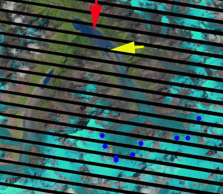
Landsat image 2011 with the yellow arrow indicating the 2011 terminus position and the red arrow the 1988 terminus position.

Hydropower dams completed, under construction and proposed.