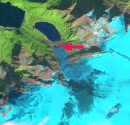
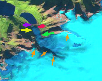
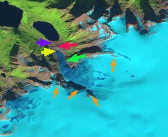
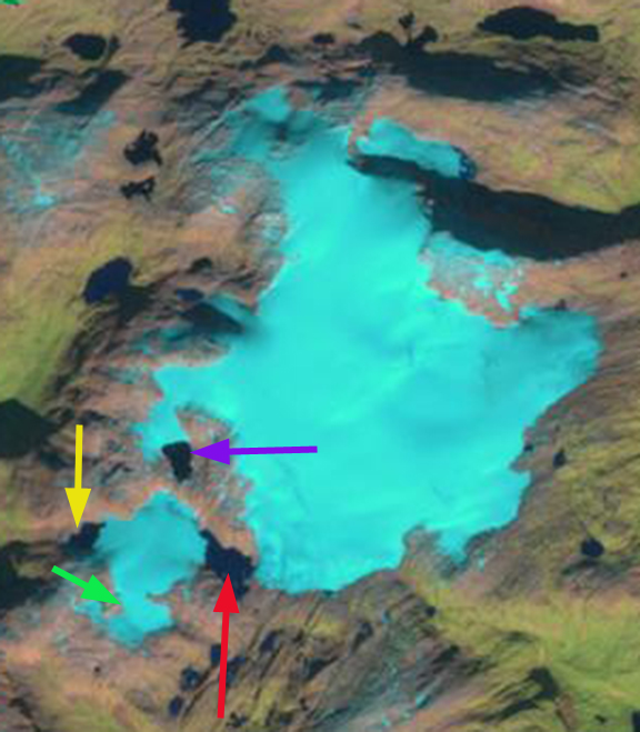
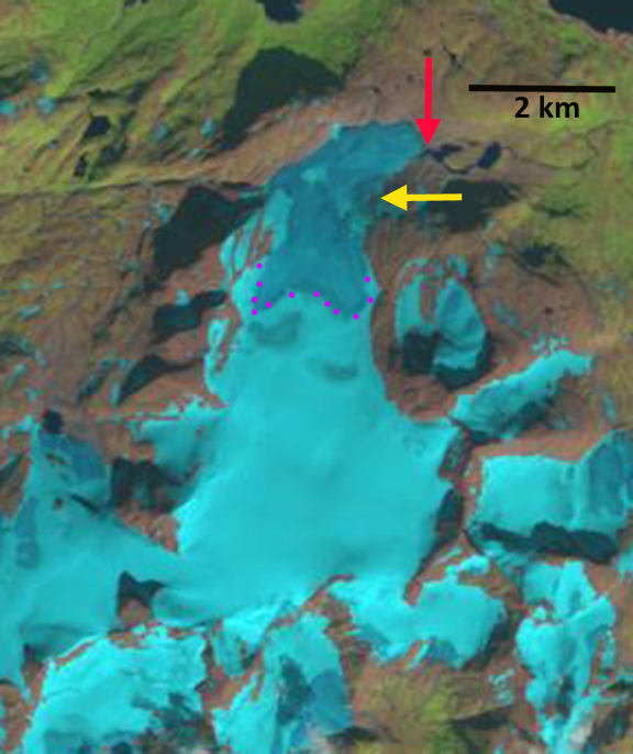
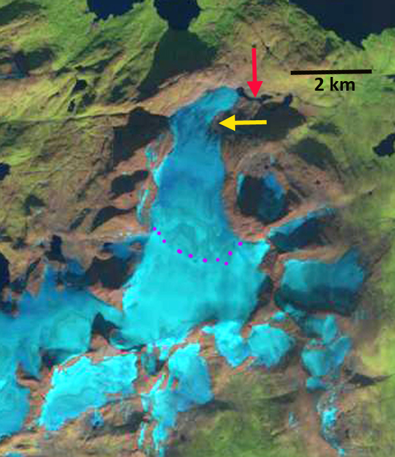
Flatisen Glacier in Landsat images from 1990 and 2018. The glacier terminates in the proglacial lake in 1990 at the red arrow and in 2018 at the yellow arrow no longer terminating in the lake. The pink arrows indicate three connections of the ice cap to the terminus tongue in 1990, with two lost by 2018.
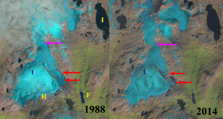
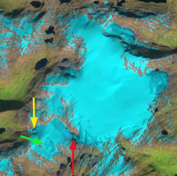
Flatisen is the primary outlet glacier on the southern side of the second largest ice cap in Norway the Western Svartisen. From 1945-2000 the glacier terminated in a proglacial lake that expanded from 1.5 km long in 1945, to 3 km in 1985 (Theakstone, 1990) to km in 2000. Haug et al (2009) indicate significant mass loss of the Western Svartisen Ice Cap from 1985-2000.
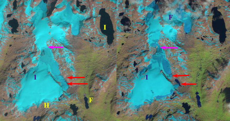
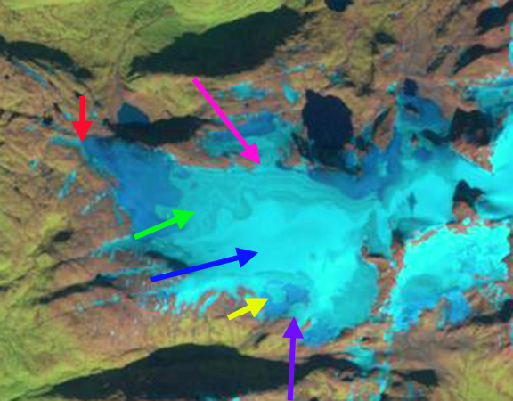
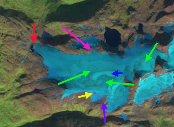
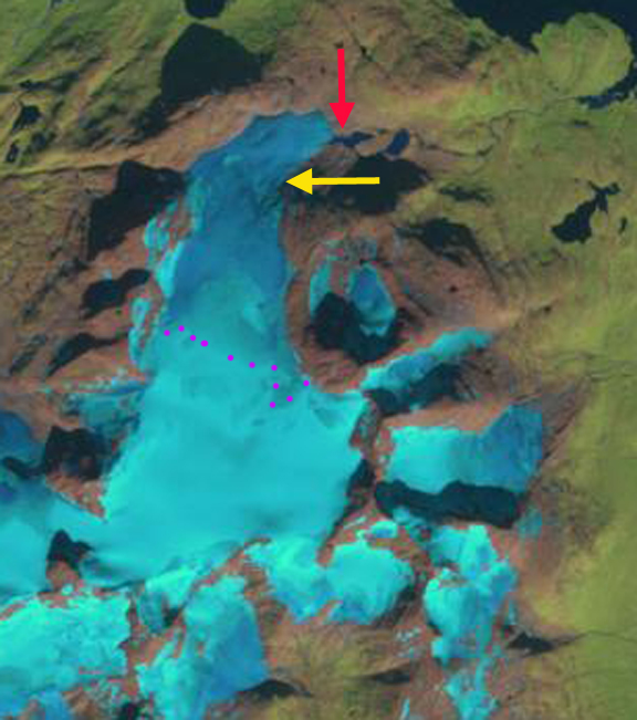
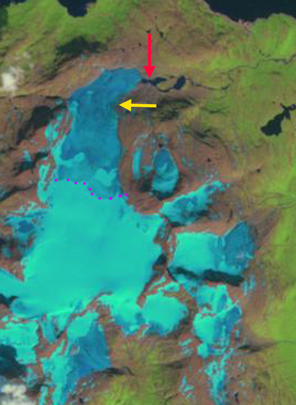
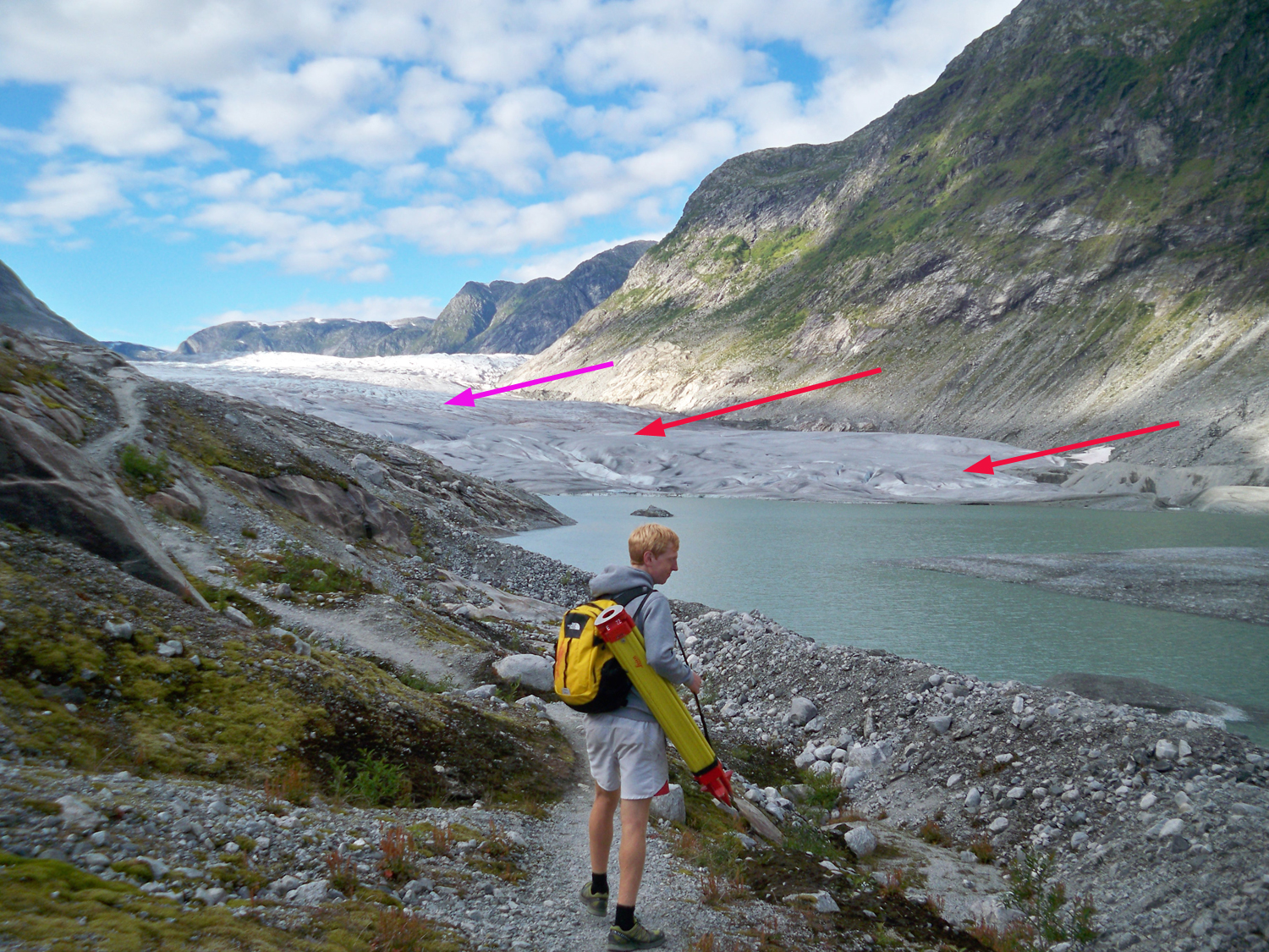
In 1990 the glacier terminated in the proglacial lake that was ~3.5 km long. There were significant feeders from the ice cap both north and south of the terminus tongue, pink arrows. In 1999 the glacier has retreated several hundred meters, still terminates in the lake and is still connected to the ice cap at the three noted locations, pink arrows. By 2014 the glacier has retreated out of the lake and has lost the two eastern connections from the ice cap to the terminus tongue. There is not retained snowcover on the valley tongue of the glacier. By 2018 the glacier has retreated 1400 m from the 1990 position, has only one narrow connection to the main ice cap to the north and has very limited retained snowpack even on 8/6/2018. There will be continued large mass balance loss for this glacier in 2018 reflective of the warm melt season in Norway. Once the glacier connection entering from the northwest is lost the glacier will have a limited accumulation zone. The retreat of this glacier is greater given the size of the glacier than at two other key glaciers of the ice cap, Engabreen and Storglombreen.
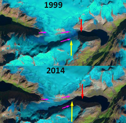
Flatisen Glacier in Landsat images from 1990 and 2018. The glacier terminates in the proglacial lake in 1990 at the red arrow and in 2018 at the yellow arrow no longer terminating in the lake. The pink arrows indicate three connections of the ice cap to the terminus tongue in 1990, with two lost by 2018.

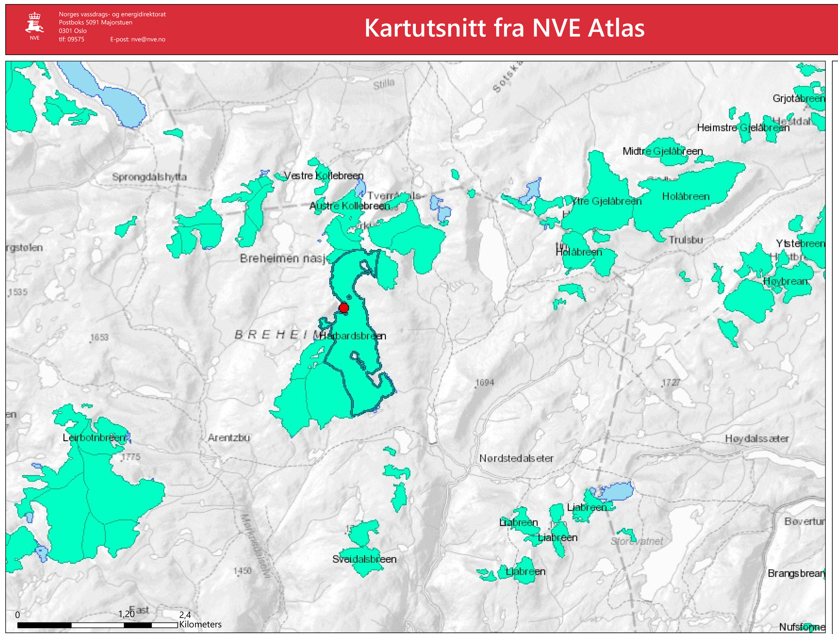
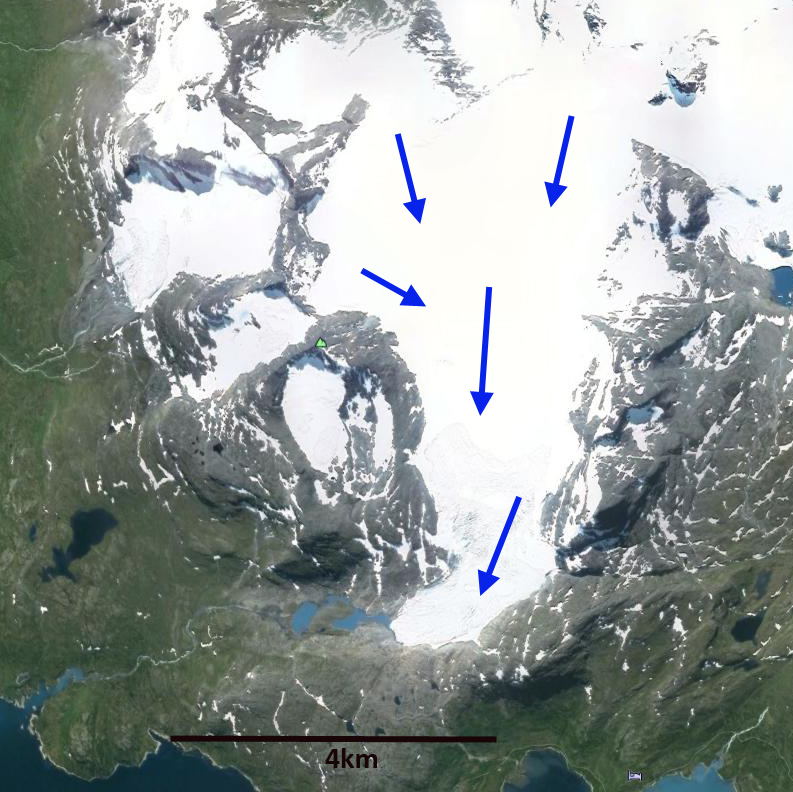
Map of Flatisen Glacier from the Norway Glacier Atlas indicating the margin in 1990 dark green and 1999 light green.