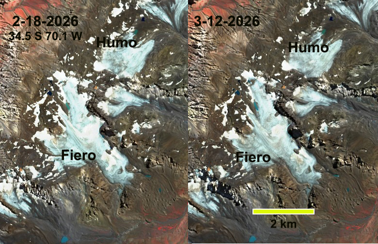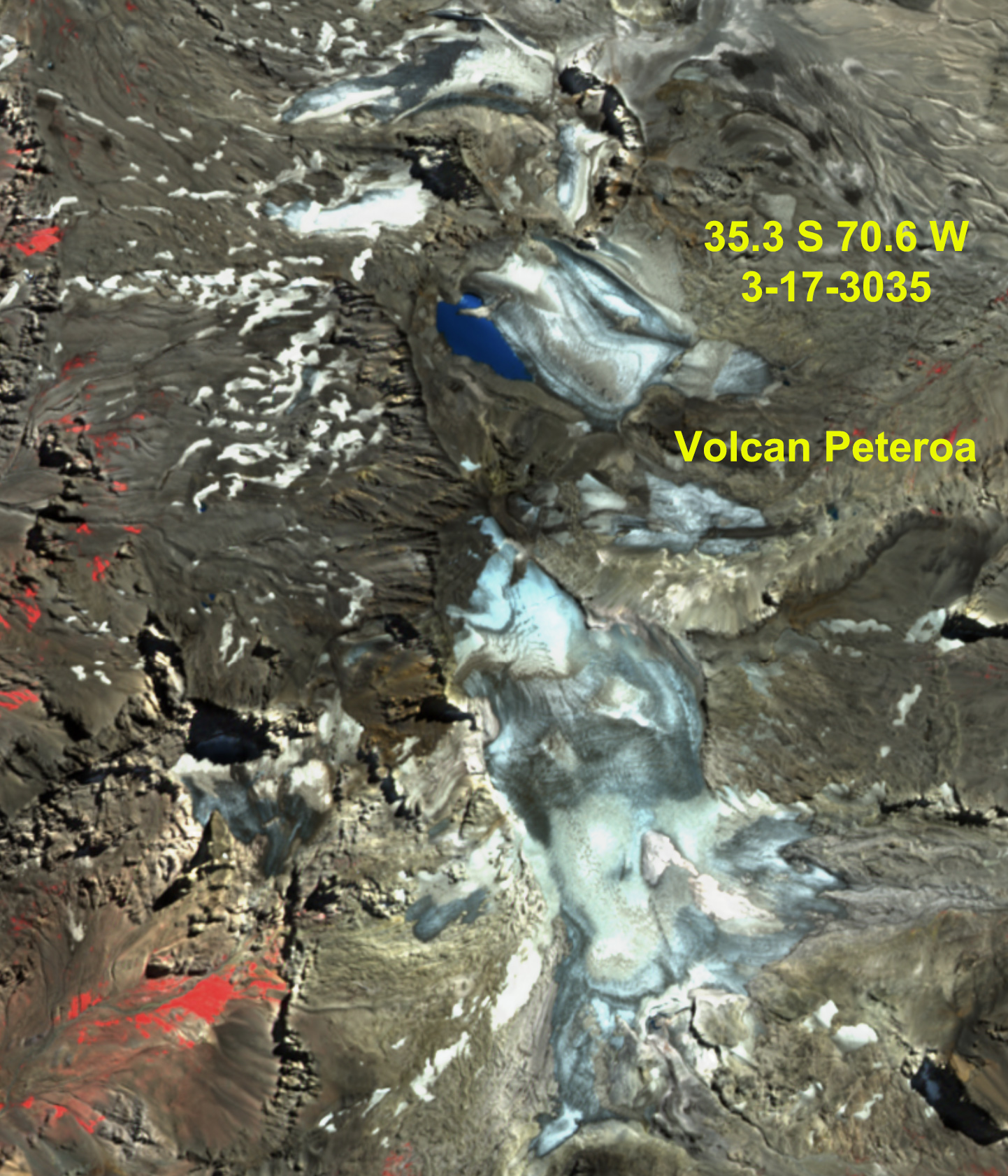
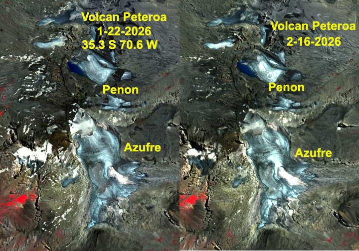
Volcan Peteroa at 35 S straddles the Argentina-Chile Border. Its glaciers-Azufre and Penon have been nearly snow free since mid-January 2026 with 5% snowcover on Feb. 16, 2026. These glaciers drain into Rio Colorado and then the Rio Lontue River of Chile.
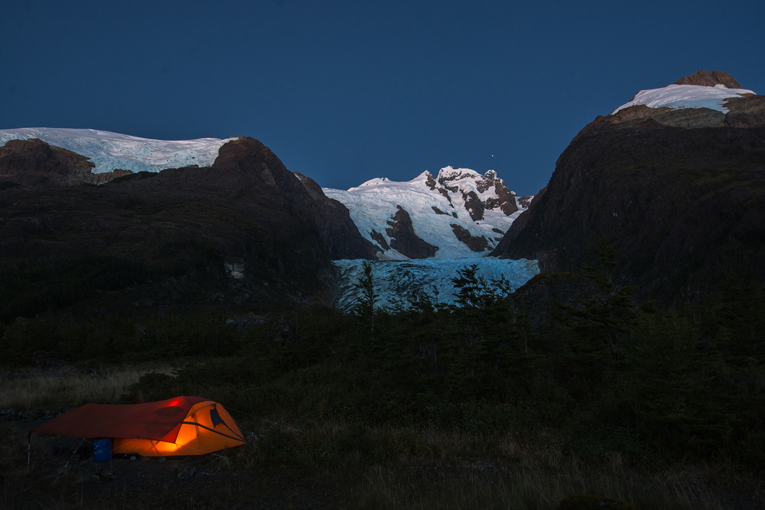
The summer of 2026 has led to high snow lines and many snow free glaciers in the Central Andes of Argentina and Chile. This follows the pattern observed in 2022, 2023 and 2025 of limited retained snowcover (Pelto, 2025). To be in equilibrium a glacier needs to have 50+% snow cover at the end of the summer. When an alpine glacier such as this loses essentially all snow cover, glacier wide mass balance loss is at least 2 m,. This equates to more than 2 m of thinning on average across the entire glacier.
The Glambie Team (2025) found the southern Andes lost 12.8% of their total mass from 2000-2023. Ayala et al (2025) identified that from 2000-2019 Central Andean glaciers were able to buffer drought conditions in this region. Annual precipitation was 36% below average in this period yet streamflow was essentially maintained. Continued area loss since 2019 is and will lead to ongoing summer runoff declines. This impacts down stream hydropower, aquatic life and agriculture.
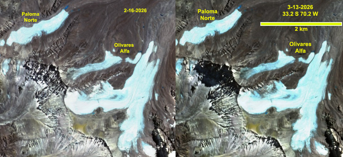
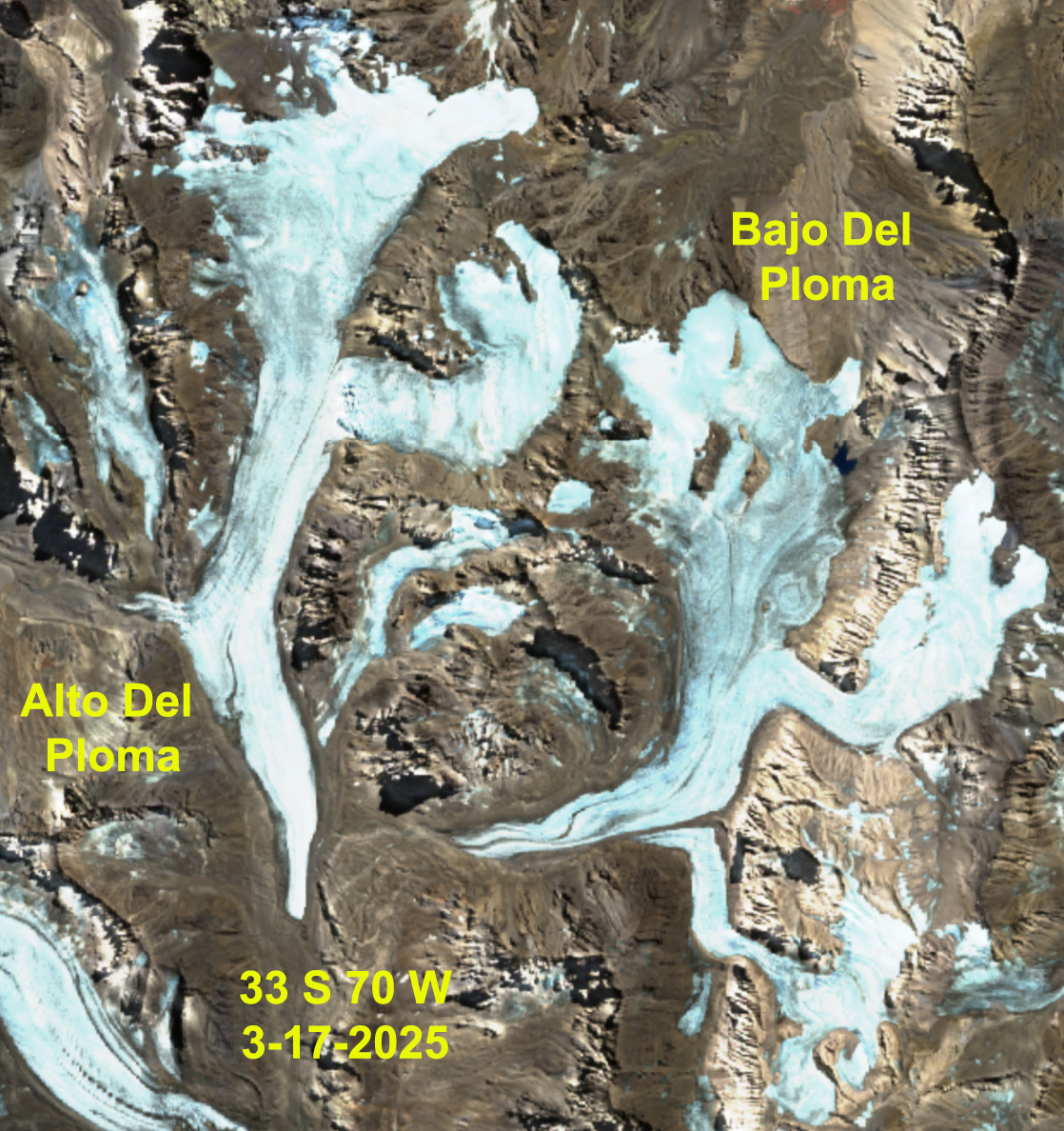
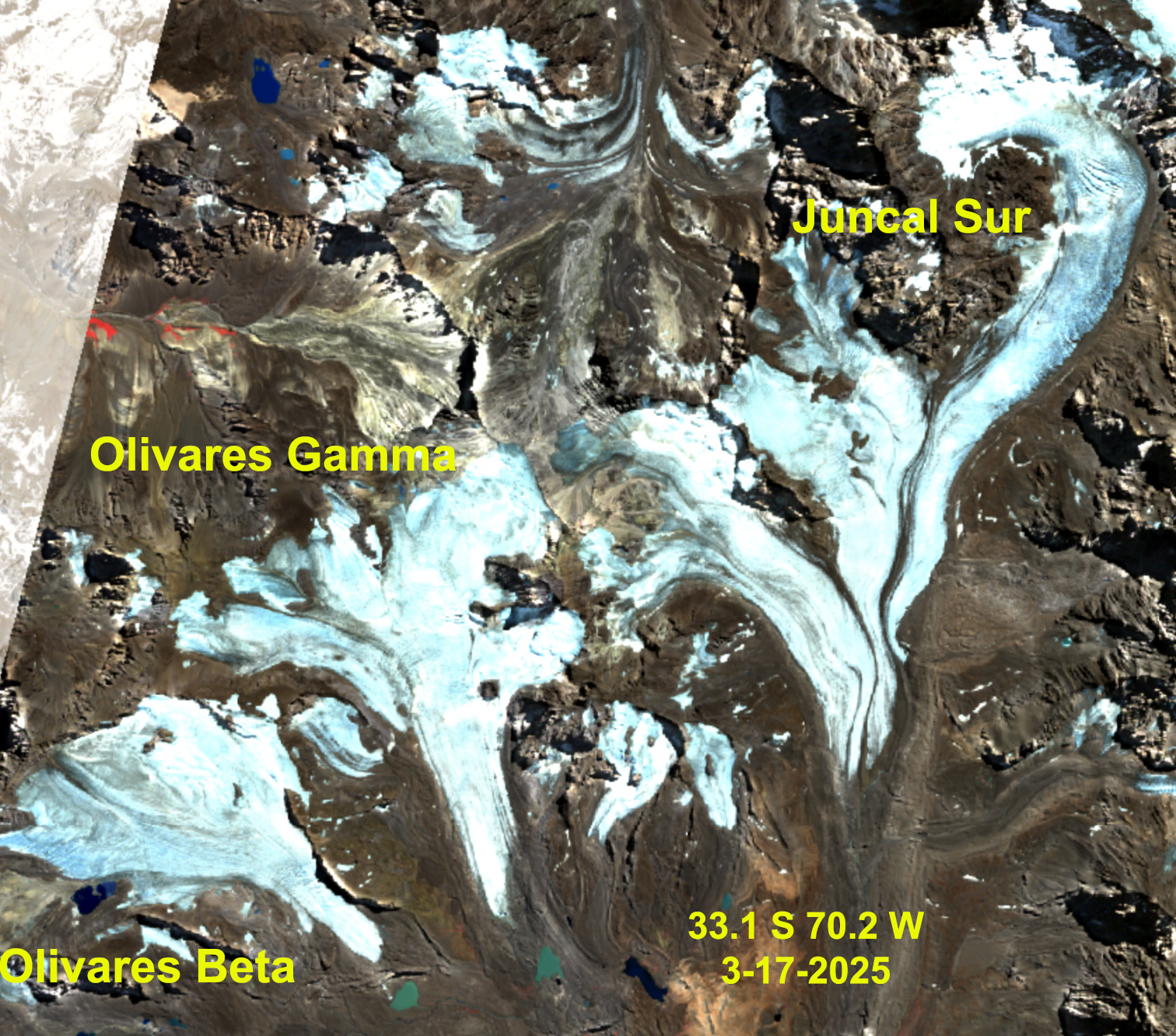
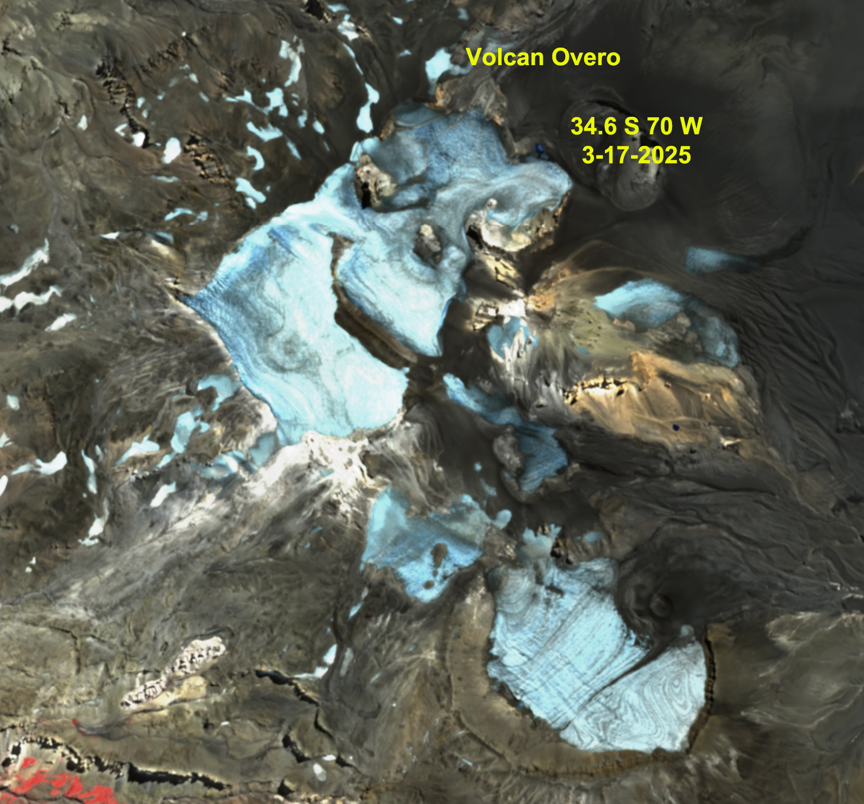
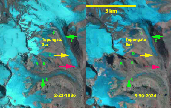
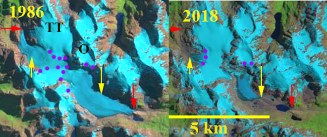
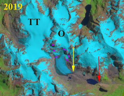
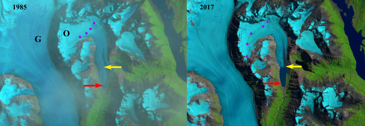
From 33 S at Olivares Alfa, to 35 S at Volcan Peteroa False Color Sentinel images illustrate the lack of snow cover in Janurary leading to less than 5% retained snow cover for each of these four glaciated areas.

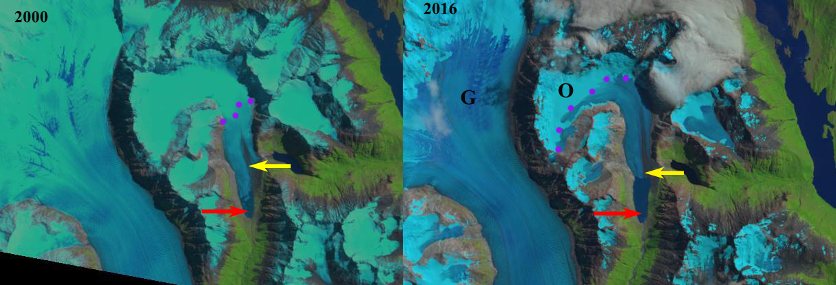
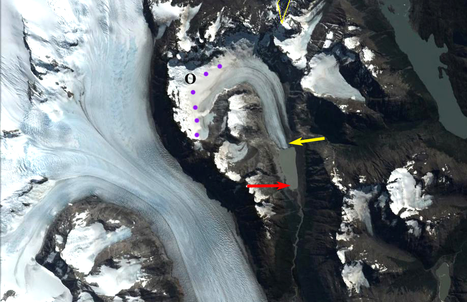
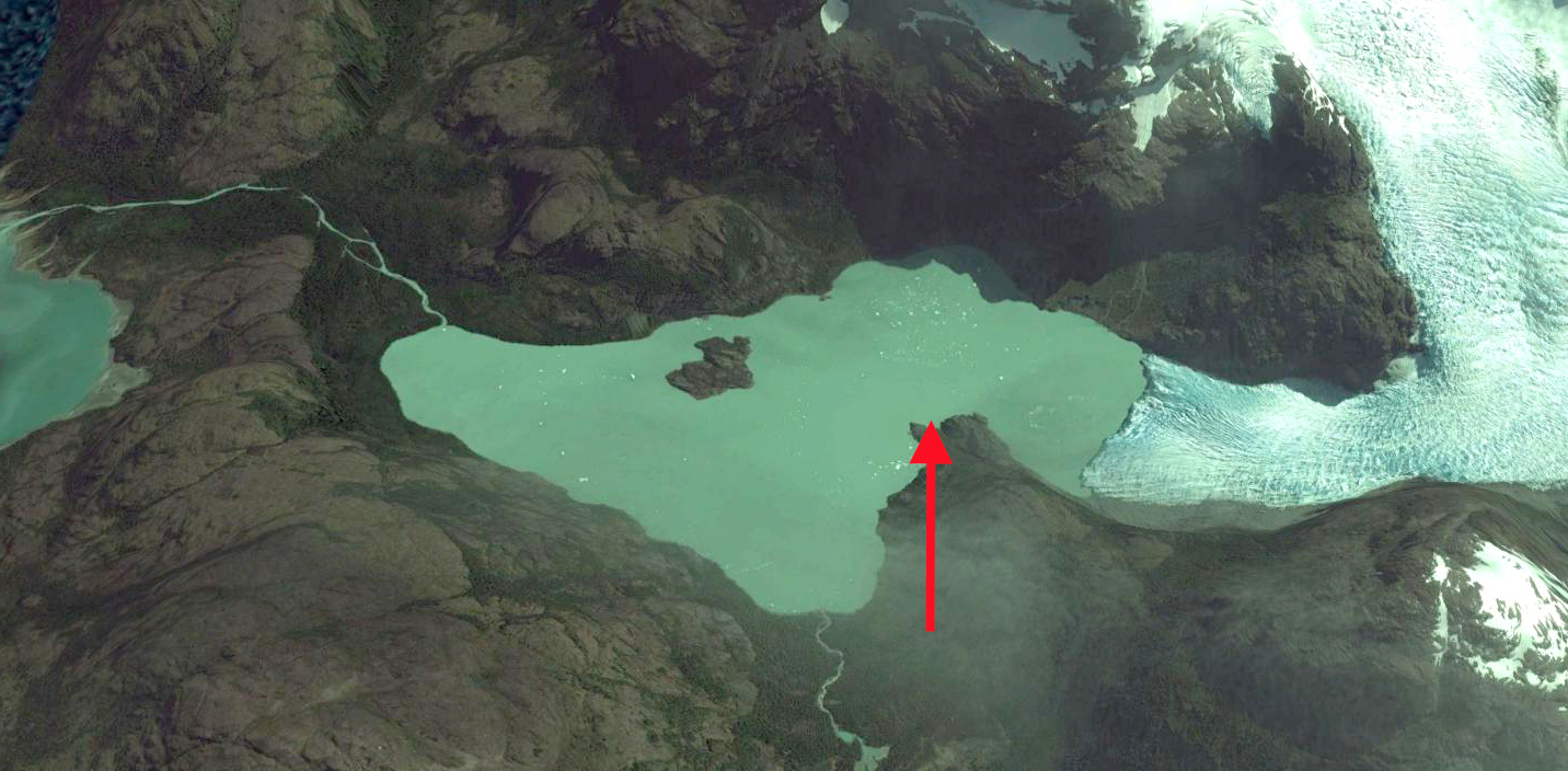
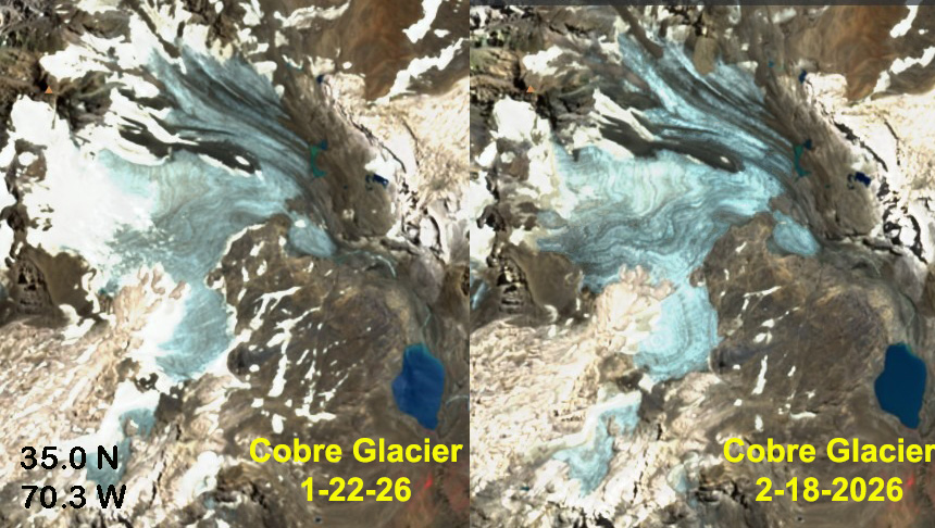
Cobre Glacier, Argentina flows east from the border. It’s snow cover declined from 20% on Jan. 22, 2026 to 5% on Feb. 18, 2026. The glacier continues to retreat rapidly, the glacier reached the lake at lower right in 2016. The glacier drains into the Rio Grande River.