

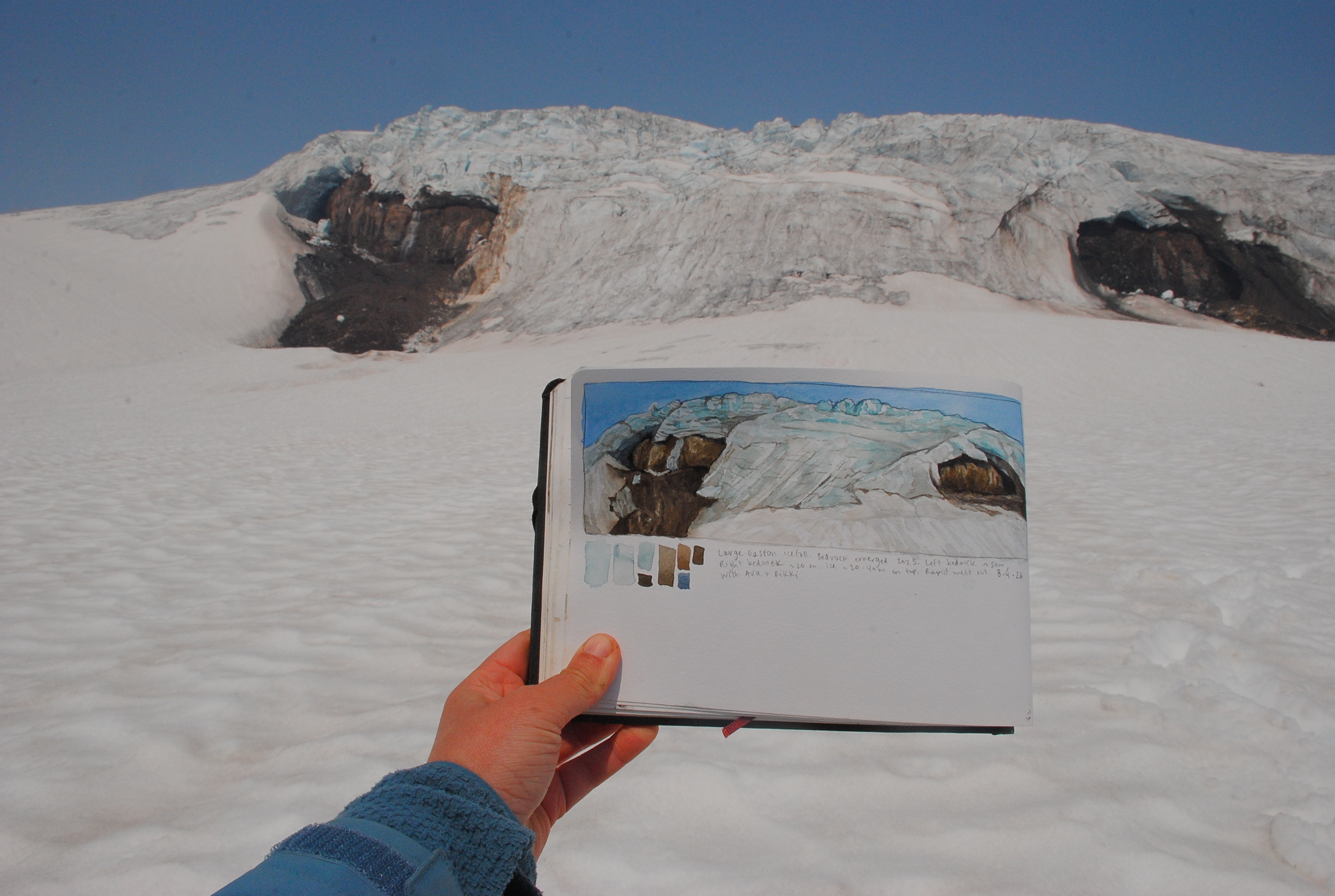
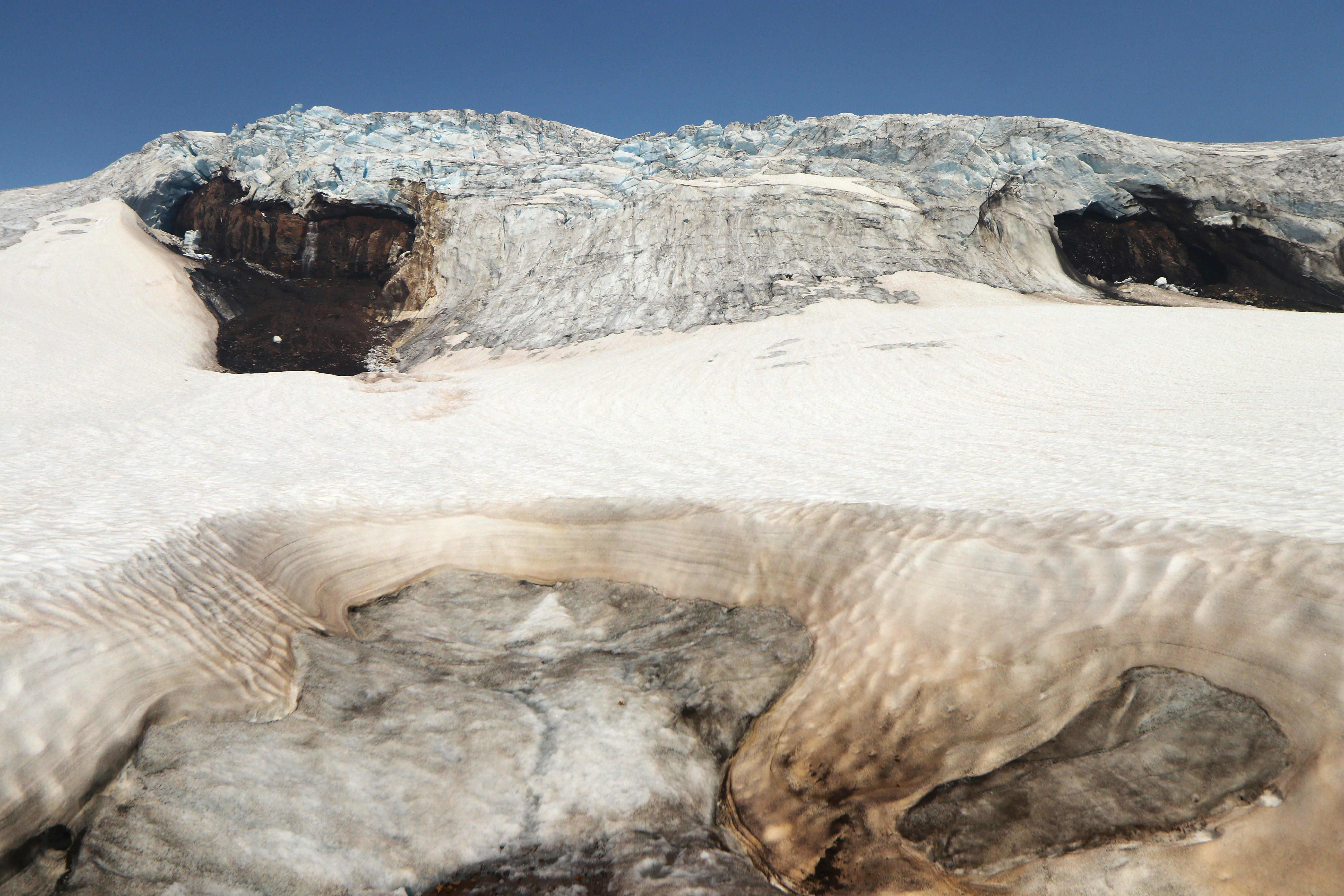
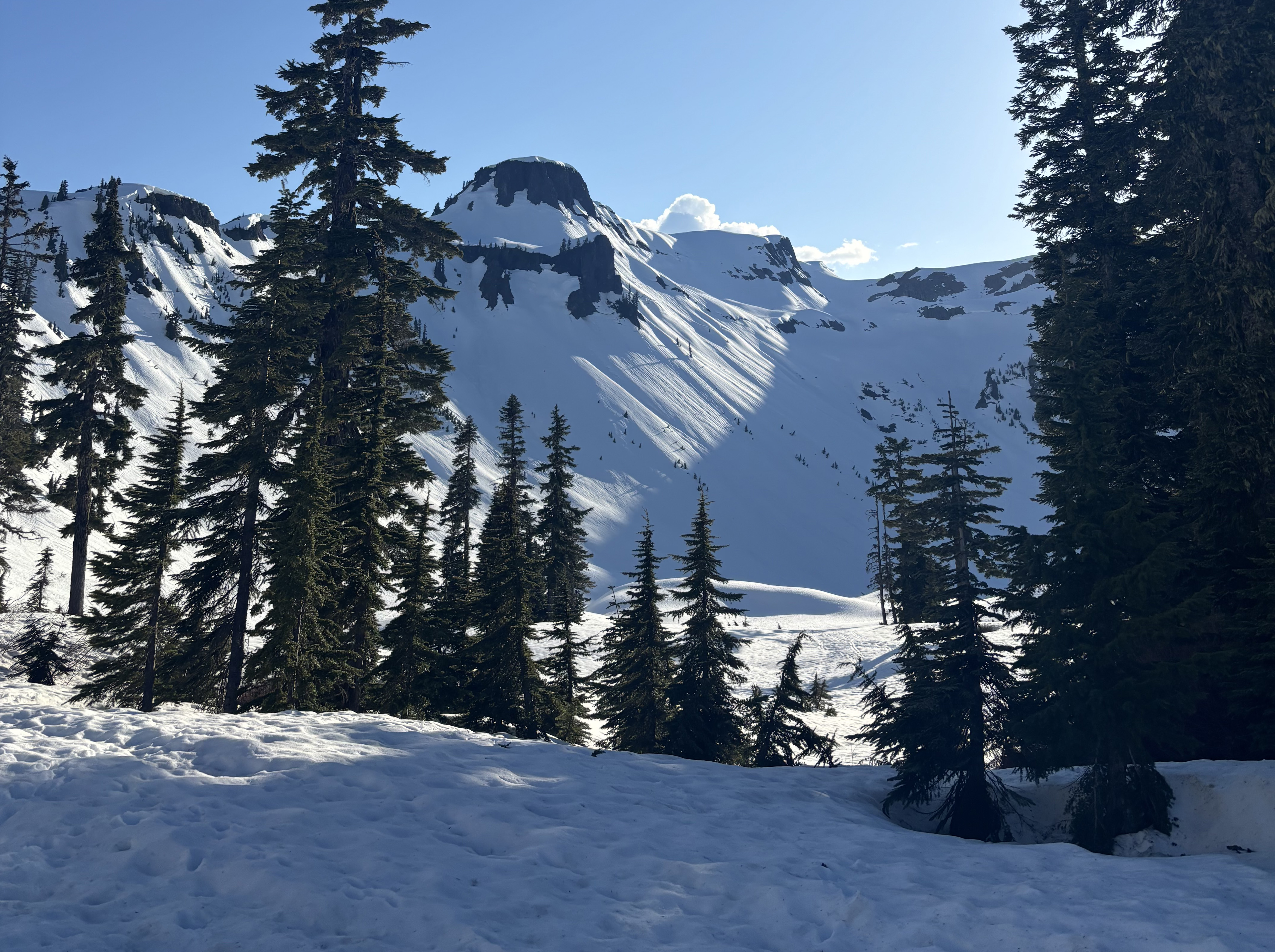
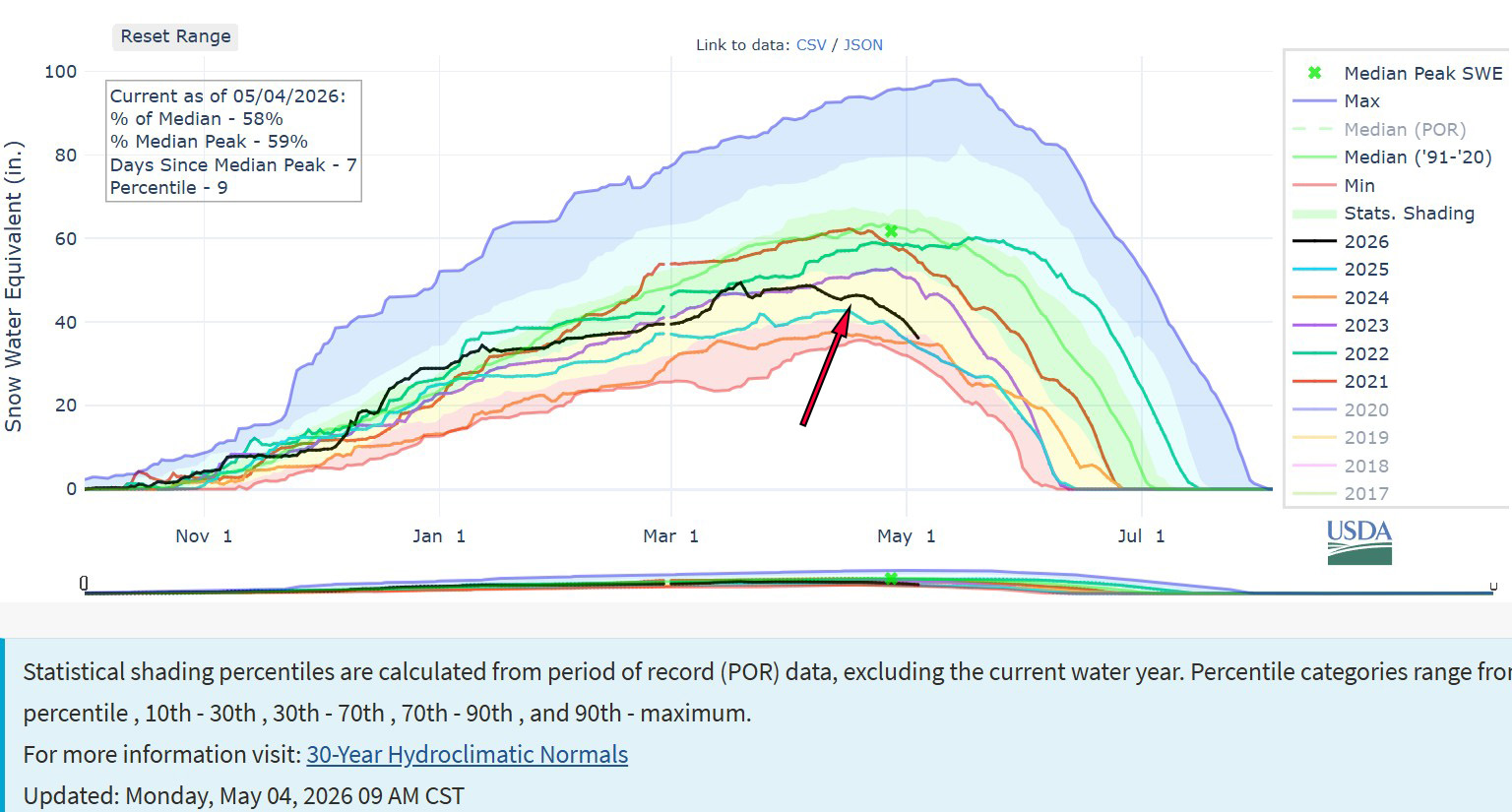
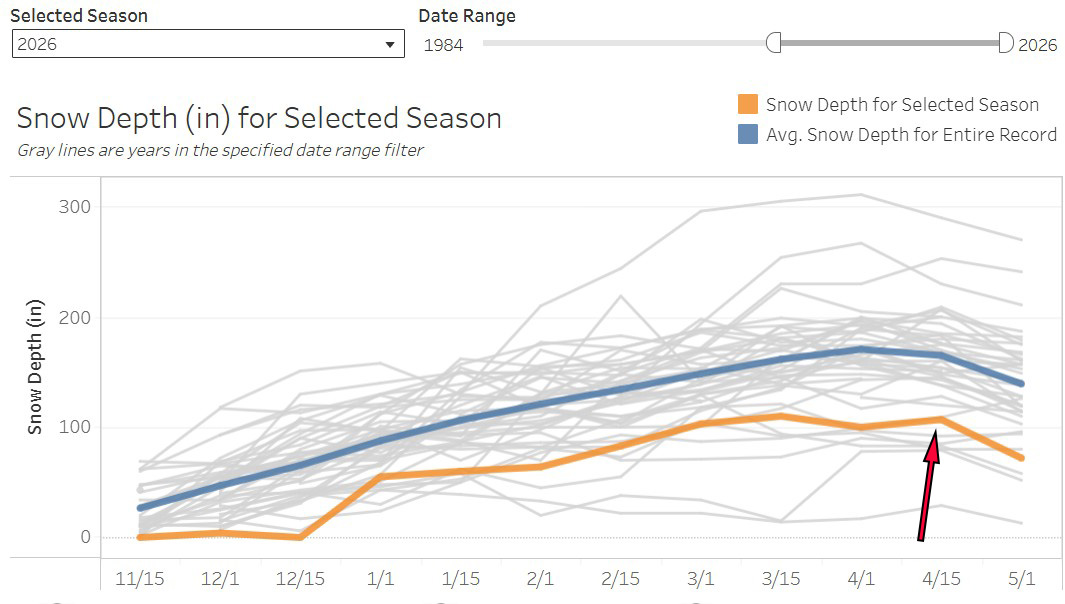
Jill Pelto: Field painting of new large bedrock exposures in the big icefall on Easton Glacier, Mt. Baker. The 2026 field season of the NCGCP brought dramatic changes. While we expected most of these, it doesn’t make them any easier to physically navigate or emotionally experience. Even at 9,000 ft, the glaciers of Mt. Baker are thinning, with new bedrock emerging. Above about 7,000 ft, the snowpack was decent, which will slightly help to mitigate the losses from lack of snowpack at lower elevations. The atmospheric river carved a story across our field sites. From this big shift in snowpack up high, to washed out roads, and altered riverbeds. It was a year of fascinating, sad, and occasionally hopeful shifts.
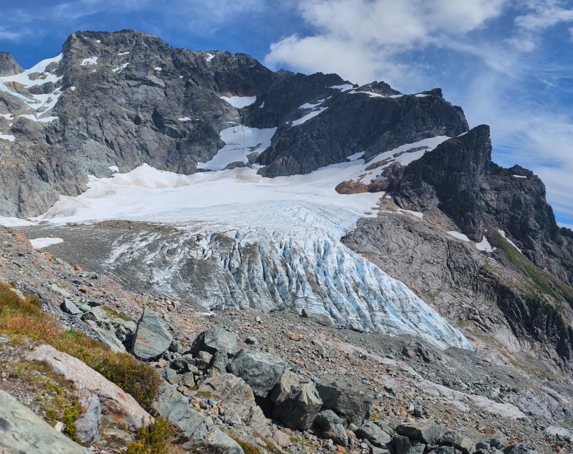
Abby Connor: Looking down at the terminus of the Lower Curtis Glacier on Mt. Shuksan, noticeably thinner than when I last visited. I grew up in Bothell, in a family that spends its weekends outdoors, assuming that massive and seemingly unchanging glaciers are a fact of life. But as we approached our first field site on the Lower Curtis Glacier on Mt. Shuksan, I struggled to reconcile the view of the noticeably less massive terminus of the glacier with my memory from my last visit eight years ago. When we reached our break spot and looked far down at the glacier, Mauri described the wall that would have towered 100 feet over where we sat, before the glacier had lost its impressive thickness. Throughout the 2026 field season, I was continually awed with the scale of the glaciers we still have in the North Cascades while surrounded by reminders of how quickly they’re disappearing, fast enough that we are on track to lose almost all of our glaciers in the state within my lifetime. In Western Washington, a place defined by the mountains and Sound, glaciers are the link between the two. They are no longer an unchanging fact of life.

Ava Reynolds: Pink monkey flower and fireweed bloom in the rocky moraine of the Columbia Glacier – one of the glaciers in the 2026 field season that looked the most impacted by warm temperatures and a reduced snowpack, with avalanche bands that feed the glacier now shutoff, rockfall evident across the entire glacier, and a growing lake of floating ice at the terminus.This field season was visually striking, highlighting the impact of our warming climate on the glaciers and surrounding ecosystem. Flowers were blooming weeks ahead of schedule, sections of new bedrock were exposed, wildfires dotted the horizon at every field site, and residual evidence from the December 2025 storm system was prevalent in downed trees and washed out riverbeds.

Shaina Dotson: Amidst the icefall of Easton Glacier. Joining the NCGCP this field season was equal parts breathtaking and sobering. Each glacier was stunning and wholly its own — ancient and irreplaceable — yet we were immersed in the evidence of a warming planet. Wildfire plumes lined the horizon, ice thinned and retreated where it once held firm, and every day I found myself torn between the beauty of this world and its unraveling.
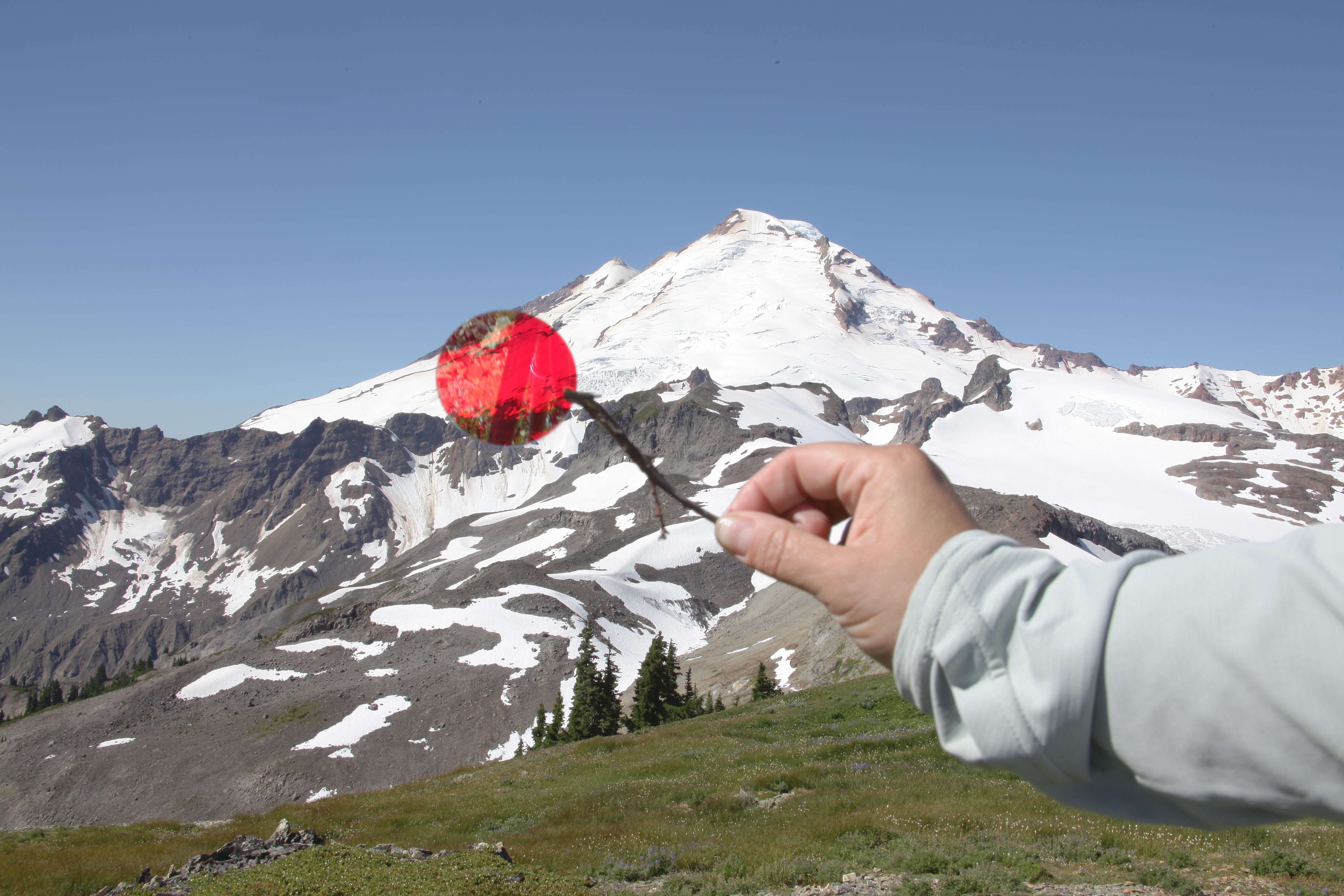
Danielle Schlunegger-Warner: Red Lens over Rainbow Glacier with Ice Alge sampled from Rainbow Glacier in the microscope. As an artist invited out to attend the 43rd field season with NCCGP, I spent my time in immersed with looking and observing. My attention drew not just to the fantastical forms of the ice on the glaciers, but the way they change the landscape around them. I saw ice algae and tiny black worms dotting the ice and snow, listened to the life bubbling up in the streams at their edges.The focus shifted between the expansive ancient glaciers, microorganisms, and the yearly changes diligently measured by the NCCGP with somber results. This experience illuminated for me not just that these glaciers the heartbeat of the North Cascades, but that their impact ripples out into our own lives in ways that are worth paying more attention to.
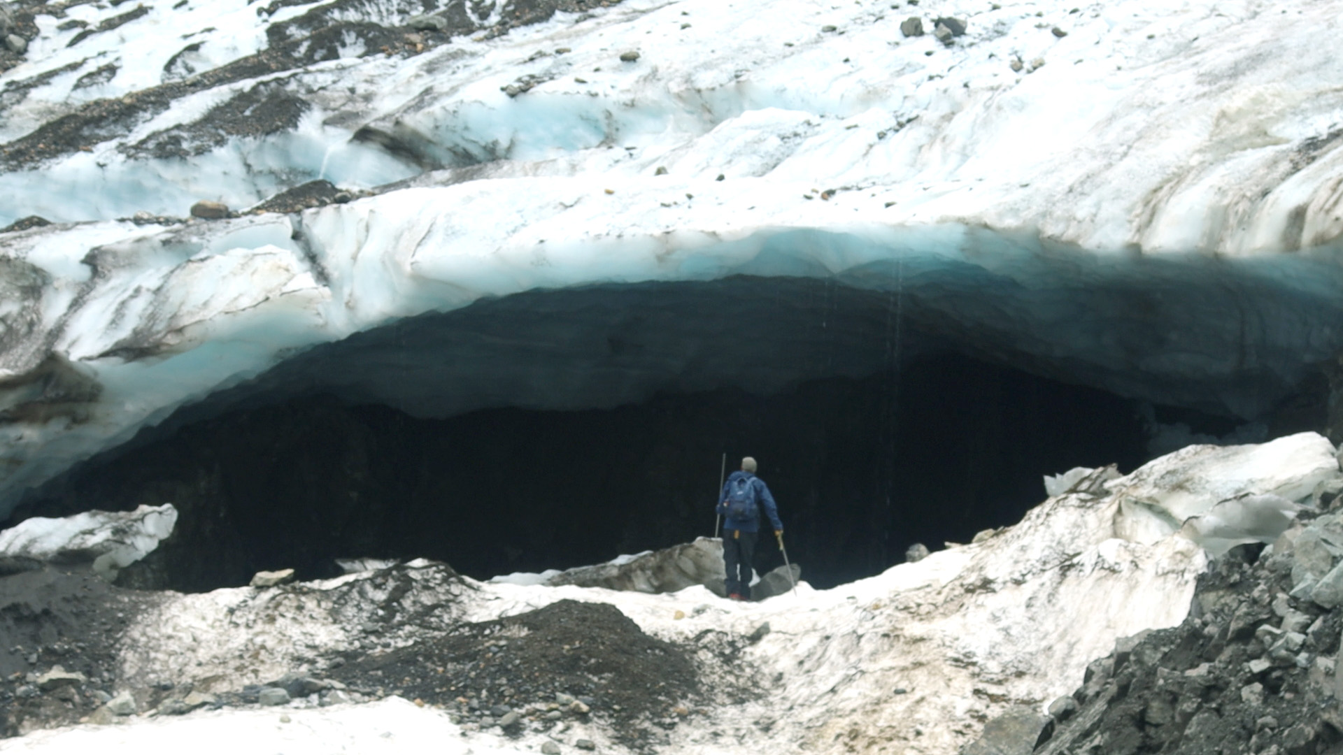
Rikki Held: Rainbow Glacier cave with Mauri for scale. The 43rd field season of the NCGCP was filled with both devastating and beautiful moments. We traversed landscapes with fresh glacier-fed streams, rugged mountains, wildflowers, mountain goats, and glaciers with unique formations and characteristics, while also witnessing heartbreaking sites including the large cave hollowing out Rainbow Glacier’s terminus on Mt. Baker and wildfire smoke plumes throughout the field season. Mauri and Jill shared their multi-year observations noting vegetation changes, newly exposed bedrock, and how far the glaciers have receded since they first visited them – e.g., Easton Glacier has retreated around 750m since 1990. This project highlights the importance of long-term data collection, science communication, and personal narratives as we all work to reduce the impacts of anthropogenic climate change and protect the environmental systems we depend on.
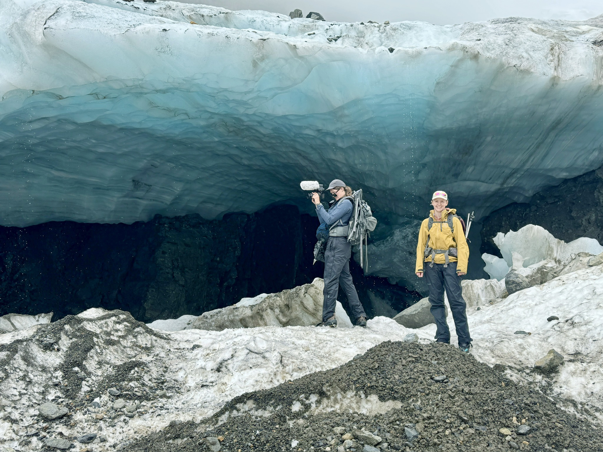
Mauri Pelto: Rainbow Glacier cave at the terminus with Abby and Rikki in foreground, viewed from an area where a previous cave had collapsed. Large ice caves are features of retreating glaciers where warm air circulates expanding the cave until it collapses. We observed several of these at the terminus of glaciers on Mount Baker this summer. The largest was at the terminus of Rainbow Glacier. The cave is large enough to hold a cape style house. It will collapse by the end of summer driving further retreat. The size of this cave and the roar of the water was quite intimidating.
Hannah Contreras: In a melted feature looking up at two newly exposed, widening bedrock areas in the Easton Glacier icefall. As bedrock becomes visible, it’s darker shade absorbs heat and melts the ice around it even faster, creating a vicious cycle. In between measuring crevasse and snow depth, this field season we observed newly exposed bedrock in the icefall, again at ~9000 ft just off the popular Easton climber’s route, and finally at the top of the famed Roman Wall (~10,000 ft). Seeing growing bands of melted out bedrock at these elevations and features highlights how threatened the Easton truly is. As a mountaineer, I have spent quite a bit of time both traveling on and marveling at glaciers, but never like this. Experiencing these landscapes always evokes a strong sense of awe, appreciation, and inspiration, but when faced with the magnitude, speed, and decisiveness of their retreat, these feelings were countered by an equally powerful sense of dread and loss.
 From a Glaciers Perspective