
East of the Chilung La and 20 km northwest of Durung Drung Glacier draining into the Sankpo (Suru) River is an unnamed glacier, here referred to as Chilung Glacier. The Suru River flows northwest from Pensi La, while the Zanskar River flows southeast from the Pensi La. The Suru River has a 44 MW hydropower project at Chutak. The glacier is 6 km long starting at 5400 m and terminating at 4400 m.

Topographic map of region
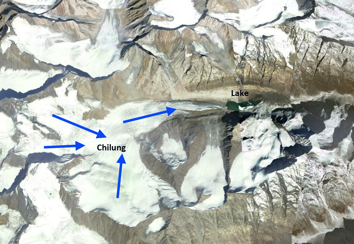
Google Earth image
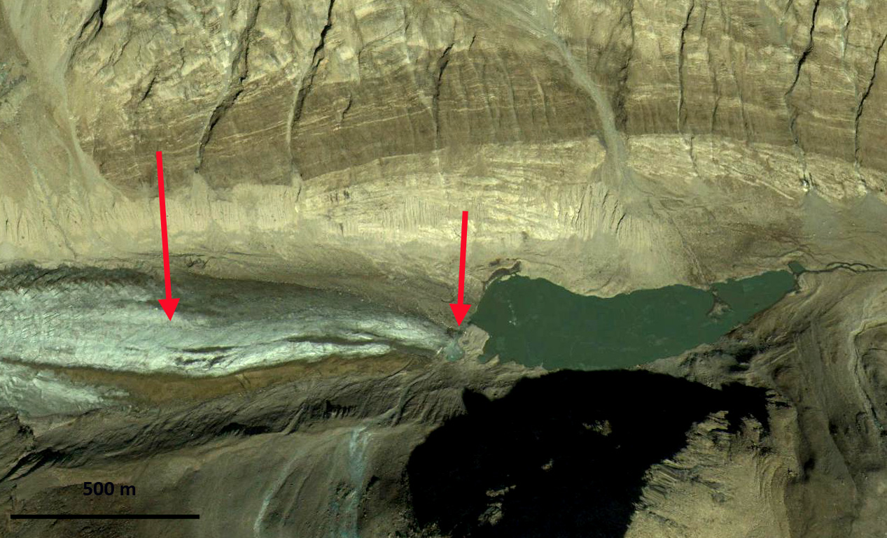
An examination of Landsat imagery from 1998-2013 indicate the expansion of a proglacial lake at the terminus and glacier retreat. The 1998 terminus is marked by a pink arrow in each image. The yellow and green arrow indicate adjacent small glaciers. In 1998 the proglacial lake is 1100 m long and in 2000 it is 1200 m long. By 2005 the glacier has retreated 200 m and the lake is 1400 m long. In 2013 the lake is 1650 m long, and the glacier has retreated 400-450 m since 1998. The retreat rate of 30 m/year is slightly faster than on Durung Drung. A comparison of the adjacent small glaciers on the slopes above Chilung Glacier, yellow and green arrows, from 2000 to 2013 indicate a loss in area of these glaciers as well. Google Earth imagery in 2000 indicates that lower 900 m of the glacier is uncrevassed and relatively stagnant, by 2013 half of this area has been lost. The lake is shallow and may not expand much further as the glacier retreats. The consistent nature of the retreat in this area was noted by Kulkarni (2014)indicating retreat of 12 of the 13 observed glaciers in the region during recent decades. Glacier thinning has exceeded the rate of retreat on many glaciers in this area, indicating that retreat is likely to increase. 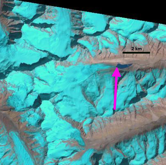
1998 Landsat image

2000 Landsat image

2005 Landsat image

2013 landsat image
2000 Google Earth image
