
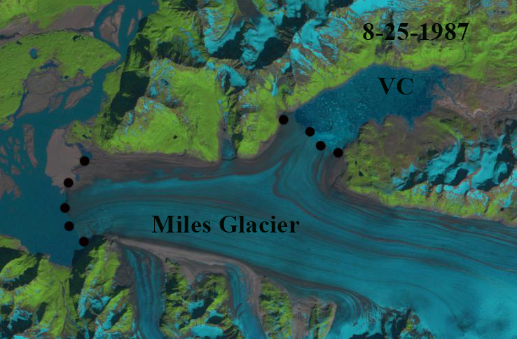
Miles Glacier terminates in an embayment on the east side of the Copper River, Alaska. A secondary terminus on the north side of the main glacier has long impounded a glacial lake that periodically drains. As miles has retreated over the last 40 years the maximum size of the glacial dammed lake has diminished, prior to its drainage. In 1987 the glacier extended onto an outwash plain directly adjacent to the Copper River, the lake reached a maximum size of 12 km2 . From 2016 to 2019 the lake drained each summer reaching a maximum average size of 5.5 km2 (Rick et al 2023). This was noted as a shrinking ice dammed lake by Field et al (2021).
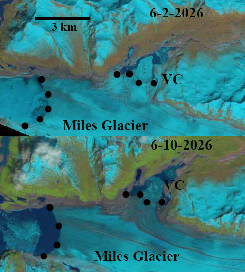
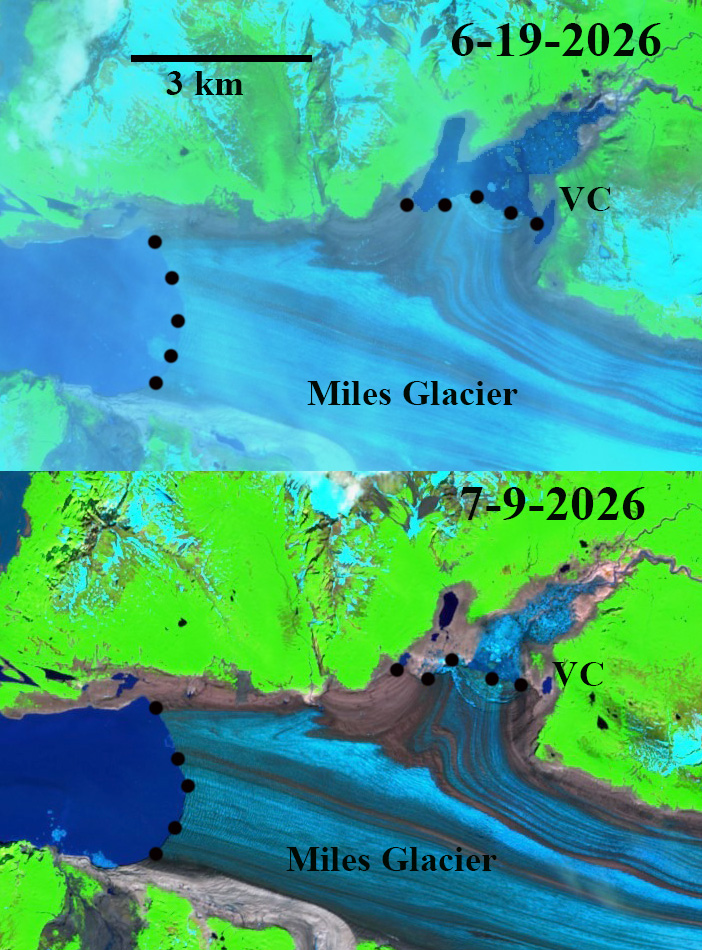
By 2021 the glacier had retreated 3.5 km since 1987. From 2021-2026 the lake reaches a maximum size of 3.5 to 4.0 km2 before draining. On June 2, 2026 the lake still has some winter lake ice and is filling. By June 10th the lake had reached 3 km2 and by June 19th it had reached 4 km2. The lake had began draining before June 25th. By July 9th it was fully drained. The Miles Glacier terminus has retreated 4.5 km since 1987. This ongoing retreat will continue to diminish the size of the lake. Ths lake does not have the complex drainage system or changing drainage location that Berg Lake has with retreat of Stellar Glacier..
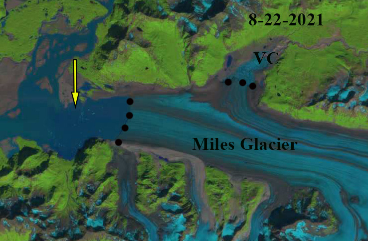
Miles Glacier and Van Cleve glacial lake in 2021 Landsat image. Black dots indicate glacier margin and yellow arrow indicates 1987 margin.


Thanks for the informative post Mauri. I just got off of the Copper and was trying to understand the way that Van Cleve works via Sentinel Hub images and the downstream USGS gage. Turns out all I needed was a quick Google search to lay out this year’s event. Thanks for the very timely post!
Given the high Copper River discharge this outburst is hard to discern.