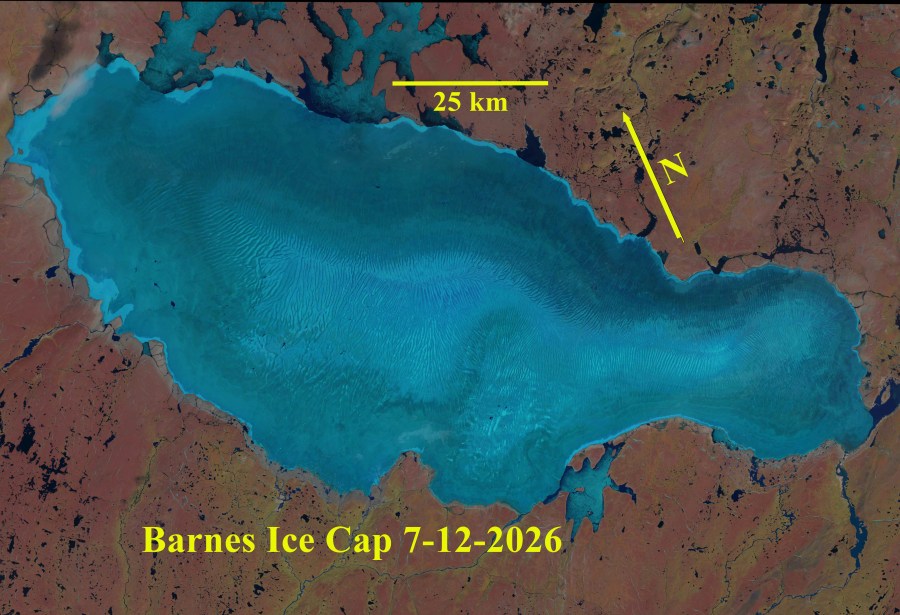
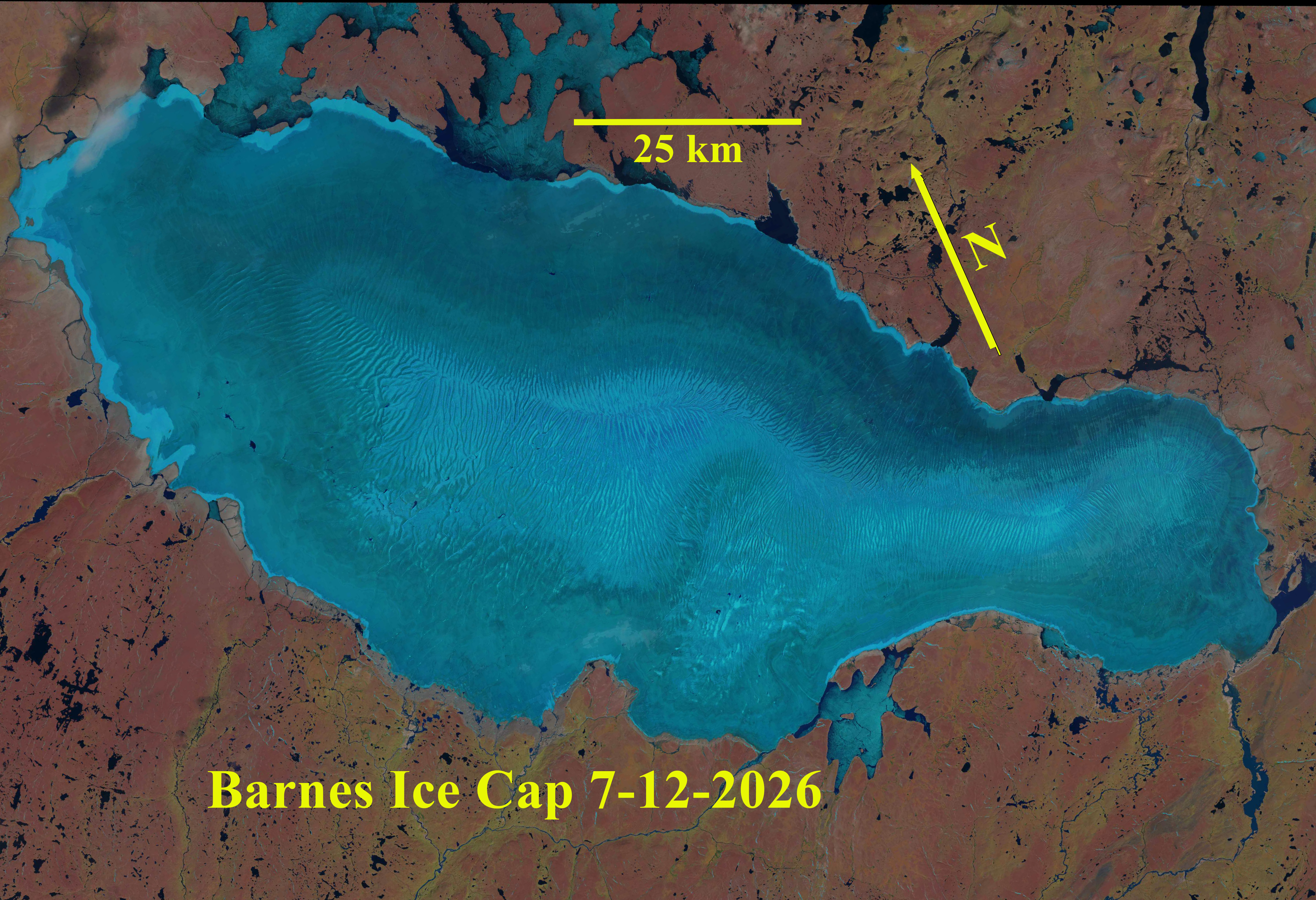
Barnes Ice Cap located in the center of Baffin Island, Canada covers an area of ~5731 km2 in 2021 (Rippin et al 2026). The ice cap is approximately 150 km long, 60 km wide and has maximum ice thickness of ~730 m and a maximum ice elevation of 1124 m above sea level (asl) at the summit of the north dome. ICESat altimeter data indicated the thinning of the BIC at a mean rate of 0.75 m/year for the 2003–2009 period Gilbert et al (2016). They also noted that the ELA was at 950 in the 1960-80 period and is at 1100 m from 2002-2010 this leaves a limited accumulation zone area. observe that Barnes Ice Cap lost its accumulation area beginning in 2010, in part due to the longer melt season. The glacier does tend to not retain snowcover the accumulation zone consists of superimposed ice at the crest. Papasodoro et al (2016) noted that glacier wide balances were −0.52 m w.e./year from 1960 to 2013 and doubled to −1.06m w.e./year from 2005 to 2013 and remained at ~-1 m/a year through 2021 (Rippin et al 2026).
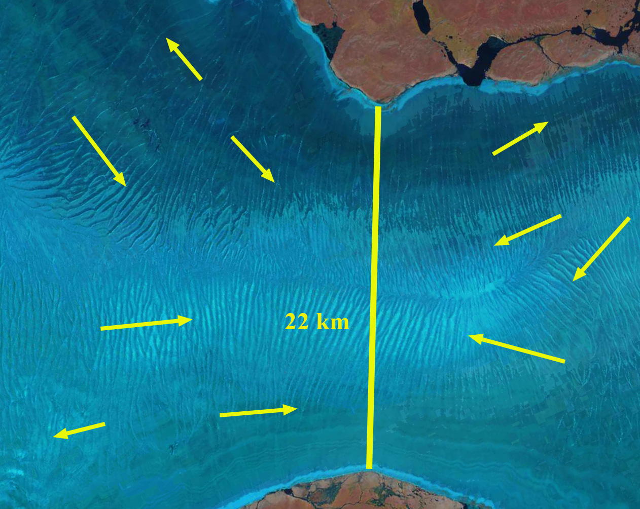
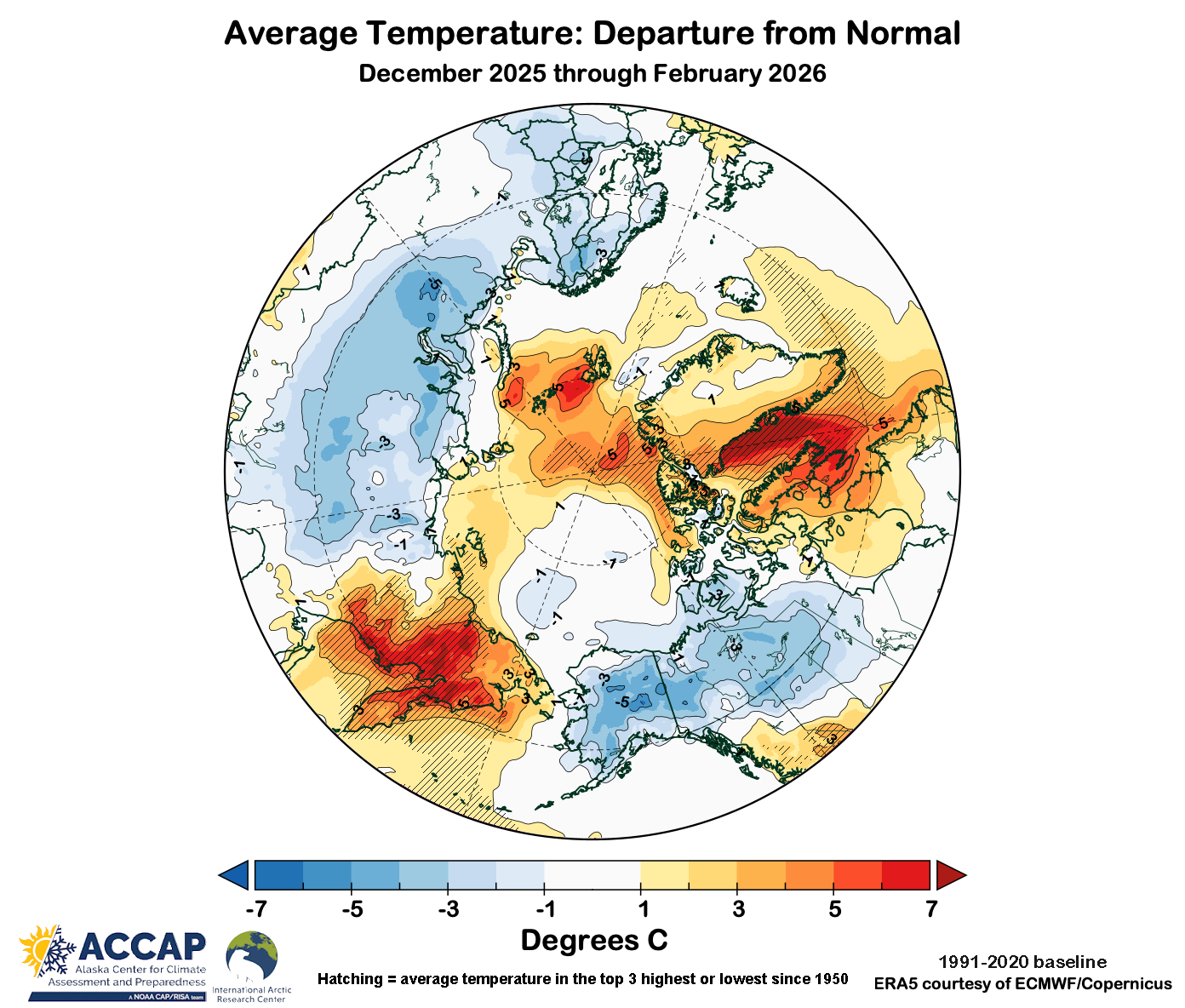
This has enabled supraglacial channels/valleys to develop and expand from year to year, extending from the ice cap crest to the margin, providing an effective pathway for meltwater to leave the ice sheet (Rippin et al 2026). This greatly diminishes refreezing, which had been the key mechanism for accumulation. The channels persist through and between melt seasons. There is insufficient ice motion or annual accumulation to offset the melt season runoff impact. Note the Band 4 image below indicates the extent of specific channels and how they cross cut specific stratigraphic ice horizons (H). Winter conditions were 3-5 C above average in the area, with spring and early summer conditions being normal or slightly below normal. This combined with the rapid snow loss on the ice cap between June 24 and July 12 indicates that snowpack was thin.
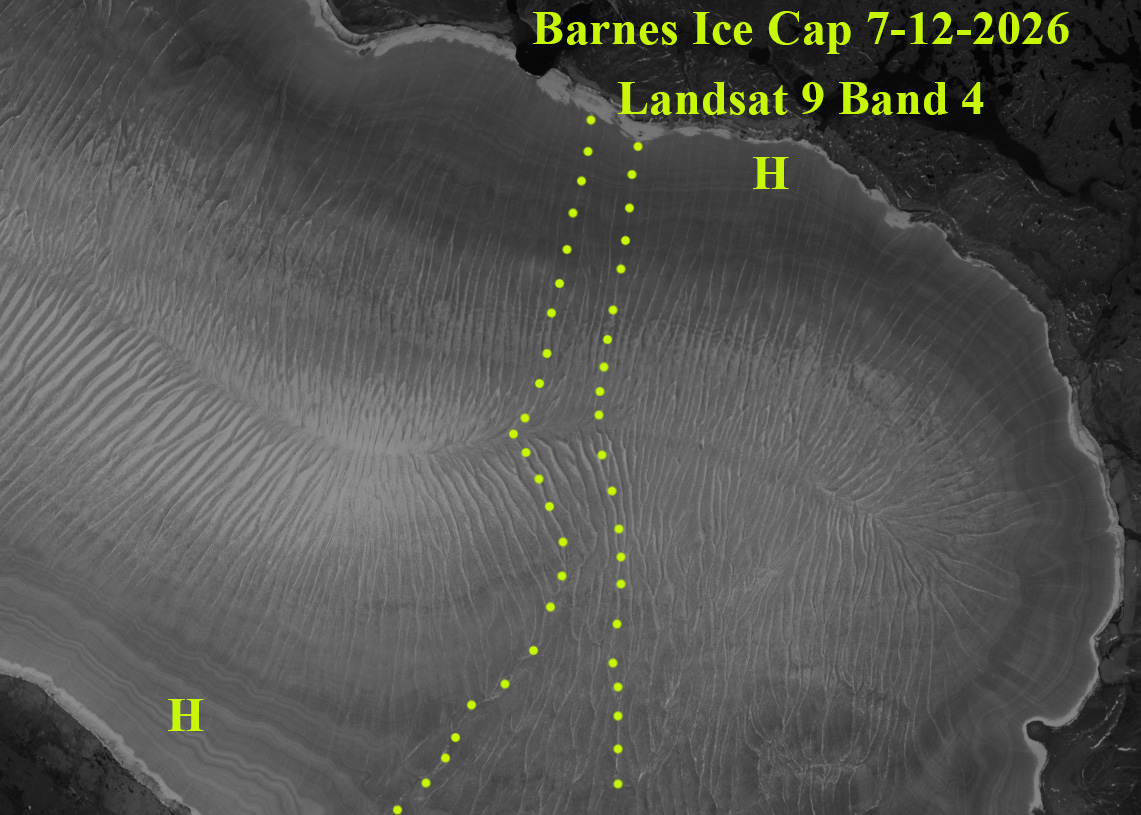
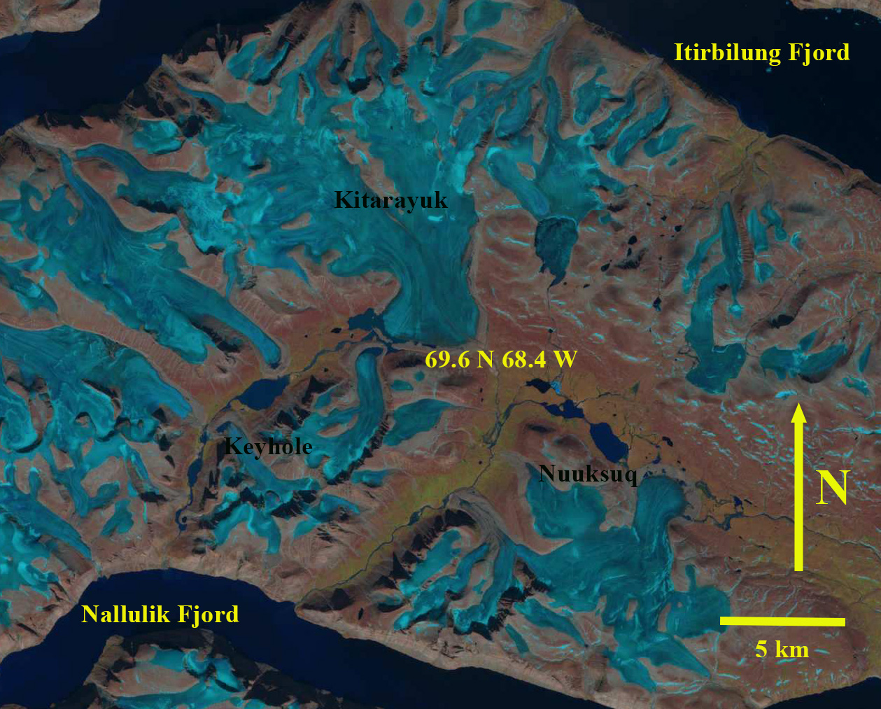
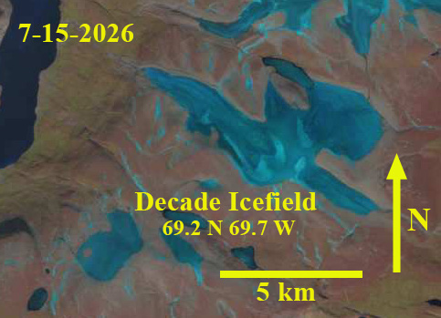
In mid-July 2026 Landsat imagery indicates the loss of all snow cover on Barnes Ice cap and that the supraglacial streams are fully activated. A series of glaciers to the east of the ice cap also have lost all snowcover including Keyhole, Kitarchick and Nuusuq Glacier. With over a month left in the melt season this will lead to substantial mass balance loss of these glaciers, driving further thinning and recession. Decade Icefield just to the north of this trio of glaciers also has lost all snow cover by mid-July.