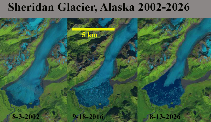
.Sheridan Glacier in the Chugach Mountains of Alaska flows southwest out of the mountains onto a terminus plain where it has gouged out a lake basin that expands as the glacier retreats. Sheridan Lake is a proglacial lake at the terminus that drains into the Sheridan River that 12 km later reaches tidewater. From 1950 to 2000 Sheridan Glacier experienced modest retreat, with a fringing proglacial Sheridan Lake persisting. Then a rapid retreat accompanied a terminus disintegration from 2000-2016. (Shugar et al 2018). This led to lake expansion that is ongoing in 2026.
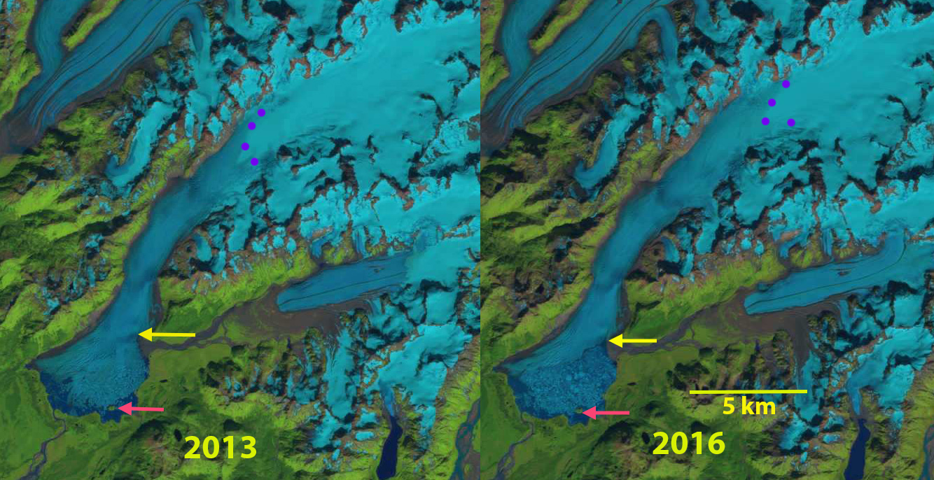
In 2002 the proglacial lake had an area of 3.8 km2, with the terminus crossing one small island in the lake. The snowline was at 750 m. In 2013 there is a 4 km2 terminus area that has disintegrated, the terminus has retreated off of the island. By 2016 the terminus has retreated north of the glacier stream from Sherman Glacier entering from the east, though much of the lake is still filled with an iceberg melange. The snowline is at 925 m. In 2020 the Sheridan Lake area has expanded to 11.2 km2, with the snowline at 970 m. In 2026 the lake has expanded to an area of 13.5 km2,.epresenting a retreat of 9.7 km2 since 2002. In 2026 the terminus tongue is not stable, unbuttressed on its lateral margins for 2 km, and retreat will continue.
The amount of terminus retreat here is less than that at Alsek, or Yakutat Glacier but the lake expansion rate is comparable to Excelsior Glacier or Allen Glacier.

 From a Glaciers Perspective