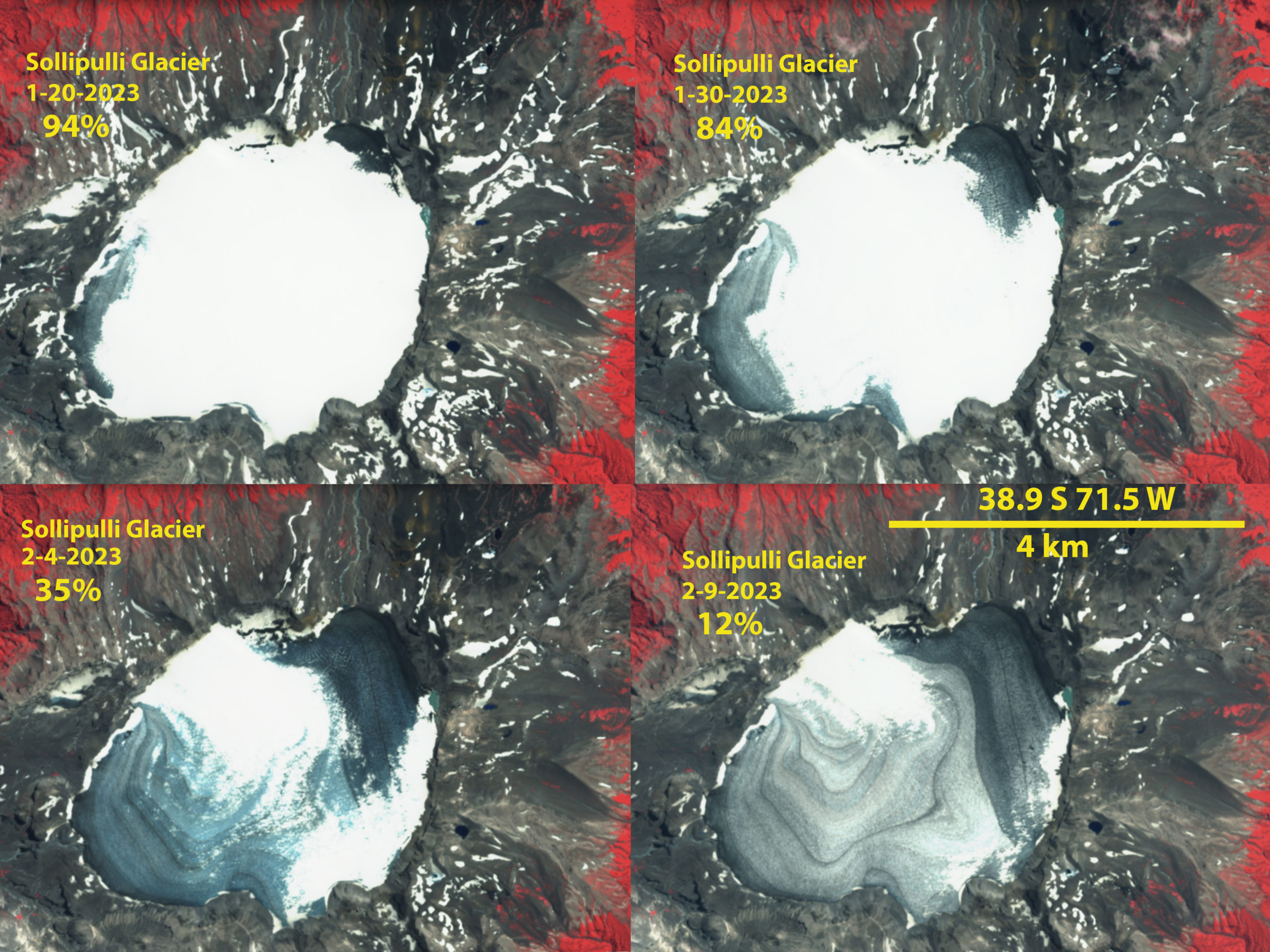
Sollipulli Glacier, Chile snowcover loss during summer 2023 heat wave in false color Sentinel images from January 20-Feb. 9. Snowcover delcined from 94% to 12% in 20 days.
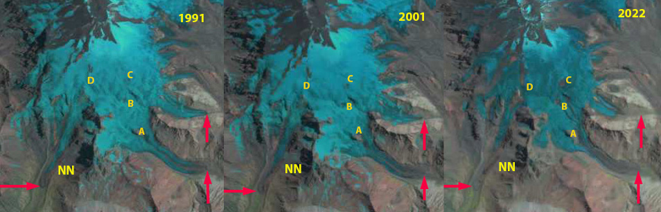
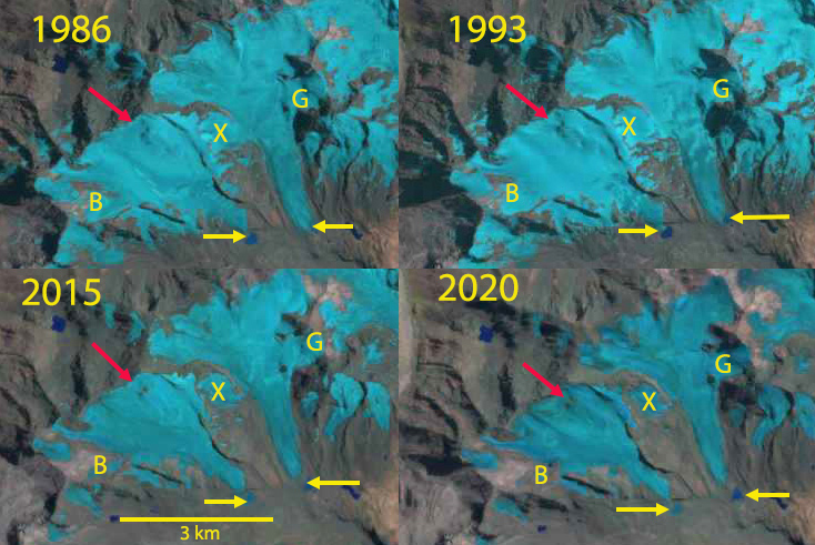
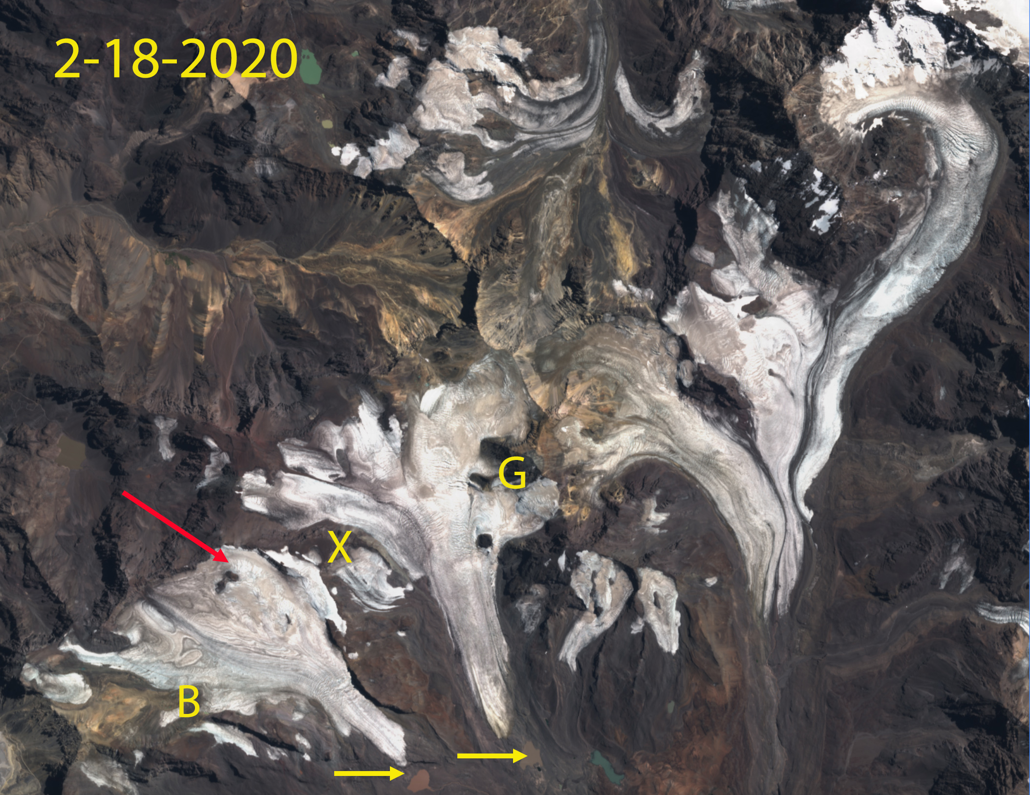
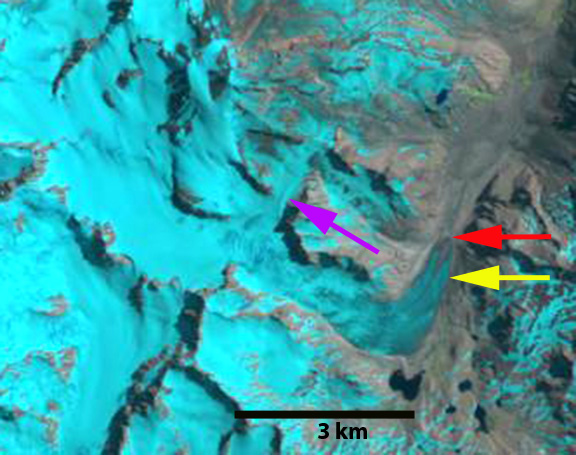
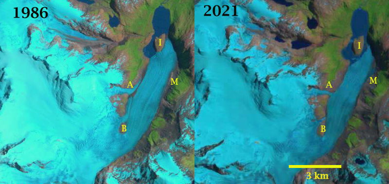
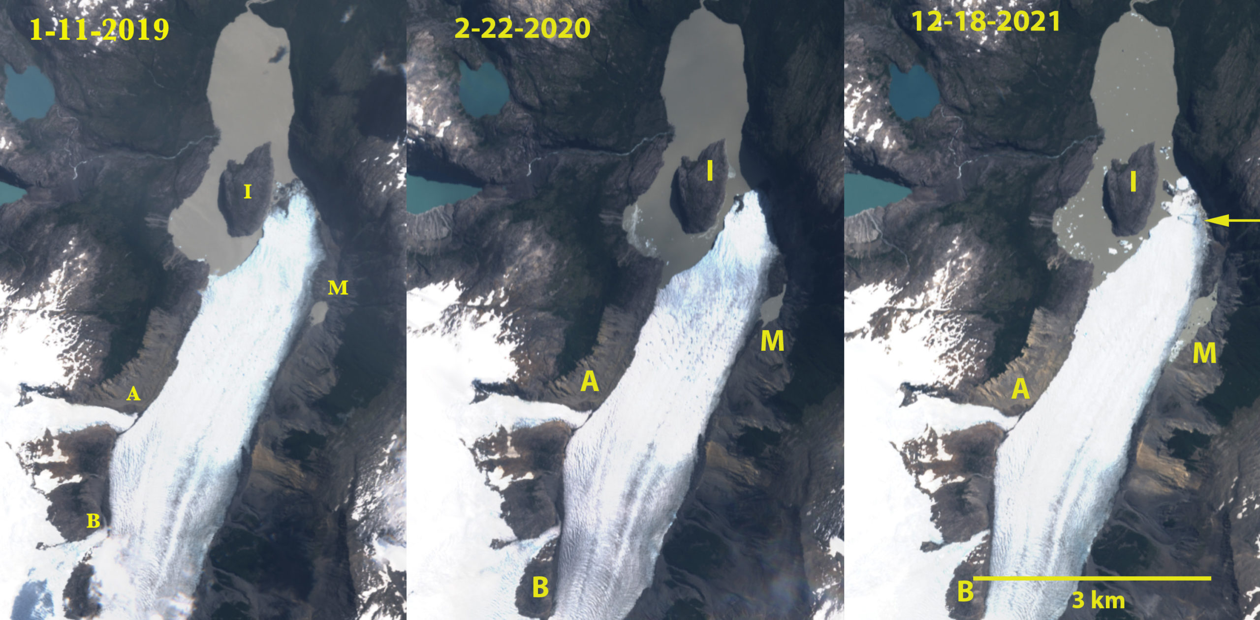
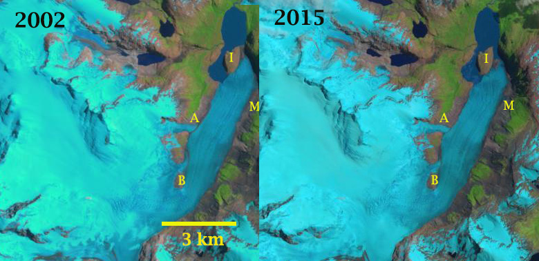
Nevados de Sollipulli is a volcano, is in the central Andes of Chile near the border with Argentina in Parque Nacional Villarica, Chile. The 4 km wide summit caldera at ~2100 m is filled by a glacier. In 2022 the summer heat waves stripped the glacier of all snowpack in January and that persisted through March, see below (Pelto, 2022). The volcano is dormant last producing lava flows 700 years ago and last erupting 2900 years ago (NASA, 2017). Reinthaler et al (2019) identified a 27% decline in glacier area from 1986-2015 on 59 volcanoes in the Andes. The study included Sollipulli where the area declined from 16.2 km2 in 1986, 20 12.5 km2 in 1999 and 11.1 km2 in 2015 (Reinthaler et al 2019). Here we examine Landsat imagery illustrating the recession from 1986-2022 and the loss of all snowcover for most of the summer of 2022. The summer of 2022 led to early summer loss of most/all the snowpack on Central Andes glaciers from 30-40 S. (Pelto, 2022).
This summer central Chile has experienced a persistent extreme heat wave that has generated ongoing disastrous forest fires (NASA EO, 2023), CONAF continues to update the fire area daily. Most of the Solllipulli Glacier is at 2000-2200 m elevation, CECS has a weather station at 1900 m on nearby Volcan Villarrica that had a high temperature on Jan. 29 and Feb. 4 of over 24 C. The highe tempertature has been above 16 C everday from Jan. 28 to Feb. 8 (see below). This has led to the snowcover diminishing rapidly on Sollipulli Glacier from January 20 to February 9, 2023. The glacier was 94% snowcovered on Jan. 20, 84% on January 30, 35% on Feb. 4 and 12% on Feb. 9. How long until it is down to 0%? This blog will be updated in this coming week to identify that and to better quantify the heat. By February 17, 2023 snowcover is down to 1%

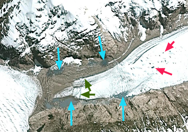
Sollipulli Glacier, Jan. 20, 2022 and fifty five days later the glacier is still bare of snowpack.
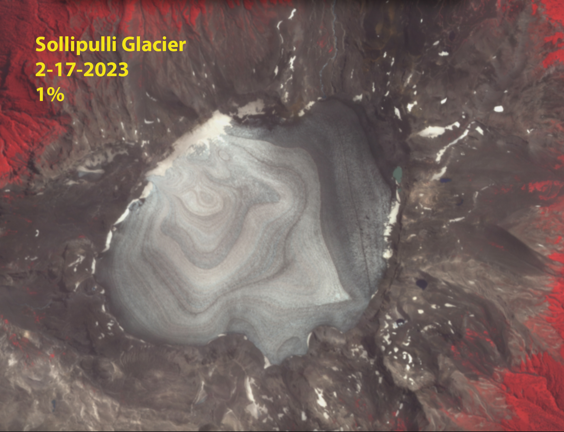
Sollipulli Glacier on Feb. 17, 2023 in false color Sentinel image, 1% snowcover left.
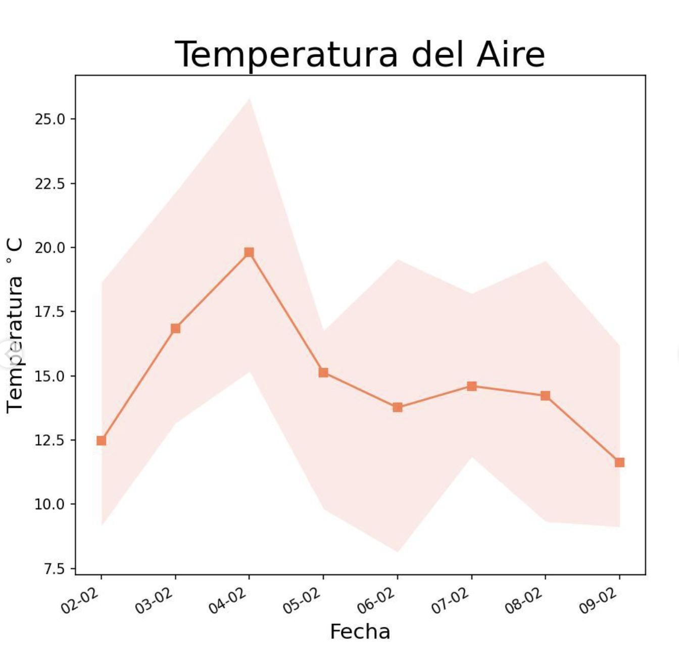
Temperature from the CECS station on Volcan Villarica at 1900 m. showing the average minimum and maximum.